Dawson Charles (@dsc_wx) 's Twitter Profile
Dawson Charles

@dsc_wx

Weather nerd | Studying meteorology @floridastate 🌪️| @FLStormChasers_

ID: 4832642369

linkhttps://www.youtube.com/@FloridaWXMedia calendar_today21-01-2016 12:13:49

4,4K Tweet

283 Followers

890 Following

Dawson Charles (@dsc_wx) 's Twitter Profile Photo

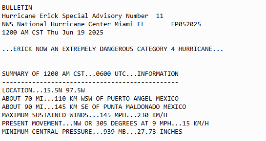
hurricane erick has made landfall near Punta Maldonado as a category 3 major hurricane with max sustained winds of 125 mph.

Dawson Charles (@dsc_wx) 's Twitter Profile Photo

for the longer track hurricanes i really need to get like a 24 pack of Monster Energy or something, 2 hours of sleep and trying to read data is not the vibe

David Schlotthauer (@weatherunited1) 's Twitter Profile Photo

Latest global model ensembles are in and there is definitely a step forward progression here. First of all, tradewinds are strong over the next week or two, but once we turn the calendar into early July, there will more than likely be a reversal and weakening of the tradewinds in

Latest global model ensembles are in and there is definitely a step forward progression here. First of all, tradewinds are strong over the next week or two, but once we turn the calendar into early July, there will more than likely be a reversal and weakening of the tradewinds in
James Hyde (@wxmeddler) 's Twitter Profile Photo

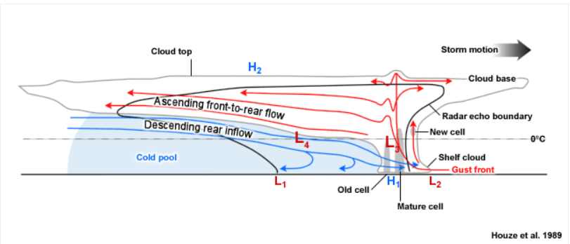
The phenomena that occurred last night is not *technically* a wake low. It was a mesoscale convective vortex (MCV) / Bookend Vortex coupled with a Rear Inflow Jet. Warning: This is a pedantic series of posts, but it's the internet, you get what you signed up for. And learn.

The phenomena that occurred last night is not *technically* a wake low. It was a mesoscale convective vortex (MCV) / Bookend Vortex coupled with a Rear Inflow Jet. 

Warning: This is a pedantic series of posts, but it's the internet, you get what you signed up for. And learn.