Luke A. Brown
@drlukebrown
Lecturer in GIS & Remote Sensing @SalfordUni and @ESA_EO Living Planet Fellow. Views my own.
ID: 19660460
https://www.salford.ac.uk/our-staff/luke-brown 28-01-2009 16:34:35
548 Tweet
496 Followers
657 Following

Finishing up another week Wytham Woods: 11 leaf-on plots scanned with the RIEGL and 5 with Mark Danson



Pleased to present results from my ESA Earth Observation Living Planet Fellowship, GROUNDED EO, at the National Earth Observation Conference 2024 in York earlier today! Lots of interesting science across the week #ukeo2024


🌲💻We are hiring! An open position for a doctoral student in our team in a project led by Aarne Hovi Topic: Remote sensing of boreal forest biomass with satellite laser sensors, with a focus on physically-based modeling. Please RT aalto.fi/en/open-positi…

UK student interested in a remote sensing PhD? University of Salford is offering 10 widening participation PhD scholarships for Sep 2025 entry. Broad eligibility criteria (UK fees only, international students cannot apply to this scheme). See salford.ac.uk/postgraduate-r… and get in touch!


New Science Strategy from European Space Agency includes 6 major thematic objectives: water cycle, carbon cycle and chemistry, energy fluxes, ecosystem health, extremes and hazards, & interfaces and coupling in the Earth system. Major consultation carried out to provide a blueprint on where to


This level of service can’t continue, NORTHERN 🚆. This is to give you notice that I will be calling an urgent meeting of the Rail North Committee to require an urgent plan to restore an acceptable level of service.


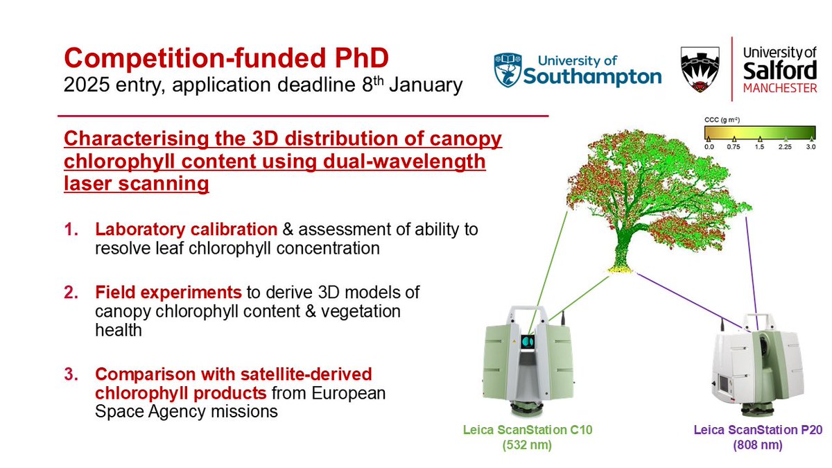
Reminder about our funded PhD opportunity on dual-wavelength laser scanning for estimating chlorophyll content & vegetation health. Based at University of Southampton under the IGNITE NERC DLA with supervision from Jadu Dash, Jo Nield, and myself. Further details: findaphd.com/phds/project/c…


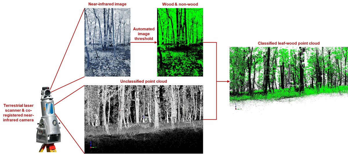
A further paper out this week! This time in Methods in Ecology and Evolution - we detail a new leaf-wood classification method for terrestrial laser scanning (TLS) data, making use of co-registered near-infrared photography: besjournals.onlinelibrary.wiley.com/doi/10.1111/20…
