FireMap.live ๐Ÿ”ฅ๐ŸŒŽ (@disaster_db) 's Twitter Profile
FireMap.live ๐Ÿ”ฅ๐ŸŒŽ

@disaster_db

Real-wildfire data at your fingertips ๐ŸŒ | Visualize global wildfire activity instantly ๐Ÿ”ฅ | Bushfire Map | #GeoINT #GeoAI| Currently in Beta

ID: 1795548242467581952

linkhttp://www.firemap.live calendar_today28-05-2024 20:10:45

1,1K Tweet

3,3K Takipรงi

444 Takip Edilen

FireMap.live ๐Ÿ”ฅ๐ŸŒŽ (@disaster_db) 's Twitter Profile Photo

Caribou Lake Wildfire Takes Off ๐Ÿ”ฅ Today, the Caribou Lake Wildfire (LWF090)โ€”a rare named wildfire in Albertaโ€”exploded in size due to extremely hot, dry, and windy conditions in the Lac La Biche region. -Over 12,255 hectares and rapidly growing -Location: 30 km southeast of

Mario Nawfal (@marionawfal) 's Twitter Profile Photo

๐Ÿ‡จ๐Ÿ‡ฆ CANADA'S ON FIRE: THOUSANDS FLEE AS TOWNS EVACUATE Wildfires just forced 17,000 people to flee northern Manitoba as flames tear through forests and close roads, airports, and entire towns. In Winnipeg, evacuees are cramming into hockey arenas while officials scramble to find

๐Ÿ‡จ๐Ÿ‡ฆ CANADA'S ON FIRE: THOUSANDS FLEE AS TOWNS EVACUATE

Wildfires just forced 17,000 people to flee northern Manitoba as flames tear through forests and close roads, airports, and entire towns.

In Winnipeg, evacuees are cramming into hockey arenas while officials scramble to find
Kyle Brittain (@badweatherkyle) 's Twitter Profile Photo

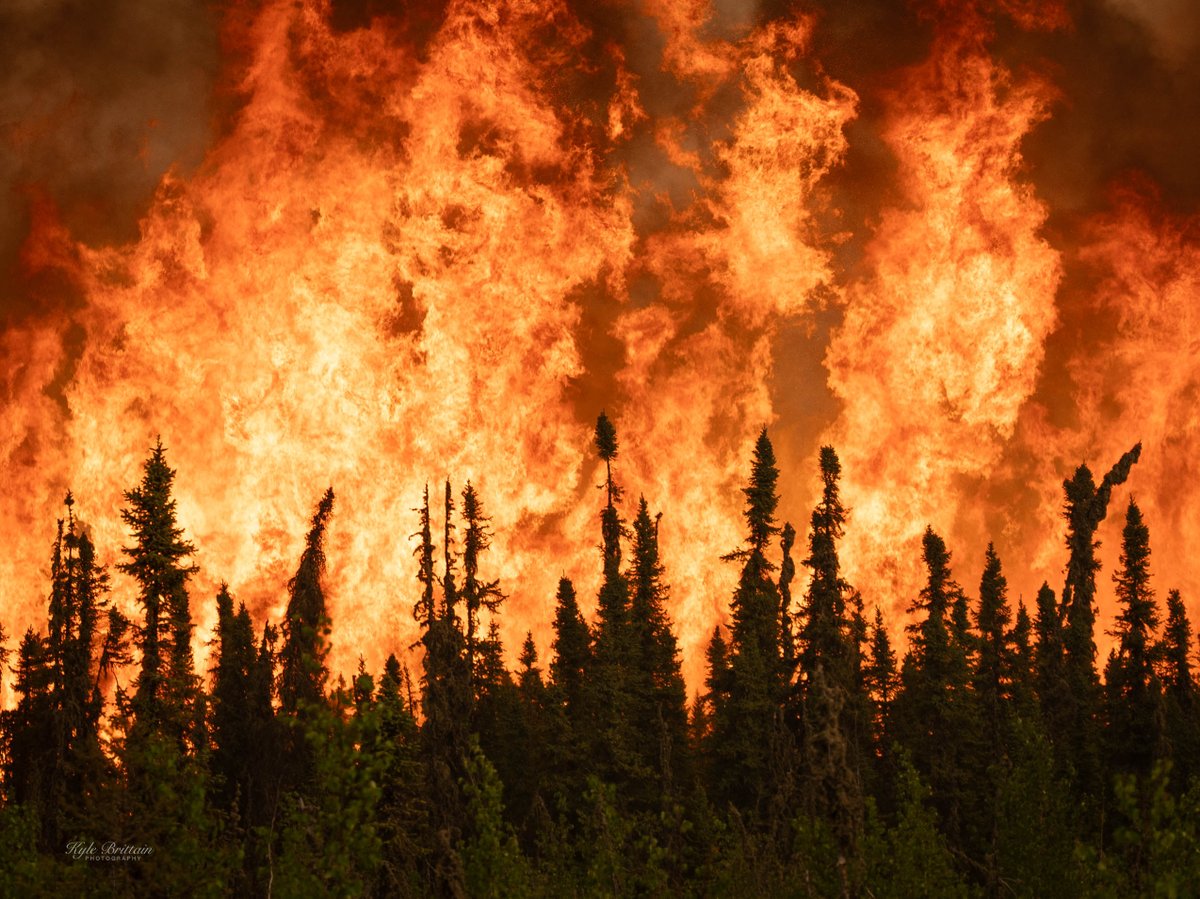
Literal walls of flame in northern Alberta on Thursday. Even hundreds of metres away, the radiation from bursts of flame like this feel like someone turning on a heat lamp just inches from your face

Literal walls of flame in northern Alberta on Thursday.

Even hundreds of metres away, the radiation from bursts of flame like this feel like someone turning on a heat lamp just inches from your face
FireMap.live ๐Ÿ”ฅ๐ŸŒŽ (@disaster_db) 's Twitter Profile Photo

๐Ÿ‡จ๐Ÿ‡ฆ๐Ÿ‡บ๐Ÿ‡ธ๐Ÿ‡จ๐Ÿ‡ด Manitoba Wildfires Update 100 firefighters proper and Colombian helicopters via U.S. heading north to support wildfire operations. Live satellite hotspots and burned area maps available on FireMap #Canada #USA #Colombia

FireMap.live ๐Ÿ”ฅ๐ŸŒŽ (@disaster_db) 's Twitter Profile Photo

#HendersonFire in Pala covers 200 acres, is 5% contained, and involves steep, hard-to-reach terrain around Tourmaline Queen Mountain and Chief Mountain, complicating firefighting efforts.

FireMap.live ๐Ÿ”ฅ๐ŸŒŽ (@disaster_db) 's Twitter Profile Photo

#Pelican2 in Pelican Narrows, Saskatchewan, Canada, with active hotspots near Mirond Lakeโ€™s western border, signaling the official burned area boundary is set to grow. #skfire #saskwildfires

#Pelican2 in Pelican Narrows, Saskatchewan, Canada, with active hotspots near Mirond Lakeโ€™s western border, signaling the official burned area boundary is set to grow. #skfire #saskwildfires
CIRA (@cira_csu) 's Twitter Profile Photo

Wildfire smoke has overtaken skies above the Eastern United States. This time lapse shows the drifting smoke over the last three days.