David H. Montgomery (@dhmontgomery) 's Twitter Profile
David H. Montgomery

@dhmontgomery

"A French history podcaster and enormous goshdang nerd after our own hearts" — @andrewvandam. Host of @thesiecle; senior data journalist with @YouGovAmerica.

ID: 194351775

linkhttp://dhmontgomery.com calendar_today23-09-2010 22:46:30

130,130K Tweet

27,27K Takipçi

3,3K Takip Edilen

Paul Huttner weather (@paulhuttnerwx) 's Twitter Profile Photo

Still on track for significant severe weather outbreak Monday. AM storms, break midday, main event late PM/evening. Wind/hail damage and strong EF2-EF5 tornadoes possible. 1st moderate Cat 4/5 risk in 14 years. Expect watches/warnings Monday! #mnwx

Still on track for significant severe weather outbreak Monday.
AM storms, break midday, main event late PM/evening.
Wind/hail damage and strong EF2-EF5 tornadoes possible.
1st moderate Cat 4/5 risk in 14 years.
Expect watches/warnings Monday!
#mnwx
NWS Twin Cities (@nwstwincities) 's Twitter Profile Photo

Round 1 Monday morning has higher confidence in storms, but main threat is "only" large hail. Round 2 Monday afternoon/evening has lower confidence in where/when storms will develop, but IF they do, they could be bad. Main concern is strong tornadoes. spc.noaa.gov/products/outlo…

Paul Huttner weather (@paulhuttnerwx) 's Twitter Profile Photo

Tornadoes are not certain Monday. But if they develop, HRRR depiction of this discreet supercell in favorable inflow S of main squall line would be the place to watch. Tricky forecast Mon. Let's see how many storms can develop. Need right mesoscale conditions PM hours! #mnwx

Tornadoes are not certain Monday. But if they develop, HRRR depiction of this discreet supercell in favorable inflow S of main squall line would be the place to watch. Tricky forecast Mon. Let's see how many storms can develop. Need right mesoscale conditions PM hours! 
#mnwx
Paul Huttner weather (@paulhuttnerwx) 's Twitter Profile Photo

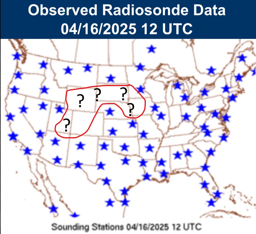
Unusually wide range of forecast model solutions tonight for 6 p.m. Monday. Have to wonder if cancelled weather balloon launches upstream of MN are having an impact on storm solutions? Critical to have the usual data feed. Models can't forecast what they can't see! #mnwx

Unusually wide range of forecast model solutions tonight for 6 p.m. Monday. Have to wonder if cancelled weather balloon launches upstream of MN are having an impact on storm solutions? Critical to have the usual data feed. Models can't forecast what they can't see! 
#mnwx
Michael Scherer (@michaelscherer) 's Twitter Profile Photo

Donald Trump canceled an interview with Ashley Parker and me, and then publicly attacked our integrity. So we called his cell and he picked up and spoke at length. He called weeks later at 1:28 am and later invited for an Oval Office interview. Read: theatlantic.com/magazine/archi…
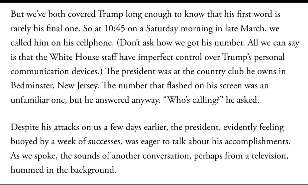
Donald Trump canceled an interview with <a href="/AshleyRParker/">Ashley Parker</a> and me, and then publicly attacked our integrity. 

So we called his cell and he picked up and spoke at length. He called weeks later at 1:28 am and later invited for an Oval Office interview. 

Read: theatlantic.com/magazine/archi…
Paul Huttner weather (@paulhuttnerwx) 's Twitter Profile Photo

Here we go, Minnesota. Tornado watch until 8 p.m. includes most of SW and parts of central Minnesota. 🌪️ I expect another watch to be issued later today that includes the Twin Cities area. Stay alert. #mnwx mprnews.org/story/2025/04/…

Paul Huttner weather (@paulhuttnerwx) 's Twitter Profile Photo

Getting some sun now just west of MSP ahead of storm line. Temperature and dew point rising rapidly. Atmosphere destabilizing. Storms may strengthen as they approach MSP. #mnwx

Getting some sun now just west of MSP ahead of storm line. 
Temperature and dew point rising rapidly.
Atmosphere destabilizing.
Storms may strengthen as they approach MSP.
#mnwx
Frederick Melo, Reporter/Axolotl (@frederickmelo) 's Twitter Profile Photo

You kind of have to read to the end to get to the part where a rock of hail 3.5 inches across whips through my chest at 170 miles per hour. Nope, ain't going out tonight... wouldn't be prudent...

You kind of have to read to the end to get to the part where a rock of hail 3.5 inches across whips through my chest at 170 miles per hour. Nope, ain't going out tonight... wouldn't be prudent...
Jarvis (@jarvis_best) 's Twitter Profile Photo

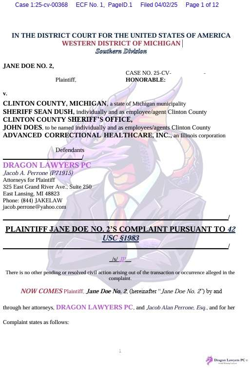
This is awesome - law firm called Dragon Lawyers filed court papers with this watermark on EVERY PAGE until the judge ordered them to stop.

This is awesome - law firm called Dragon Lawyers filed court papers with this watermark on EVERY PAGE until the judge ordered them to stop.
Lakshya Jain (@lxeagle17) 's Twitter Profile Photo

Guys, you're still trying to replace the European Union. I told you we can't do it, and we can't do it. What we can do is recreate it. We recreate it in the aggregate.

Paul Douglas (@pdouglasweather) 's Twitter Profile Photo

The gap in the line west of MSP is holding. We aren’t out of the woods but strongest storms may pass just south (and north) of MSP The anti-tornado dome is working perfectly

NWS Twin Cities (@nwstwincities) 's Twitter Profile Photo

5:20PM Radar Update: The threat has trended down for the northern portion of the line, but development is still possible as it moves east so no all clear there yet. The area of greatest threat is along the southern portion of the line, w/ active tornado warnings. #mnwx #wiwx

5:20PM Radar Update: The threat has trended down for the northern portion of the line, but development is still possible as it moves east so no all clear there yet. The area of greatest threat is along the southern portion of the line, w/ active tornado warnings. #mnwx #wiwx