Devan Masciulli (@devanmasciulli) 's Twitter Profile
Devan Masciulli

@devanmasciulli

Meteorologist in SLC, UT⛅️ Follow my weather page @KSL_Devan // @millersvilleu Alum ‘21 // Philly girl. Go birds. // Phil 4:13. // Opinions are my own.

ID: 2503019572

calendar_today23-04-2014 01:47:06

1,1K Tweet

601 Followers

465 Following

NWS Lincoln IL (@nwslincolnil) 's Twitter Profile Photo

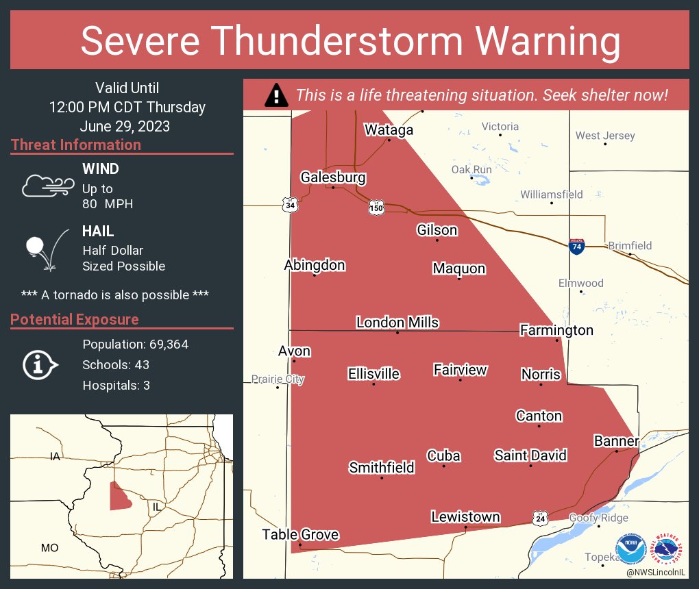
Severe Thunderstorm Warning including Galesburg IL, Canton IL and Abingdon IL until 12:00 PM CDT. This destructive storm will contain wind gusts to 80 MPH!

Severe Thunderstorm Warning including Galesburg IL, Canton IL and  Abingdon IL until 12:00 PM CDT. This destructive storm will contain wind gusts to 80 MPH!
NWS Lincoln IL (@nwslincolnil) 's Twitter Profile Photo

Areas of fog will occur until after sunrise, especially where heavier rain occurred on Saturday. Visibility as low as a quarter mile will occur. Use extra caution while driving. #ILwx

Areas of fog will occur until after sunrise, especially where heavier rain occurred on Saturday. Visibility as low as a quarter mile will occur. Use extra caution while driving. #ILwx
NWS Chicago (@nwschicago) 's Twitter Profile Photo

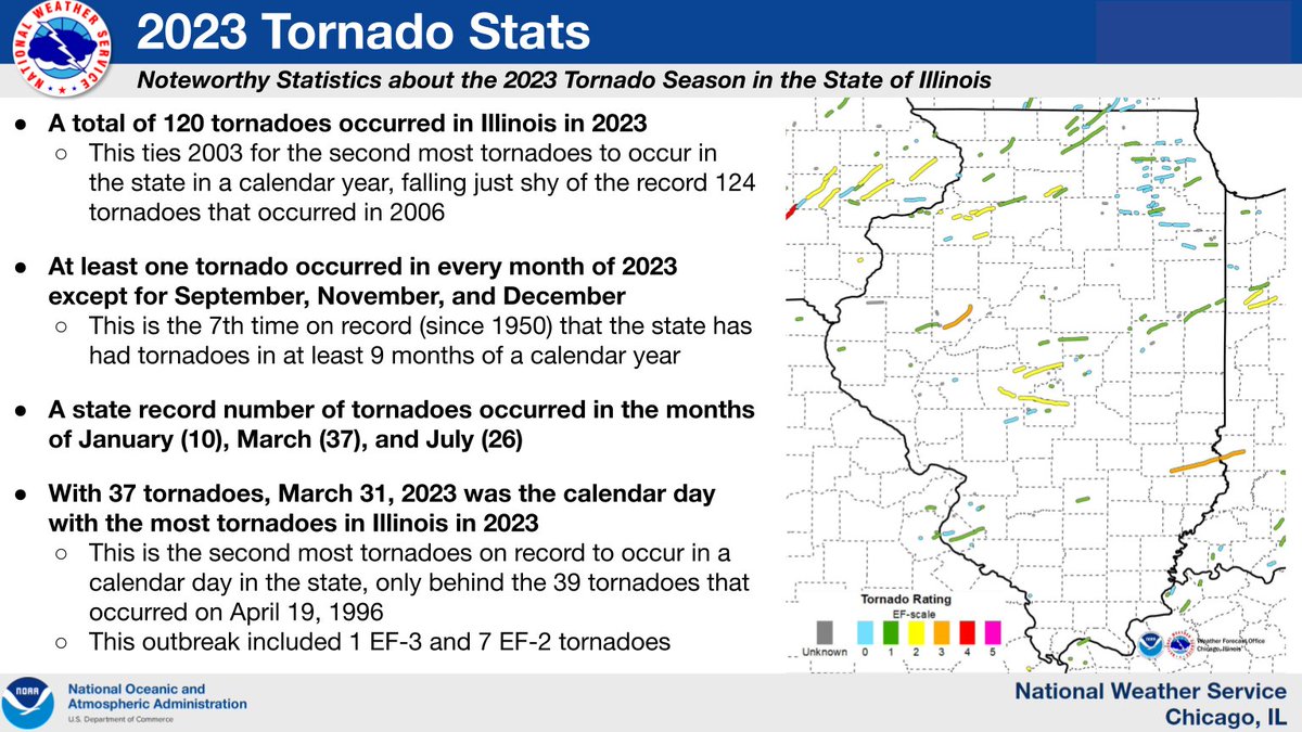
This past calendar year was also a remarkably active year for tornadoes in the state of Illinois as a whole. A total of 120 tornadoes were confirmed in the state in 2023, which falls just shy of the state record of 124 tornadoes in a calendar year, set back in 2006. #ilwx (6/8)

This past calendar year was also a remarkably active year for tornadoes in the state of Illinois as a whole. A total of 120 tornadoes were confirmed in the state in 2023, which falls just shy of the state record of 124 tornadoes in a calendar year, set back in 2006. #ilwx
(6/8)
Matthew Johnson (@ksl_matt) 's Twitter Profile Photo

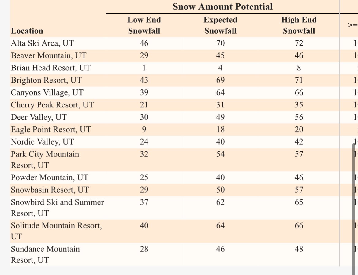
JANUBURIED: 2-5 FEET of new snow is going to fall on top of the 1-2 FEET that we’ve already seen. These totals capture snowfall from tonight - Sunday PM in the northern mtns. This will swing our snowpack numbers, but also push avalanche danger to new heights! #utwx ❄️ 🚨

JANUBURIED: 2-5 FEET of new snow is going to fall on top of the 1-2 FEET that we’ve already seen. These totals capture snowfall from tonight - Sunday PM in the northern mtns. This will swing our snowpack numbers, but also push avalanche danger to new heights! #utwx ❄️ 🚨
NWS Salt Lake City (@nwssaltlakecity) 's Twitter Profile Photo

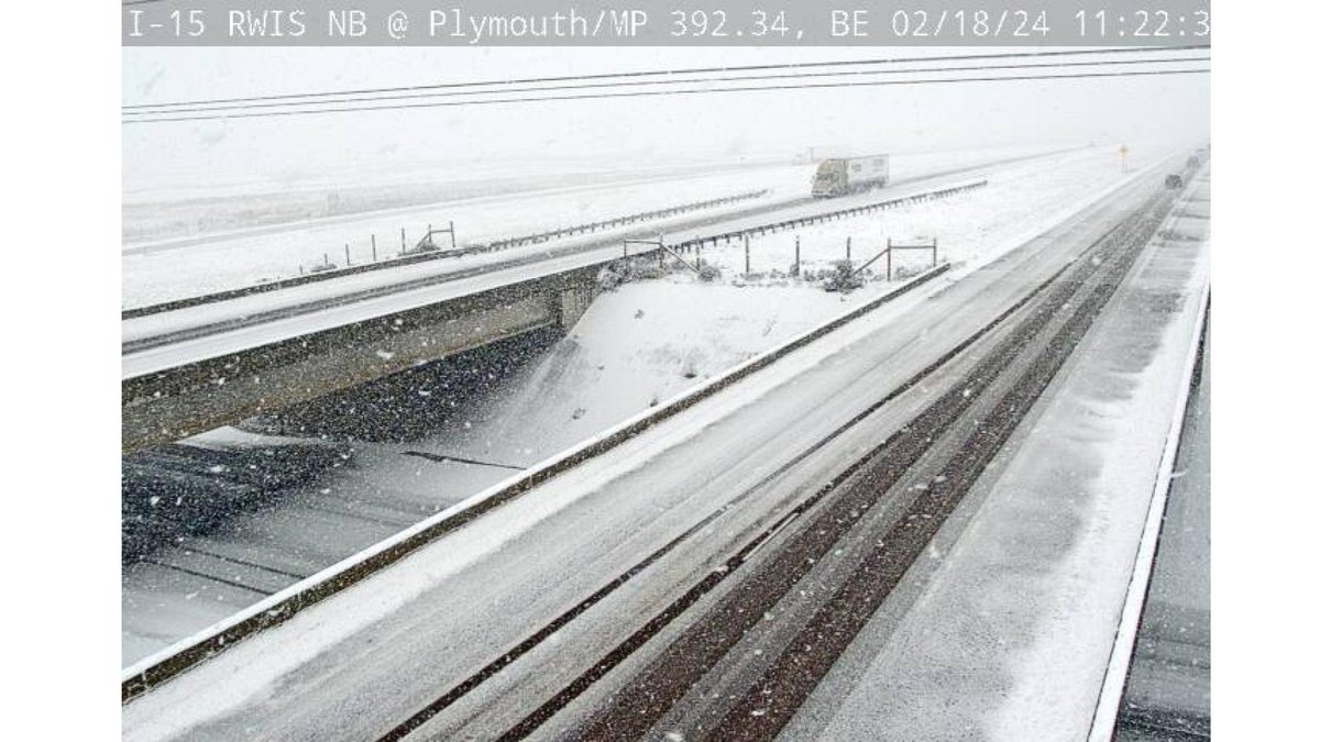
Snow is coming down across far northern Utah including areas near and north of Brigham City and the Cache Valley. Slow down and use caution in these areas! #utwx

Snow is coming down across far northern Utah including areas near and north of Brigham City and the Cache Valley.  Slow down and use caution in these areas!  #utwx
NWS Salt Lake City (@nwssaltlakecity) 's Twitter Profile Photo

So about this weather... Snow lovers: getting psyched 😃 Snow haters: so it begins... 😡 Check out the webcam courtesy of Snowbird, from their Hidden Peak cam. #utwx

So about this weather...

Snow lovers: getting psyched 😃
Snow haters: so it begins... 😡

Check out the webcam courtesy of Snowbird, from their Hidden Peak cam. #utwx
NWS Salt Lake City (@nwssaltlakecity) 's Twitter Profile Photo

Heads up if you're recreating in the mountains of NE Utah/SW Wyoming or on Bear Lake. Isolated strong to severe storms will develop this afternoon that'll pose a risk for those outdoors. #utwx #wywx

Heads up if you're recreating in the mountains of NE Utah/SW Wyoming or on Bear Lake. Isolated strong to severe storms will develop this afternoon that'll pose a risk for those outdoors. #utwx #wywx