Ken Pryor (@stormrangerwx) 's Twitter Profile
Ken Pryor

@stormrangerwx

Meteorologist, Ph.D. in Atmospheric Physics @UMBC 2022, satellite meteorology product developer, author, swimmer 🏊‍♂️, and severe weather aficionado.

ID: 1502793590715686917

linkhttps://kenpryor67.pythonanywhere.com/ calendar_today12-03-2022 23:48:30

12,12K Tweet

104 Followers

53 Following

Scott Duncan (@scottduncanwx) 's Twitter Profile Photo

Severe thunderstorms ripping through Central London today ⚡ This is Embankment Station. Very impressive storm intensity for this late in the year especially. 🎥 Adam Howse

Ken Pryor (@stormrangerwx) 's Twitter Profile Photo

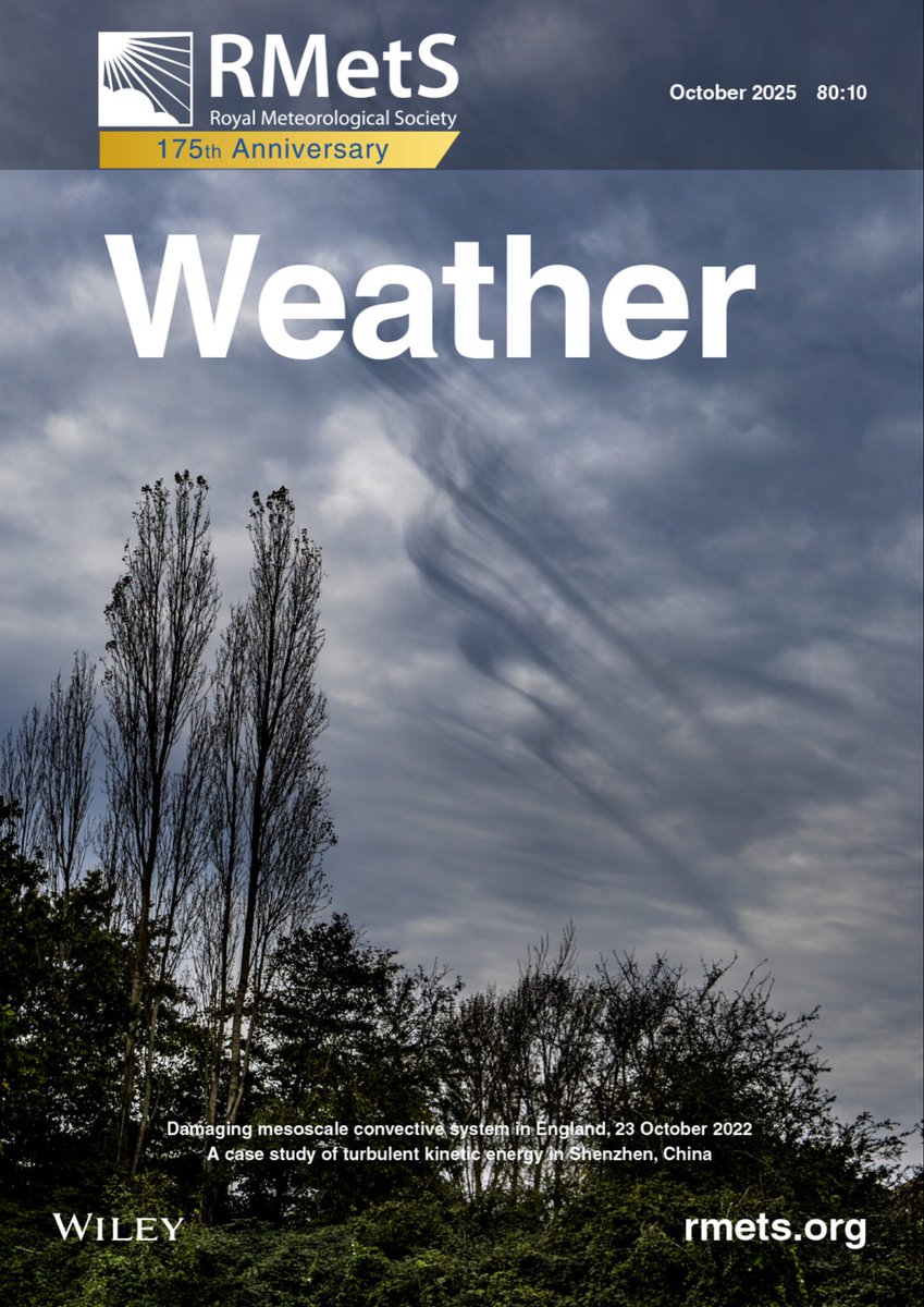
Important weather anniversary in the U.K. today. On 23 October 2022, a severe and damaging mesoscale convective system (MCS) developed and intensified over the English Channel and tracked north-northeastward into southern England, producing widespread damaging winds and moderate

Important weather anniversary in the U.K. today. On 23 October 2022, a severe and damaging mesoscale convective system (MCS) developed and intensified over the English Channel and tracked north-northeastward into southern England, producing widespread damaging winds and moderate
Ken Pryor (@stormrangerwx) 's Twitter Profile Photo

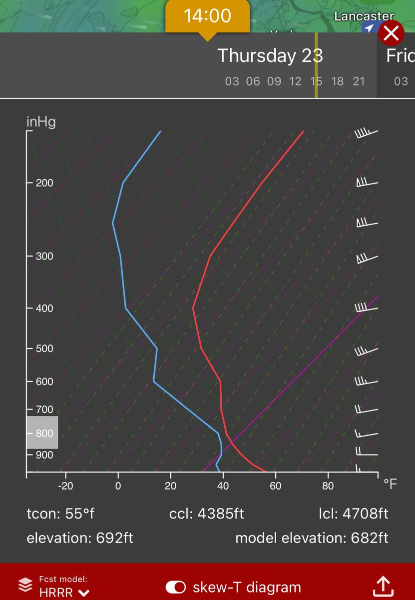
Another day in the cold sector here in central MD: stratocumulus undulatus clouds moving over #mtairymd at 2:00pm. Winds 7 to 12 kts from the W. Dense stratocumulus clouds are forming in the unstable, turbulent wind flow aided by modest surface heating and strong vertical wind

Another day in the cold sector here in central MD: stratocumulus undulatus clouds moving over #mtairymd at 2:00pm. Winds 7 to 12 kts from the W. Dense stratocumulus clouds are forming in the unstable, turbulent wind flow aided by modest surface heating and strong vertical wind
Ken Pryor (@stormrangerwx) 's Twitter Profile Photo

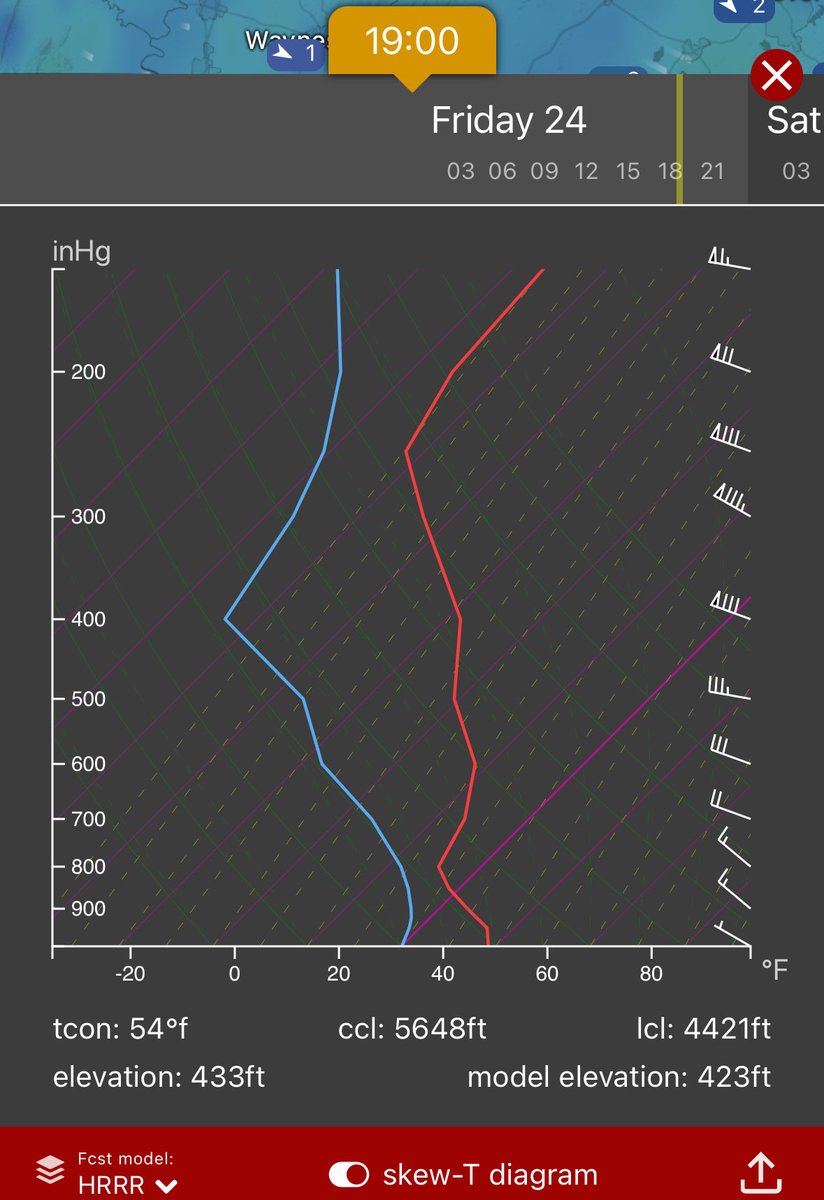
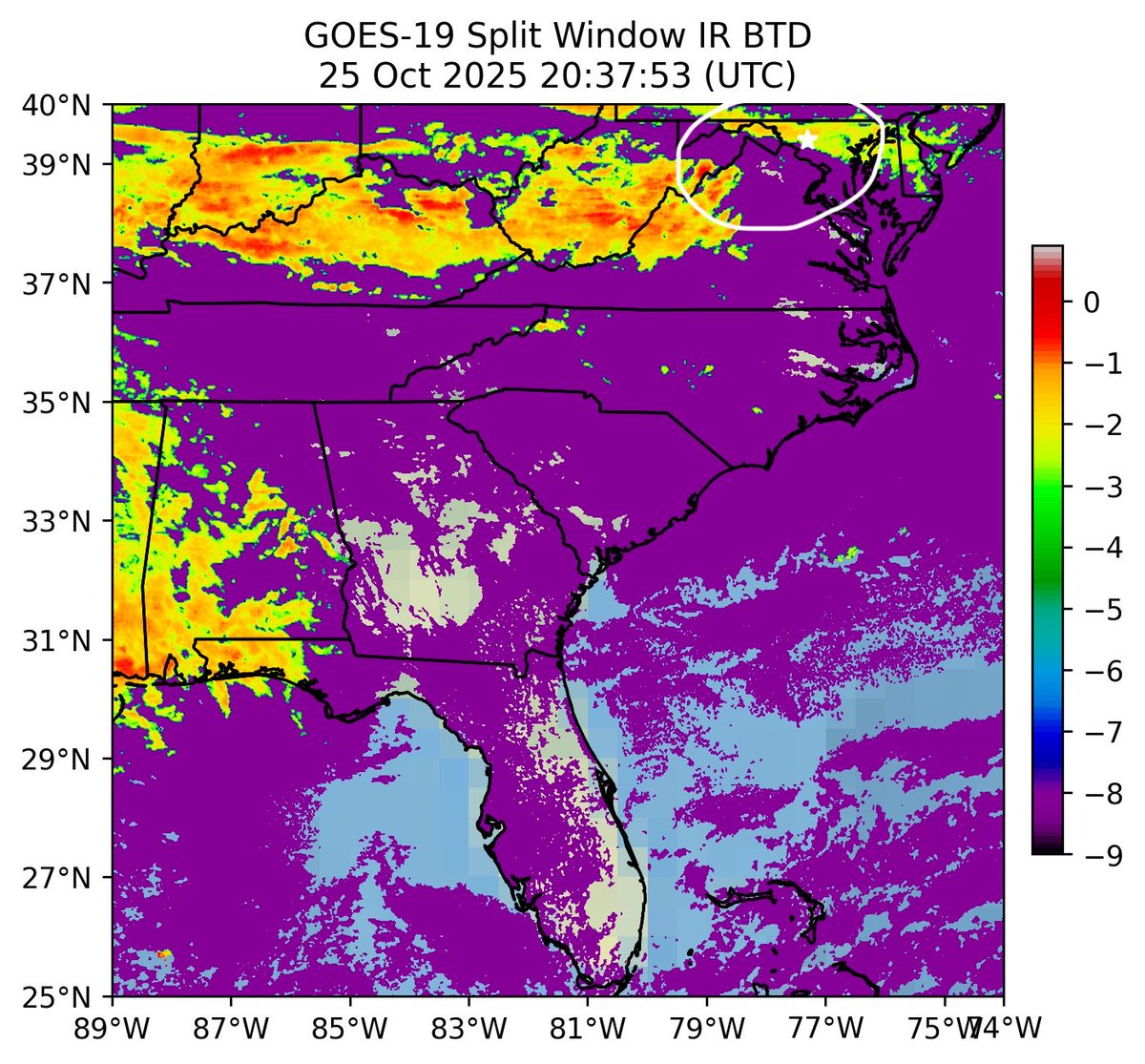
Happy Friday evening! Caught this great shot of stratocumulus undulatus clouds moving over #frederickmd at 6:40pm, sustained by residual instability and moderate vertical wind shear. Stratocumulus cloud clusters are showing clearly in #goes19 IR imagery (around the white star)

Happy Friday evening! Caught this great shot of stratocumulus undulatus clouds moving over #frederickmd at 6:40pm, sustained by residual instability and moderate vertical wind shear. Stratocumulus cloud clusters are showing clearly in #goes19 IR  imagery (around the white star)
Ken Pryor (@stormrangerwx) 's Twitter Profile Photo

Interesting cloud Saturday. Imposing stratocumulus undulatus clouds moving over Frederick, MD at 3:00 pm in unstable NW’ly flow. The stratocumulus cloud belt shows clearly in GOES-19 infrared imagery, forming from the earlier rapid development and conglomeration of cumulus clouds

Interesting cloud Saturday. Imposing stratocumulus undulatus clouds moving over Frederick, MD at 3:00 pm in unstable NW’ly flow. The stratocumulus cloud belt shows clearly in GOES-19 infrared imagery, forming from the earlier rapid development and conglomeration of cumulus clouds
Ken Pryor (@stormrangerwx) 's Twitter Profile Photo

Squall line passage through Frederick County, MD between 8:30 and 8:50 am. Here in #newmarketmd, low-end downburst wind gusts estimated at 10M AGL of 25-30 knots preceded the heavy downpours. An embedded mini-supercell, aided by strong vertical wind shear and convective

Ken Pryor (@stormrangerwx) 's Twitter Profile Photo

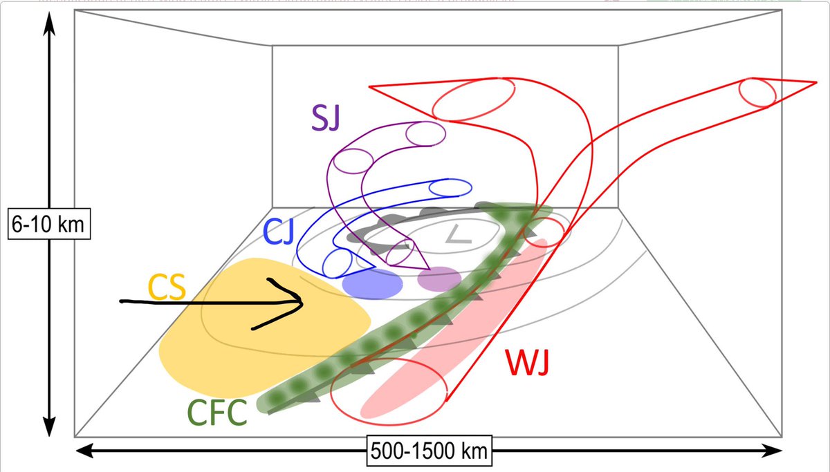
Formidable stratocumulus cloud layer moving over #newmarketmd at 5:00 pm, a signal of the advancing cold sector (CS) convection and wind field in the wake of the large NE US wave cyclone. Low-level turbulence and instability is favoring gusty wind squalls over central MD during

Formidable stratocumulus cloud layer moving over #newmarketmd at 5:00 pm, a signal of the advancing cold sector (CS) convection and wind field in the wake of the large NE US wave cyclone. Low-level turbulence and instability is favoring gusty wind squalls over central MD during
IEMBot LWX (@iembot_lwx) 's Twitter Profile Photo

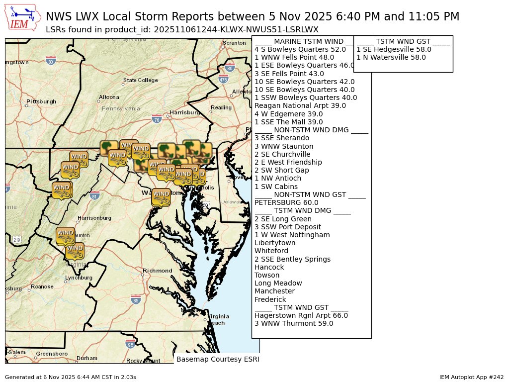
Camp David,MD (RSP) ASOS reports gust of 51 knots (58.7 mph) from W @ 0208Z -- KRSP 060254Z AUTO 30016G43KT 270V330 10SM SCT032 BKN047 OVC065 A2979 RMK AO2 PK WND 28051/0208 SLPNO 53013 PWINO FZRANO $

Ken Pryor (@stormrangerwx) 's Twitter Profile Photo

Severe-warned squall line moving through Frederick County, MD between 9:10 and 9:40 pm. Estimated downburst wind gusts here in #newmarketmd between 28-33 knots. No lightning or thunder with this storm. Capital Weather Gang DMVwx NWS Baltimore-Washington Nick's Weather Eye MeteoMdWX MetJam

IEMBot LWX (@iembot_lwx) 's Twitter Profile Photo

LWX issues Summary Local Storm Report, 33 out of 33 reports were previously sent and not repeated here. mesonet.agron.iastate.edu/lsr/?by=wfo&wf…

LWX issues Summary Local Storm Report, 33 out of 33 reports were previously sent and not repeated here. mesonet.agron.iastate.edu/lsr/?by=wfo&wf…