OpenStreetMap Chile (@osmcl) 's Twitter Profile
OpenStreetMap Chile

@osmcl

Cuenta en Twitter de la Fundación #OpenStreetMap Chile

ID: 256837313

linkhttps://www.openstreetmap.cl calendar_today24-02-2011 05:01:20

1,1K Tweet

1,1K Followers

60 Following

OpenStreetMap Chile (@osmcl) 's Twitter Profile Photo

La Iglesia de la Santísima Trinidad en Villa Las Estrellas, Isla Rey Jorge, Región de Magallanes y de la Antártica Chilena, es la iglesia ortodoxa más austral del mundo. #OpenStreetMap #Antártica #VillaLasEstrellas #РПЦ openstreetmap.org/way/749856717 (Foto CCBYSA por ArJuna)

La Iglesia de la Santísima Trinidad en Villa Las Estrellas, Isla Rey Jorge, Región de Magallanes y de la Antártica Chilena, es la iglesia ortodoxa más austral del mundo.  
#OpenStreetMap #Antártica #VillaLasEstrellas #РПЦ

openstreetmap.org/way/749856717

(Foto CCBYSA por ArJuna)
State of the Map (@sotm) 's Twitter Profile Photo

We are excited to announce that #StateoftheMap 2022 will take place in-person in Firenze, Italy on August 19-21, as well as online! ✨ ℹ More info: blog.openstreetmap.org/2022/02/16/ann… #SotM #SotM2022 #OpenStreetMap #gischat

We are excited to announce that #StateoftheMap 2022 will take place in-person in Firenze, Italy on August 19-21, as well as online! ✨
ℹ More info: blog.openstreetmap.org/2022/02/16/ann…
#SotM #SotM2022 #OpenStreetMap #gischat
State of the Map (@sotm) 's Twitter Profile Photo

Let's reveal the #SOTM2022 official logo! ✨ Congrats to Feye Andal for submitting the winning logo inspired by the symbol of Firenze! And the Call for Participation is now officially OPEN!📣 More info and news ➡ blog.openstreetmap.org/2022/03/19/ann… #StateoftheMap #gischat #OpenStreetMap


Let's reveal the #SOTM2022 official logo! ✨
Congrats to <a href="/dfeyeandal/">Feye Andal</a> for submitting the winning logo inspired by the symbol of Firenze!
And the Call for Participation is now officially OPEN!📣
More info and news ➡ blog.openstreetmap.org/2022/03/19/ann… 
#StateoftheMap #gischat #OpenStreetMap
State of the Map (@sotm) 's Twitter Profile Photo

One month for preparing and submitting your proposal for a talk, workshop, or panel at #SotM2022! 🗓 What inspiring idea will you share with the #OpenStreetMap community? We can't wait to learn more about it! ✨

OpenStreetMap Chile (@osmcl) 's Twitter Profile Photo

Quedan solo dos días para postular al programa de ayudas de viaje para asistir al State of the Map de este año en Florencia, Italia. Recuerda revisar los requisitos y presentar tu postulación a tiempo 2022.stateofthemap.org/travel_grant_p… #OpenStreetMap #sotm2022

State of the Map (@sotm) 's Twitter Profile Photo

#StateoftheMap2022 CALL FOR LIGHTNING TALKS is now open! Lightning Talks are 5minute talks, and you can speak in-person or online! Deadline: 12 August More on our blog: blog.openstreetmap.org/2022/07/03/cal… Apply via OSM Wiki: wiki.openstreetmap.org/wiki/State_of_… #StateoftheMap #SotM2022 #SotM

#StateoftheMap2022 CALL FOR LIGHTNING TALKS is now open!

Lightning Talks are 5minute talks, and you can speak in-person or online! 

Deadline: 12 August

More on our blog: blog.openstreetmap.org/2022/07/03/cal…

Apply via OSM Wiki: wiki.openstreetmap.org/wiki/State_of_…

#StateoftheMap #SotM2022 #SotM
OpenStreetMap Chile (@osmcl) 's Twitter Profile Photo

La Municipalidad de las Condes (Las Condes) ha implementado un sistema para ver el estado de la mesas instaladas en cada local de votación de la comuna. Utiliza #OpenStreetMap y da atribución a los voluntarios como corresponde 👍 elecciones.lascondes.cl/mapa

La Municipalidad de las Condes (<a href="/Muni_LasCondes/">Las Condes</a>) ha implementado un sistema para ver el estado de la mesas instaladas en cada local de votación de la comuna. Utiliza #OpenStreetMap y da atribución a los voluntarios como corresponde 👍  elecciones.lascondes.cl/mapa
Humanitarian OpenStreetMap Team (@hotosm) 's Twitter Profile Photo

Thank you to everyone who has supported the #TurkeyEarthquake response. 1,641 #OpenStreetMap users have contributed data that will support the response. You can find current projects to map here: tasks.hotosm.org/explore?campai… Download up-to-date data here: data.humdata.org/dataset?organi…

Thank you to everyone who has supported the #TurkeyEarthquake response. 1,641 #OpenStreetMap users have contributed data that will support the response.

You can find current projects to map here: tasks.hotosm.org/explore?campai…

Download up-to-date data here: data.humdata.org/dataset?organi…
Wikimedia Chile (@wikimedia_cl) 's Twitter Profile Photo

#Wikidata es la gran base de datos abierta y colaborativa que sostiene los contenidos de #Wikipedia y los demás proyectos Wiki 💻🌐Si te dedicas al trabajo con #datos ¡No te pierdas esta jornada de formación abierta! ✍️Inscripciones: bit.ly/TallerWikidata…

#Wikidata es la gran base de datos abierta y colaborativa que sostiene los contenidos de #Wikipedia y los demás proyectos Wiki
 💻🌐Si te dedicas al trabajo con #datos ¡No te pierdas esta jornada de formación abierta! 

✍️Inscripciones: bit.ly/TallerWikidata…
OpenStreetMap en Español (@esopenstreetmap) 's Twitter Profile Photo

Alguna comunidad latinoamericana podría ser la que albergue el State of the Map del 2024?? State of the Map 2024 – ¡Se abre la Convocatoria de sedes! blog.openstreetmap.org/2023/04/06/sta… #Sotm #Sotm2024 #OpenStreetMap

Alguna comunidad latinoamericana podría ser la que albergue el State of the Map del 2024??

State of the Map 2024 – ¡Se abre la Convocatoria de sedes!

blog.openstreetmap.org/2023/04/06/sta…

#Sotm #Sotm2024 #OpenStreetMap
OpenStreetMap Chile (@osmcl) 's Twitter Profile Photo

Te invitamos a participar de la actividad de edición colaborativa con el fin de mejorar el mapa de Chile agregando rutas de evacuación y puntos de encuentro elaborados por SENAPRED. Hoy a las 11:00(CLST) via teams (bit.ly/OSMchile) Inscripción: form.jotform.com/232634850490356

LAC Hub - HOT 🌎 (@maphublac) 's Twitter Profile Photo

📣 ¡Entérate! OpenStreetMap introducirá los mapas vectoriales, un hito que trae consigo las teselas vectoriales. Este avance transformará la forma en que se manejan y muestran los datos del mapa. 🗺️ Conoce más en el blog: bit.ly/42ILj9K
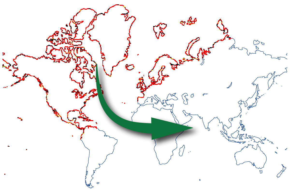
📣 ¡Entérate! <a href="/openstreetmap/">OpenStreetMap</a> introducirá los mapas vectoriales, un hito que trae consigo las teselas vectoriales. Este avance transformará la forma en que se manejan y muestran los datos del mapa. 🗺️

Conoce más en el blog: bit.ly/42ILj9K
LAC Hub - HOT 🌎 (@maphublac) 's Twitter Profile Photo

¡Descubre el potencial de OpenStreetMap! Acceder a los datos de #OSM para #QGIS y otras aplicaciones es ahora más fácil gracias a las mejoras en la herramienta de exportación de Humanitarian OpenStreetMap Team. 🗺️🛠️ ¡Conoce la actualización y aprovecha su potencial! → bit.ly/3uQTRPk
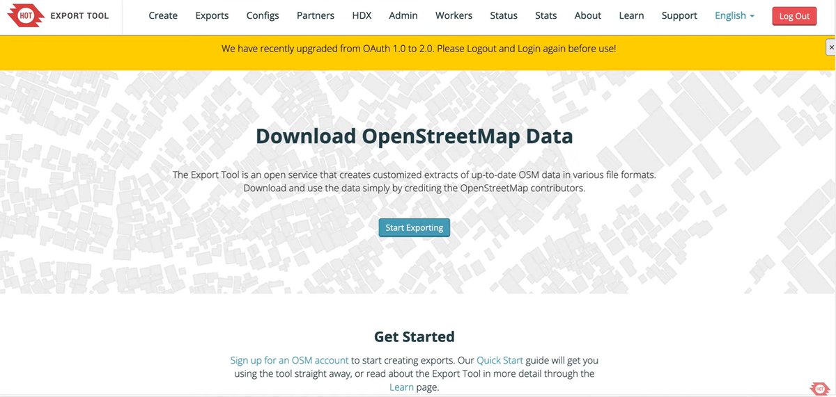

¡Descubre el potencial de <a href="/openstreetmap/">OpenStreetMap</a>! Acceder a los datos de #OSM para #QGIS y otras aplicaciones es ahora más fácil gracias a las mejoras en la herramienta de exportación de <a href="/hotosm/">Humanitarian OpenStreetMap Team</a>.

🗺️🛠️ ¡Conoce la actualización y aprovecha su potencial! → bit.ly/3uQTRPk
State of the Map (@sotm) 's Twitter Profile Photo

Our website is now live! 2025.stateofthemap.org 🤩🥳 📅 Conference dates: 3-5 October #SotM2025 #sotm #stateofthemap #stateofthemap2025

Our website is now live! 2025.stateofthemap.org 🤩🥳

📅 Conference dates: 3-5 October 

#SotM2025 #sotm #stateofthemap #stateofthemap2025