NICFI Satellite Data Program (@nicfisatdata) 's Twitter Profile
NICFI Satellite Data Program

@nicfisatdata

The NICFI Satellite Data Program is an initiative providing comprehensive access to high resolution satellite data across the #tropical forest regions

ID: 1564170938240966657

linkhttp://www.planet.com/nicfi calendar_today29-08-2022 08:41:06

454 Tweet

1,1K Followers

119 Following

Matt Finer (@mattfiner) 's Twitter Profile Photo

Organized crime goes international: links to illegal mining in Brazil, Colombia & Peru Fascinating (& terrifying) look at illegal mining across Amazon "new hotspots of Amazon illegal mining are in rivers" ojo-publico.com/5059/organized… Rodrigo Pedroso,Fundación para la Conservación y el Desarrollo,Conservación y Desarrollo Sostenible - Perú,OjoPúblico

NICFI Satellite Data Program (@nicfisatdata) 's Twitter Profile Photo

Are you using Planet's QGIS plugin to access the #NICFISatelliteDataProgram basemaps? One of our users experienced problems recently, and shared that with us. Luckily, there is a solution 👇 community.planet.com/integrations-7…

Are you using <a href="/planet/">Planet</a>'s <a href="/qgis/">QGIS</a> plugin to access the #NICFISatelliteDataProgram basemaps? 

One of our users experienced problems recently, and shared that with us. Luckily, there is a solution 👇

community.planet.com/integrations-7…
NICFI Satellite Data Program (@nicfisatdata) 's Twitter Profile Photo

Check out the JICA-JAXA's technical note explaining the new Forest Early Warning System in the Tropics JJ-FAST Planet-NICFI data is used to validated the alerts eorc.jaxa.jp/jjfast/note.ht… 🛰️🗺️👀✅ JICA - Japan International Cooperation Agency JAXA(Japan Aerospace Exploration Agency)

Check out the JICA-JAXA's technical note explaining the new Forest Early Warning System in the Tropics <a href="/JICA_JJFAST/">JJ-FAST</a> 

Planet-NICFI data is used to validated the alerts eorc.jaxa.jp/jjfast/note.ht… 🛰️🗺️👀✅

<a href="/jica_direct_en/">JICA - Japan International Cooperation Agency</a> <a href="/JAXA_en/">JAXA(Japan Aerospace Exploration Agency)</a>
NICFI Satellite Data Program (@nicfisatdata) 's Twitter Profile Photo

Our non-profit user Enveritas.org is working to decrease #deforestation related to smallholder coffee production in #Rwanda. partners.enveritas.org/rwanda-develop…?

NICFI Satellite Data Program (@nicfisatdata) 's Twitter Profile Photo

Having our users tell their colleagues about the #NICFISatelliteDataProgram is a great confirmation of its value. But even better, is when they tell THE INTERNET 🤩 Some examples👇 tinyurl.com/dhpxbdvk tinyurl.com/4r2tz539 tinyurl.com/yc567fky tinyurl.com/4v8v24hx

Having our users tell their colleagues about the #NICFISatelliteDataProgram is a great confirmation of its value. But even better, is when they tell THE INTERNET 🤩 

Some examples👇
tinyurl.com/dhpxbdvk
tinyurl.com/4r2tz539
tinyurl.com/yc567fky
tinyurl.com/4v8v24hx
NICFI Satellite Data Program (@nicfisatdata) 's Twitter Profile Photo

Did you miss the webinar, Deforestation Exposed, or do you have any questions about the NICFI Satellite Data Program data? Then join us for “office hours” on June 11 at 9 AM EST. Sign up here 👉 wri.zoom.us/webinar/regist…

Did you miss the webinar, Deforestation Exposed, or do you have any questions about the NICFI Satellite Data Program data? Then join us for “office hours” on June 11 at 9 AM EST. 

Sign up here 👉 wri.zoom.us/webinar/regist…
NICFI Satellite Data Program (@nicfisatdata) 's Twitter Profile Photo

🌱This #WorldEnvironmentDay, let’s stand up for our forests. The #NICFISatelliteDataProgram recognises that tropical forest conservation is vital to - 🌊 fresh water supplies 🌧️ regional rain patterns 🌍 life on the planet. To find out more, visit 👉t.ly/7qcK4

🌱This #WorldEnvironmentDay, let’s stand up for our forests.

The #NICFISatelliteDataProgram recognises that tropical forest conservation is vital to -

🌊 fresh water supplies
🌧️ regional rain patterns
🌍 life on the planet.

To find out more, visit 👉t.ly/7qcK4
NICFI Satellite Data Program (@nicfisatdata) 's Twitter Profile Photo

🌳Here we are! This week, the NICFI Satellite Data Program Team are at the Oslo Tropical Forest Forum to learn more about tropical forest conservation and reverse deforestation. To find out more, visit 👉t.ly/Xyut9 #OTFF2024

🌳Here we are! This week, the NICFI Satellite Data Program Team are at the Oslo Tropical Forest Forum to learn more about tropical forest conservation and reverse deforestation.

To find out more, visit 👉t.ly/Xyut9
#OTFF2024
NICFI Satellite Data Program (@nicfisatdata) 's Twitter Profile Photo

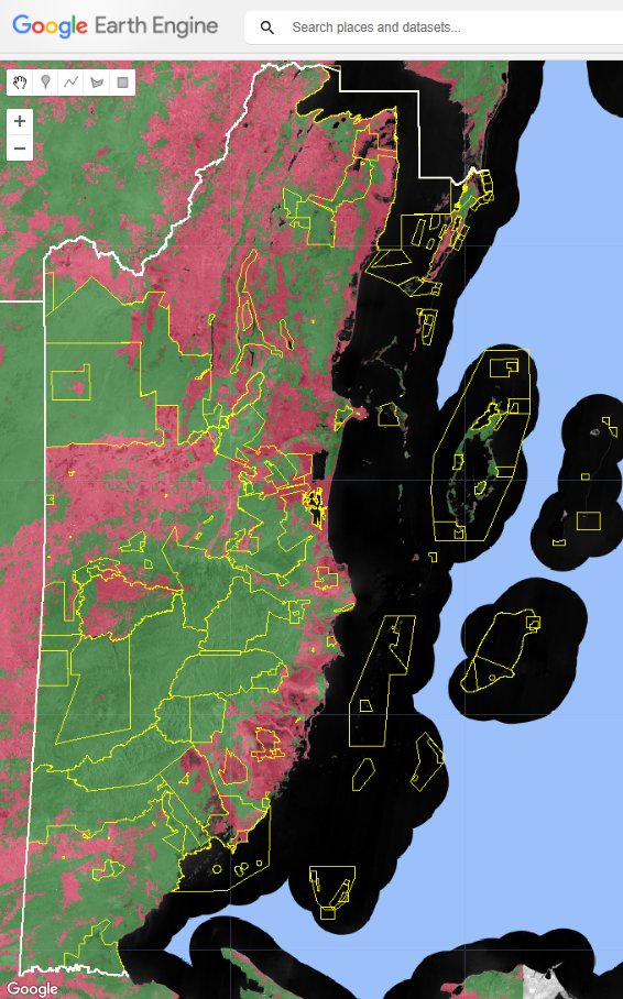
🛰️Check out the #GEE-based viewer that the 🇧🇿 Belize GEO 🛰️ team have compiled, which makes it possible to compare all 56 mosaics provided to date! 👉 Follow the link (if you have #EarthEngine access to the mosaics) to find out more! - code.earthengine.google.com/?scriptPath=us…

🛰️Check out the #GEE-based viewer that the <a href="/BzGEO/">🇧🇿 Belize GEO 🛰️</a> team have compiled, which makes it possible to compare all 56 mosaics provided to date! 

👉 Follow the link (if you have #EarthEngine access to the mosaics) to find out more! - code.earthengine.google.com/?scriptPath=us…