hurricanes
@hurricanes
News about hurricanes and the tropics - primarily in the Atlantic
ID: 1403031
https://www.sciencespacerobots.com/hurricanes/ 18-03-2007 07:19:42
1,1K Tweet
8,8K Followers
122 Following
 's Twitter Profile Photo")
 on Twitter photo #MILTON UPDATE: There is a lot to say about Hurricane Milton. But here are some key points:
- There is no way to know for sure if the Tampa Bay area will take a direct hit. It's too close to call. It will likely be too close to call up to near landfall.
- If the center jogs")
 's Twitter Profile Photo")
 on Twitter photo 🚨 A High Risk of Excessive Rainfall has been issued for parts of the central/northern FL Peninsula beginning tomorrow (Wednesday). Inland and coastal flooding may combine to increase the overall flood threat and produce the risk of life-threatening flash flooding. #FLwx")
 's Twitter Profile Photo")
 's Twitter Profile Photo")
 on Twitter photo 1100 AM EDT Wed Oct 09 2024
...TORNADIC SUPERCELLS FROM #MILTON BEGINNING TO SWEEP ACROSS THE
SOUTHERN #FLORIDA PENINSULA...
...THE TIME TO PREPARE, INCLUDING #EVACUATE IF TOLD DO SO, IS
QUICKLY COMING TO AN END ALONG THE FLORIDA WEST COAST...
#FL #hurricane #hurricanemilton")
@hurricanes
News about hurricanes and the tropics - primarily in the Atlantic
ID: 1403031
https://www.sciencespacerobots.com/hurricanes/ 18-03-2007 07:19:42
1,1K Tweet
8,8K Followers
122 Following
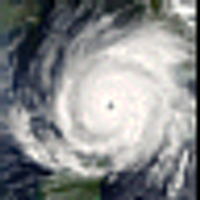
 on Twitter photo Hurricane Melissa's maximum sustained winds increased to 185 mph as it approaches Jamaica. The minimum central pressure is down to 892 mb. sciencespacerobots.com/melissa-185-mp…")