Grand County Office of Emergency Management (@grandcountyoem) 's Twitter Profile
Grand County Office of Emergency Management

@grandcountyoem

Enhancing public safety through education, communication, & coordination! Sign up for CodeRED Alerts: bit.ly/2msDnJX Find us on Facebook: GrandCountyOEM

ID: 35831099

linkhttp://www.gcemergency.com calendar_today27-04-2009 19:19:31

1,1K Tweet

3,3K Followers

125 Following
National Interagency Fire Center (@nifc_fire) 's Twitter Profile Photo

#NationalFireNews: Currently, 68 large fires have burned 438,904 acres. Three new large fires were reported, two in Idaho and one in Montana. More than 13,000 wildland firefighters and support personnel are assigned to incidents across the country. #FireYear2022

#NationalFireNews: Currently, 68 large fires have burned 438,904 acres. Three new large fires were reported, two in Idaho and one in Montana. More than 13,000 wildland firefighters and support personnel are assigned to incidents across the country. #FireYear2022
Grand County Office of Emergency Management (@grandcountyoem) 's Twitter Profile Photo

⚠️🔥 PRESCRIBED BURN ON COTTONWOOD PASS 🔥⚠️ Forest Service, ARP to continue the Blue Ridge prescribed fire project in the area near Cottonwood Pass as conditions allow. For more information, visit inciweb.nwcg.gov/incident/8439/ #GrandCountyColorado #prescribedburn #wildfiremitigation

NWS Boulder (@nwsboulder) 's Twitter Profile Photo

Berthoud Pass was the coldest spot in the nation today, with a low temperature of 5 F 🥶 It's currently 16 F, but with winds gusting to 33 mph, the wind chill is down to -3 F. #COwx

Grand County Office of Emergency Management (@grandcountyoem) 's Twitter Profile Photo

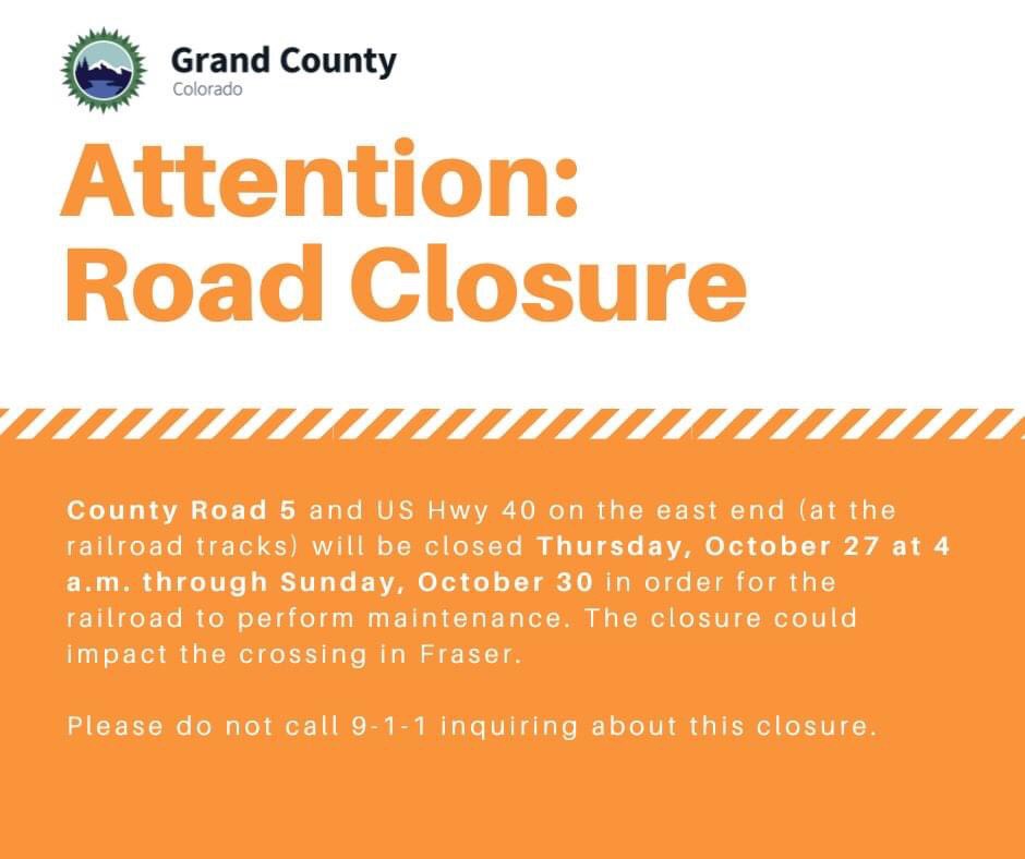
❗️PLEASE BE ADVISED ❗️ CR 5 and HWY 40 on the east end of (RR tracks) will be closed starting tomorrow October 27th at 4am and will reopen on Sunday October 30th.

❗️PLEASE BE ADVISED ❗️ CR 5 and HWY 40 on the east end of (RR tracks) will be closed starting tomorrow October 27th at 4am and will reopen on Sunday October 30th.
NWS Boulder (@nwsboulder) 's Twitter Profile Photo

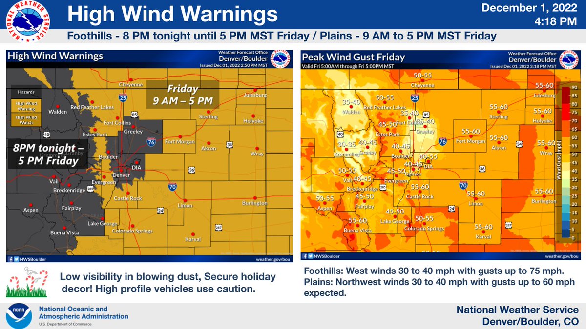
❄️Winter weather begins in the mountains tonight - Friday evening. 🍃Gusty winds arrive tonight - late Friday evening for most of the region. Secure holiday decor! #COwx 🧐We can't give all the details in one tweet so check out our packet for more info: weather.gov/media/bou/DssP…

❄️Winter weather begins in the mountains tonight - Friday evening. 
🍃Gusty winds arrive tonight - late Friday evening for most of the region. Secure holiday decor! #COwx
🧐We can't give all the details in one tweet so check out our packet for more info: weather.gov/media/bou/DssP…
Grand County Office of Emergency Management (@grandcountyoem) 's Twitter Profile Photo

NWS has issued a Snow Squall warning for Grand County. It will be starting in the NW around 9:30 AM and moving through the county until 12:00 PM. Expect wind gusts of up to 60 MPH. If possible, please avoid traveling at this time.

NWS Boulder (@nwsboulder) 's Twitter Profile Photo

Here are some of the latest wind reports across North Central and Northeastern Colorado. A High Wind Warning is in effect for much of the forecast area through 5 pm this afternoon. #cowx

Here are some of the latest wind reports across North Central and Northeastern Colorado. A High Wind Warning is in effect for much of the forecast area through 5 pm this afternoon.  #cowx
CO - Emergency Mgmt (@coemergency) 's Twitter Profile Photo

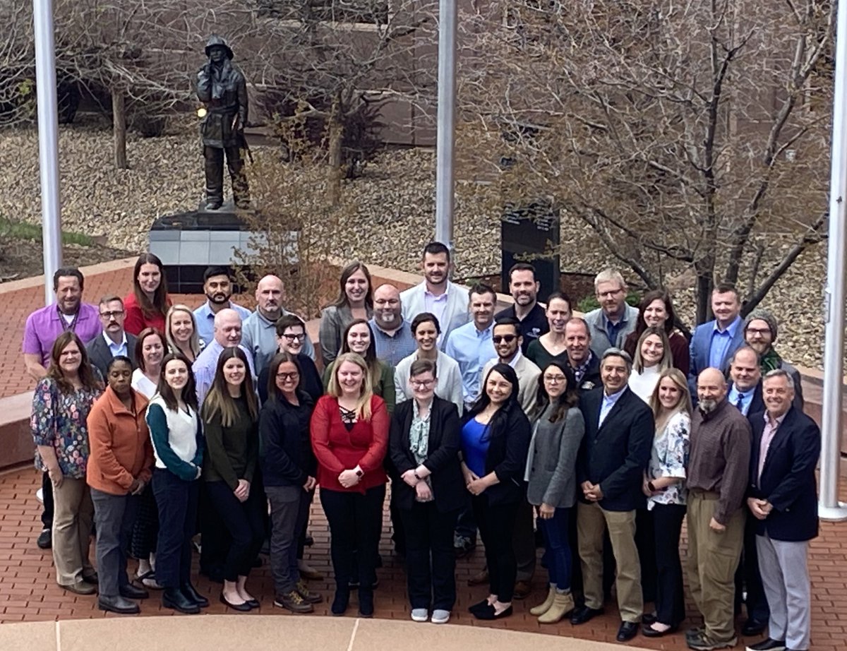
Congratulations to the 35 Colorado emergency management and public safety officials graduating from our National Emergency Management Basic Academy today after completing more than 120 hours of course hours.

Congratulations to the 35 Colorado emergency management and public safety officials graduating from our National  Emergency Management Basic Academy today after completing more than 120 hours of course hours.
NWS Boulder (@nwsboulder) 's Twitter Profile Photo

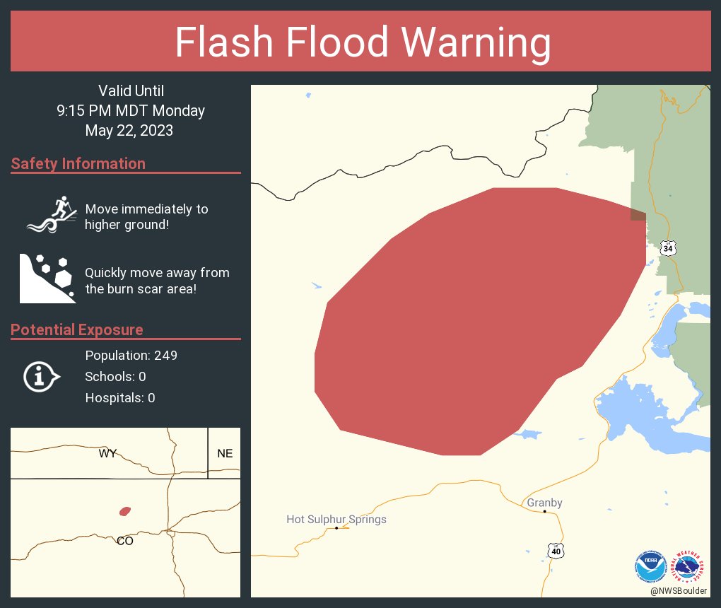
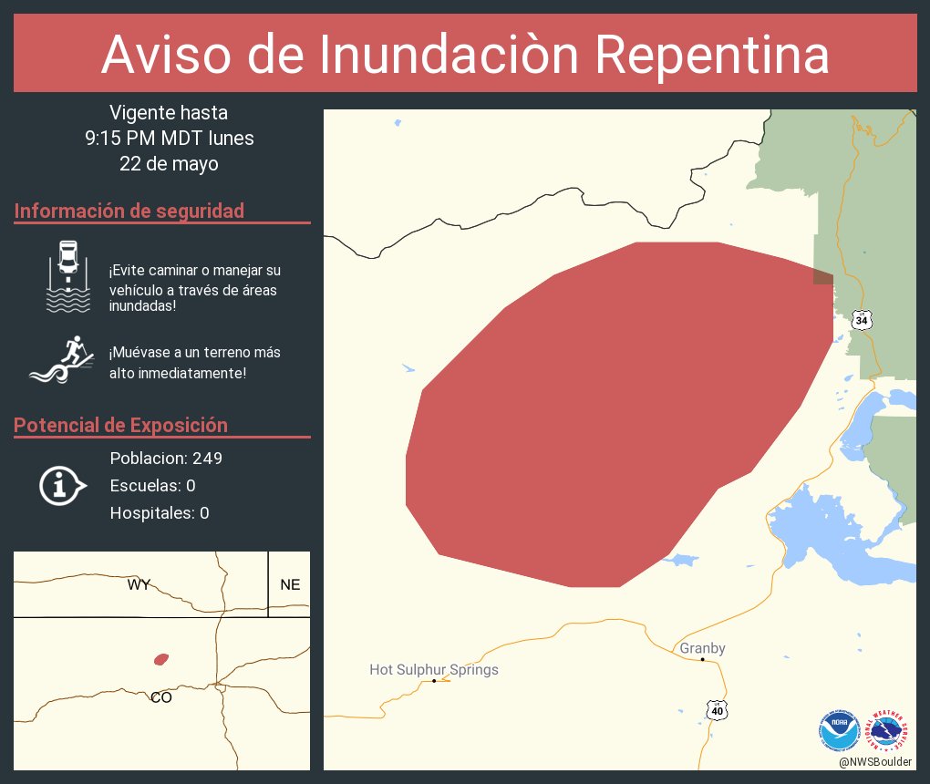
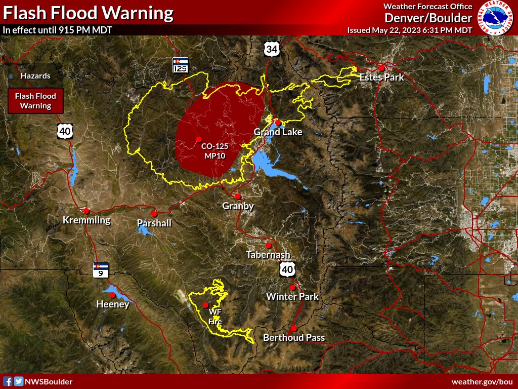
At 155 PM MDT, Doppler radar indicated thunderstorms producing heavy rain over the East Troublesome Burn Scar. Up to 0.5 inches of rain have fallen. Additional rainfall amounts up to 1 inch are possible in the warned area. Flash flooding is ongoing or expected to begin shortly.

NWS Boulder (@nwsboulder) 's Twitter Profile Photo

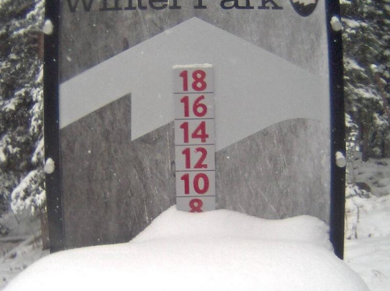
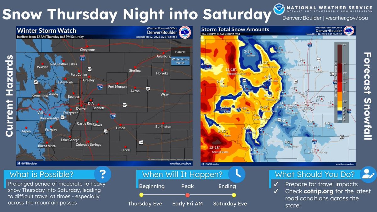
A Winter Storm Watch is in effect from late Thursday night through Saturday evening for the mountains. Snow accumulations of 8-16" are expected with locally higher amounts in Rabbit Ears Pass and Park Range. Be prepared for winter driving conditions! #cowx

A Winter Storm Watch is in effect from late Thursday night through Saturday evening for the mountains. Snow accumulations of 8-16" are expected with locally higher amounts in Rabbit Ears Pass and Park Range. Be prepared for winter driving conditions! #cowx
Grand County Office of Emergency Management (@grandcountyoem) 's Twitter Profile Photo

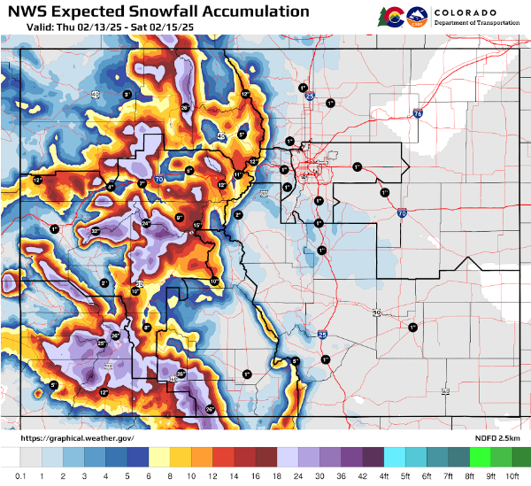
❄️WINTER WEATHER ALERT Snow totals on Rabbit Ears and Berthoud are expected to hit double digits with the incoming storm. #KnowBeforeYouGo this weekend! For current road conditions, please rely on cotrip.org, not calling 9-1-1. #grandcountycolorado #US40 #cowx

Colorado Department of Transportation (CDOT) (@coloradodot) 's Twitter Profile Photo

❄️TRAVEL ALERT❄️ | Travel in the mountains will be hazardous from Thursday evening (2/13/25) through Saturday morning (2/15) for both the central and southwestern mountains of #Colorado. 📰codot.gov/news/2025/febr… #COwx #WinterWise #KnowBeforeYouGo

❄️TRAVEL ALERT❄️ |  

Travel in the mountains will be hazardous from Thursday evening (2/13/25) through Saturday morning (2/15) for both the central and southwestern mountains of #Colorado.  

📰codot.gov/news/2025/febr…

#COwx #WinterWise #KnowBeforeYouGo
Grand County Office of Emergency Management (@grandcountyoem) 's Twitter Profile Photo

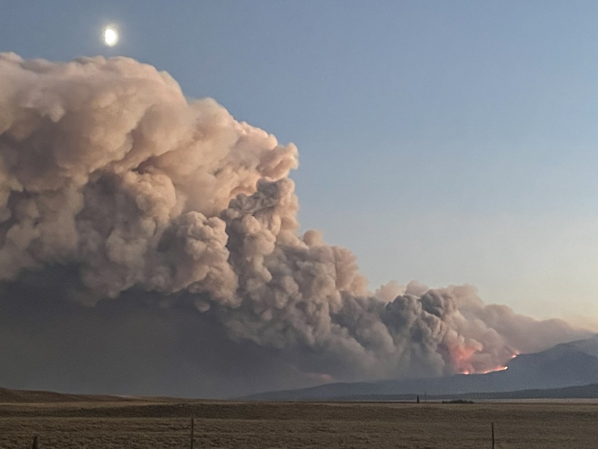
⚠️Find Windy Gap Fire updates at GCEmergency.com ⚠️ Public Information Phone Line: 970-725-7025, Option 1 #WindyGapFire #GrandCounty #COFire

⚠️Find Windy Gap Fire updates at GCEmergency.com ⚠️

Public Information Phone Line: 970-725-7025, Option 1

#WindyGapFire #GrandCounty #COFire