CJ Longo (@cjlongo_em) 's Twitter Profile
CJ Longo

@cjlongo_em

Emergency Manager-Planning Section Chief | BSEM ‘22, MSEM student @millersvilleu | Tweets=my own | #EMGTwitter | he/him 🏳️‍🌈

ID: 976314571639197696

calendar_today21-03-2018 04:28:27

1,1K Tweet

461 Followers

709 Following

National Weather Service (@nws) 's Twitter Profile Photo

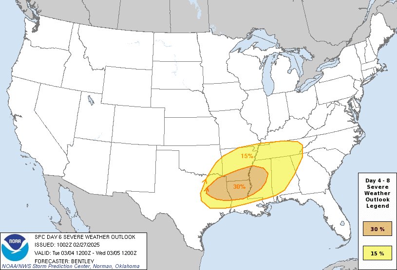
⚠️Heads Up On Tuesday and Wednesday "While specifics will remain uncertain until the event draws closer, the potential for multiple rounds of severe convection including supercells, clusters, and likely an eventual squall line will likely bring a threat for all severe weather

⚠️Heads Up On Tuesday and Wednesday
"While specifics will remain uncertain until the event draws closer, the potential for multiple rounds of severe convection including supercells, clusters, and likely an eventual squall line will likely bring a threat for all severe weather
National Weather Service (@nws) 's Twitter Profile Photo

❗️🧵This weekend brings the likelihood of dangerous severe weather (details in thread) Preparation should be completed now - before weather strikes: ✅Know your safe place ✅Assemble an emergency kit ✅Write a family plan ✅Practice drills at home and work ✅Have multiple ways

NWS Storm Prediction Center (@nwsspc) 's Twitter Profile Photo

This is only the 3rd time since at least 2006 (when we can easily query our records), and likely only the 3rd time in SPC history based on available data, that a High Risk has been issued on Day 2. The 2 previous times were: 4/14/2012 4/7/2006

National Weather Service (@nws) 's Twitter Profile Photo

Residents of... Alabama Mississippi Louisiana Western Georgia Tennessee The Florida Panhandle Today is a day to pay close attention to the weather. ✅Review your severe weather safety procedures for the possibility of dangerous weather today. ✅Stay tuned to NOAA Weather

Red Cross New Jersey (@njredcross) 's Twitter Profile Photo

We made 22 homes in the Center Homes neighborhood of South Toms River safer today, installing 60 free smoke alarms & educating families about vital fire safety steps! Thank you to South Toms River OEM, South Toms River EMS, Manitou Park Volunteer Fire Company, & South Toms River PD!
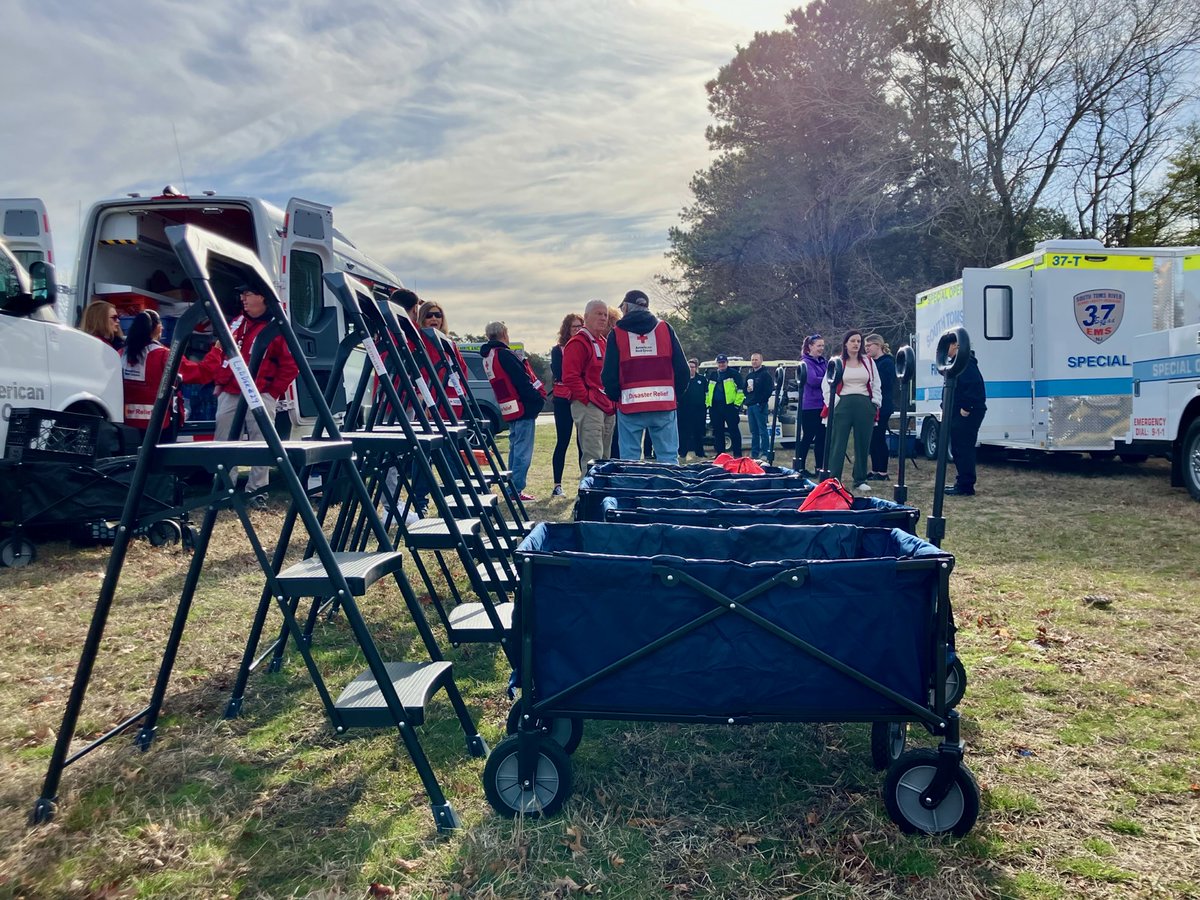
We made 22 homes in the Center Homes neighborhood of <a href="/STRBoro/">South Toms River</a> safer today, installing 60 free smoke alarms &amp; educating families about vital fire safety steps! Thank you to South Toms River OEM, South Toms River EMS, Manitou Park Volunteer Fire Company, &amp; South Toms River PD!
Steve Keeley (@keeleyfox29) 's Twitter Profile Photo

HAPPENING NOW: On scene with New Jersey Forest Fire Service teams at latest South Jersey wildfire burning in the dry forest & brush in Vineland, Cumberland County. Crews assessing as flames spread in what earlier was labeled “HIGH” risk conditions for forest fire today.

Red Cross New Jersey (@njredcross) 's Twitter Profile Photo

At this time, there are two shelters open for those evacuating due to the wildfire in Ocean County: Southern Regional High School 105 Cedar Bridge Road Manahawkin, NJ 08050 Manchester Township High School 101 Hawks Way Manchester, NJ 08759

At this time, there are two shelters open for those evacuating due to the wildfire in Ocean County:

Southern Regional High School
105 Cedar Bridge Road
Manahawkin, NJ 08050

Manchester Township High School
101 Hawks Way
Manchester, NJ 08759
Red Cross New Jersey (@njredcross) 's Twitter Profile Photo

More than 300 people stayed at our 2 temporary Red Cross shelters last night. At this time, many families are returning home as they’ve learned of evac orders being lifted. Our volunteers continue to support first responders and those actively fighting the #JonesRoadWildfire

More than 300 people stayed at our 2 temporary Red Cross shelters last night. At this time, many families are returning home as they’ve learned of evac orders being lifted. Our volunteers continue to support first responders and those actively fighting the #JonesRoadWildfire
New Jersey Forest Fire Service (@njdepforestfire) 's Twitter Profile Photo

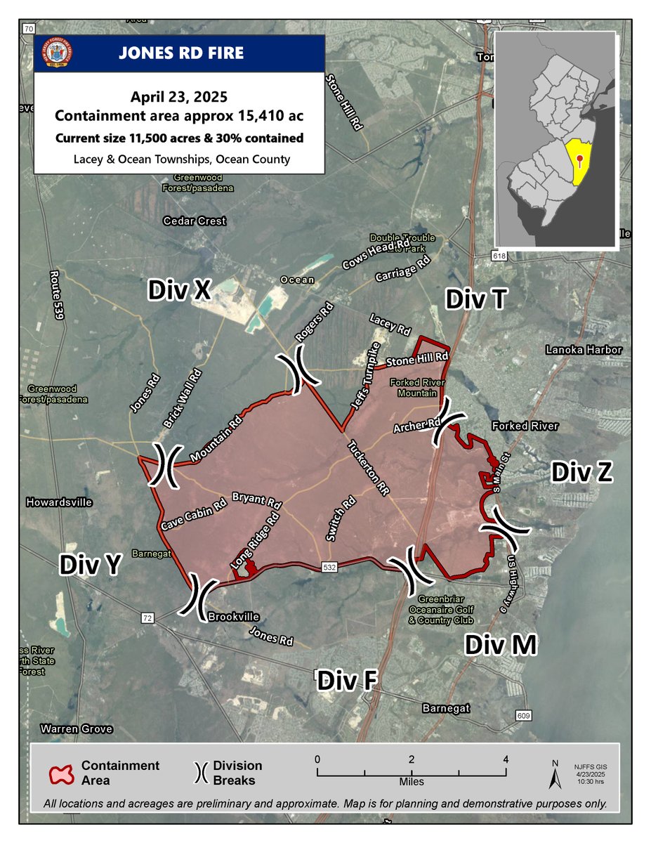
WILDFIRE UPDATE: Jones Road Wildfire - Ocean & Lacey Townships, Ocean County The New Jersey Forest Fire Service has released the attached map to outline the area of the Jones Road Wildfire to residents affected in Ocean & Lacey Townships.

WILDFIRE UPDATE: Jones Road Wildfire - Ocean &amp; Lacey Townships, Ocean County

The New Jersey Forest Fire Service has released the attached map to outline the area of the Jones Road Wildfire to residents affected in Ocean &amp; Lacey Townships.
Red Cross New Jersey (@njredcross) 's Twitter Profile Photo

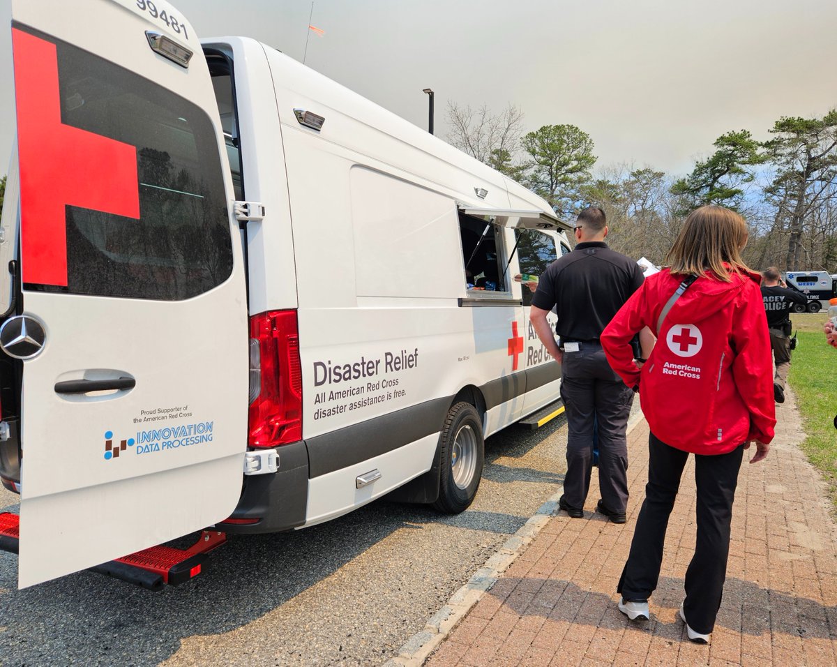
More than 50 Red Cross volunteers and staff have been supporting first responders and firefighters as they battle the Jones Road Wildfire in #OceanCounty. Today, teams also delivered masks & meals to communities, helping residents cope with a difficult two days.

More than 50 Red Cross volunteers and staff have been supporting first responders and firefighters as they battle the Jones Road Wildfire in #OceanCounty. Today, teams also delivered masks &amp; meals to communities, helping residents cope with a difficult two days.
New Jersey Forest Fire Service (@njdepforestfire) 's Twitter Profile Photo

WILDFIRE UPDATE: Jones Road Wildfire - Ocean & Lacey Townships, Ocean County At 12 p.m. on Monday, April 28, @NJDEPForestFire achieved 75% containment of a 15,300-acre wildfire burning in the Ocean County Natural Lands Trust’s Forked River Mountains Wilderness Area.

WILDFIRE UPDATE: Jones Road Wildfire - Ocean &amp; Lacey Townships, Ocean County

At 12 p.m. on Monday, April 28, @NJDEPForestFire achieved 75% containment of a 15,300-acre wildfire burning in the Ocean County Natural Lands Trust’s Forked River Mountains Wilderness Area.
NWS Mount Holly (@nws_mountholly) 's Twitter Profile Photo

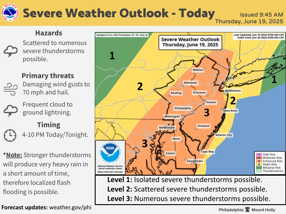
Update: Hot and very humid conditions will fuel thunderstorm development later this afternoon and evening. Severe thunderstorms are possible with damaging winds to 70 mph the main threat. Timing is 4-10 PM, mostly from west to east. Stay weather aware! #pawx #mdwx #dewx #njwx

Update: Hot and very humid conditions will fuel thunderstorm development later this afternoon and evening. Severe thunderstorms are possible with damaging winds to 70 mph the main threat. Timing is 4-10 PM, mostly from west to east. Stay weather aware! #pawx #mdwx #dewx #njwx
Red Cross New Jersey (@njredcross) 's Twitter Profile Photo

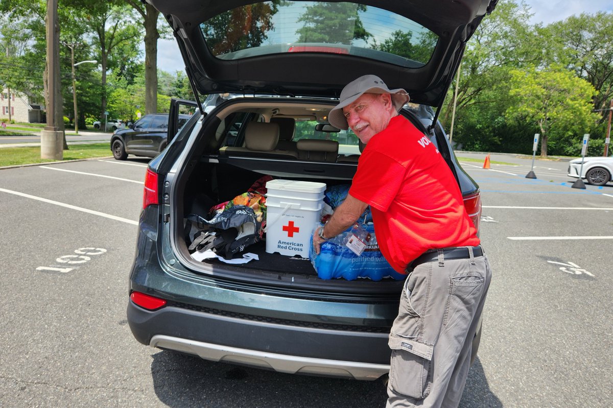
Red Cross volunteers continue to help their neighbors affected by the flooding in Central NJ caused by torrential rains Monday evening. We've been out distributing emergency supplies like cleanup kits, food and water. Read more about how we're helping: rdcrss.org/46QrMbf

Red Cross volunteers continue to help their neighbors affected by the flooding in Central NJ caused by torrential rains Monday evening. We've been out distributing emergency supplies like cleanup kits, food and water. Read more about how we're helping: rdcrss.org/46QrMbf
Reed Timmer, PhD (@reedtimmerusa) 's Twitter Profile Photo

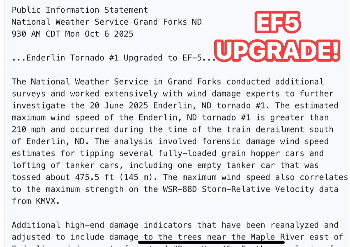
BIG BREAKING NEWS! The Enderlin, North Dakota #tornado from June 20, 2025 has been UPGRADED TO AN EF5. This is the first EF5 since 2013, and happened during the record-breaking year for tornadoes in North Dakota. This happened with the second supercell while we were doing search

BIG BREAKING NEWS! The Enderlin, North Dakota #tornado from June 20, 2025 has been UPGRADED TO AN EF5. This is the first EF5 since 2013, and happened during the record-breaking year for tornadoes in North Dakota. This happened with the second supercell while we were doing search
Collin Gross (@collingrosswx) 's Twitter Profile Photo

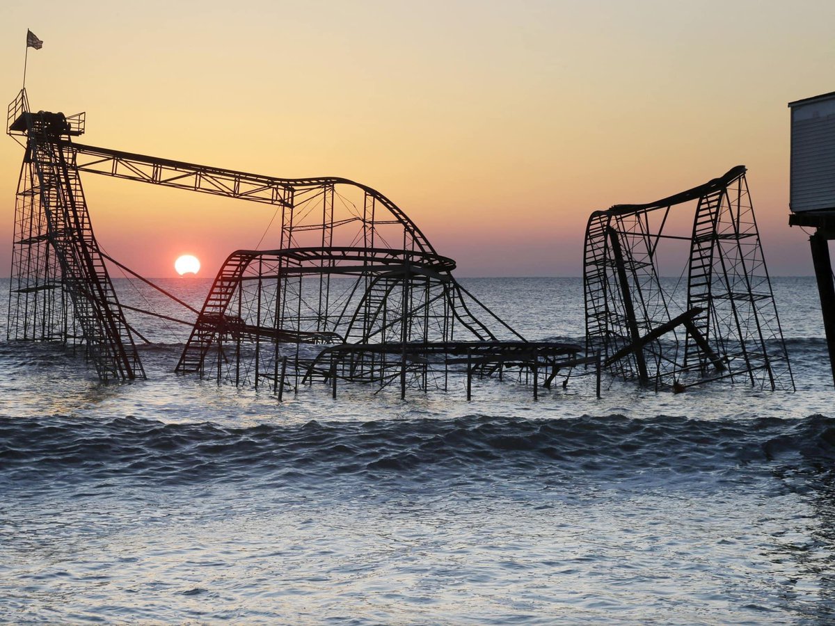
13 years ago today, Superstorm Sandy made its catastrophic landfall in New Jersey. 80-90mph winds caused extensive tree damage and a storm surge of 4-9 feet forever changed coastal communities. Damage totaled $36.8 billion, making it the costliest storm in state history.

13 years ago today, Superstorm Sandy made its catastrophic landfall in New Jersey. 80-90mph winds caused extensive tree damage and a storm surge of 4-9 feet forever changed coastal communities. Damage totaled $36.8 billion, making it the costliest storm in state history.