Anne Brown (@annebrownkjrh) 's Twitter Profile
Anne Brown

@annebrownkjrh

Weekend Morning Meteorologist @kjrh, previously worked @WeatherTeam18 / From Tulsa, OK @Cascia_Alumni / @UofOklahoma graduate

ID: 942881646298189824

linkhttp://kjrh.com calendar_today18-12-2017 22:17:57

3,3K Tweet

1,1K Followers

907 Following
NWS Tulsa (@nwstulsa) 's Twitter Profile Photo

The Winter Weather Awareness Week topic for this Tuesday is Winter Precip Types. We get all of them and it's not just the surface conditions that determine them. Reporting real-time precip types via mPING, social media or a simple phone call helps our ops! #okwx #arwx #WWAW2024

The Winter Weather Awareness Week topic for this Tuesday is Winter Precip Types. We get all of them and it's not just the surface conditions that determine them. Reporting real-time precip types via mPING, social media or a simple phone call helps our ops! #okwx #arwx #WWAW2024
Oklahoma Mesonet (@okmesonet) 's Twitter Profile Photo

Another look back at Christmas Day weather (no, don't bother clicking for embiggenation, just go by the colors). 2021 still stands as the warmest in Mesonet history, and 2000's version is still the coldest. Get the deets in today's Ticker ticker.mesonet.org #okwx #okmesonet

Another look back at Christmas Day weather (no, don't bother clicking for embiggenation, just go by the colors).  2021 still stands as the warmest in Mesonet history, and 2000's version is still the coldest. Get the deets in today's Ticker ticker.mesonet.org #okwx #okmesonet
NWS Tulsa (@nwstulsa) 's Twitter Profile Photo

In what seems like a broken record here lately, areas of dense fog are expected to develop tonight into Monday across mainly eastern #OKwx. This fog is likely to impact the morning commute. Advisories may be needed later this evening.

In what seems like a broken record here lately, areas of dense fog are expected to develop tonight into Monday across mainly eastern #OKwx. This fog is likely to impact the morning commute. Advisories may be needed later this evening.
NWS Tulsa (@nwstulsa) 's Twitter Profile Photo

Our latest briefing for what to expect for the next week: youtube.com/watch?v=vqnH0g… Highlights: 1.) Cooler and breezy this evening and Tuesday 2.) Quiet weather mid week 3.) Another storm brings much cooler weather to the area next week, potentially some wintry precip. #okwx #arwx

NWS Tulsa (@nwstulsa) 's Twitter Profile Photo

Clouds are beginning to clear from the west and will continue through the afternoon allowing some melting, especially on roads. The green in this image is showing the large footprint of snowfall experienced across the region over the last 36 hours. #okwx #arwx

NWS Tulsa (@nwstulsa) 's Twitter Profile Photo

We expanded the Winter Weather Advisory for a larger portion of northeast OK and northwest AR. It's looking like up to 2" of snow/sleet with a light glaze of freezing rain. The highest amounts will be close to the OK-KS border, except more ice in NW AR. #okwx #arwx

We expanded the Winter Weather Advisory for a larger portion of northeast OK and northwest AR. It's looking like up to 2" of snow/sleet with a light glaze of freezing rain. The highest amounts will be close to the OK-KS border, except more ice in NW AR. #okwx #arwx
NWS Tulsa (@nwstulsa) 's Twitter Profile Photo

Damage surveys from this afternoon found 5 tornadoes from this morning's activity. Further assessment will continue tomorrow with another one or two areas of interest. #okwx forecast.weather.gov/product.php?si…

NWS Tulsa (@nwstulsa) 's Twitter Profile Photo

[03/29/25 4:29 PM] The potential for severe weather is expected to ramp up later this evening and into the overnight hours across NE OK & far NW AR with all modes of severe weather possible. Stay weather aware as we move into this evening. #okwx #arwx

[03/29/25 4:29 PM] The potential for severe weather is expected to ramp up later this evening and into the overnight hours across NE OK & far NW AR with all modes of severe weather possible. Stay weather aware as we move into this evening. #okwx #arwx
Weatherdemon⚡️🌪🌪⚡️ (@weatherdemon) 's Twitter Profile Photo

#okwx Michael Seger Emma Landeros Anne Brown Brandon Wholey KJRH NWS Tulsa So far I have seen fences gone, trees are rooted, 628 inch tree branches down, between 98th St., North and Garnett tracking east north east to 106th St. north and 129th Ave. The image is from St. John’s i
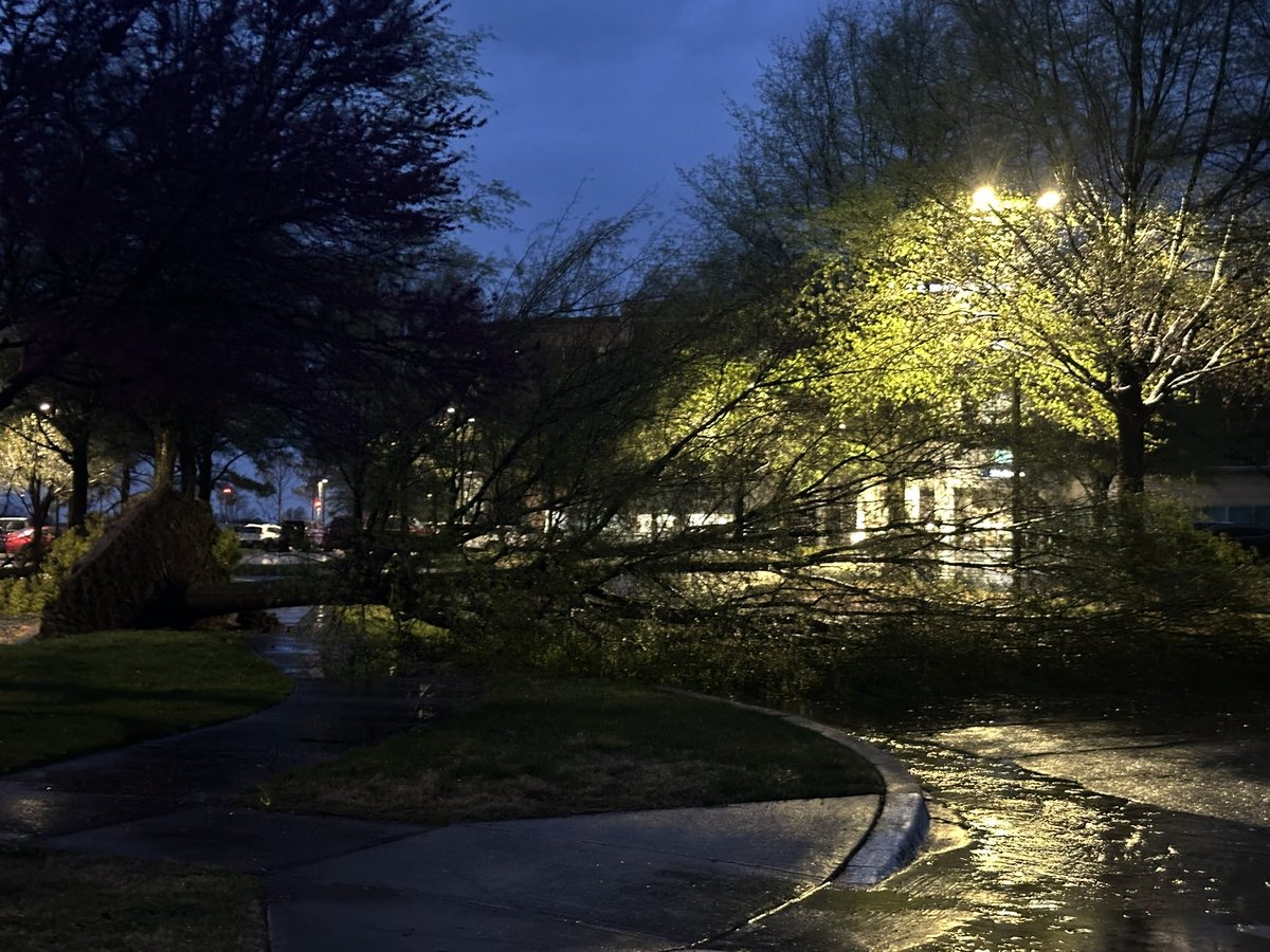
#okwx <a href="/MichaelSeger/">Michael Seger</a> <a href="/emmalanderoswx/">Emma Landeros</a> <a href="/AnneBrownKJRH/">Anne Brown</a> <a href="/BrandonWholey/">Brandon Wholey KJRH</a> <a href="/NWStulsa/">NWS Tulsa</a>
So far I have seen fences gone, trees are rooted, 628 inch tree branches down, between 98th St., North and Garnett tracking east north east to 106th St. north and 129th Ave. The image is from St. John’s i