Narangerel Davaasuren
@d_narangerel
Technology services, image processing, Environmental sciences, Remote sensing, GIS
ID: 355399437
15-08-2011 08:55:27
267 Tweet
56 Takipçi
290 Takip Edilen

Check out "PACE Applications Workshop 2022" eventbrite.com/e/pace-applica… Eventbrite

📢 Anyone who is interested to participate in IGARSS 2022 with no presentation can register anytime until the conference date, including walk-in: igarss2022.org/registration.a… IGARSS 2022 #IGARSS2022 #geoscience #remotesensing #utar #KualaLumpur





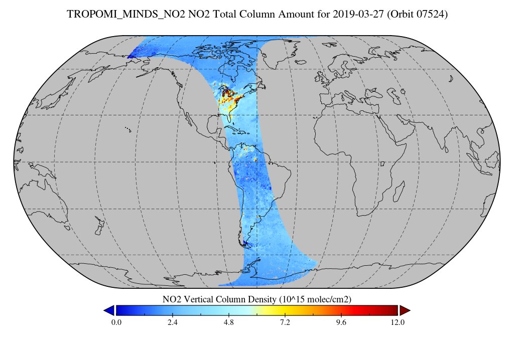
On our MINDS: A new MEaSUREs Multi-Decadal Nitrogen Dioxide and Derived Products from Satellites (MINDS) nitrogen dioxide L2 dataset derived from the TROPOMI instrument on the ESA Earth Observation Sentinel-5P satellite is available at NASA’s #GESDISC. Discover data: go.nasa.gov/39yHgW3


VLIZ recruits: a biodiversity science officer in the framework of the Horizon Europe 🇪🇺 projects Marco-Bolo, MARBEFES and iMagine. Apply no later than September 11. More information 👉🏾bit.ly/3w6q5Dh #jobsatvliz #marineobservationcentre #biodiversity


‼️ Job Opportunity ‼️ 🌊📈💻 The British Oceanographic Data Centre are hiring a marine data manager! British Oceanographic Data Centre Based in either Southampton or Liverpool, apply now! careers.noc.ac.uk/vacancy/marine… #marinedatamanager #marinejob #jobopportunity

🌍 Learn how to use #CREODIAS, the European platform for EO data access & processing, and take advantage of its full potential. Watch our free on-demand webinar: youtu.be/BRrfEy3wMyU Copernicus EU CloudFerro S.A.


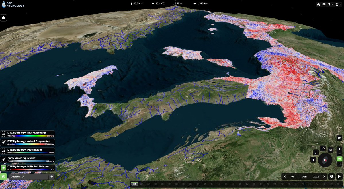
High-resolution soil moisture for the whole #Mediterranean Basin is coming! You can explore the data, enjoy here😀 explorer.dte-hydro.adamplatform.eu In the framework of ESA Earth Observation projects #digitaltwinearth #hydrology and 4dmed #hydrology

The #Brunt iceberg is free! 🧊🌊 After yesterday's calving event was detected, the first high-res images were taken by Copernicus EU's #Sentinel2 this morning 📸🛰️ The distance it has already moved is amazing - definitely one to watch 👀





High-resolution methane mapping with hyper and multispectral data (HiResCH4)🌬️ 🛰️HiResCH4 project explores few missions' potential (e.g. Sentinel-2, PRISMA) for methane mapping through simulations, advanced retrieval methods, and real data evaluation. 🔗eo4society.esa.int/2024/06/10/met…
