CYMS Cyclone Monitoring Service by Sentinel-1 (@cyms_s1) 's Twitter Profile
CYMS Cyclone Monitoring Service by Sentinel-1

@cyms_s1

provides SAR-derived ocean surface wind speed data along Tropical Cyclone tracks, funded by MPC-S1.
find us on bsky.app/profile/cyms-s…

ID: 1275058420480126977

linkhttp://www.esa-cyms.org calendar_today22-06-2020 13:30:01

173 Tweet

196 Followers

36 Following

CYMS Cyclone Monitoring Service by Sentinel-1 (@cyms_s1) 's Twitter Profile Photo

Hurricane #John, eastern Pacific. ESA Earth Observation acquisitions on 2024/09/24 on 00:47 UTC, for #2024SHOC from Copernicus EU #Sentinel1 A. Max sustained wind velocities (left) just above 55 m/s, derived from SAR sea surface roughness (right).
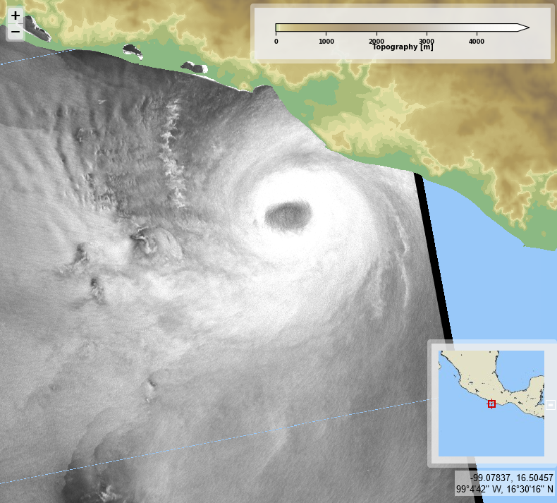
Hurricane #John, eastern Pacific. <a href="/ESA_EO/">ESA Earth Observation</a> acquisitions on 2024/09/24 on 00:47 UTC, for #2024SHOC from <a href="/CopernicusEU/">Copernicus EU</a> #Sentinel1 A. Max sustained wind velocities (left) just above 55 m/s, derived from SAR sea surface roughness (right).
CYMS Cyclone Monitoring Service by Sentinel-1 (@cyms_s1) 's Twitter Profile Photo

Hurricane #John (again), eastern Pacific and #Helene, Gulf of Mexico. ESA Earth Observation acquisitions on 2024/09/26 on 12:43 & 23:37 UTC resp., for #2024SHOC from Copernicus EU #Sentinel1 A. Max sustained wind velocities (left) resp. around 45 and 55 m/s, derived from SAR roughness (right).
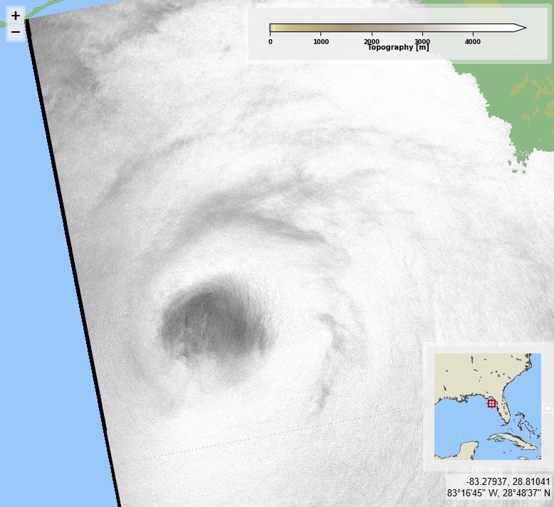
Hurricane #John (again), eastern Pacific and #Helene, Gulf of Mexico. <a href="/ESA_EO/">ESA Earth Observation</a> acquisitions on 2024/09/26 on 12:43 &amp; 23:37 UTC resp., for #2024SHOC from <a href="/CopernicusEU/">Copernicus EU</a> #Sentinel1 A. Max sustained wind velocities (left) resp. around 45 and 55 m/s, derived from SAR roughness (right).
CYMS Cyclone Monitoring Service by Sentinel-1 (@cyms_s1) 's Twitter Profile Photo

Typhoon #Krathon, western Pacific. ESA Earth Observation acquisitions on 2024/09/30, 22:01 UTC, for #2024SHOC from Copernicus EU #Sentinel1 A. Max sustained wind velocities (left) reaching nearly 60 m/s, derived from SAR sea surface roughness (right).
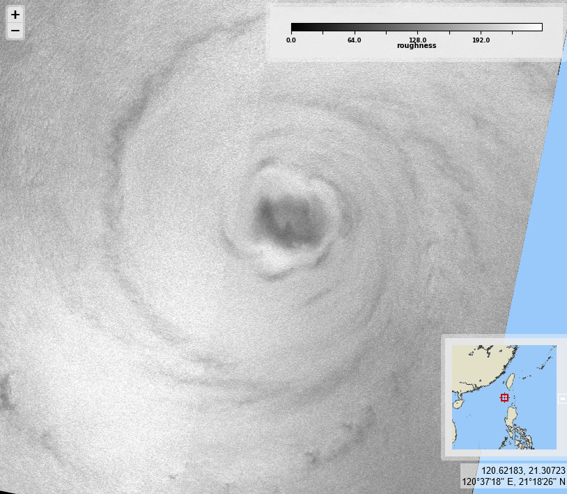
Typhoon #Krathon, western Pacific. <a href="/ESA_EO/">ESA Earth Observation</a> acquisitions on 2024/09/30, 22:01 UTC, for #2024SHOC from <a href="/CopernicusEU/">Copernicus EU</a> #Sentinel1 A. Max sustained wind velocities (left) reaching nearly 60 m/s, derived from SAR sea surface roughness (right).
CYMS Cyclone Monitoring Service by Sentinel-1 (@cyms_s1) 's Twitter Profile Photo

Two acquisitions over hurricane #Krik ~12h30 appart. ESA Earth Observation acquisitions on 2024/10/02, 08:36 & 21:05 UTC, for #2024SHOC from Copernicus EU #Sentinel1 A. Max sustained wind velocities (left) just over 35 m/s first, then reaching nearly 50 m/s, derived from SAR roughness (right).
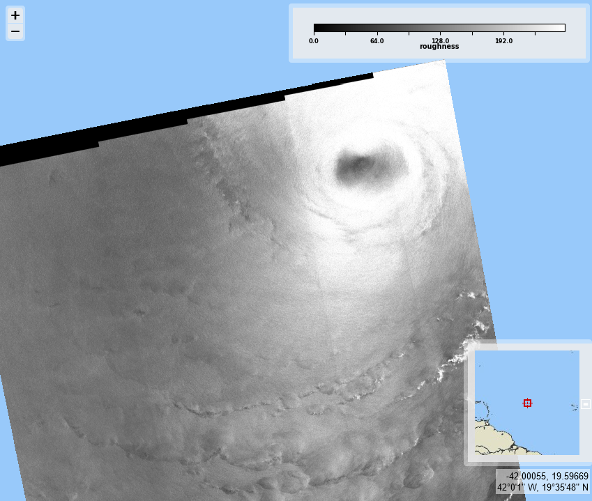
Two acquisitions over hurricane #Krik ~12h30 appart. <a href="/ESA_EO/">ESA Earth Observation</a> acquisitions on 2024/10/02, 08:36 &amp; 21:05 UTC, for #2024SHOC from <a href="/CopernicusEU/">Copernicus EU</a> #Sentinel1 A. Max sustained wind velocities (left) just over 35 m/s first, then reaching nearly 50 m/s, derived from SAR roughness (right).
CYMS Cyclone Monitoring Service by Sentinel-1 (@cyms_s1) 's Twitter Profile Photo

Tropical storm #Oscar, over the Tucks and Caicos islands. ESA Earth Observation acquisitions on 2024/10/19 on 22:54 UTC, for #2024SHOC from Copernicus EU #Sentinel1 A. Max sustained wind velocities (left) above 35 m/s, derived from SAR sea surface roughness (right).
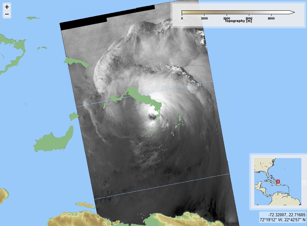
Tropical storm #Oscar, over the Tucks and Caicos islands. <a href="/ESA_EO/">ESA Earth Observation</a> acquisitions on 2024/10/19 on 22:54 UTC, for #2024SHOC from <a href="/CopernicusEU/">Copernicus EU</a> #Sentinel1 A. Max sustained wind velocities (left) above 35 m/s, derived from SAR sea surface roughness (right).
CYMS Cyclone Monitoring Service by Sentinel-1 (@cyms_s1) 's Twitter Profile Photo

Hurricane #Kristy, eastern Pacific. ESA Earth Observation acquisitions on 2024/10/25 on 2:17 UTC, for #2024SHOC from Copernicus EU #Sentinel1 A. Max sustained wind velocities (left) just below 58 m/s, derived from SAR sea surface roughness (right).
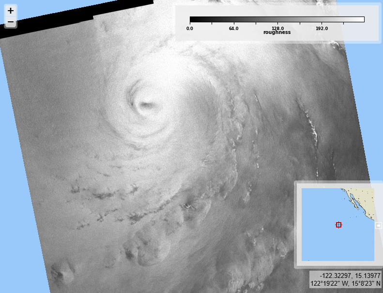
Hurricane #Kristy, eastern Pacific. <a href="/ESA_EO/">ESA Earth Observation</a> acquisitions on 2024/10/25 on 2:17 UTC, for #2024SHOC from <a href="/CopernicusEU/">Copernicus EU</a> #Sentinel1 A. Max sustained wind velocities (left) just below 58 m/s, derived from SAR sea surface roughness (right).
CYMS Cyclone Monitoring Service by Sentinel-1 (@cyms_s1) 's Twitter Profile Photo

Typhoon #Kong-rey, east of Philippines. ESA Earth Observation acquisitions on 2024/10/28 on 21:29 UTC, for #2024SHOC from Copernicus EU #Sentinel1 A. Max sustained wind velocities (left) just below 50 m/s, derived from SAR sea surface roughness (right).
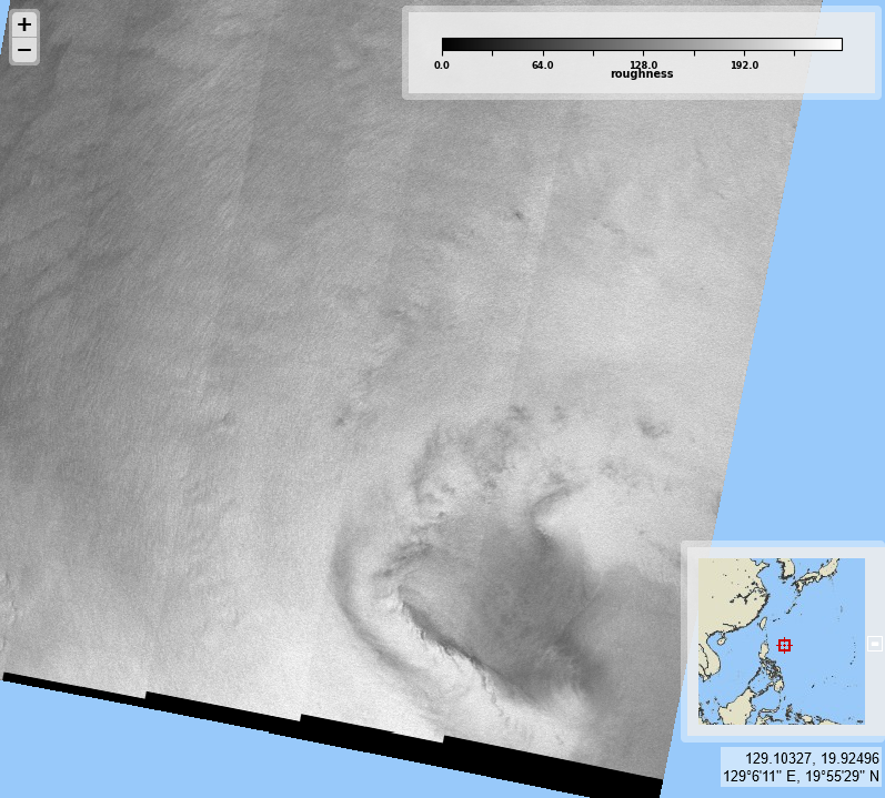
Typhoon #Kong-rey, east of Philippines. <a href="/ESA_EO/">ESA Earth Observation</a> acquisitions on 2024/10/28 on 21:29 UTC, for #2024SHOC from <a href="/CopernicusEU/">Copernicus EU</a> #Sentinel1 A. Max sustained wind velocities (left) just below 50 m/s, derived from SAR sea surface roughness (right).
CYMS Cyclone Monitoring Service by Sentinel-1 (@cyms_s1) 's Twitter Profile Photo

#Kong-rey, close to Taiwan, and tropical storm Patty, east of Azores. ESA Earth Observation acquisitions on 2024/10/31 & 11/02 resp., for #2024SHOC from Copernicus EU #Sentinel1 A. Max sustained wind velocities (left), derived from SAR sea surface roughness (right).
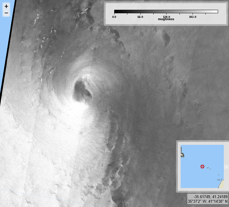
#Kong-rey, close to Taiwan, and tropical storm Patty, east of Azores. <a href="/ESA_EO/">ESA Earth Observation</a> acquisitions on 2024/10/31 &amp; 11/02 resp., for #2024SHOC from <a href="/CopernicusEU/">Copernicus EU</a> #Sentinel1 A. Max sustained wind velocities (left), derived from SAR sea surface roughness (right).
CYMS Cyclone Monitoring Service by Sentinel-1 (@cyms_s1) 's Twitter Profile Photo

Typhoon #Yinxing, east of Philippines. ESA Earth Observation acquisitions on 2024/11/04 on 21:21 UTC, for #2024SHOC from Copernicus EU #Sentinel1 A. Max sustained wind velocities (left) just over 50 m/s, derived from SAR sea surface roughness (right).
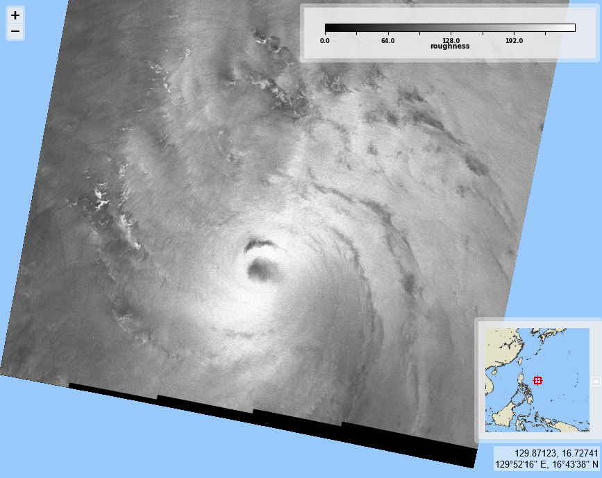
Typhoon #Yinxing, east of Philippines. <a href="/ESA_EO/">ESA Earth Observation</a> acquisitions on 2024/11/04 on 21:21 UTC, for #2024SHOC from <a href="/CopernicusEU/">Copernicus EU</a> #Sentinel1 A. Max sustained wind velocities (left) just over 50 m/s, derived from SAR sea surface roughness (right).
CYMS Cyclone Monitoring Service by Sentinel-1 (@cyms_s1) 's Twitter Profile Photo

Hurricane #Rafael, north of western Cuba. ESA Earth Observation acquisitions on 2024/11/06 on 23:43 UTC, for #2024SHOC from Copernicus EU #Sentinel1 A. Max sustained wind velocities (left) nearing 55 m/s, derived from SAR sea surface roughness (right).
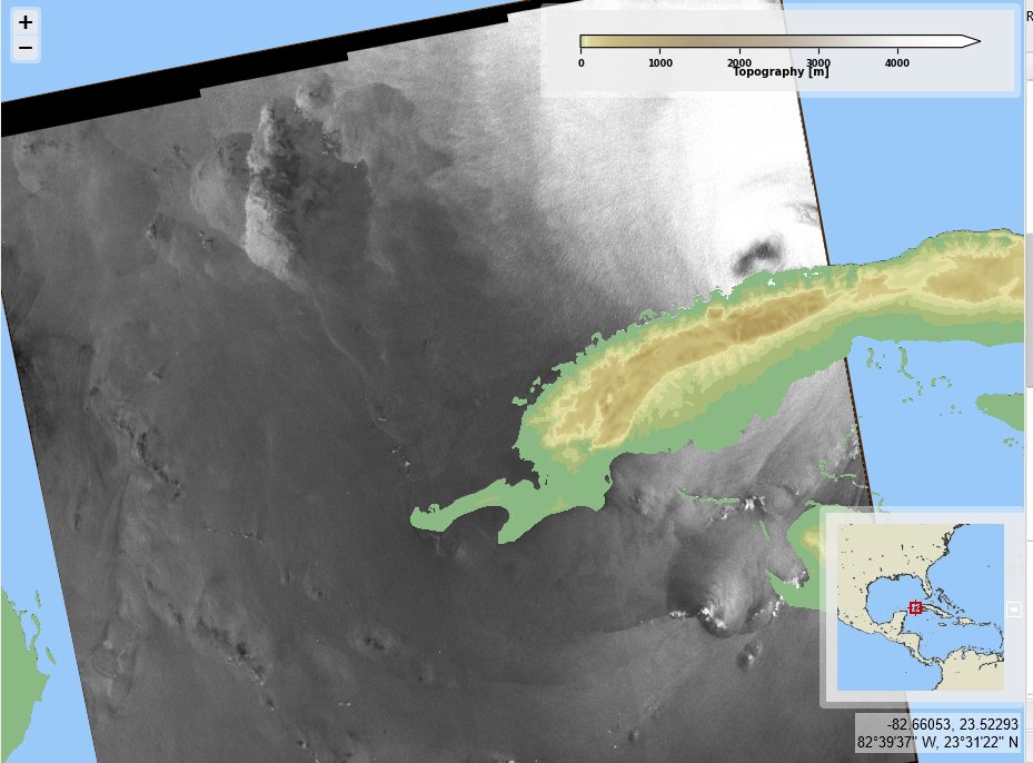
Hurricane #Rafael, north of western Cuba. <a href="/ESA_EO/">ESA Earth Observation</a> acquisitions on 2024/11/06 on 23:43 UTC, for #2024SHOC from <a href="/CopernicusEU/">Copernicus EU</a> #Sentinel1 A. Max sustained wind velocities (left) nearing 55 m/s, derived from SAR sea surface roughness (right).
CYMS Cyclone Monitoring Service by Sentinel-1 (@cyms_s1) 's Twitter Profile Photo

Typhoon #Yinxing again, west of Philippines. ESA Earth Observation acquisitions on 2024/11/08 on 10:15 UTC, for #2024SHOC from Copernicus EU #Sentinel1 A. Max sustained wind velocities (left) just over 45 m/s, derived from SAR sea surface roughness (right).
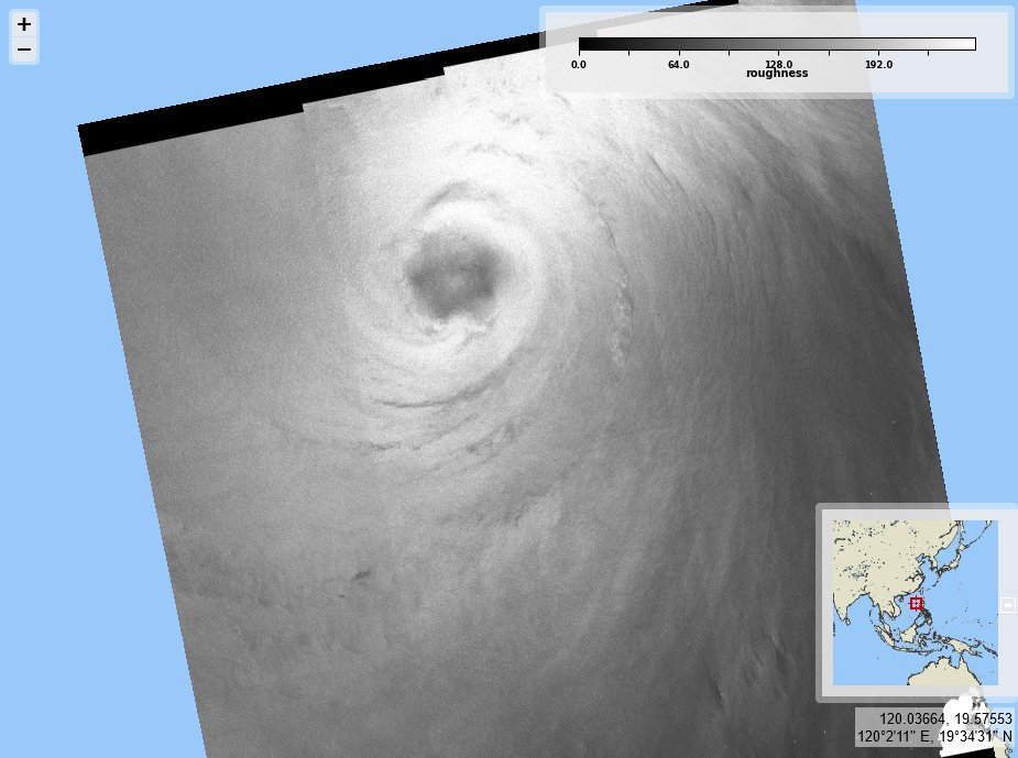
Typhoon #Yinxing again, west of Philippines. <a href="/ESA_EO/">ESA Earth Observation</a> acquisitions on 2024/11/08 on 10:15 UTC, for #2024SHOC from <a href="/CopernicusEU/">Copernicus EU</a> #Sentinel1 A. Max sustained wind velocities (left) just over 45 m/s, derived from SAR sea surface roughness (right).
CYMS Cyclone Monitoring Service by Sentinel-1 (@cyms_s1) 's Twitter Profile Photo

Typhoon #ManYi and tropical storm #Sara. ESA Earth Observation acquisitions on 2024/11/17 22:02 & 16 23:58 UTC, for #2024SHOC from Copernicus EU #Sentinel1 A. Max sustained wind velocities (left) around 30 m/s & 18 m/s, derived from SAR sea surface roughness (right).
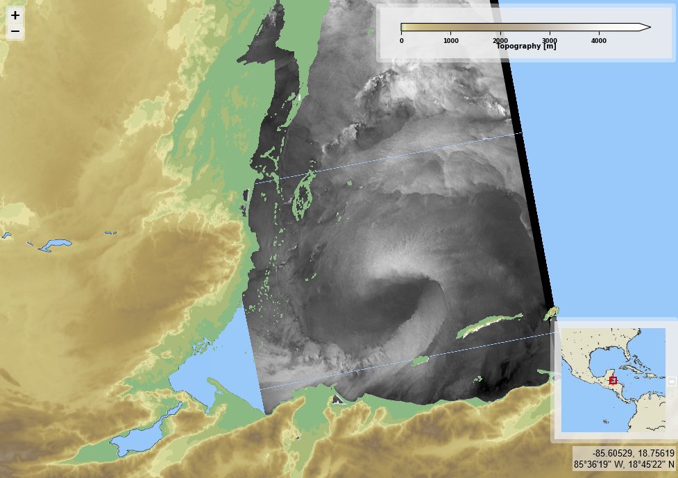
Typhoon #ManYi and tropical storm #Sara. <a href="/ESA_EO/">ESA Earth Observation</a> acquisitions on 2024/11/17 22:02 &amp; 16 23:58 UTC, for #2024SHOC from <a href="/CopernicusEU/">Copernicus EU</a> #Sentinel1 A. Max sustained wind velocities (left) around 30 m/s &amp; 18 m/s, derived from SAR sea surface roughness (right).
CYMS Cyclone Monitoring Service by Sentinel-1 (@cyms_s1) 's Twitter Profile Photo

Storm #Caetano, west of French coasts on 2024/11/21, 06:32 UTC, for #2024SHOC from Copernicus EU #Sentinel1 A. Some Météo-France measurements over Brittany (mainland and islands) recorded over 150 km/h (41 m/s) on the same day. Max wind velocities (left) derived from SAR (right).
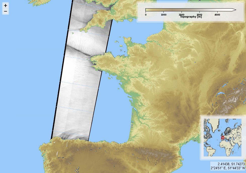
Storm #Caetano, west of French coasts on 2024/11/21, 06:32 UTC, for #2024SHOC from <a href="/CopernicusEU/">Copernicus EU</a> #Sentinel1 A. Some <a href="/meteofrance/">Météo-France</a> measurements over Brittany (mainland and islands) recorded over 150 km/h (41 m/s) on the same day. Max wind velocities (left) derived from SAR (right).
CYMS Cyclone Monitoring Service by Sentinel-1 (@cyms_s1) 's Twitter Profile Photo

A storm over Svalbard on 2024/11/26, 06:32 UTC, for #2024SHOC from Copernicus EU #Sentinel1 A with Max sustained winds (left) over 25 m/s from SAR roughness (right). Would somebody know if it earned a name?
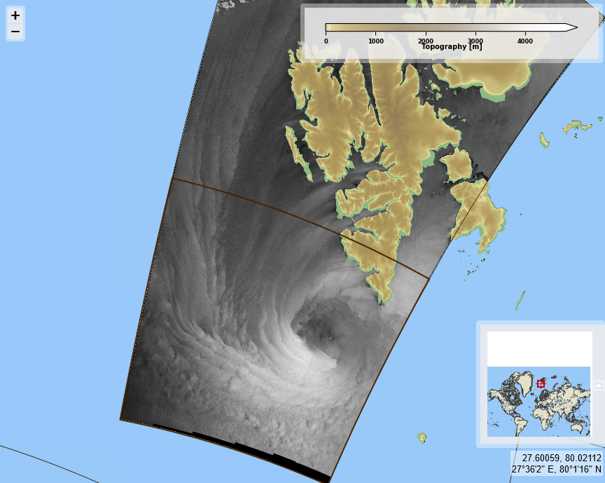
A storm over Svalbard on 2024/11/26, 06:32 UTC, for #2024SHOC from <a href="/CopernicusEU/">Copernicus EU</a> #Sentinel1 A with Max sustained winds (left) over 25 m/s from SAR roughness (right). 
Would somebody know if it earned a name?
CYMS Cyclone Monitoring Service by Sentinel-1 (@cyms_s1) 's Twitter Profile Photo

Cyclone #Chido North-East of Madagascar on 2024/12/13, 02:08 UTC, for #2024SHOC from Copernicus EU #Sentinel1 A. Max sustained wind velocities (left) close to 58 m/s, derived from SAR sea surface roughness (right).
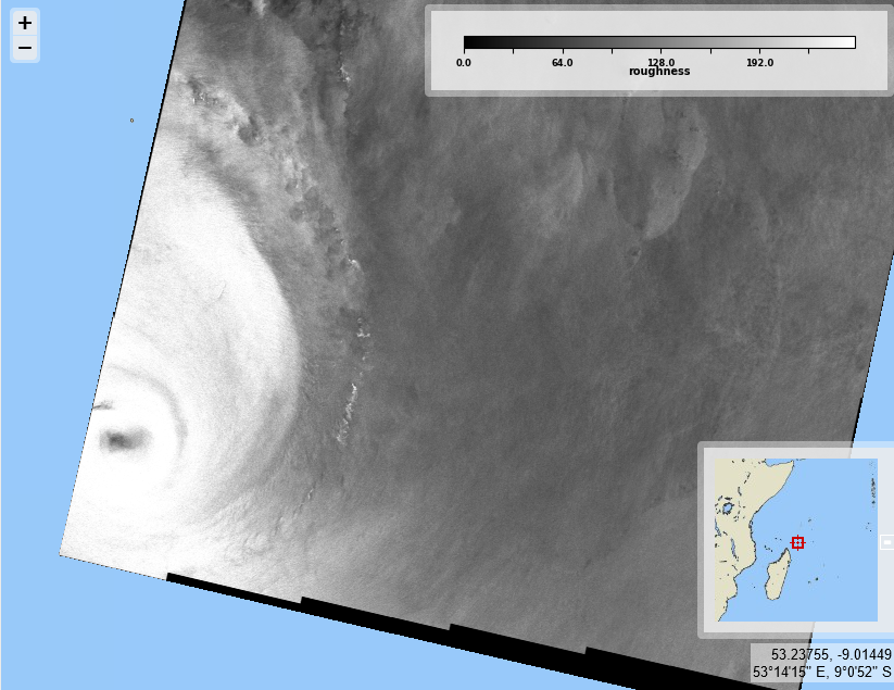
Cyclone #Chido North-East of Madagascar on 2024/12/13, 02:08 UTC, for #2024SHOC from <a href="/CopernicusEU/">Copernicus EU</a> #Sentinel1 A. Max sustained wind velocities (left) close to 58 m/s, derived from SAR sea surface roughness (right).
CYMS Cyclone Monitoring Service by Sentinel-1 (@cyms_s1) 's Twitter Profile Photo

Severe Tropical Storm #Dikeledi North-East of Madagascar on 2025/01/10, 01:36 UTC, for #2025SHOC from Copernicus EU #Sentinel1 A. Max sustained wind velocities (left) close to 34 m/s, derived from SAR sea surface roughness (right).
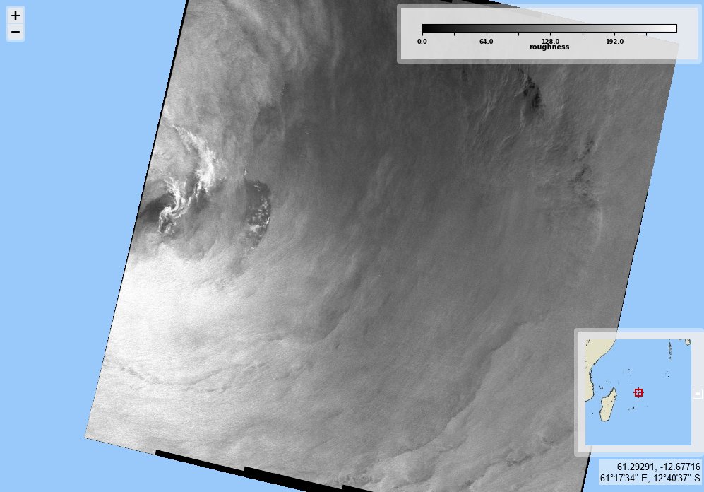
Severe Tropical Storm #Dikeledi North-East of Madagascar on 2025/01/10, 01:36 UTC, for #2025SHOC from <a href="/CopernicusEU/">Copernicus EU</a> #Sentinel1 A. Max sustained wind velocities (left) close to 34 m/s, derived from SAR sea surface roughness (right).
CYMS Cyclone Monitoring Service by Sentinel-1 (@cyms_s1) 's Twitter Profile Photo

Tropical cyclone #Dikeledi South of Madagascar on 2025/01/16, 02:29 UTC, for #2025SHOC from Copernicus EU #Sentinel1 A. Max sustained wind velocities (left) just above 50 m/s, derived from SAR sea surface roughness (right).
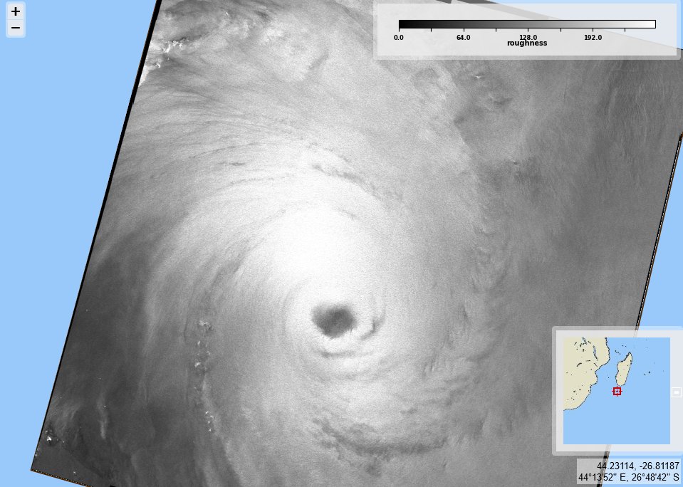
Tropical cyclone #Dikeledi South of Madagascar on 2025/01/16, 02:29 UTC, for #2025SHOC from <a href="/CopernicusEU/">Copernicus EU</a> #Sentinel1 A. Max sustained wind velocities (left) just above 50 m/s, derived from SAR sea surface roughness (right).
CYMS Cyclone Monitoring Service by Sentinel-1 (@cyms_s1) 's Twitter Profile Photo

Tropical cyclone #Sean West of Australia on 2025/01/21, 11:26 UTC, for #2025SHOC from Copernicus EU #Sentinel1 A. Max sustained wind velocities (left) just above 36 m/s, derived from SAR sea surface roughness (right).
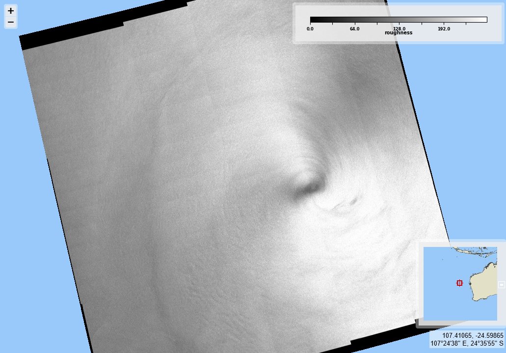
Tropical cyclone #Sean West of Australia on 2025/01/21, 11:26 UTC, for #2025SHOC from <a href="/CopernicusEU/">Copernicus EU</a> #Sentinel1 A. Max sustained wind velocities (left) just above 36 m/s, derived from SAR sea surface roughness (right).