CHRS UC Irvine (@chrsucirvine) 's Twitter Profile
CHRS UC Irvine

@chrsucirvine

The Center for Hydrometeorology & Remote Sensing aims to advance the knowledge of the water and energy cycles in order to predict impacts on water resources.

ID: 759168490980777984

linkhttp://chrs.web.uci.edu calendar_today29-07-2016 23:27:27

121 Tweet

233 Followers

268 Following

NWS Eastern Region (@nwseastern) 's Twitter Profile Photo

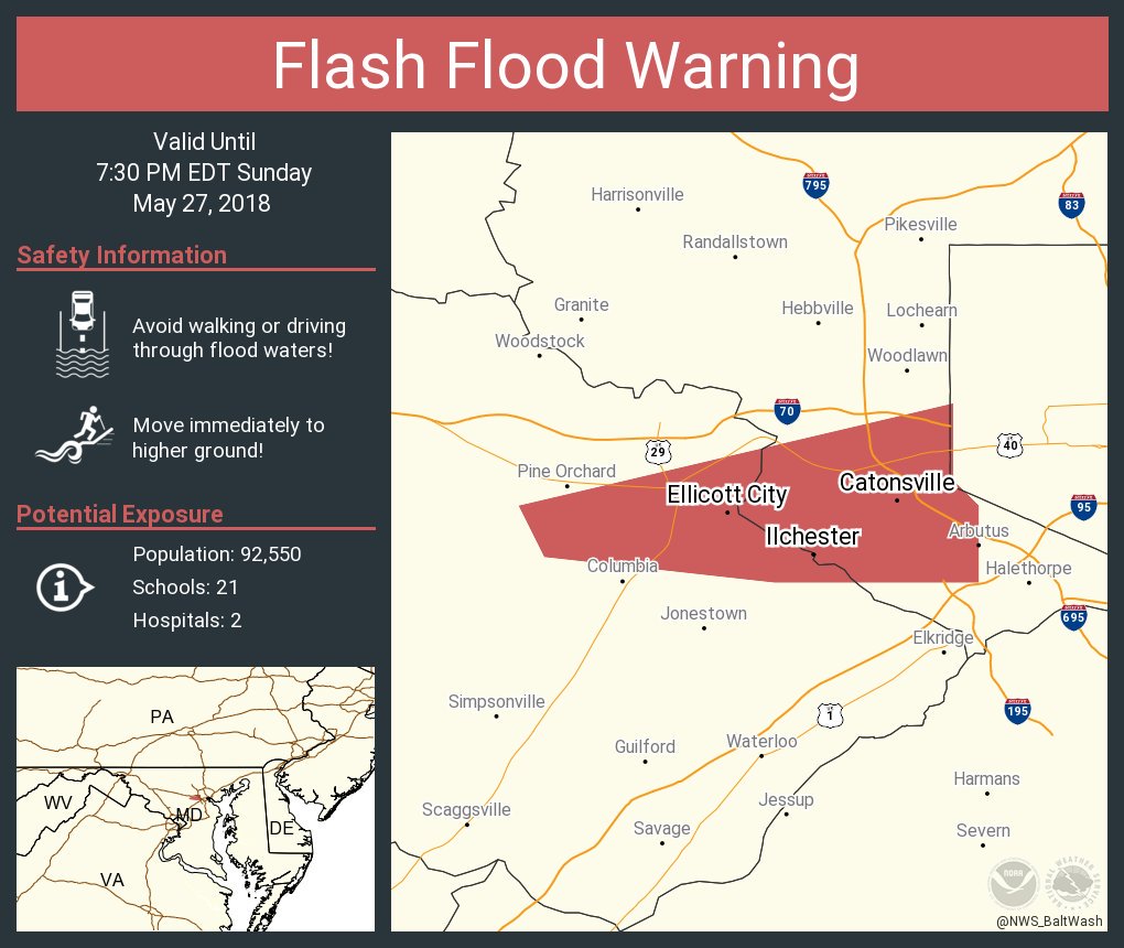
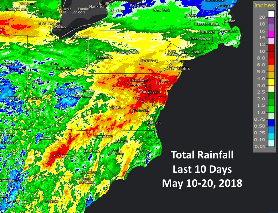
Flash Flood Emergency for parts of MD west of Baltimore including Ellicott City & Catonsville. Extremely heavy rainfall causing major flash flooding along the Patapsco River. This is an extremely dangerous situation similar to the catastrophic Ellicott City flash flood of 7/30/16

Flash Flood Emergency for parts of MD west of Baltimore including Ellicott City & Catonsville. Extremely heavy rainfall causing major flash flooding along the Patapsco River. This is an extremely dangerous situation similar to the catastrophic Ellicott City flash flood of 7/30/16
CHRS UC Irvine (@chrsucirvine) 's Twitter Profile Photo

Exciting news: our paper on the CHRS Data Portal was published by Nature Scientific Data! This was a huge milestone in our step toward having an impactful online presence, and we cannot thank the team who put this together enough for their efforts! doi.org/10.1038/sdata.…

Exciting news: our paper on the CHRS Data Portal was published by Nature Scientific Data! This was a huge milestone in our step toward having an impactful online presence, and we cannot thank the team who put this together enough for their efforts! doi.org/10.1038/sdata.…
CHRS UC Irvine (@chrsucirvine) 's Twitter Profile Photo

A series of devastating floods and flash floods have deluged large parts of Iran following the unprecedented rainfall events from March 17th to April 20th. We have created an open-access report of our findings and takeaways from these events. chrs.web.uci.edu/articles/iran_…

CHRS UC Irvine (@chrsucirvine) 's Twitter Profile Photo

Check out our recent publication on the application of advanced Deep Learning algorithms for precipitation estimation from multispectral satellite imagery. doi.org/10.3390/rs1119… #Precipitation#AI#DeepLearning

CUAHSI (@cuahsi) 's Twitter Profile Photo

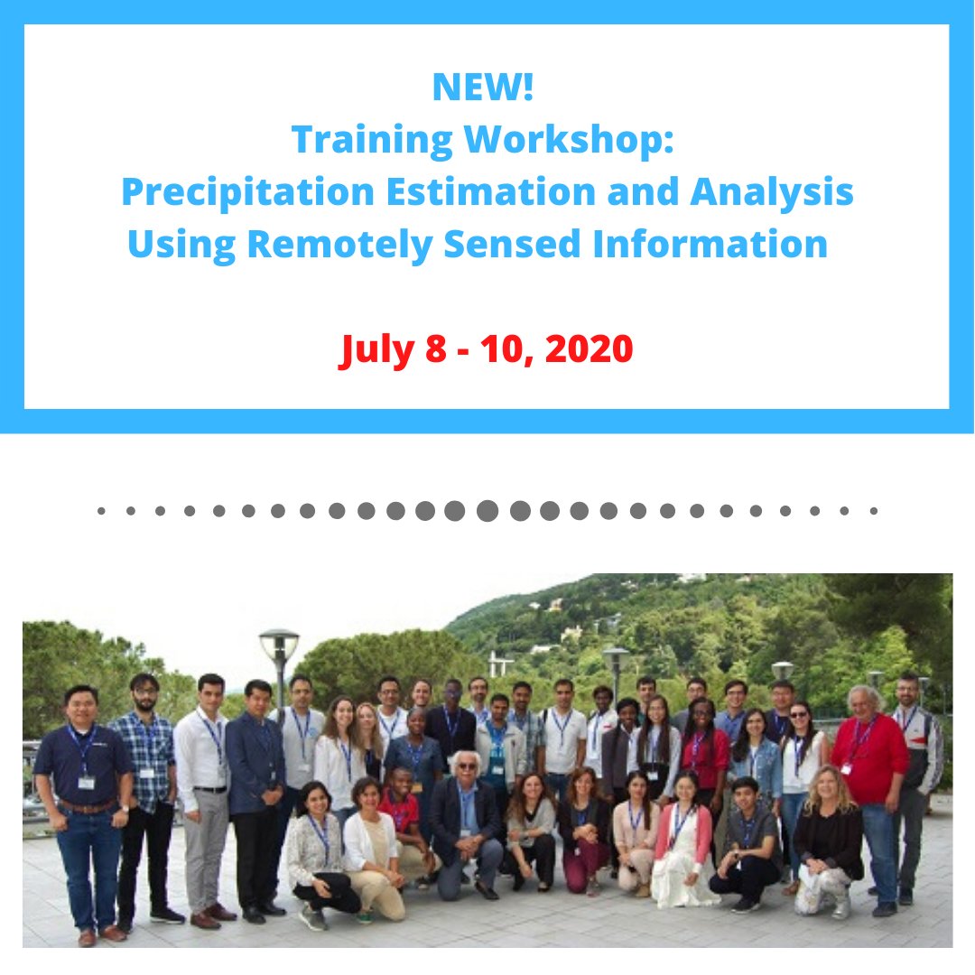
Applications are now open for the training workshop: Precipitation Estimation and Analysis Using Remotely Sensed Information! Join CUAHSI, UCI Graduate Division and CEE@UCI July 8 - 10, 2020 at UC Irvine Learn more and apply here: ow.ly/tyGd50yfEpQ #CUAHSIworkshop #MATLAB

Applications are now open for the training workshop: Precipitation Estimation and Analysis Using Remotely Sensed Information! Join CUAHSI, <a href="/UCIrvineGD/">UCI Graduate Division</a> and <a href="/CEEUCI/">CEE@UCI</a> July 8 - 10, 2020 at <a href="/UCIrvine/">UC Irvine</a> Learn more and apply here: ow.ly/tyGd50yfEpQ
#CUAHSIworkshop #MATLAB
CUAHSI (@cuahsi) 's Twitter Profile Photo

Calling grad students and early career scientists to join CUAHSI at UC Irvine for the training workshop: Precipitation Estimation and Analysis Using Remotely Sensed Information! Learn more and apply here: ow.ly/LnyS50yvOFJ . . #remotesensing #data #precipitation

Calling grad students and early career scientists to join CUAHSI at <a href="/UCIrvine/">UC Irvine</a> for the training workshop: Precipitation Estimation and Analysis Using Remotely Sensed Information! Learn more and apply here: ow.ly/LnyS50yvOFJ
.
.
#remotesensing #data #precipitation
Zack Labe (@zlabe) 's Twitter Profile Photo

Well above average temperatures (925 mb) so far this year over the #Arctic Ocean. "Warmth" was transported through the Bering Sea and Fram Strait. Cooler (relative to average) conditions over the surrounding land.

Well above average temperatures (925 mb) so far this year over the #Arctic Ocean. "Warmth" was transported through the Bering Sea and Fram Strait. Cooler (relative to average) conditions over the surrounding land.
NHC Eastern Pacific (@nhc_pacific) 's Twitter Profile Photo

Today is the official first day of the eastern Pacific hurricane season, and regularly scheduled Tropical Weather Outlooks have resumed. Here is the list of names for the 2018 eastern Pacific tropical cyclones: nhc.noaa.gov/gtwo.php?basin…

Today is the official first day of the eastern Pacific hurricane season, and regularly scheduled Tropical Weather Outlooks have resumed. Here is the list of names for the 2018 eastern Pacific tropical cyclones: nhc.noaa.gov/gtwo.php?basin…
NWS Eastern Region (@nwseastern) 's Twitter Profile Photo

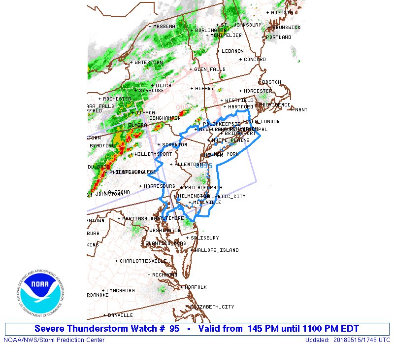
A severe thunderstorm watch has been issued for parts of southern Connecticut, southeastern New York including the NYC metro area & Long Island, all of New Jersey, eastern Pennsylvania including the Philadelphia metro, northern Delaware & northeastern Maryland until 11 pm EDT

A severe thunderstorm watch has been issued for parts of southern Connecticut, southeastern New York including the NYC metro area &amp; Long Island, all of New Jersey, eastern Pennsylvania including the Philadelphia metro, northern Delaware &amp; northeastern Maryland until 11 pm EDT
NOAA Satellites (@noaasatellites) 's Twitter Profile Photo

NOAA #GOES17 satellite has successfully shared the first SEISS data, an instrument that detects charged particles energized by geomagnetic storms, like this one observed on May 6. #spaceweather #spacewxmonth Learn more: go.usa.gov/xQQuN

NOAA #GOES17 satellite has successfully shared the first SEISS data, an instrument that detects charged particles energized by geomagnetic storms, like this one observed on May 6. #spaceweather #spacewxmonth Learn more: go.usa.gov/xQQuN
Amir AghaKouchak (@amiraghakouchak) 's Twitter Profile Photo

Nguyen et al. show that warm climate regions exhibit decreasing rainfall trends, while arid and polar climate regions show increasing trends. More on trends across scales in the latest Bulletin of the American Meteorological Society: goo.gl/XcrSas Andrés Snitcofsky CHRS UC Irvine

Nguyen et al. show that warm climate regions exhibit decreasing rainfall trends, while arid and polar climate regions show increasing trends. More on trends across scales in the latest Bulletin of the American Meteorological Society: goo.gl/XcrSas
<a href="/AMS/">Andrés Snitcofsky</a> <a href="/CHRSUCIrvine/">CHRS UC Irvine</a>
NOAA Satellites (@noaasatellites) 's Twitter Profile Photo

On this date in 1980, NOAA's GOES-3 satellite captured the #eruption of Mount St. Helens - check out the volcanic cloud that rose an estimated 12 to 16 miles above sea level in this visible and infrared imgaery.

NOAA Satellites (@noaasatellites) 's Twitter Profile Photo

The second Geostationary Lightning Mapper to ever reach orbit has shared its first images. This initial imagery from NOAA’s recently launched #GOES17 satellite captures a line of severe storms over the Plains. See the full video: go.usa.gov/xQEQb