Christian Thau (@christjanberger) 's Twitter Profile
Christian Thau

@christjanberger

Team geoinformation @jenalichtstadt and associated scientist @JEOS_Jena. Remote sensing of urban areas and vegetation.

ID: 437382861

linkhttps://www.researchgate.net/profile/Christian_Berger2 calendar_today15-12-2011 10:17:20

268 Tweet

538 Followers

1,1K Following
Teja Kattenborn (@tejakattenborn) 's Twitter Profile Photo

Anybody working with UAV imagery (RGB is enough) and deadwood mapping in temperate forests (preferably Europe / Germany)? We are looking for collaborators / additional data for an ongoing multi-scale / deep learning study. @Felix_Schiefer

Shaun Levick (@shaunlevick) 's Twitter Profile Photo

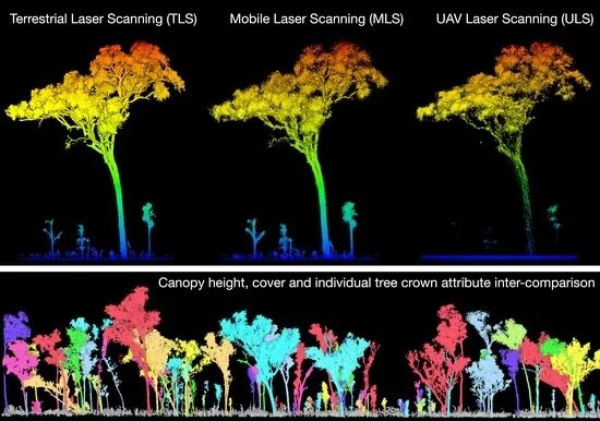
Leveraging TLS as a Calibration and Validation Tool for MLS and ULS Mapping of Savanna Structure and Biomass at Landscape-Scales #LiDAR #savanna CSIRO Remote Sensing MDPI early view here: mdpi.com/2072-4292/13/2…

Leveraging TLS as a Calibration and Validation Tool for MLS and ULS Mapping of Savanna Structure and Biomass at Landscape-Scales #LiDAR #savanna <a href="/CSIRO/">CSIRO</a> <a href="/RemoteSens_MDPI/">Remote Sensing MDPI</a> early view here: mdpi.com/2072-4292/13/2…
Teja Kattenborn (@tejakattenborn) 's Twitter Profile Photo

We synthesized recent developments and current trends on using Convolutional Neural Networks in remote sensing of vegetation: authors.elsevier.com/a/1cQX33I9x1cg… I hope this review can encourage more people to use these powerful techniques. KIT Karlsruhe Remote Sensing Centre for Earth System Research
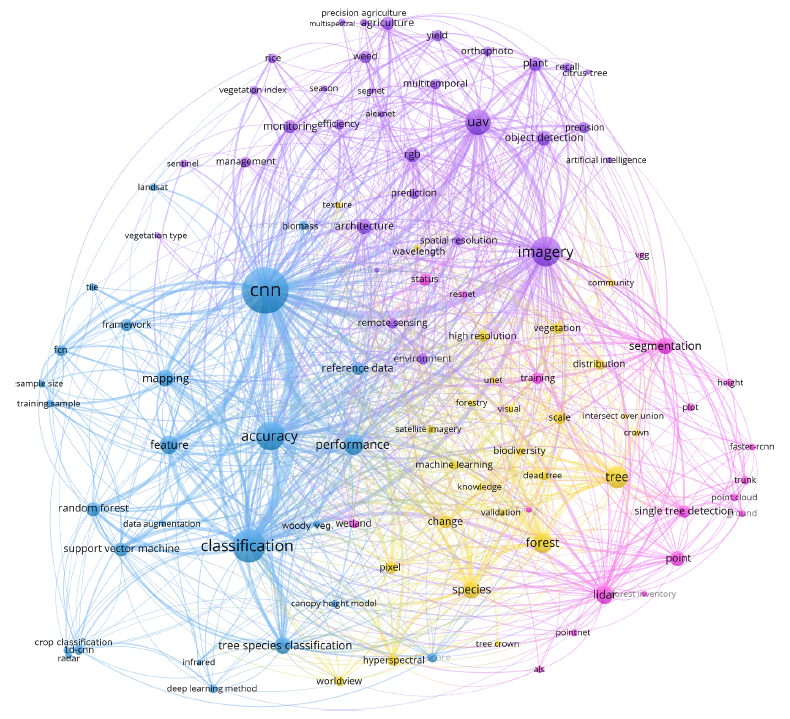
We synthesized recent developments and current trends on using Convolutional Neural Networks in remote sensing of vegetation:
authors.elsevier.com/a/1cQX33I9x1cg…
I hope this review can encourage more people to use these powerful techniques.

<a href="/KITKarlsruhe/">KIT Karlsruhe</a> <a href="/Rsc4Earth/">Remote Sensing Centre for Earth System Research</a>
Kim Calders (@kimcalders) 's Twitter Profile Photo

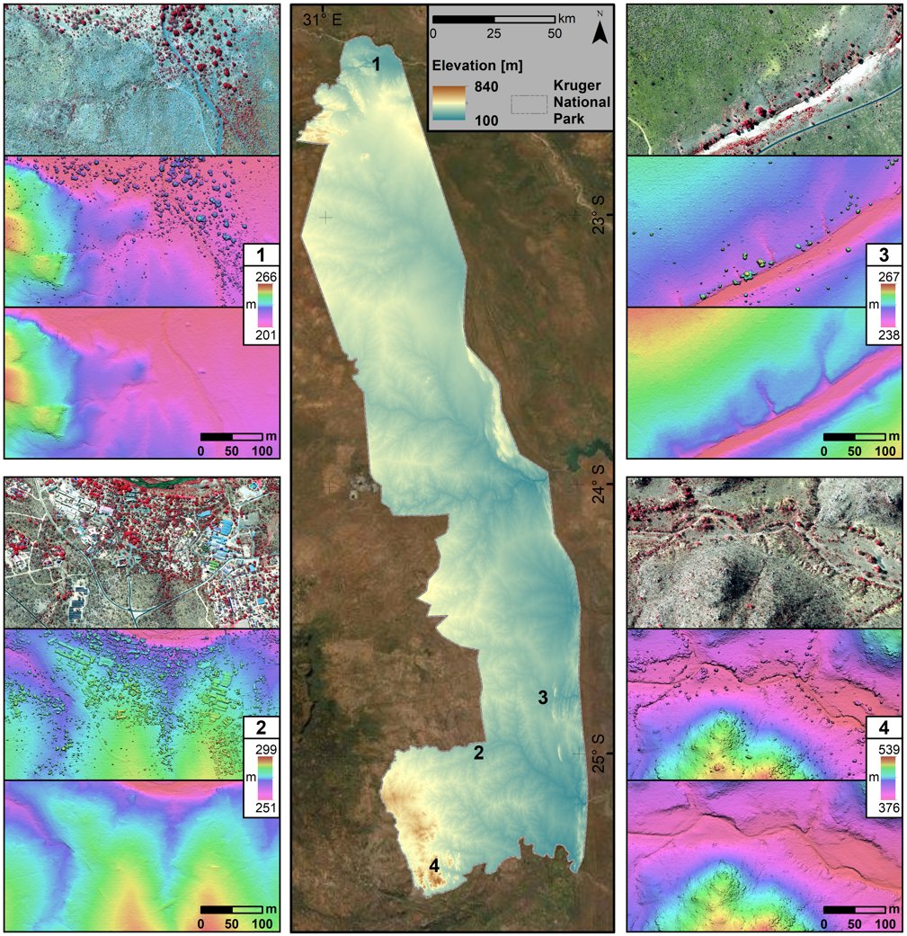
New publication led by Barbara D'hont on using UAV lidar to map termite mounds in tropical savannas. Termite mounds deliver essential ecosystem services, promote biodiversity & potentially buffer plants against climate change. mdpi.com/2072-4292/13/3…
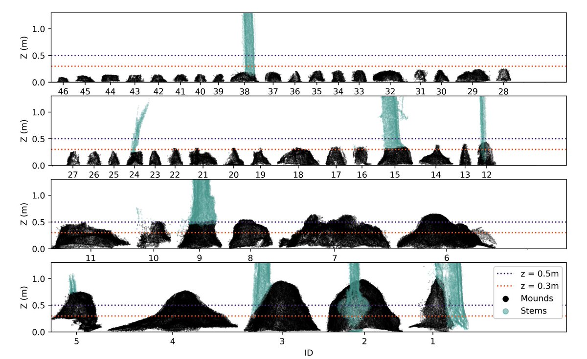
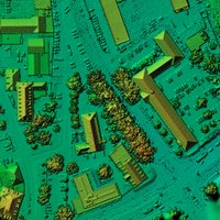
New publication led by <a href="/BarbaraDhont/">Barbara D'hont</a> on using UAV lidar to map termite mounds in tropical savannas.
Termite mounds deliver essential ecosystem services, promote biodiversity &amp; potentially buffer plants against climate change.

mdpi.com/2072-4292/13/3…
Jena Earth Observation School (@jeos_jena) 's Twitter Profile Photo

Check out the latest episode of the 'Down to Earth' podcast featuring Jena Earth Observation School Prof. Dr. Christiane Schmullius talking about her experiences and 🛰️interests. Make sure to follow the DtE podcast from Inspire, Develop, Empower, and Advance (IDEA)! 🎧🎧 Listen to it here: ow.ly/Lb6L50E2XCh 🎧🎧 Universität Jena
Phil Wilkes (@kungphil) 's Twitter Profile Photo

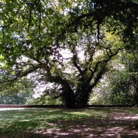
Take a trip around the magnificent trees of Cowdray Estate Queen Elizabeth I oak 🌳 Cowdray Colossus 🌳 Lady in Waiting oak Interactive #3D tour on Sketchfab: skfb.ly/onJBZ

Google AI (@googleai) 's Twitter Profile Photo

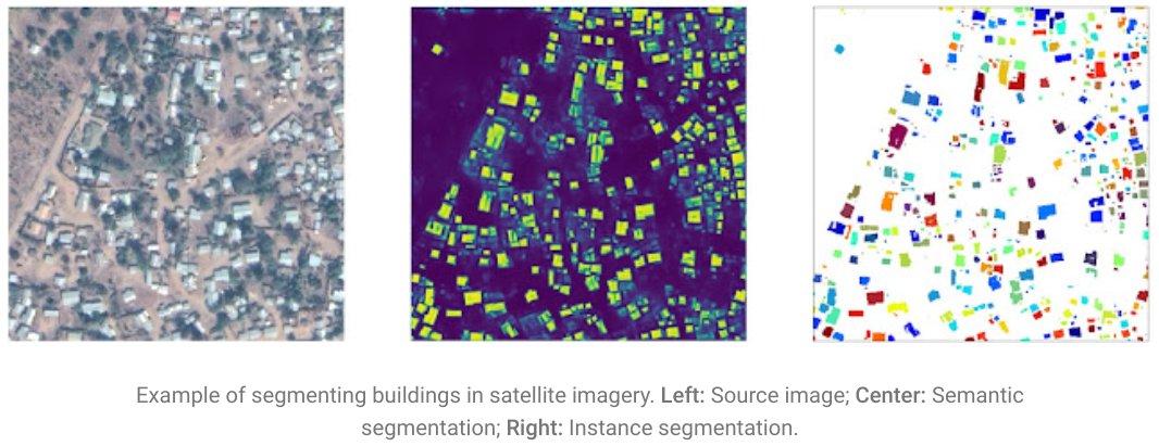
Today we are releasing the Open Buildings Dataset, a new open-source dataset containing the locations and footprints of >500M buildings with coverage across Africa, which can support numerous scientific and humanitarian applications. Read more at goo.gle/3751HVR

Today we are releasing the Open Buildings Dataset, a new open-source dataset containing the locations and footprints of &gt;500M buildings with coverage across Africa, which can support numerous scientific and humanitarian applications. Read more at goo.gle/3751HVR
Fabian Fassnacht (@fabianfassnach1) 's Twitter Profile Photo

Very interesting article on #mdpi : academic.oup.com/rev/advance-ar… I feel very much assured in my decision 1 or 2 years ago to not further support any MDPI journal in any way.

Hans van der Kwast @hansakwast@fosstodon.org (@hansakwast) 's Twitter Profile Photo

I'm happy to announce that the PCRaster Tools plugin for #QGIS is now available! It adds ~100 tools for raster processing to the Processing Toolbox. Thanks to Nyall Dawson North Road for developing the plugin together! #PCRaster plugins.qgis.org/plugins/pcrast…
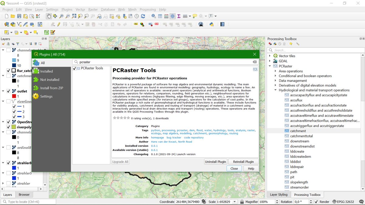
I'm happy to announce that the PCRaster Tools plugin for #QGIS is now available! It adds ~100 tools for raster processing to the Processing Toolbox. Thanks to <a href="/nyalldawson/">Nyall Dawson</a> <a href="/northroadgeo/">North Road</a> for developing the plugin together! #PCRaster
plugins.qgis.org/plugins/pcrast…
Karen Anderson (@kanderson_rs) 's Twitter Profile Photo

Earlier this year, Prof Ted Milton passed away. I miss him so much - a great scientist, the best mentor and a true friend. The godfather of field spectroscopy... many of us learned so much from him. We wrote a little thing about his life + legacy ... tandfonline.com/doi/full/10.10…

Jena Earth Observation School (@jeos_jena) 's Twitter Profile Photo

Jena Earth Observation School & EO College 🎓 are happy to announce that the #LandInFocus #MOOC is online as of yesterday! Check it out here: bit.ly/3a9J6cG and learn about the basics of #remotesensing. We will release practical courses later this year, so stay tuned and follow EO College 🎓!

<a href="/JEOS_Jena/">Jena Earth Observation School</a> &amp; <a href="/eo_college/">EO College 🎓</a> are happy to announce that the #LandInFocus #MOOC is online as of yesterday!

Check it out here: bit.ly/3a9J6cG and learn about the basics of #remotesensing. We will release practical courses later this year, so stay tuned and follow <a href="/eo_college/">EO College 🎓</a>!
Jena Earth Observation School (@jeos_jena) 's Twitter Profile Photo

Remote sensing meets art! 🛰️↔️🎨 From 20th October (4.15 pm) onwards, you can visit an exhibition called "GEO ART - The Earth from Space". Opening hours: 21.10. - 26.11. Mo-Th, 11am - 6pm Main university building (Room 25), Jena Come and check it out! deinjena.de/ausstellung-ge…

Jena Earth Observation School (@jeos_jena) 's Twitter Profile Photo

We just published the 1st set of practical courses from our #LandInFocus #MOOC series. Enroll now to learn how to map land cover/use in urban spaces! Visit bit.ly/2ZMHe8i to start the course. Stay tuned for more content soon. ESA Earth Observation Universität Jena Jena Earth Observation School EO College 🎓

We just published the 1st set of practical courses from our #LandInFocus #MOOC series. 
Enroll now to learn how to map land cover/use in urban spaces!

Visit bit.ly/2ZMHe8i to start the course. Stay tuned for more content soon.

<a href="/ESA_EO/">ESA Earth Observation</a> <a href="/UniJena/">Universität Jena</a> <a href="/JEOS_Jena/">Jena Earth Observation School</a> <a href="/eo_college/">EO College 🎓</a>
Jena Earth Observation School (@jeos_jena) 's Twitter Profile Photo

We just published another set of practical courses from our #LandInFocus #MOOC series. Enroll now to learn about disaster monitoring using remote sensing. Visit bit.ly/3Fx6i2v to start the course & stay tuned for more content. ESA Earth Observation Universität Jena Jena Earth Observation School EO College 🎓
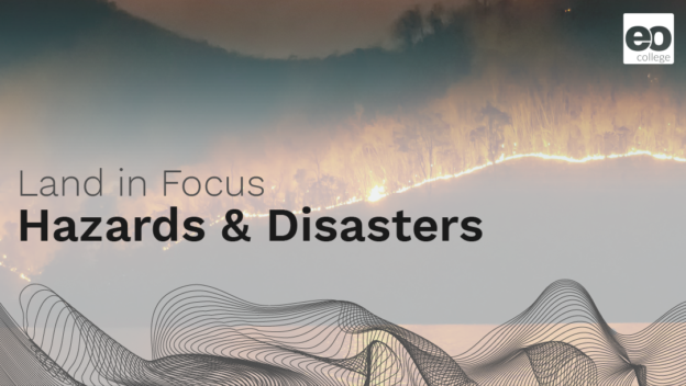
We just published another set of practical courses from our #LandInFocus #MOOC series.
Enroll now to learn about disaster monitoring using remote sensing.

Visit bit.ly/3Fx6i2v to start the course &amp; stay tuned for more content.

<a href="/ESA_EO/">ESA Earth Observation</a> <a href="/UniJena/">Universität Jena</a> <a href="/JEOS_Jena/">Jena Earth Observation School</a> <a href="/eo_college/">EO College 🎓</a>
MapTiler (@maptiler) 's Twitter Profile Photo

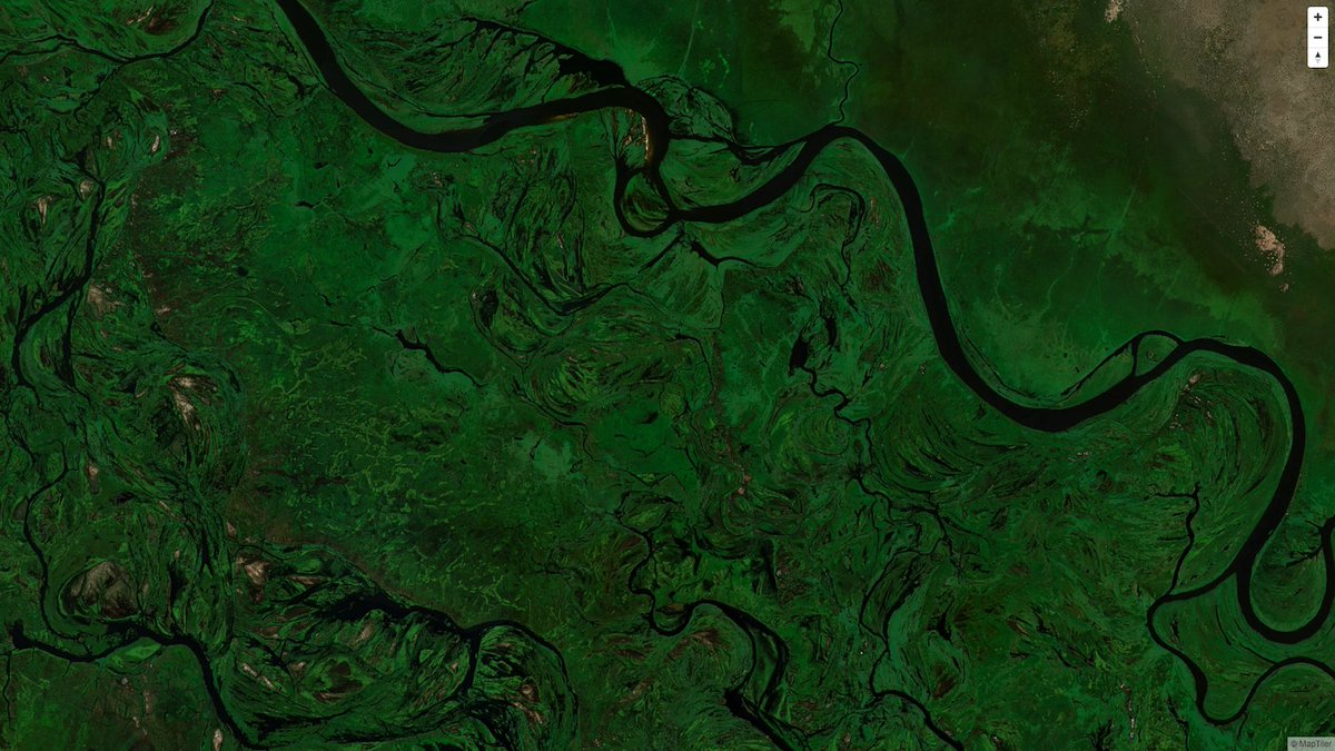
We have created a single image of the entire world detailed enough to find your own house. If printed it would cover nearly 16 soccer fields! Find out more here: maptiler.link/3o0yFQj #EOChat #satellite #space #maps

We have created a single image of the entire world detailed enough to find your own house. If printed it would cover nearly 16 soccer fields! Find out more here: maptiler.link/3o0yFQj #EOChat #satellite #space #maps