Chad Crilley (@chadcwx) 's Twitter Profile
Chad Crilley

@chadcwx

independent Broadcast Meteorologist/Professional Storm Chaser 🌪️Former Chief Meteorologist 📺 San Diego Boy at Heart 🌴

ID: 871151432

linkhttps://m.youtube.com/@Chadcrilleyweather calendar_today10-10-2012 05:05:28

5,5K Tweet

1,1K Followers

1,1K Following

FOX 9 (@fox9) 's Twitter Profile Photo

Multiple tornadoes have been reported near New Richmond, WI. The worst of the storms have passed out of the Twin Cities metro but tornado warnings have been issued in parts of northern Minnesota and western Wisconsin as the storms push east. (Video via Tara Olson)

Chad Crilley (@chadcwx) 's Twitter Profile Photo

If it wasn’t so upsetting it would be almost laughable that the same people who are calling for the NWS to be gutted are the ones who want them held “accountable” for being understaffed during a tornado outbreak. 😅

Avery Tomasco (@averytomascowx) 's Twitter Profile Photo

All I'll say is this. The National Weather Service issued a flood watch for Kerr County more than 12 hours ahead of the catastrophic flood. A flash flood warning was issued for Hunt & Ingram 3 HOURS before the Guadalupe started to climb. They did their job and they did it well

StormHQ ☈ (@stormhqwx) 's Twitter Profile Photo

Complete devastation along the Guadalupe River shows the devastating after catastrophic flooding. Search and rescue continues across the area.

FOX Weather (@foxweather) 's Twitter Profile Photo

JUST IN: Officials in Texas say at least 32 dead with dozens still missing following flash flooding on July 4th. Latest: foxweather.com/weather-news/c…

Chad Crilley (@chadcwx) 's Twitter Profile Photo

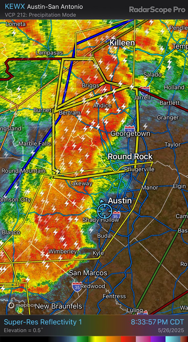
Another round of heavy rain on the way late this afternoon/evening across devastated central Texas. Greatest potential for additional flooding looks to be north of U.S. 290 & in the Hill Country. Austin metro still at play though. #txwx

Another round of heavy rain on the way late this afternoon/evening across devastated central Texas. Greatest potential for additional flooding looks to be north of U.S. 290 & in the Hill Country. Austin metro still at play though. #txwx
Ari Sarsalari (@ariweather) 's Twitter Profile Photo

NWS did an exceptional job forecasting an extremely difficult flooding situation in TX the other night.. Anyone blaming them is just blatantly ignorant of the chain of events. The overnight timing played a huge part in the deaths imo. Horrific situation NWS Weather Prediction Center NWS Austin/San Antonio

Chad Crilley (@chadcwx) 's Twitter Profile Photo

Social media is so insufferable right now that it’s hard to want to post any content to any platform. These people don’t even believe in the conspiracy theories they push, they just love the clicks. Is my feed the only one? 🙄

Chad Crilley (@chadcwx) 's Twitter Profile Photo

Extremely ominous wording coming from the latest WPC MCD. A very similar setup to the 7/4 floods across central Texas tonight/tomorrow with an MCV spinning overhead and very high PWATS. Flooding is likely! Hill Country & I-35 corridor at play including ATX and San Antonio.