Chris Oxendine(@ceo2373) 's Twitter Profileg
Chris Oxendine

@ceo2373

dad x 4, husband, Veteran, Director of Defense/Intel solutions @esri, Investor, USMA grad, PhD, love grilling, ultra 🏃🏽‍♂️, 🚣‍♀️ , 🍷& 🥃

ID:19289989

linkhttp://linkedin.com/in/chrisoxendine calendar_today21-01-2009 14:50:30

3,1K Tweets

1,0K Followers

2,5K Following

Esri Defense & Intel(@Esri_Defense) 's Twitter Profile Photo

Imagine having a digital twin, a virtual representation of real-world environments. Seamlessly merge data, visualize insights, and strategize effectively for success. esri.social/jffM50Rizee

account_circle
Veterans Affairs(@DeptVetAffairs) 's Twitter Profile Photo

With VA's Health & Benefits app, you can use your phone’s built-in security features to access your health and benefits information. You can refill prescriptions, send secure messages, view appointments, check claim or appeal status, or find nearest VA facilities and services.

account_circle
Esri Blog(@EsriBlog) 's Twitter Profile Photo

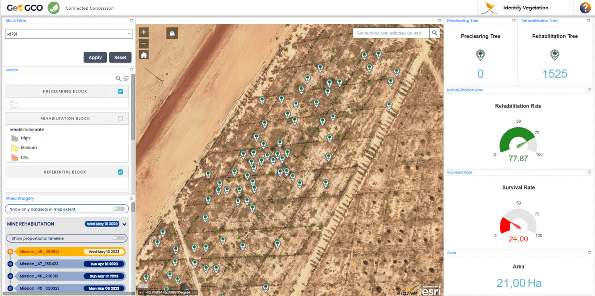
The French mining company Eramet is implementing an environmental management system built with GIS technology at every mine to measure water, air, and soil quality, and to guide the company’s pledge to reach zero emissions by 2050. esri.social/JtQb50R6CGP

The French mining company @GroupeEramet is implementing an environmental management system built with GIS technology at every mine to measure water, air, and soil quality, and to guide the company’s pledge to reach zero emissions by 2050. esri.social/JtQb50R6CGP
account_circle
Army Map Guy | Aviation and Airports 🗺(@ArmyMapGuy_Avn) 's Twitter Profile Photo

Explore the with Esri's Map Viewer analysis tools.

See how the team (h/t Cooper Thomas )used three web-based workflows to uncover insights about the path of totality. 🌑🌕 ow.ly/lz6h50R5FgB
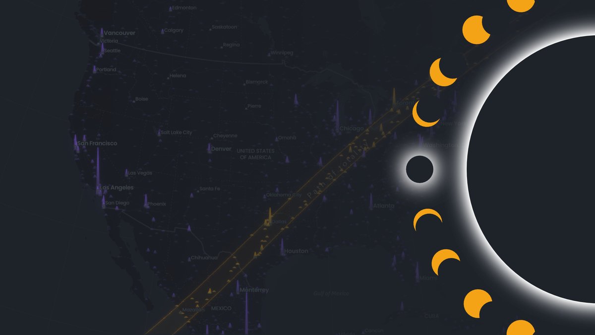
Explore the #eclipse with @Esri's Map Viewer analysis tools. See how the #StoryMaps team (h/t @InfiniteCoop )used three web-based workflows to uncover insights about the path of totality. 🌑🌕 ow.ly/lz6h50R5FgB
account_circle
Esri National Government(@EsriFederalGovt) 's Twitter Profile Photo

Join us at the Esri User Conference to learn how GIS empowers Native communities. Register now and add the Native Nations Summit to your schedule! esri.social/8Nba50QXa1Z

Join us at the Esri User Conference to learn how GIS empowers Native communities. Register now and add the Native Nations Summit to your schedule! esri.social/8Nba50QXa1Z #NativeCommunities #GIS #EsriUC
account_circle
Army Map Guy | Aviation and Airports 🗺(@ArmyMapGuy_Avn) 's Twitter Profile Photo

Short watch on an Immersive experiences that gives us a different access point to data. Game engines and 3D visualization are pushing the future when it comes to resilient cities, policy, and planning. ow.ly/BNL850R28kt

account_circle
Nic Cruz Patane(@niccruzpatane) 's Twitter Profile Photo

Since buying our Tesla Model Y Performance in September of 2021, these features have been added all through OTA updates:

• Full-Self Driving Beta
• Track Mode
• Cloud profiles
• Auto cancelling turn signal’s
• Ability to apply brakes when regen is limited
• Single pull

Since buying our Tesla Model Y Performance in September of 2021, these features have been added all through OTA updates: • Full-Self Driving Beta • Track Mode • Cloud profiles • Auto cancelling turn signal’s • Ability to apply brakes when regen is limited • Single pull
account_circle
Chris Oxendine(@ceo2373) 's Twitter Profile Photo

'The wedding is an event, love is a practice.
The graduation is an event, education is a practice.
The race is an event, fitness is a practice.
The heart, mind, and body are endless pursuits.'

-James Clear

account_circle
Army Map Guy | Aviation and Airports 🗺(@ArmyMapGuy_Avn) 's Twitter Profile Photo

Kinetik, a midstream operator in Texas, is revolutionizing its pipeline workflow with ArcGIS Earth. With real-time data access and collaboration, they streamline operations and boost efficiency. Great to see this in a sector outside of the usual folks. ➡️ ow.ly/SCH750QpYop

account_circle
Army Map Guy | Aviation and Airports 🗺(@ArmyMapGuy_Avn) 's Twitter Profile Photo

In this new podcast from Esri, Alex Martonik and John Lenahan discuss why more and more companies are using location technology to help maintain their competitive edge while protecting the planet. I've got to work with John on several initiatives. ow.ly/tCzJ50QpYkQ

account_circle
Chris Oxendine(@ceo2373) 's Twitter Profile Photo

An exceptional collection of case studies on how organizations use AI and location intelligence for sustainability, efficiency, and growth. Read the ebook. ow.ly/Rv9r104XImy

An exceptional collection of case studies on how organizations use AI and location intelligence for sustainability, efficiency, and growth. Read the ebook. ow.ly/Rv9r104XImy #Esri
account_circle
Esri Defense & Intel(@Esri_Defense) 's Twitter Profile Photo

Esri is thrilled to be a part of at booth 6815. Experience firsthand how our GIS software performs on various hardware devices, showcasing the power of mission-critical analysis, collaborative ecosystem, and situational awareness.

account_circle
Chris Oxendine(@ceo2373) 's Twitter Profile Photo

Must watch…it will be the best 2:30 minutes of your day. ❤️ Spread love through your local community! ❤️ youtu.be/yLsSy64xILI?si…

account_circle
Jasmin Moghbeli(@AstroJaws) 's Twitter Profile Photo

The ARED (Advanced Resistive Exercise Device) is conveniently located right by the Cupola, a magnificent set of 7 windows facing Earth. I was the first to work out this morning so the Cupola shutters were shut when I first started. A couple sets in, I realized I could be looking

account_circle
Army Map Guy | Aviation and Airports 🗺(@ArmyMapGuy_Avn) 's Twitter Profile Photo

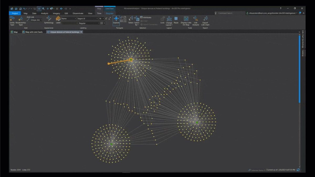
That's powerful ➡️ the Movement Analysis tools in ArcGIS AllSource. This toolset helps you to analyze point track data, compare tracks over different areas, extract unique identifiers from a point track dataset, and identify where tracks meet. ow.ly/4hct50PCQUm

That's powerful ➡️ the Movement Analysis tools in ArcGIS AllSource. This toolset helps you to analyze point track data, compare tracks over different areas, extract unique identifiers from a point track dataset, and identify where tracks meet. ow.ly/4hct50PCQUm
account_circle
Esri(@Esri) 's Twitter Profile Photo

Marine Microplastics are a growing issue for the ocean. 🌊 NOAA scientist Dr. Jennifer Webster reveals the sources of microplastic pollution in the ocean and beyond. Find out how mapping this pervasive problem can help.

🔹Watch the full video: esri.social/Gyf450Pqh1s NOAANCEI

account_circle