Brendan Crowell
@bwcphd
Assistant Professor at @osuearthscience dabbling in geodesy and seismology. @Scripps_Ocean and @GeorgiaTech grad. Formerly at @PNSN1
ID: 783817357877612545
https://www.seismogeodesy.com/ 05-10-2016 23:53:15
751 Tweet
1,1K Followers
461 Following

#geodesy folks, check out this faculty position at The Ohio State University School of Earth Sciences at the Associate or Full level. Fairly open to all fields of geodesy. osu.wd1.myworkdayjobs.com/OSUCareers/job…


A very crude offset estimation for International GNSS Service (IGS) station TWTF for the M7.4 earthquake in Taiwan. Due to the timing of the event, only a few 30-s GNSS samples are available after the earthquake near the UTC day boundary. ~20 cm southward motion with ~10 cm subsidence



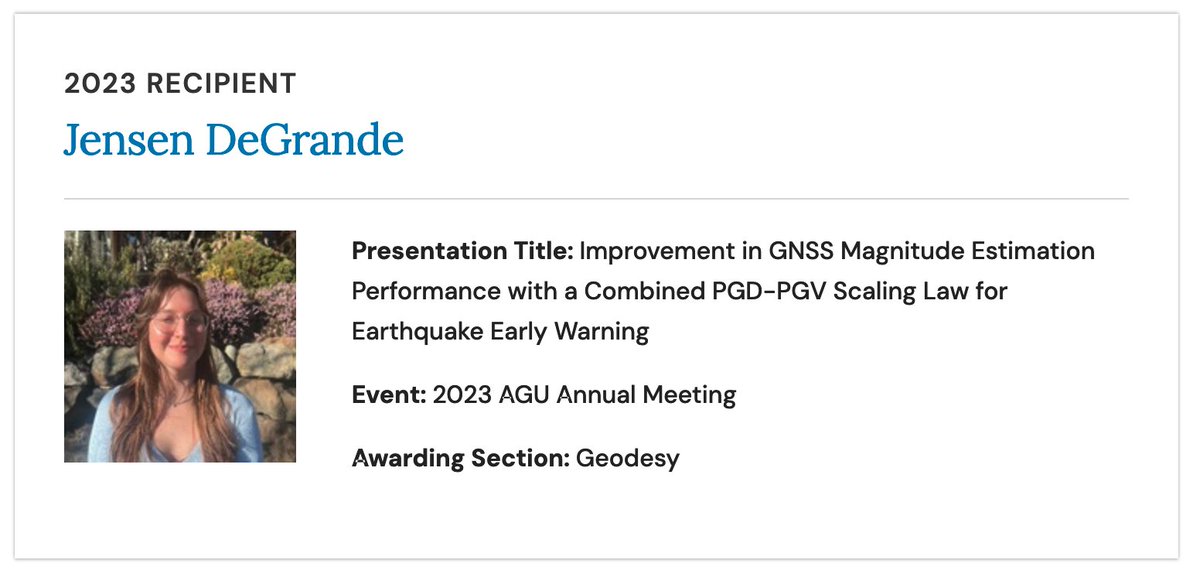
Congrats to my student Jensen DeGrande for winning one of the AGUGeodesy section OSPA awards at the Fall meeting!


GPS stations are now part of the USGS ShakeAlert Earthquake Early Warning System network. GPS stations augment seismometers, significantly improving the system’s ability to accurately detect the largest earthquakes. Read more ⬇️ loom.ly/b70yS-Y

A long journey to get here, its such an honor to see GFAST finally in production in USGS ShakeAlert

In light of the news adding GNSS to USGS ShakeAlert, I wanted to reshare the following video of the expected performance of GFAST for the Tohoku earthquake. If a similar event occurred in Cascadia, this gives you a sense of the performance youtu.be/ZHZpUpTJRu8?si…

West Coast residents can now benefit from satellite data in their earthquake early warning system. USGS ShakeAlert is now leveraging GPS data, the USGS announced this week. thenationaldesk.com/news/americas-…

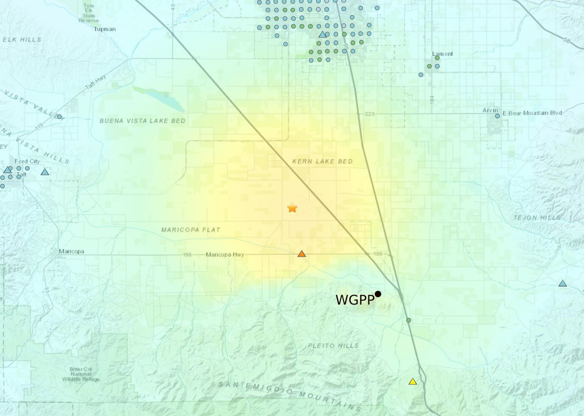
The M5.2 in Lamont, California this morning was recorded nicely on 5-Hz GNSS site WGPP, roughly 15 km SE of the epicenter. Shown are the velocity observations computed from time-differenced carrier phase observations. Peak ~ 15 cm/s EarthScope Consortium


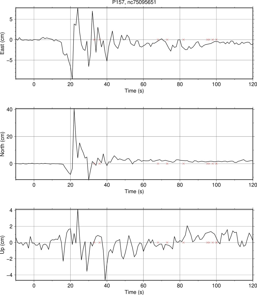
Excellent GNSS recordings in real-time for todays M7 earthquake offshore Petrolia. Peak displacement was just above 40 cm for P157. Solutions from CWU PANGA EarthScope Consortium

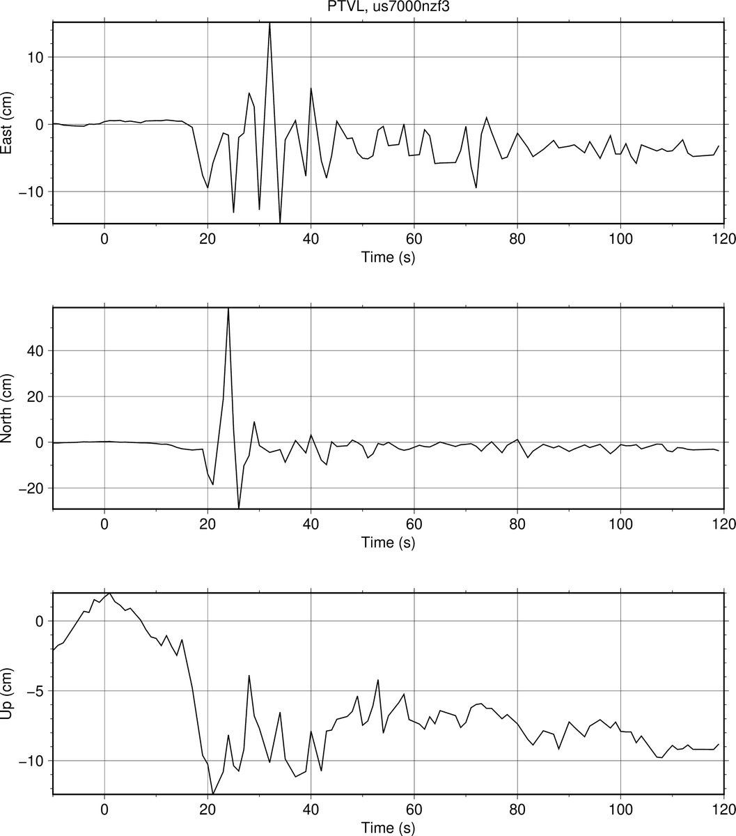
Upwards of 60 cm of peak motion recorded in Port Villa, Vanuatu during today's M7.3 earthquake. Subsidence of around 10 cm. Real-time GNSS solutions from CWU. International GNSS Service (IGS)

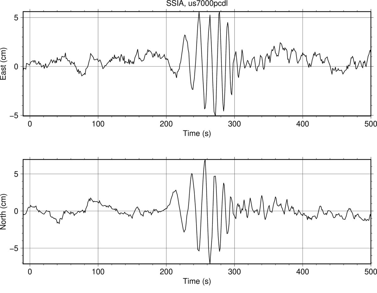
The surface wave from the M7.6 Cayman Islands earthquake was recorded well on GNSS station SSIA in El Salvador, 840 km away. Peak motion of almost 7 cm. EarthScope Consortium

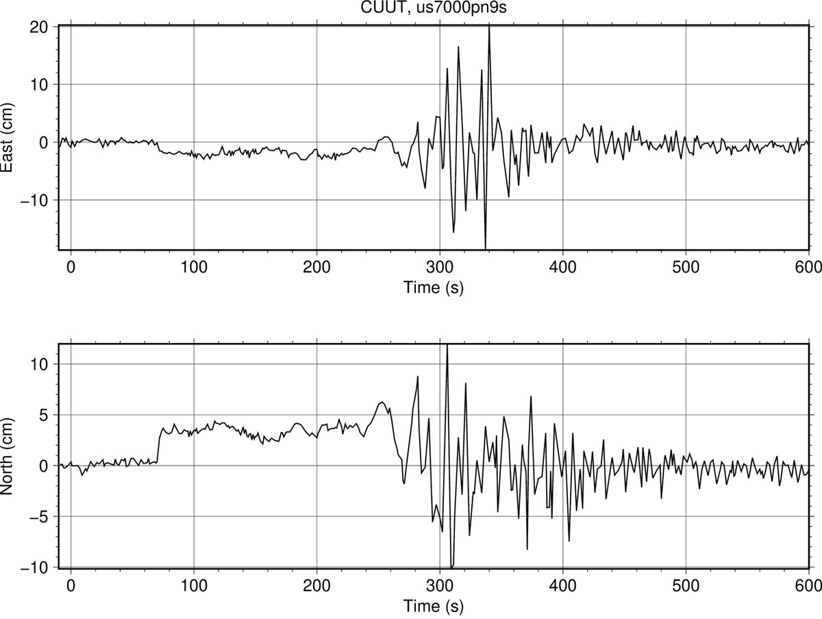
Peak displacement of 20 cm recorded on International GNSS Service (IGS) GNSS station CUUT in Bangkok today from the devastating M7.7 earthquake near Mandalay, 1000 km from the source.

An assistant professor in The Ohio State University School of Earth Sciences Arts and Sciences, Brendan Crowell was awarded a 2025-26 The Fulbright Program U.S. Specialist grant to EPNEcuador in Quito, Ecuador to improve early warning for tsunami hazards for residents in the Ecuador subduction zone. #Fulbright oia.osu.edu/news/2025/04/1…


