D. Wilson (@buttewxspotter) 's Twitter Profile
D. Wilson

@buttewxspotter

Skywarn Spotter #BU36

ID: 135319086

calendar_today21-04-2010 00:00:06

20,20K Tweet

2,2K Followers

173 Following

NOAA Space Weather Prediction Center (@nwsswpc) 's Twitter Profile Photo

CME arrival at Earth is anticipated and a G4 Watch is now in effect for 2 Jun. CME arrival later on 1 Jun could lead to G3, with G4 potential increased on 2 Jun, and as CME passage weakens, G1-G2 still possible on 3 Jun. Full story at swpc.noaa.gov/news/g4-severe…

CME arrival at Earth is anticipated and a G4 Watch is now in effect for 2 Jun. CME arrival later on 1 Jun could lead to G3, with G4 potential increased on 2 Jun, and as CME passage weakens, G1-G2 still possible on 3 Jun. Full story at swpc.noaa.gov/news/g4-severe…
NWS Sacramento (@nwssacramento) 's Twitter Profile Photo

With triple digits in the forecast again today, be sure to practice heat safety AND remain cognizant of cold water safety this weekend! #CAwx

With triple digits in the forecast again today, be sure to practice heat safety AND remain cognizant of cold water safety this weekend! 

#CAwx
NWS Sacramento (@nwssacramento) 's Twitter Profile Photo

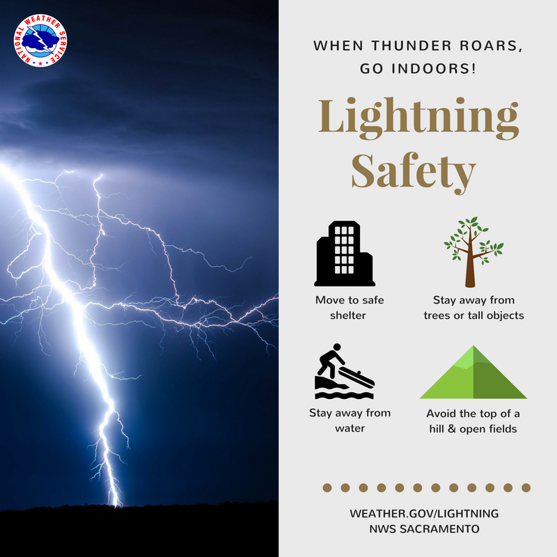
Despite the hot weather, we are monitoring some isolated mountain thunderstorm chances this weekend and again later into the week ahead. Be sure to stay weather aware if recreating at higher elevations and always have multiple ways to receive weather alerts! ⚡️📻📱 #CAwx

Despite the hot weather, we are monitoring some isolated mountain thunderstorm chances this weekend and again later into the week ahead. Be sure to stay weather aware if recreating at higher elevations and always have multiple ways to receive weather alerts! ⚡️📻📱

#CAwx
NOAA Space Weather Prediction Center (@nwsswpc) 's Twitter Profile Photo

We will not know the true nature of the CME structure until it arrives at our solar wind observatories located 1 million miles from Earth. It is at that point, SWPC forecasters can make determinations about warnings . Please continue visit spaceweather.gov for the latest.

We will not know the true nature of the CME structure until it arrives at our solar wind observatories located 1 million miles from Earth. It is at that point, SWPC forecasters can make determinations about warnings . Please continue visit spaceweather.gov for the latest.
IEMBot STO (@iembot_sto) 's Twitter Profile Photo

STO issues Red Flag Warning valid at Jun 2, 2:00 AM PDT till Jun 2, 8:00 PM PDT mesonet.agron.iastate.edu/vtec/f/2025-O-…

CAL FIRE LNU (@calfirelnu) 's Twitter Profile Photo

🚩 Red Flag Warning in Effect 🚩 The NWS Sacramento has issued a #RedFlagWarning from 2 am to 8 pm Monday for the northern Sacramento Valley, including portions of our Unit covering Colusa County. This alert is due to gusty winds and low relative humidity. Winds ... North to
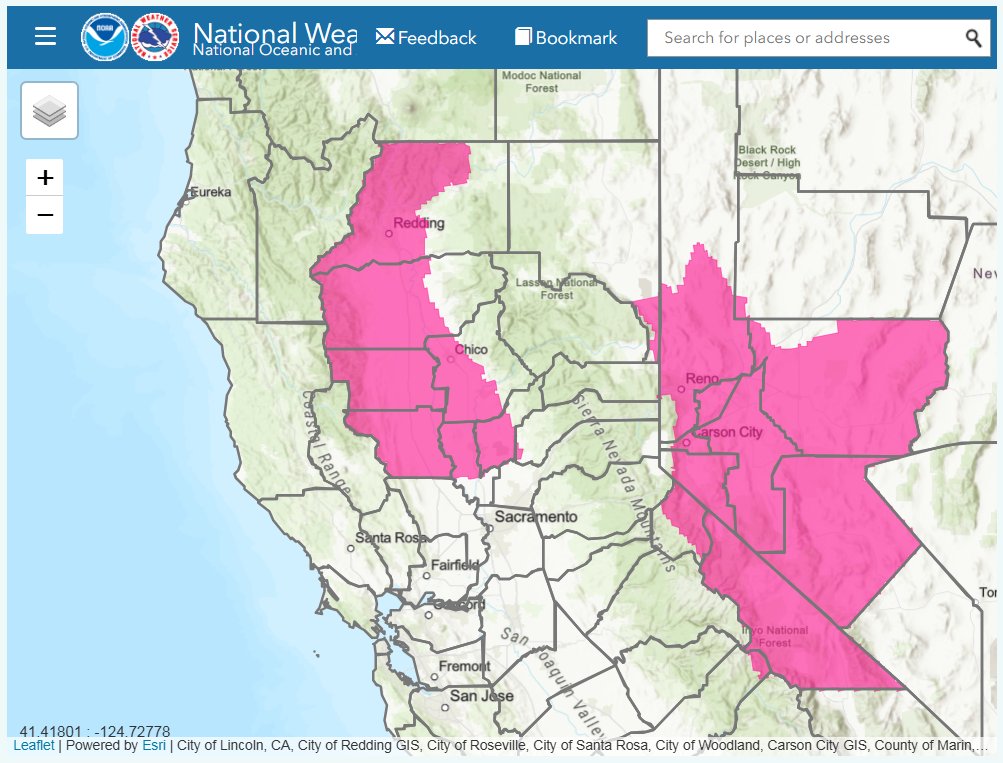
🚩 Red Flag Warning in Effect 🚩

The <a href="/NWSSacramento/">NWS Sacramento</a> has issued a #RedFlagWarning from 2 am to 8 pm Monday for the northern Sacramento Valley, including portions of our Unit covering <a href="/ColusaGov/">Colusa County</a>. This alert is due to gusty winds and low relative humidity.

Winds ... North to
NWS Sacramento (@nwssacramento) 's Twitter Profile Photo

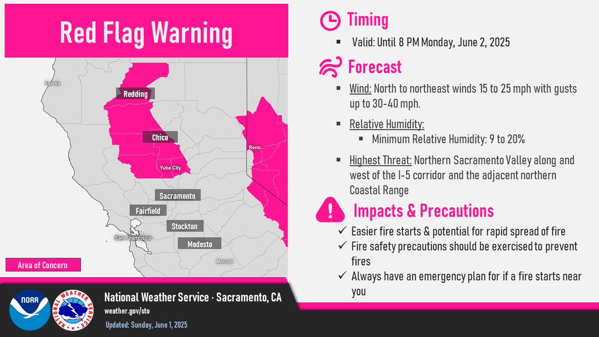
A Red Flag Warning has been issued for the Northern & Central Sac. Valley along and west of I-5 corridor and adjacent Coastal Range for low humidity and gusty winds creating critical fire weather conditions. Please see weather.gov/sto for more details! #CAwx

A Red Flag Warning has been issued for the Northern &amp; Central Sac. Valley along and west of I-5 corridor and adjacent Coastal Range for low humidity and gusty winds creating critical fire weather conditions. Please see weather.gov/sto for more details! #CAwx
Rob Mayeda (@robmayeda) 's Twitter Profile Photo

Fire danger rising as north wind develops across interior NorCal and the North Bay mountains tonight - Mon AM. Gfx wind near 2,500’ & RH% plus RH% values near sea level. This coincides with the declaration of the start of fire season w/ Santa Rosa Fire Department Monday #CAwx 6/1/2025
CAL FIRE (@cal_fire) 's Twitter Profile Photo

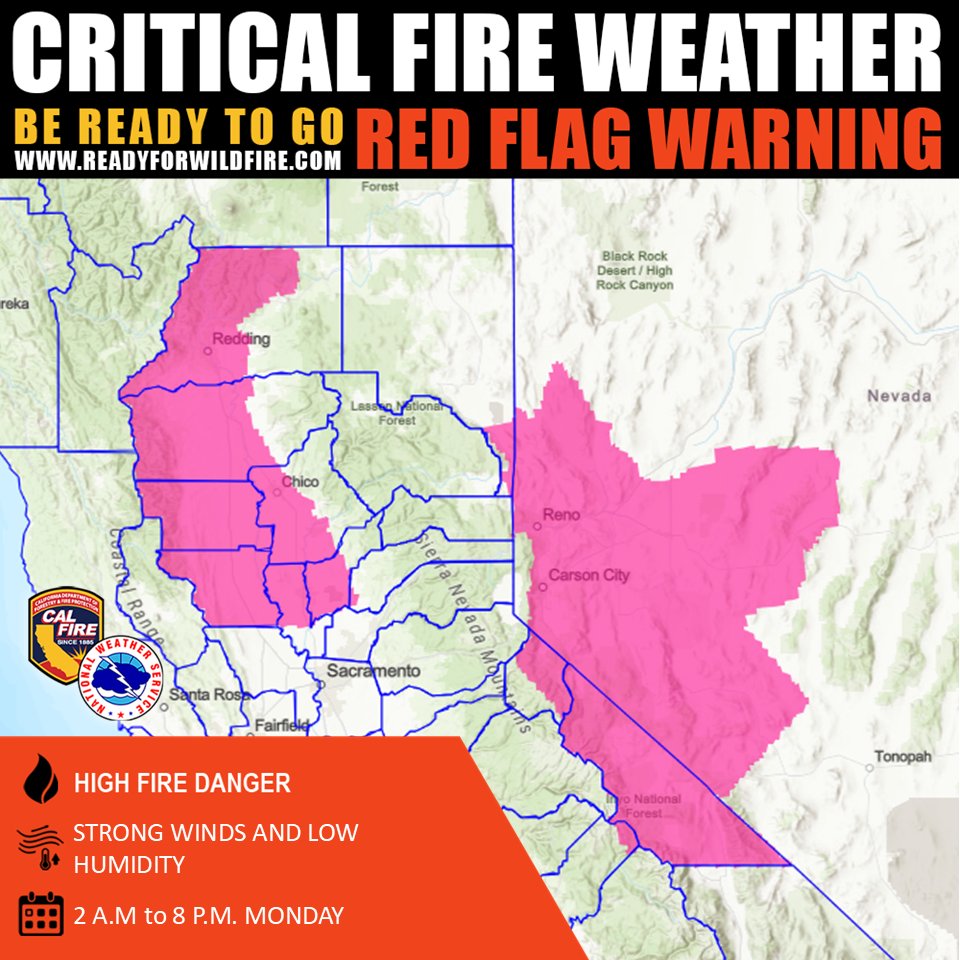
🚩 RED FLAG WARNING 🚩 The National Weather Service has issued a Red Flag Warning from 2 AM to 8 PM Monday for the Northern and Central Sacramento Valley and the adjacent Northern Coastal Range due to moderate to strong northerly winds and low relative humidity. Use extreme

🚩 RED FLAG WARNING 🚩
The National Weather Service has issued a Red Flag Warning from 2 AM to 8 PM Monday for the Northern and Central Sacramento Valley and the adjacent Northern Coastal Range due to moderate to strong northerly winds and low relative humidity.
Use extreme
NWS Sacramento (@nwssacramento) 's Twitter Profile Photo

Our Red Flag Warning remains in effect for the Northern and Central Sac. Valley and into the Coastal Range until 8 PM tonight from a combination of low humidity and gusty winds. Please continue to practice fire safety and visit weather.gov/sto for more details! #CAwx

Our Red Flag Warning remains in effect for the Northern and Central Sac. Valley and into the Coastal Range until 8 PM tonight from a combination of low humidity and gusty winds. Please continue to practice fire safety and visit weather.gov/sto for more details! #CAwx
National Interagency Fire Center (@nifc_fire) 's Twitter Profile Photo

#NationalFireNews: Total acres burned through May is very close to the 10-year average at 99.5%, with an above average tally of wildfires of 133%. 🔥 Read the full outlook & see maps for July, August, & September here --> nifc.gov/nicc-files/pre…

#NationalFireNews: Total acres burned through May is very close to the 10-year average at 99.5%, with an above average tally of wildfires of 133%.

🔥 Read the full outlook &amp; see maps for July, August, &amp; September here --&gt; nifc.gov/nicc-files/pre…
CAL FIRE Shasta-Trinity Unit/Shasta County FD (@calfireshu) 's Twitter Profile Photo

REDDING – CAL FIRE Shasta Trinity Unit announces crews will begin scraping hand lines on the lower portion of the project, located between Millville Plains Road and the Bear Creek Bridge, in preparation for a prescribed burning of roadside grass.

REDDING – CAL FIRE Shasta Trinity Unit announces crews will begin scraping hand lines on the lower portion of the project, located between Millville Plains Road and the Bear Creek Bridge, in preparation for a prescribed burning of roadside grass.
NWS Sacramento (@nwssacramento) 's Twitter Profile Photo

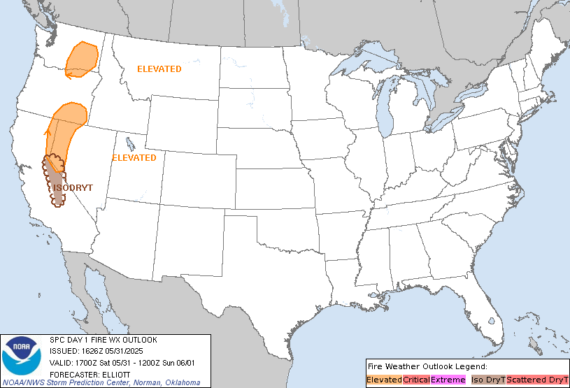
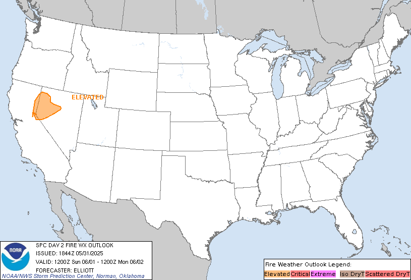
Elevated fire weather conditions return tomorrow across the Northern and Central Sacramento Valley from the combination of low humidity and breezy winds. Be sure to continue practicing fire safety and have an emergency plan in place for this summer! #Cawx

Elevated fire weather conditions return tomorrow across the Northern and Central Sacramento Valley from the combination of low humidity and breezy winds. Be sure to continue practicing fire safety and have an emergency plan in place for this summer! #Cawx
CAL FIRE LNU (@calfirelnu) 's Twitter Profile Photo

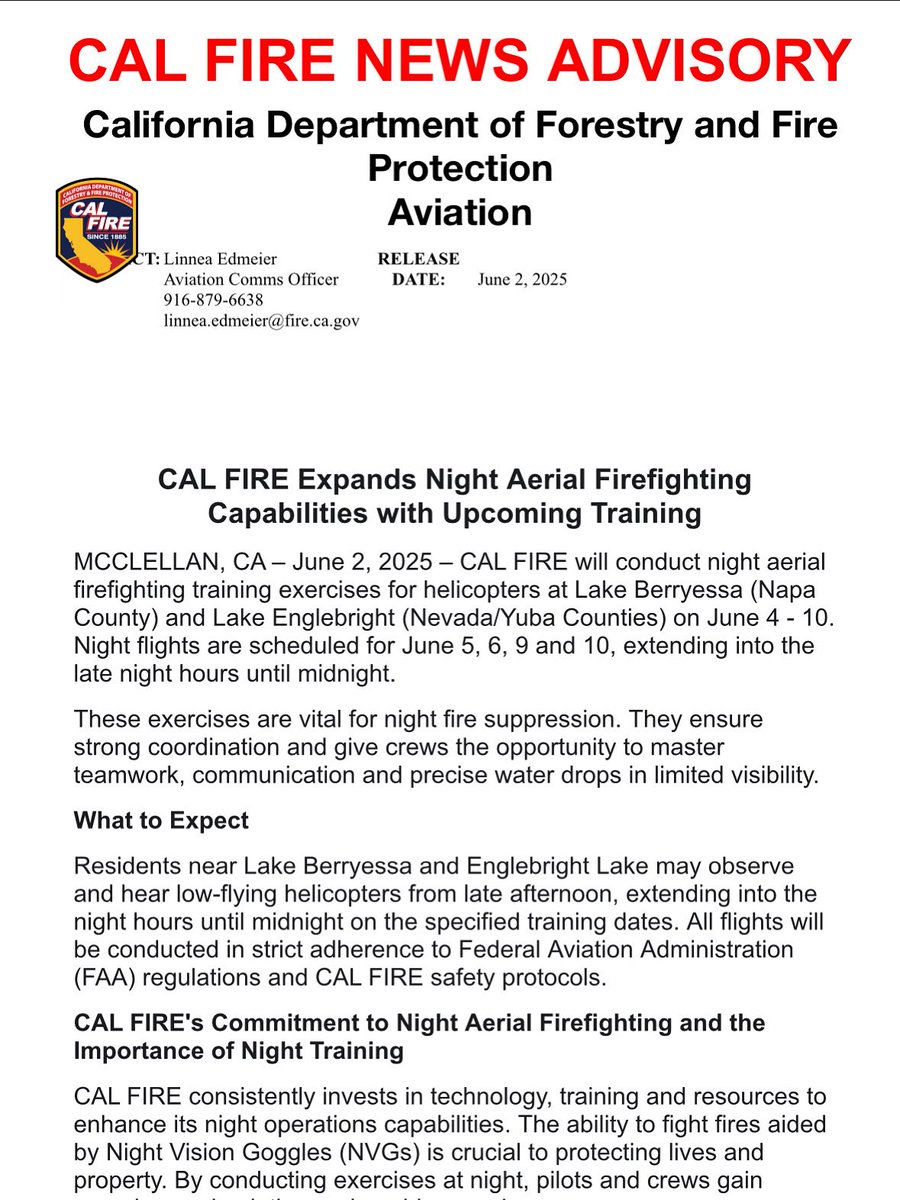
.CAL FIRE will be conducting night aerial firefighting training exercises for helicopters at Lake Berryessa (Napa County) and Lake Englebright (Nevada/Yuba Counties) between June 4-10. Night flights are scheduled for June 5, 6, 9 and 10, extending into the late night hours until

.<a href="/CAL_FIRE/">CAL FIRE</a> will be conducting night aerial firefighting training exercises for helicopters at Lake Berryessa (Napa County) and Lake Englebright (Nevada/Yuba Counties) between June 4-10. Night flights are scheduled for June 5, 6, 9 and 10, extending into the late night hours until