Ben Cohen (@bencohentc) 's Twitter Profile
Ben Cohen

@bencohentc

Endlessly fascinated by Tropical Cyclones. Amateur photographer. I love the outdoors and want to preserve the planet. | VTSU Lyndon 2026 | 21 years old |

ID: 1259539334044225536

calendar_today10-05-2020 17:44:44

5,5K Tweet

1,1K Followers

1,1K Following

Ben Cohen (@bencohentc) 's Twitter Profile Photo

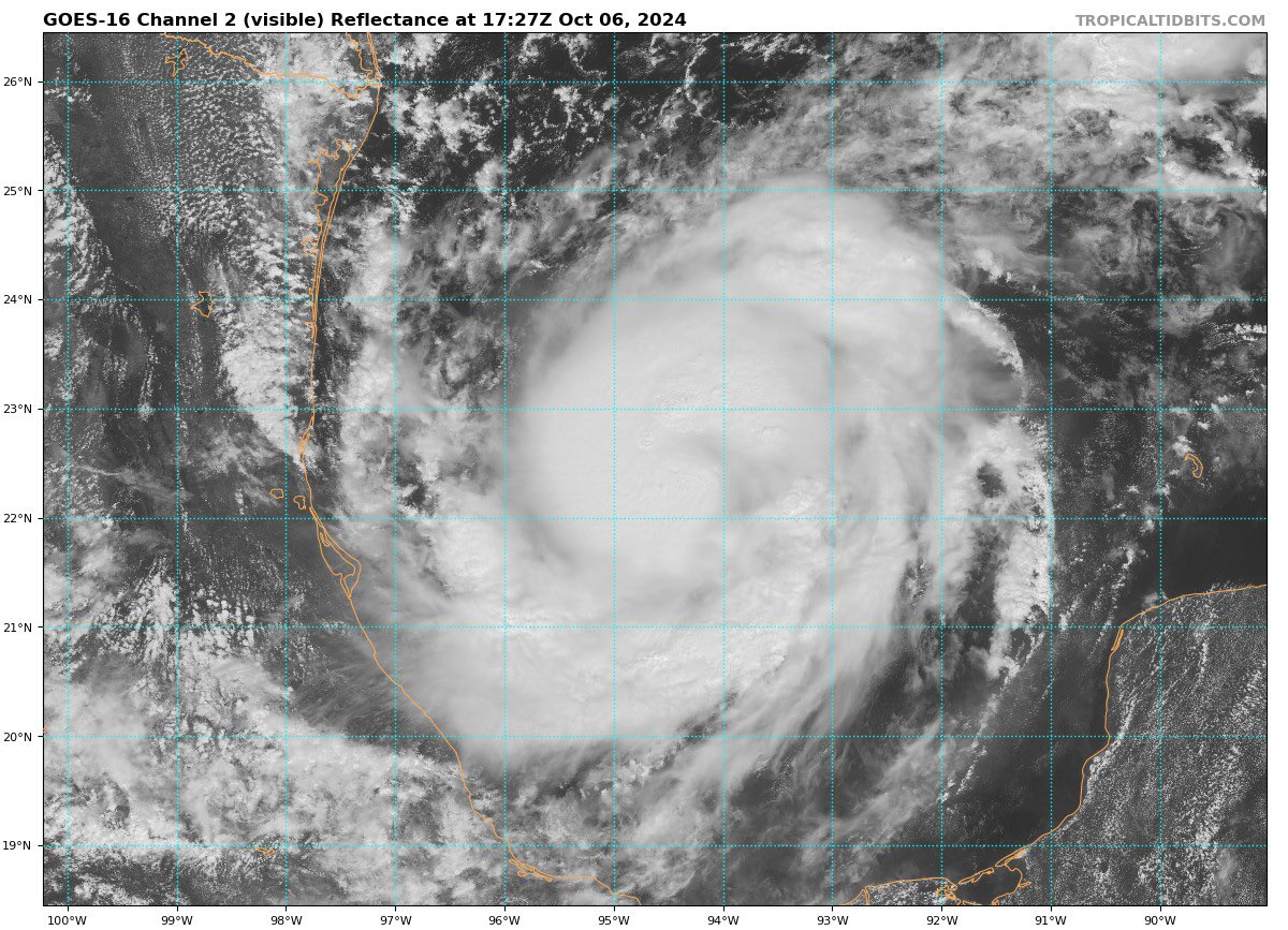
Recon has found that #Milton is likely already a hurricane this afternoon with winds around 80mph and a pressure in high 980s. The TC is exhibiting the classic "comma head" CDO structure along with dual VHTs rotating about the center. A burst of Robust RI is likely into tonight.

Recon has found that #Milton is likely already a hurricane this afternoon with winds around 80mph and a pressure in high 980s. The TC is exhibiting the classic "comma head" CDO structure along with dual VHTs rotating about the center. A burst of Robust RI is likely into tonight.
Ben Cohen (@bencohentc) 's Twitter Profile Photo

#Milton is beginning to rapidly increase its rate of intensification tonight. Recon and TDR data have revealed that the system's core is very compact. In no uncertain terms could we see explosive intensification of Milton tomorrow given it's structure and conditions ahead of it.

Ben Cohen (@bencohentc) 's Twitter Profile Photo

Hurricane #Milton is explosively intensifying this morning with pressure dropping approximately 22mbs in only 3 hours! The system now has winds of 150mph per recon, a high end category 4. Once Milton's eye completely clears out we will likely be looking at a category 5 hurricane.

Ben Cohen (@bencohentc) 's Twitter Profile Photo

#Milton's eye is in the process of clearing as it intensifies further to 155mph/933mbs as of the NHC's 11am update. TCs will experience even more rapid pressure falls when the process of subsidence evacuates mass in the eye, clearing it out. Pressure is likely already in the 920s

#Milton's eye is in the process of clearing as it intensifies further to 155mph/933mbs as of the NHC's 11am update. TCs will experience even more rapid pressure falls when the process of subsidence evacuates mass in the eye, clearing it out. Pressure is likely already in the 920s
Ben Cohen (@bencohentc) 's Twitter Profile Photo

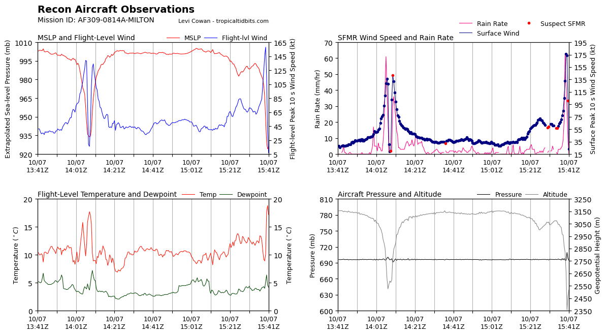
Absolutely mind blowing data coming out of recon's latest pass through #Milton. FL Winds are around 160kts and pressure has dropped to the low to mid 920s. Per this data, Milton is now a category 5 hurricane.

Absolutely mind blowing data coming out of recon's latest pass through #Milton. FL Winds are around 160kts and pressure has dropped to the low to mid 920s. Per this data, Milton is now a category 5 hurricane.
Ben Cohen (@bencohentc) 's Twitter Profile Photo

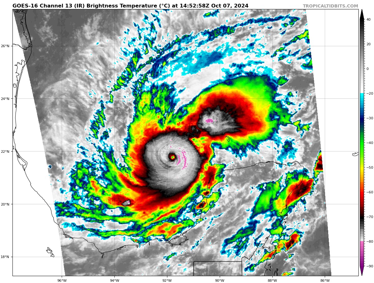
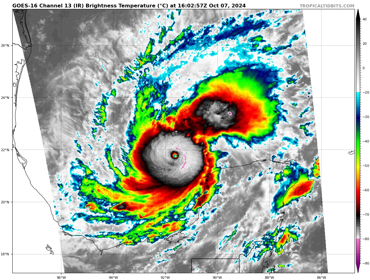
#Milton's pinhole eye has cleared on IR satellite. We are likely seeing a 170mph+ sub 915mb intensity right now given the data from the last recon pass.

#Milton's pinhole eye has cleared on IR satellite. We are likely seeing a 170mph+ sub 915mb intensity right now given the data from the last recon pass.
Ben Cohen (@bencohentc) 's Twitter Profile Photo

Running out of words to describe how exceptional #Milton's intensification is. now with max winds of 175mph and a minimum pressure of 911mbs, Milton is the most intense Atlantic hurricane since Dorian in 2019, and the most intense gulf hurricane since Rita 2005.

Ben Cohen (@bencohentc) 's Twitter Profile Photo

Another astonishing thing is how much #Milton's eye has contracted. As you can see from this radar loop it is roughly half it's original diameter. Similar structural evolutions were observed in typhoons Goni and Chanthu. Also notice how symmetrical the eyewall has become!

Ben Cohen (@bencohentc) 's Twitter Profile Photo

What an insane satellite view this evening over the Gulf. Category 5 hurricane #Milton and wildfire smoke from Canada being pulled south over LA by the same trough that is steering Milton into Florida.

What an insane satellite view this evening over the Gulf. Category 5 hurricane #Milton and wildfire smoke from Canada being pulled south over LA by the same trough that is steering Milton into Florida.
Ben Cohen (@bencohentc) 's Twitter Profile Photo

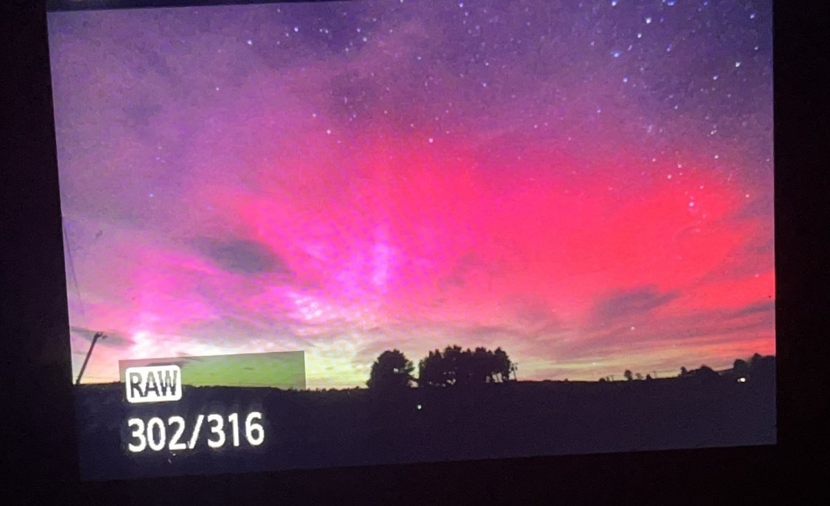
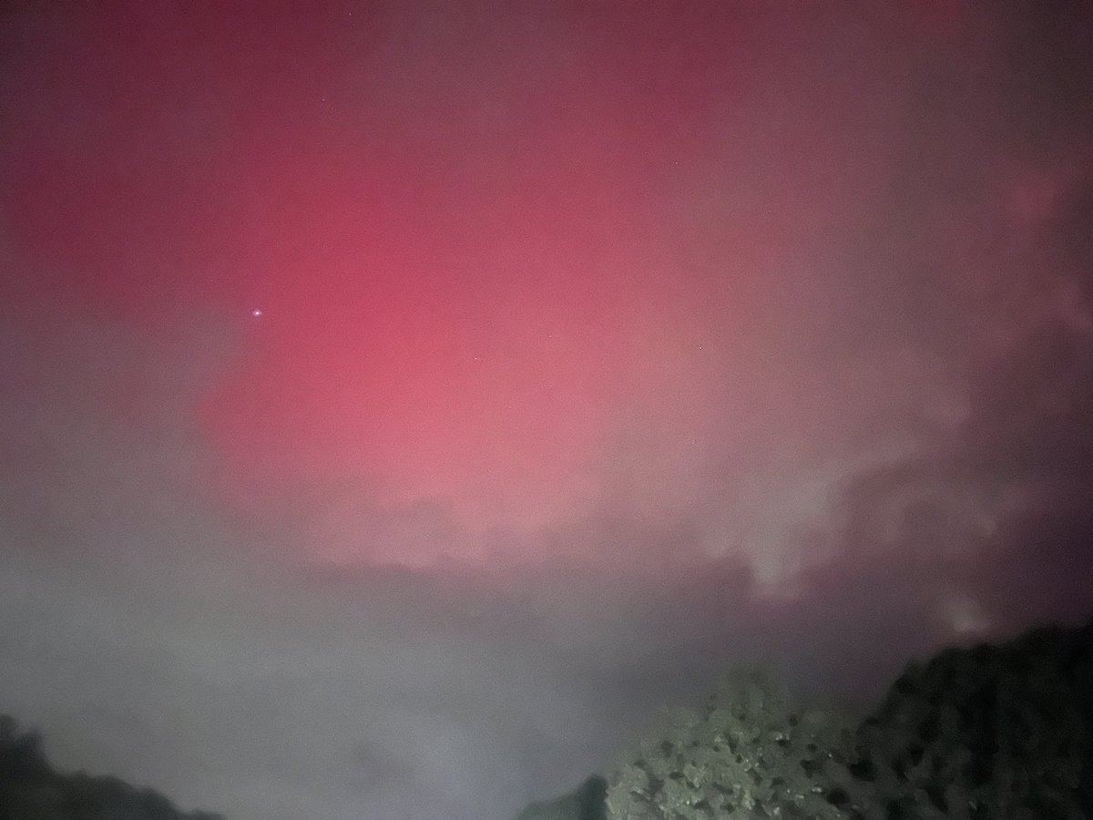
I will never forget driving south on I-93 into central NH just after sunset and looking up to see the entire sky was glowing pink. What a spectacular night! Space Weather Watch Dr. Tamitha Skov bro #aurora

I will never forget driving south on I-93 into central NH just after sunset and looking up to see the entire sky was glowing pink. What a spectacular night! <a href="/spacewxwatch/">Space Weather Watch</a> <a href="/TamithaSkov/">Dr. Tamitha Skov</a> <a href="/Wicky_dubs_WX/">bro</a> #aurora
Ben Cohen (@bencohentc) 's Twitter Profile Photo

What a year it has been. From making so many new friends to having the worst 3 months of my life and almost dying, then picking myself up again for an amazing last few months of the year. Super thankful to still be here and to be mostly healthy again ❤️. Here's to a great 2025!