Rebekke Muench (@beemuench) 's Twitter Profile
Rebekke Muench

@beemuench

#RemoteSensing Tweets are my own, retweets ≠ endorsements. she/her

ID: 337406115

calendar_today18-07-2011 00:07:54

4,4K Tweet

1,1K Followers

1,1K Following

EOTEC DevNet (@eotecdevnet) 's Twitter Profile Photo

🎉 Big congrats to ኬን ሙቤ on winning the 2023 GISforAfrica Excellence Award! Your work in GIS and RS is truly inspiring, and your contributions to #EOTECDevNet are invaluable. 🎉 Wishing you ongoing success! #GISforAfrica #EarthObservation

OpenStreetMap Africa (@osmafrica) 's Twitter Profile Photo

Registration is now open for our first mapathon of 2024. Join us on Jan 20th to #MapSouthSudan🇸🇸 with OSM South Sudan Contribute to vital maps & support local communities! #OpenStreetMap #MapSouthSudan Event details here ➡️mobilizon.openstreetmap.fr/events/016e9b8…

Harvest (@harvestprogram) 's Twitter Profile Photo

NASA Harvest has teamed up with Virginia Tech faculty to evaluate and improve the design of agricultural insurance programs using satellite data! Learn more about our partnership here 👉news.vt.edu/articles/2024/…
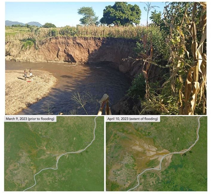
NASA Harvest has teamed up with <a href="/virginia_tech/">Virginia Tech</a> faculty to evaluate and improve the design of agricultural insurance programs using satellite data! 
Learn more about our partnership here 👉news.vt.edu/articles/2024/…
NICFI Satellite Data Program (@nicfisatdata) 's Twitter Profile Photo

🎉✨Happy belated 25,000th registered user✨🎉 This impressive milestone of the #NICFISatelliteDataProgram happened in late November 2023, and we almost missed it! 🙈 It is impressive how fast things go by 💨💨💨 Planet KSAT Airbus NICFI

🇧🇿 Belize GEO 🛰️ (@bzgeo) 's Twitter Profile Photo

📢 It's New Data Monday! 😉 The March 2024 NICFI Satellite Data Program monthly 🛰️ mosaics for the #Americas, #Africa, and #Asia dropped over the weekend + are now available in #EarthEngine (+ direct download via planet.com/basemaps/). 🏆 to Planet & NICFI! x.com/BzGEO/status/1…

📢 It's New Data Monday! 😉 The March 2024 <a href="/NICFISatData/">NICFI Satellite Data Program</a> monthly 🛰️ mosaics for the #Americas, #Africa, and #Asia dropped over the weekend + are now available in #EarthEngine (+ direct download via planet.com/basemaps/). 🏆 to <a href="/Planet/">Planet</a> &amp; <a href="/ClimateForest/">NICFI</a>!
x.com/BzGEO/status/1…
UAH Lab for Applied Science (@uah_las) 's Twitter Profile Photo

🚨📢LAS is Hiring 📢🚨 More opportunities to join our growing team in #Huntsville, AL! UAH Lab for Applied Science is looking for a #remoteSensing and #AirQuality expert to lead SERVIR Global's Air Quality and #Health portfolio. Think you have the right stuff? Apply here: bit.ly/las_aqL
🚨📢LAS is Hiring 📢🚨
More opportunities to join our growing team in #Huntsville, AL! 
<a href="/UAH_LAS/">UAH Lab for Applied Science</a> is looking for a #remoteSensing and #AirQuality expert to lead <a href="/SERVIRGlobal/">SERVIR Global</a>'s Air Quality and #Health portfolio. Think you have the right stuff? Apply here: bit.ly/las_aqL
GEDI (@gedi_knights) 's Twitter Profile Photo

GEDI returns on Earth Day! 🎉🛰️ #GEDI's reinstall on the evening of 22 April brings an end to its long, cold storage in space. Thermal control will warm us upon site arrival, followed by power-up around 9 am EDT on 23 April. Recovery to normal operations will follow.

Harvest (@harvestprogram) 's Twitter Profile Photo

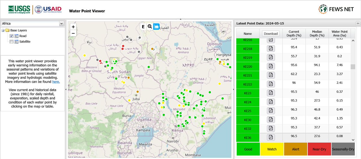
To track water availability for livestock and agriculture across Africa, scientists with FEWS NET developed a tool called the Water Point Viewer that monitors 338 rangeland ponds from Senegal to Somalia. 🔗nasaharvest.org/news/mapping-w…

To track water availability for livestock and agriculture across Africa, scientists with <a href="/FEWSNET/">FEWS NET</a> developed a tool called the Water Point Viewer that monitors 338 rangeland ponds from Senegal to Somalia.
🔗nasaharvest.org/news/mapping-w…
SERVIR Global (@servirglobal) 's Twitter Profile Photo

Do you want to learn how to access global #rainfall, #SoilMoisture, and #vegetation health datasets at the push of a button? Take our free and open course, Introduction to #ClimateSERV, offered by Faculty ITC | University of Twente's Geoversity: geoversity.io/courses/introd…


Do you want to learn how to access global #rainfall, #SoilMoisture, and #vegetation health datasets at the push of a button? Take our free and open course, Introduction to #ClimateSERV, offered by <a href="/FacultyITC/">Faculty ITC | University of Twente</a>'s Geoversity: geoversity.io/courses/introd…
IEEE Geoscience and Remote Sensing Society (@ieee_grss) 's Twitter Profile Photo

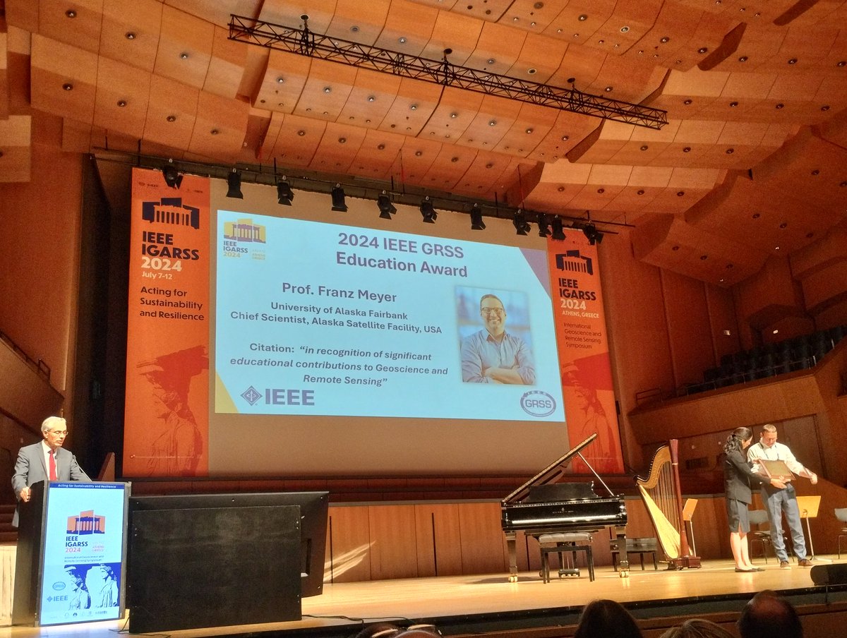
🏆 This year's IEEE GRSS Education Award was presented to Prof. Franz J. Meyer "in recognition of significant education contribution to geoscience and remote sensing." 🌍🛰️ #IEEEGRSS #EducationAward #Geoscience #RemoteSensing

🏆 This year's IEEE GRSS Education Award was presented to Prof. Franz J. Meyer  "in recognition of significant education contribution to geoscience and remote sensing." 🌍🛰️ 

#IEEEGRSS #EducationAward #Geoscience #RemoteSensing
Robbie Schingler (@schingler) 's Twitter Profile Photo

Wild Wild Space - a new HBO documentary - is streaming on July 17. It features the backstory of Astra Rocket Lab and Planet - and captures the personalities of the founders well! Based largely on the Ashlee Vance book. press.wbd.com/us/media-relea… youtube.com/watch?v=Q50dAi…

Julian Fox (@juliancfox) 's Twitter Profile Photo

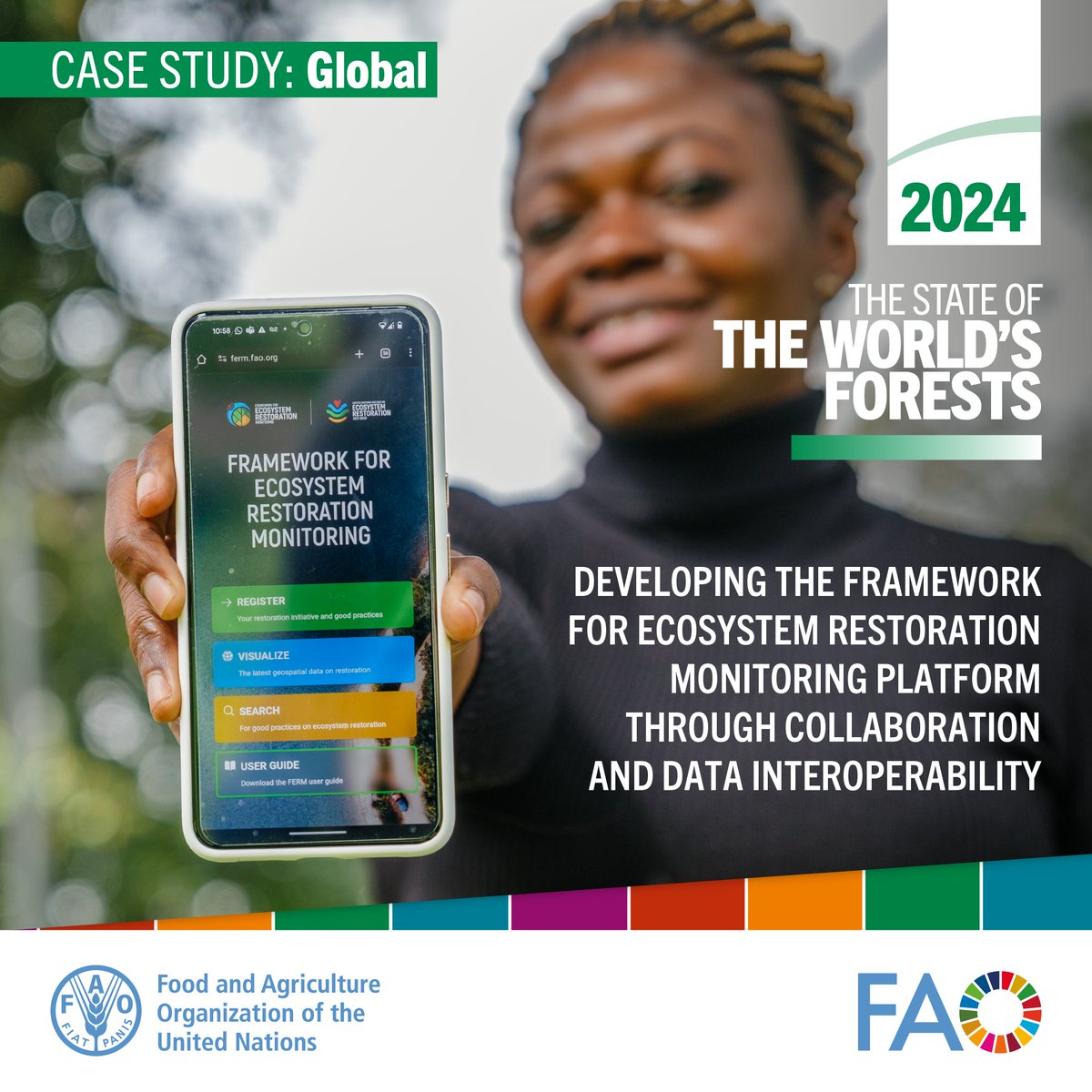
📢 Exciting news! The 2024 State of Word's Forests (SOFO) report is out! 📚 Dive into Forest Monitoring Innovations toward deforestation-free commodities, Ecosystem Restoration, MRV, and much more #SOFO2024 doi.org/10.4060/cd1211…

📢 Exciting news! The 2024 State of Word's Forests (SOFO) report is out! 📚 Dive into Forest Monitoring Innovations toward deforestation-free commodities, Ecosystem Restoration, MRV, and much more #SOFO2024
doi.org/10.4060/cd1211…
Planet (@planet) 's Twitter Profile Photo

On Friday, we launched 36 SuperDoves into orbit on SpaceX’s Transporter-11 Mission, and today, our “first light” satellite images are already here! This is the fastest we’ve ever received our first light data; and gee wiz(!), the world is looking beautiful! Here are just some

On Friday, we launched 36 SuperDoves into orbit on <a href="/SpaceX/">SpaceX</a>’s Transporter-11 Mission, and today, our “first light” satellite images are already here!

This is the fastest we’ve ever received our first light data; and gee wiz(!), the world is looking beautiful!

Here are just some
Will Marshall (@will4planet) 's Twitter Profile Photo

We’ve signed a multi-year contract with DLR - English - the German Space Agency! Researchers across the organization will gain access to our Planet satellite data to support climate change research and advance security. Europe is leading the way in innovation in the EO market, and
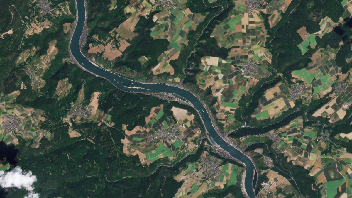
We’ve signed a multi-year contract with <a href="/DLR_en/">DLR - English</a> - the German Space Agency!

Researchers across the organization will gain access to our Planet satellite data to support climate change research and advance security.

Europe is leading the way in innovation in the EO market, and
NICFI Satellite Data Program (@nicfisatdata) 's Twitter Profile Photo

(Re)discover the #NICFISatelliteDataProgram and the range of possibilities offered by high-res satellite images: nicfi.no 🌍Helping to combat climate change 🌳Reducing tropical deforestation 🍃Advancing biodiversity conservation ✊🏻 Protecting indigenous communities

(Re)discover the #NICFISatelliteDataProgram and the range of possibilities offered by high-res satellite images: nicfi.no
🌍Helping to combat climate change
🌳Reducing tropical deforestation
🍃Advancing biodiversity conservation
✊🏻 Protecting indigenous communities
Will Marshall (@will4planet) 's Twitter Profile Photo

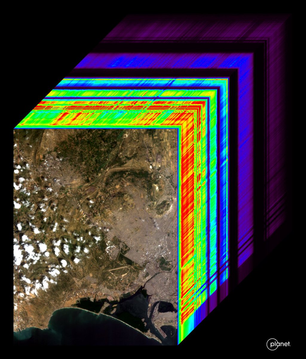
First Light from our first hyperspectral satellite, Tanager-1! This image is of Karachi, Pakistan on Sept 19th. The image has 420 spectral bands, and here we’re showing one in visible-wavelength, one near-infrared image, and one shortwave infrared image of the same site + the

First Light from our first hyperspectral satellite, Tanager-1!

This image is of Karachi, Pakistan on Sept 19th. The image has 420 spectral bands, and here we’re showing one in visible-wavelength, one near-infrared image, and one shortwave infrared image of the same site + the
Planet (@planet) 's Twitter Profile Photo

Visualizing the invisible: Tanager-1 is now detecting methane and CO2 emissions across the globe! Our partner CarbonMapper just released images of the first set of plumes spotted in our first hyperspectral satellite’s data. Get the details: planet.com/pulse/carbon-m…
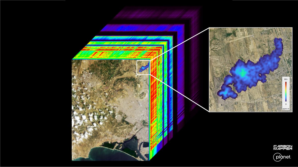
Visualizing the invisible: Tanager-1 is now detecting methane and CO2 emissions across the globe! 

Our partner <a href="/carbonmapper/">CarbonMapper</a> just released images of the first set of plumes spotted in our first hyperspectral satellite’s data.

Get the details: planet.com/pulse/carbon-m…
Will Marshall (@will4planet) 's Twitter Profile Photo

That's right, we build all our satellites right here in downtown San Francisco! Fastest satellite producers in the world. 🛰️🌎 Fun chat with San Francisco Business Times about @Planet’s work:
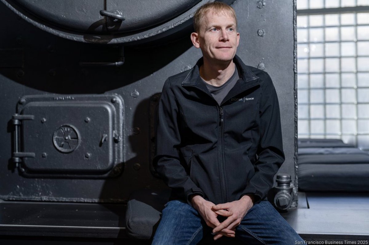
That's right, we build all our satellites right here in downtown San Francisco! Fastest satellite producers in the world. 🛰️🌎

Fun chat with <a href="/SFBusinessTimes/">San Francisco Business Times</a> about @Planet’s work: