BAM Weather (BAMWX)(@bamwxcom) 's Twitter Profileg
BAM Weather (BAMWX)

@bamwxcom

Get a new type of weather forecast with Clarity by BAM Weather & make smarter decisions! Learn More: https://t.co/PyXnVPhZl3

https://t.co/9WtuccPQJi

ID:119126557

linkhttp://bamwx.com calendar_today02-03-2010 19:05:35

96,2K Tweets

37,6K Followers

320 Following

BAM Weather (BAMWX)(@bamwxcom) 's Twitter Profile Photo

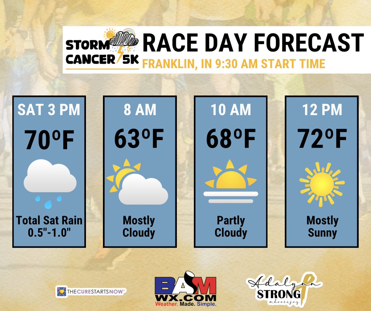
JUST 3⃣ MORE DAYS UNTIL OUR STORM CANCER 5K!

😎☀️The weather looks to be perfect for Sunday with temperatures hanging in the mid-to-upper 60s for the start of the race and reaching the lower 70s by noon.

🌧️☔️We'll have to watch for some rain showers on Saturday for early packet

JUST 3⃣ MORE DAYS UNTIL OUR STORM CANCER 5K! 😎☀️The weather looks to be perfect for Sunday with temperatures hanging in the mid-to-upper 60s for the start of the race and reaching the lower 70s by noon. 🌧️☔️We'll have to watch for some rain showers on Saturday for early packet
account_circle
BAM Weather (BAMWX)(@bamwxcom) 's Twitter Profile Photo

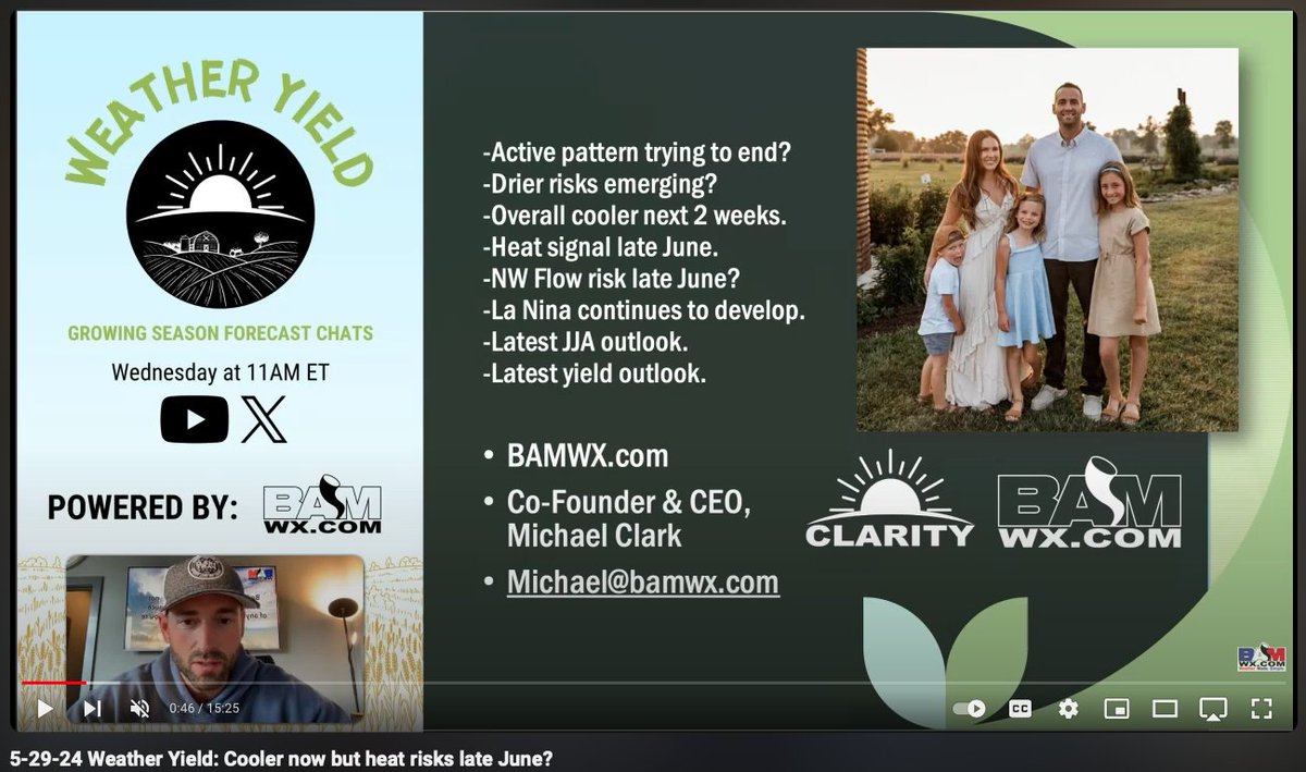
The pattern the next two weeks leans cooler overall, but we're seeing multiple signals to indicate that changes late June with a potential heat wave for the .

Both the EPS and CFS Weekly data now hinting at the potential. We could also see a shift in the precipitation

The pattern the next two weeks leans cooler overall, but we're seeing multiple signals to indicate that changes late June with a potential heat wave for the #CornBelt. Both the EPS and CFS Weekly data now hinting at the potential. We could also see a shift in the precipitation
account_circle
Will Danby(@WillDanbywx) 's Twitter Profile Photo

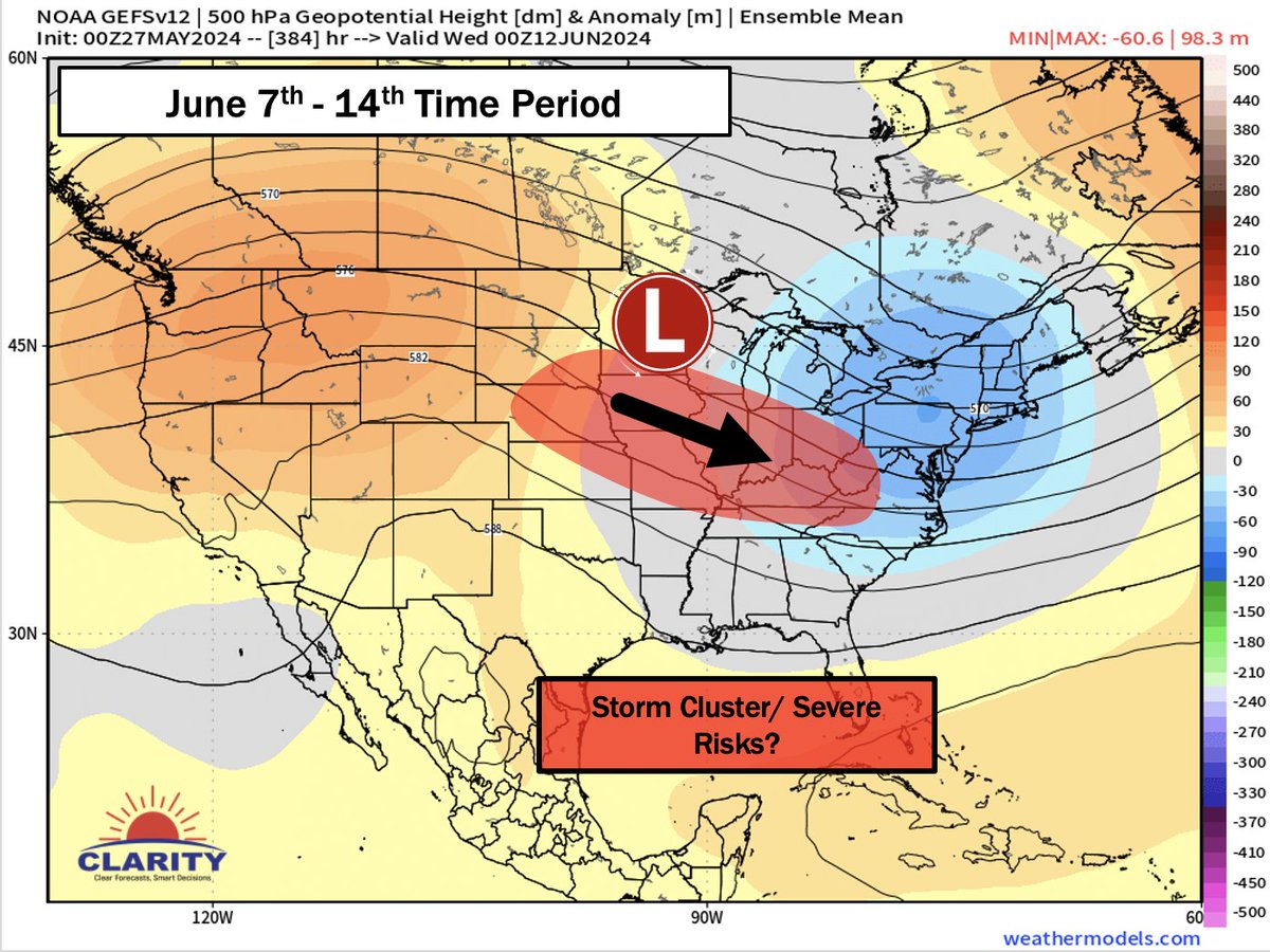
A lower confidence forecast, it is worth monitoring the potential for some storm clusters into the 2nd week of June

There is at least a decent gradient on the height charts for the setup to occur, but the risk is the for the blue area to become too N-S oriented as opposed to

A lower confidence forecast, it is worth monitoring the potential for some storm clusters into the 2nd week of June There is at least a decent gradient on the height charts for the setup to occur, but the risk is the for the blue area to become too N-S oriented as opposed to
account_circle
BAM Weather (BAMWX)(@bamwxcom) 's Twitter Profile Photo

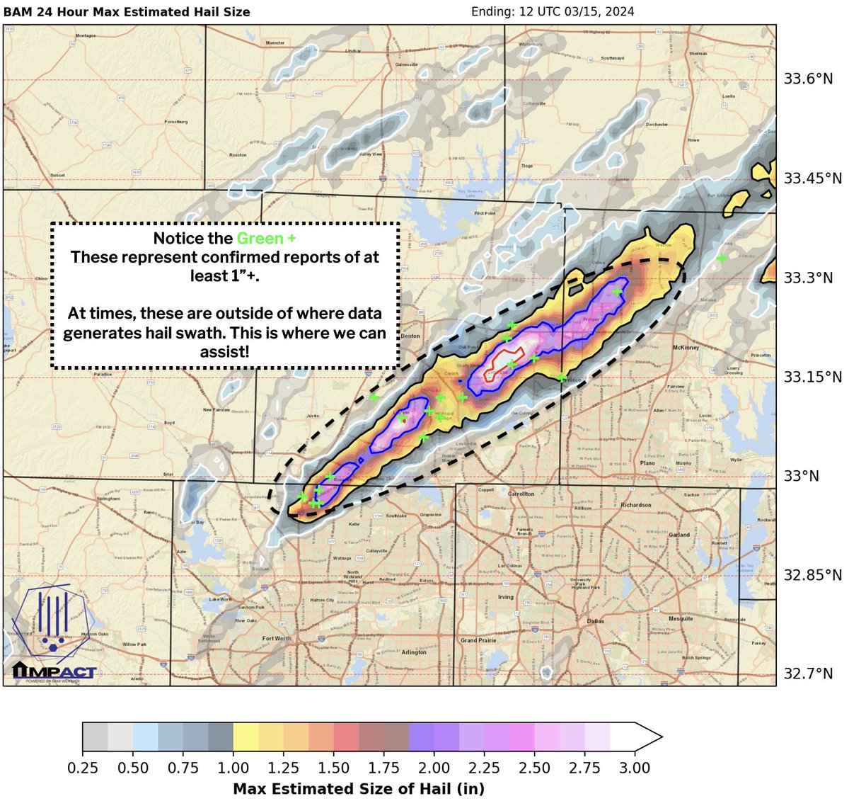
The past few weeks have been very active in terms of severe weather. ⛈️

We've been working with our public adjuster clients to provide forensic reports 📑, hail maps, and consultation detailing these events! You need to have ALL the pieces in order to win claims!

Let's chat 💬

The past few weeks have been very active in terms of severe weather. ⛈️ We've been working with our public adjuster clients to provide forensic reports 📑, hail maps, and consultation detailing these events! You need to have ALL the pieces in order to win claims! Let's chat 💬
account_circle
BAM Weather (BAMWX)(@bamwxcom) 's Twitter Profile Photo

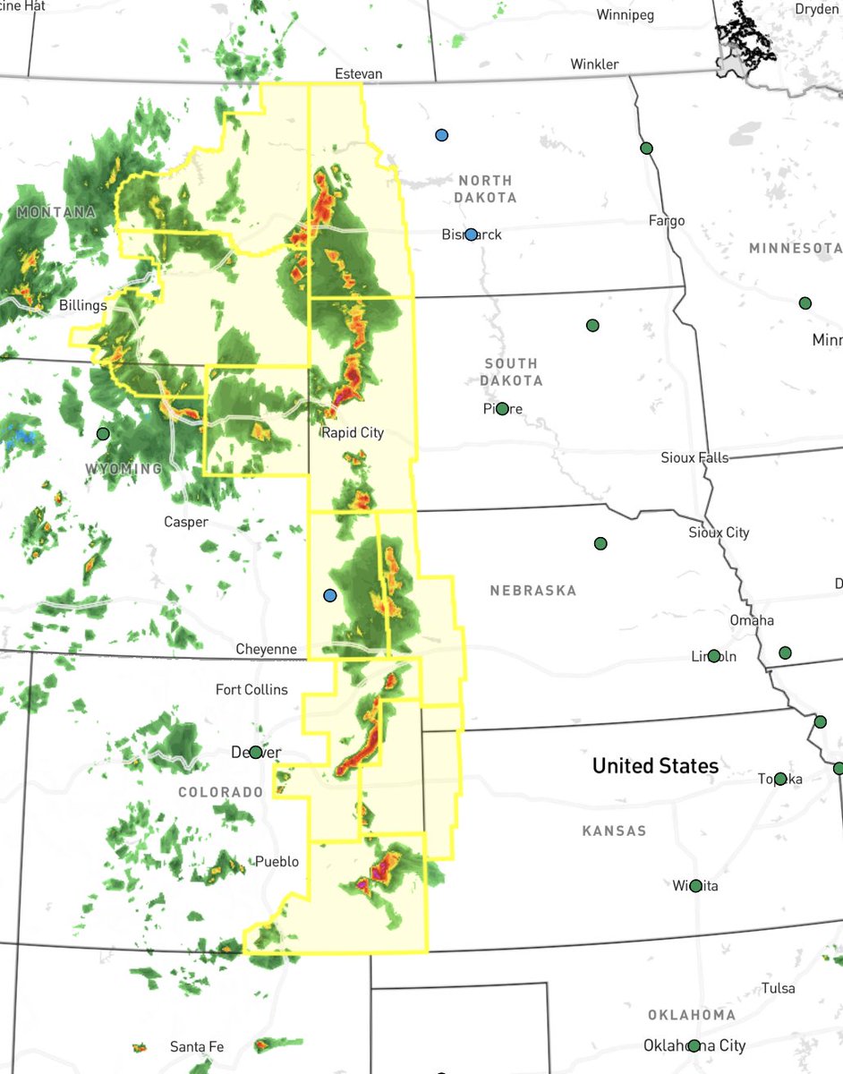
Over the next two days we will have severe thunderstorms ⛈️ as far N as ND and as far S as S TX with todays storms being mainly focused across the N/C Plains 🌱!

Greatest risks include large hail and strong winds💨,however, tomorrow looks to have all risks on the table across

Over the next two days we will have severe thunderstorms ⛈️ as far N as ND and as far S as S TX with todays storms being mainly focused across the N/C Plains 🌱! Greatest risks include large hail and strong winds💨,however, tomorrow looks to have all risks on the table across
account_circle
BAM Weather (BAMWX)(@bamwxcom) 's Twitter Profile Photo

🎆Any time you get instability values this far north at this time of the year - expect some fireworks.

👇Latest GFS/ Euro 'CAPE' values SUN afternoon.

⛈️Severe weather looks likely. Exact specifics TBD.

🎆Any time you get instability values this far north at this time of the year - expect some fireworks. 👇Latest GFS/ Euro 'CAPE' values SUN afternoon. ⛈️Severe weather looks likely. Exact specifics TBD. #plant24 #severeweather #storms #OATT
account_circle
BAM Weather (BAMWX)(@bamwxcom) 's Twitter Profile Photo

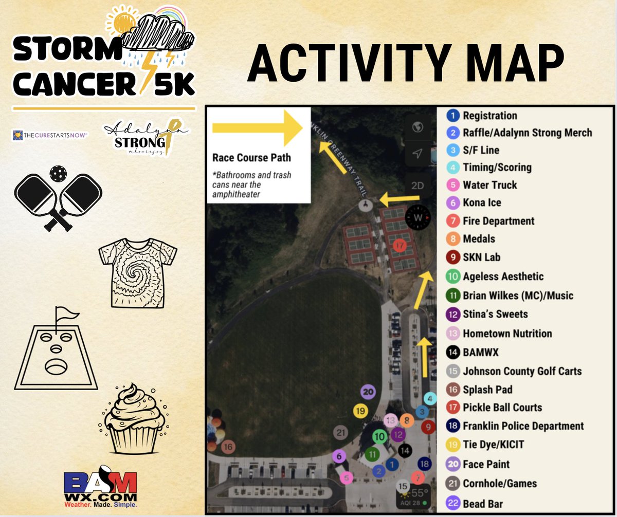
❗STORM CANCER 5K INFORMATION❗

Optional: EARLY PACKET PICK UP
--Come pick up your race packets on Saturday, June 1, from 2-4 PM at the amphitheater, otherwise packet pick up will start at 8:30 AM on Sunday!

5K RACE MAP
--The 5K will start at the amphitheater at 9:30 AM (be

❗STORM CANCER 5K INFORMATION❗ Optional: EARLY PACKET PICK UP --Come pick up your race packets on Saturday, June 1, from 2-4 PM at the amphitheater, otherwise packet pick up will start at 8:30 AM on Sunday! 5K RACE MAP --The 5K will start at the amphitheater at 9:30 AM (be
account_circle
Benton Hodges(@BPHTurf) 's Twitter Profile Photo

Everyone in the turf world has their preferred automated weather apps & websites, usually multiple to get the job done.

@BAMWXcom is taking the automated weather forecast a step further by using trained meteorologists to enhance their forecasts and provide 24/7 chat access to

account_circle
Kirk 🇺🇸 Hinz | BAM ⚡️Weather(@Met_khinz) 's Twitter Profile Photo

We at BAM Weather (BAMWX) would love to help make sure this doesn't happen again Ruoff Music Center / Live Nation.

These situations are perfect examples of why you simply cannot eliminate the human element from weather forecasting.

account_circle
Kirk 🇺🇸 Hinz | BAM ⚡️Weather(@Met_khinz) 's Twitter Profile Photo

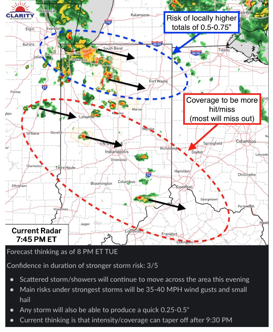
way too close last night during the Hozier concert at the Ruoff Music Center...thousands of folks at risk here.

We sent out a nowcast update via Clarity WELL before the storms were even close to the metro, they didn't come out of nowhere.

These kinds of

#Lightning way too close last night during the @Hozier concert at the Ruoff Music Center...thousands of folks at risk here. We sent out a nowcast update via @clarity_wx WELL before the storms were even close to the #Indy metro, they didn't come out of nowhere. These kinds of
account_circle
BAM Weather (BAMWX)(@bamwxcom) 's Twitter Profile Photo

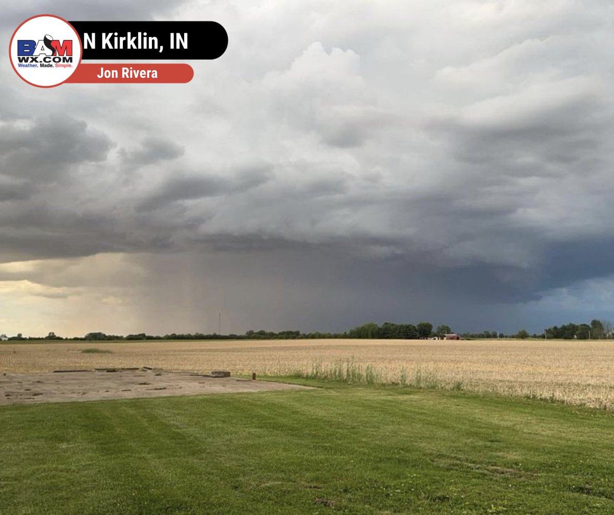
⛈Some of our followers sent us some cool pictures of last night's storms that rolled through the region. Small hail fell, along with some gusty winds in a few of the cells. The most notable thing was the amount of lightning in these thunderstorms!⚡️

It also made for a beautiful

⛈Some of our followers sent us some cool pictures of last night's storms that rolled through the region. Small hail fell, along with some gusty winds in a few of the cells. The most notable thing was the amount of lightning in these thunderstorms!⚡️ It also made for a beautiful
account_circle
BAM Weather (BAMWX)(@bamwxcom) 's Twitter Profile Photo

A welcome sign for many across W as ⛈️ push east.

Further E you go it's been very active, but towards the CO/KS border it's been more difficult to see consistent 🌧️!

We've been discussing this in our recent Long Range Videos 🎥

Send us a DM if you're curious on how

A welcome sign for many across W #KSwx as ⛈️ push east. Further E you go it's been very active, but towards the CO/KS border it's been more difficult to see consistent 🌧️! We've been discussing this in our recent Long Range Videos 🎥 Send us a DM if you're curious on how
account_circle
BAM Weather (BAMWX)(@bamwxcom) 's Twitter Profile Photo

Need some more race day forecasting from us?? 🏁

Well you're in luck! 👀

We will be working closely with our friends at WWT Raceway as they get ready for their NASCAR Race Weekend and Confluence Music Festival! 🤩

This weekend looks to be another active one across the

Need some more race day forecasting from us?? 🏁 Well you're in luck! 👀 We will be working closely with our friends at @WWTRaceway as they get ready for their @NASCAR Race Weekend and Confluence Music Festival! 🤩 This weekend looks to be another active one across the
account_circle
AgriTalk Radio(@agritalk) 's Twitter Profile Photo

AM - Chip Flory talked cattle market reaction to Friday's headlines and USDA reports with Ross Baldwin AgMarket and got the summer weather outlook from Michael Clark and Bret Walts BAM Weather (BAMWX). agritalk.com
account_circle
BAM Weather (BAMWX)(@bamwxcom) 's Twitter Profile Photo

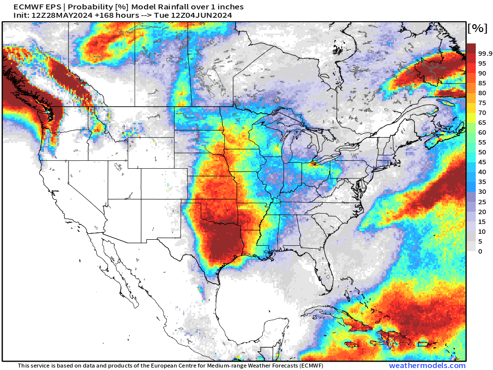
👇Probability of 1' or more of rainfall the next 7 days via the latest Euro Ensemble.

✅We will be tracking the continued active pattern and more over at BAMWX.com and the Clarity platform!

👇Probability of 1' or more of rainfall the next 7 days via the latest Euro Ensemble. ✅We will be tracking the continued active pattern and more over at BAMWX.com and the @clarity_wx platform! #plant24 #OATT #corn #soybeans
account_circle