ardusimple (@ardusimple) 's Twitter Profile
ardusimple

@ardusimple

Affordable and plug&play GPS/GNSS RTK receivers for individuals and professionals

ID: 916549900590108672

linkhttp://www.ardusimple.com calendar_today07-10-2017 06:24:59

859 Tweet

2,2K Followers

1,1K Following

ardusimple (@ardusimple) 's Twitter Profile Photo

Ensuring structural safety is critical in civil engineering — especially when it comes to bridges. Discover how ArduSimple’s RTK kit was used to monitor the world’s longest walking bridge in Hungary during dynamic stress testing. ardusimple.com/movement-monit…

Ensuring structural safety is critical in civil engineering — especially when it comes to bridges. Discover how ArduSimple’s RTK kit was used to monitor the world’s longest walking bridge in Hungary during dynamic stress testing.
ardusimple.com/movement-monit…
ardusimple (@ardusimple) 's Twitter Profile Photo

We’re proud to see Regrarians — the leading agricultural landscape planning organization — putting ArduSimple RTK units to work! From feature surveys to drone-based GCP capture, their members are achieving centimeter-level accuracy with our affordable RTK kits. RegrariansLtd.
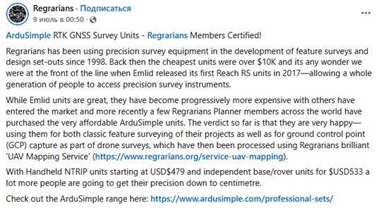
We’re proud to see Regrarians  — the leading agricultural landscape planning organization — putting ArduSimple RTK units to work!
From feature surveys to drone-based GCP capture, their members are achieving centimeter-level accuracy with our affordable RTK kits.
<a href="/HeenanDoherty/">RegrariansLtd.</a>
ardusimple (@ardusimple) 's Twitter Profile Photo

🎓 One of our favorite use cases: PTE University Geoinformatics M.Sc. student builds RTK base station using ArduSimple! Dániel Kocsis, a graduate student at the University of Pécs, developed an RTK base station as part of his thesis project.

🎓 One of our favorite use cases: PTE University Geoinformatics M.Sc. student builds RTK base station using ArduSimple!
Dániel Kocsis, a graduate student at the University of Pécs, developed an RTK base station as part of his thesis project.
ardusimple (@ardusimple) 's Twitter Profile Photo

Customer Project: Integration of the simpleRTK3B with Compass into the BlueBoat platform! The customer followed our official step-by-step guide for connecting the simpleRTK3B (Unicore Communications UM982) to ArduPilot for high-precision navigation and heading. ardusimple.com/how-to-set-up-…
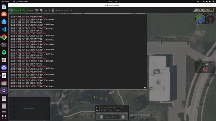
Customer Project: Integration of the simpleRTK3B with Compass into the BlueBoat platform!
The customer followed our official step-by-step guide for connecting the simpleRTK3B (<a href="/UnicoreC/">Unicore Communications</a>  UM982) to ArduPilot for high-precision navigation and heading.
ardusimple.com/how-to-set-up-…
ardusimple (@ardusimple) 's Twitter Profile Photo

Today we're excited to share the EclipseNB project — a network of 15 low-cost, dual-frequency GNSS stations installed in New Brunswick, Canada. The goal: study how the ionosphere reacts to events like a solar eclipse and a major geomagnetic storm. agupubs.onlinelibrary.wiley.com/doi/full/10.10… u-blox

ardusimple (@ardusimple) 's Twitter Profile Photo

Keep your GNSS and surveying gear safe from water, dust, and shock during transport and storage with ArduSimple Waterproof Transport Case IP67! youtube.com/watch?v=JAGjud…

ardusimple (@ardusimple) 's Twitter Profile Photo

Holybro stopped shipping. Customers say Holybro isn’t sending orders due to “unexpected operational delays.” Their website states: "All shipments are currently delayed due to unforeseen circumstances." Check what is causing delays and what you can do: ardusimple.com/holybro-stoppe…

Holybro stopped shipping. Customers say Holybro isn’t sending orders due to “unexpected operational delays.” Their website states: "All shipments are currently delayed due to unforeseen circumstances." 
Check what is causing delays and what you can do: 
ardusimple.com/holybro-stoppe…
ardusimple (@ardusimple) 's Twitter Profile Photo

Practical guides for drone use case If you're working with drones and need reliable, centimeter-level accuracy, we've put together practical tutorials to help you get started quickly—without hours of research. Learn more ardusimple.com/drones-and-uav/

Practical guides for drone use case
If you're working with drones and need reliable, centimeter-level accuracy, we've put together practical  tutorials to help you get started quickly—without hours of research.
Learn more ardusimple.com/drones-and-uav/
ardusimple (@ardusimple) 's Twitter Profile Photo

Join ArduSimple! We're looking for creative minds to help us make high-precision positioning simpler. Open positions: – Web/Graphic Designer – Technical Writer – IT & Web Systems Admin Details here: ardusimple.com/careers/

ardusimple (@ardusimple) 's Twitter Profile Photo

Built it. Coded it. Drove it. WEEDINATOR 2025 is a DIY autonomous farming robot using ArduSimple RTK for cm-precision weeding and cultivation. No fancy tractor needed — just open-source brains, a soldering iron, and a good GPS. Read more: pcbway.com/project/sharep… u-blox

ardusimple (@ardusimple) 's Twitter Profile Photo

Today we’re excited to share a cool customer project from GitHub user WildBuckwheat He’s designed a custom PCB that connects the ArduSimple simpleRTK2B Micro F9P (or any Micro series board) directly to a Raspberry Pi — a clean and compact solution! ardusimple.com/customer-proje…

Today we’re excited to share a cool customer project from GitHub user WildBuckwheat
He’s designed a custom PCB that connects the ArduSimple simpleRTK2B Micro F9P (or any Micro series board) directly to a Raspberry Pi — a clean and compact solution!
ardusimple.com/customer-proje…
ardusimple (@ardusimple) 's Twitter Profile Photo

GPS Grading Made Simple with RTK + OpenGrade Looking to boost precision in your earthworks projects? Our latest guide walks you through connecting an ArduSimple RTK receiver to OpenGrade — the free, open‑source GPS grading software for Windows. Tutorial: ardusimple.com/how-to-use-rtk…

GPS Grading Made Simple with RTK + OpenGrade
Looking to boost precision in your earthworks projects? Our latest guide walks you through connecting an ArduSimple RTK receiver to OpenGrade — the free, open‑source GPS grading software for Windows.
Tutorial: ardusimple.com/how-to-use-rtk…
ardusimple (@ardusimple) 's Twitter Profile Photo

GPS isn’t just about location — it’s also an incredibly precise clock. With accuracy down to 10 nanoseconds, GPS can synchronize devices or sensors anywhere in the world. Learn how Timepulse works and how you can use it in your projects. ardusimple.com/understanding-…

GPS isn’t just about location — it’s also an incredibly precise clock. With accuracy down to 10 nanoseconds, GPS can synchronize devices or sensors anywhere in the world. Learn how Timepulse works and how you can use it in your projects.
ardusimple.com/understanding-…
ardusimple (@ardusimple) 's Twitter Profile Photo

Building an autonomous robot? We’ve prepared practical guides for common projects: Waypoint‑following vehicles – ArduPilot with Pixhawk Multi‑sensor commercial robots – ROS 2 with advanced processing Robotic lawn mowers – OpenMower open‑source platform ardusimple.com/rtk-applicatio…

Building an autonomous robot?
We’ve prepared practical guides for common projects:
Waypoint‑following vehicles – ArduPilot with Pixhawk
Multi‑sensor commercial robots – ROS 2 with advanced processing
Robotic lawn mowers – OpenMower open‑source platform
ardusimple.com/rtk-applicatio…
ardusimple (@ardusimple) 's Twitter Profile Photo

Not sure where to start with RTK? Our RTK Selector Assistant will guide you through a few simple questions to recommend the best product for your needs. Try the RTK Selector Assistant here: ardusimple.com/product/produc…

ardusimple (@ardusimple) 's Twitter Profile Photo

Researchers have developed a self-powered, mobile ground-truth system using LiDAR, GNSS time-synced sensor stations, multi-sensor fusion. simpleRTK3B (mosaic-H) boards provided sub-ms time sync between sensor stations without internet or cables. mdpi.com/1424-8220/25/1…

Researchers have developed a self-powered, mobile ground-truth system using  LiDAR, GNSS time-synced sensor stations, multi-sensor fusion.
simpleRTK3B (mosaic-H) boards provided sub-ms time sync between sensor stations without internet or cables. 
mdpi.com/1424-8220/25/1…
ardusimple (@ardusimple) 's Twitter Profile Photo

Researchers have shown that low-cost GNSS networks can track water vapor in the atmosphere during heavy rain events. This information can improve short-term weather forecasts. The research used hundreds of CentipedeRTK base stations. researchgate.net/publication/39…

ardusimple (@ardusimple) 's Twitter Profile Photo

Whether you’re a pro or new to mapping, RTK delivers cm-level accuracy. Our RTK Applications page offers quick setup guides (QGIS, SurvPC, QField..) and practical workflows for land surveys, archaeology, drone mapping with GCPs, utility mapping, and more. ardusimple.com/survey-and-map…

Whether you’re a pro or new to mapping, RTK delivers cm-level accuracy. Our RTK Applications page offers quick setup guides (QGIS, SurvPC, QField..) and practical workflows for land surveys, archaeology, drone mapping with GCPs, utility mapping, and more.
ardusimple.com/survey-and-map…
ardusimple (@ardusimple) 's Twitter Profile Photo

Using RTK to Study Grazing Behaviour Researchers fitted cows with collars containing a simpleRTK2B Basic Starter Kit for 1 cm accurate positioning. The system detected ingestion with 98.2% accuracy, estimated bite frequency, and more. orbi.uliege.be/bitstream/2268…

Using RTK to Study Grazing Behaviour
Researchers fitted cows with collars containing a simpleRTK2B Basic Starter Kit for 1 cm accurate positioning. The system detected ingestion with 98.2% accuracy, estimated bite frequency, and more.
orbi.uliege.be/bitstream/2268…