ArcNews (@arcnewsmagazine) 's Twitter Profile
ArcNews

@arcnewsmagazine

ArcNews is the magazine for anyone interested in GIS, mapping, and Esri software. Tweets by ArcNews editors Citabria Stevens or Brian Cooke of @Esri.

ID: 2952863167

linkhttp://www.esri.com/arcnews calendar_today31-12-2014 01:01:08

3,3K Tweet

4,4K Takipçi

941 Takip Edilen

ArcNews (@arcnewsmagazine) 's Twitter Profile Photo

To operate as one company, Avangrid standardized gas leak surveys across its six #naturalgas operating companies. Now, they all use ArcGIS Workforce, ArcGIS Field Maps, and ArcGIS Dashboards to conduct GIS-based inspections. ow.ly/gB4H50UKMK7 #GIS #ArcGIS

To operate as one company, <a href="/Avangrid/">Avangrid</a> standardized gas leak surveys across its six #naturalgas operating companies. Now, they all use ArcGIS Workforce, ArcGIS Field Maps, and ArcGIS Dashboards to conduct GIS-based inspections. ow.ly/gB4H50UKMK7 #GIS #ArcGIS
ArcNews (@arcnewsmagazine) 's Twitter Profile Photo

Tallahassee-Leon County GIS has a long history of retaining employees. Here's how they do it, according to GIS program coordinator Scott Weisman: ow.ly/nFCi50UKMMv #GIS #countygovernment #employeeretention #workforceretention

ArcNews (@arcnewsmagazine) 's Twitter Profile Photo

With help from Esri, 2892 Miles to Go integrated Community Mapping for #RacialEquity and #SocialJustice tutorials into its programs. Through this collaboration, young people have learned how to use #GIS while working to improve their communities. ow.ly/1iMp50UKMQ5

With help from <a href="/Esri/">Esri</a>, 2892 Miles to Go integrated Community Mapping for #RacialEquity and #SocialJustice tutorials into its programs. Through this collaboration, young people have learned how to use #GIS while working to improve their communities. ow.ly/1iMp50UKMQ5
ArcNews (@arcnewsmagazine) 's Twitter Profile Photo

Now is an opportune time to revisit what is taught in #GIScience courses. This spring, 10 teaching modules will be released that include theoretical, practical, and ethical lessons in #GIS. Find out more: ow.ly/4kml50UKMTK

Now is an opportune time to revisit what is taught in #GIScience courses. This spring, 10 teaching modules will be released that include theoretical, practical, and ethical lessons in #GIS. Find out more: ow.ly/4kml50UKMTK
ArcNews (@arcnewsmagazine) 's Twitter Profile Photo

The spring issue of #ArcNews is out! Find out how radar imaging gave disaster response agencies a head start during the LA wildfires, see how Tennessee is using predictive modeling to identify wetlands, discover #ArcGIS for #Microsoft, and much more! ow.ly/AYSC50VtkNB Esri

The spring issue of #ArcNews is out! Find out how radar imaging gave disaster response agencies a head start during the LA wildfires, see how Tennessee is using predictive modeling to identify wetlands, discover #ArcGIS for #Microsoft, and much more! ow.ly/AYSC50VtkNB <a href="/Esri/">Esri</a>
ArcNews (@arcnewsmagazine) 's Twitter Profile Photo

Amid high winds and heavy smoke, satellite imagery and GIS from @ICEYE brought clarity to emergency responders of the LA wildfires. ow.ly/6oF950VxO1K #GIS #EmergencyManagement #WildfireResponse

Amid high winds and heavy smoke, satellite imagery and GIS from @ICEYE brought clarity to emergency responders of the LA wildfires. ow.ly/6oF950VxO1K

#GIS #EmergencyManagement #WildfireResponse
American Association of Geographers (@theaag) 's Twitter Profile Photo

Cartography—the art and science of mapmaking—has undergone a seismic transformation, integrating advanced technologies. Despite this evolution, the educational frameworks that support cartography have not kept pace. Learn more with ArcNews: bit.ly/4ciqxCt

ArcNews (@arcnewsmagazine) 's Twitter Profile Photo

Before they could adequately protect their vital wetlands, the Tennessee Department of Environment and Conservation (TNEnvironment) first needed to find them all with GeoAI. ow.ly/9TjE50VzhYM #WetlandsConservation #GeoAI #EnvironmentalProtection
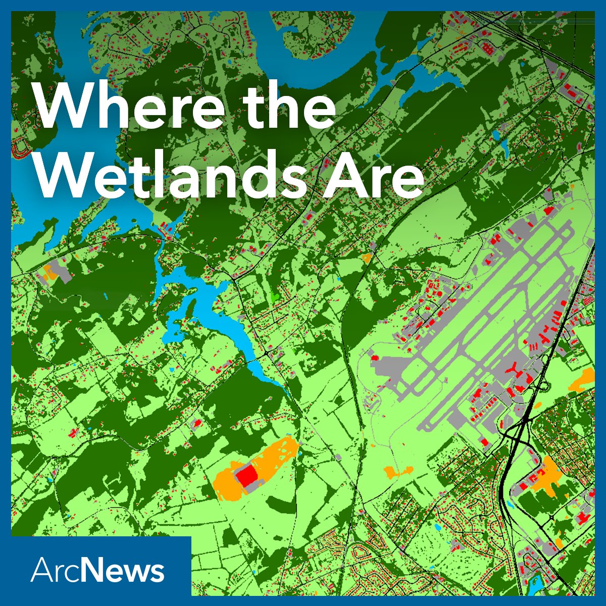
Before they could adequately protect their vital wetlands, the Tennessee Department of Environment and Conservation (<a href="/TNEnvironment/">TNEnvironment</a>) first needed to find them all with GeoAI. ow.ly/9TjE50VzhYM

#WetlandsConservation #GeoAI #EnvironmentalProtection
ArcNews (@arcnewsmagazine) 's Twitter Profile Photo

What perspectives can we gain from the Freedom of Informatin Act, 50 years later? Ralph Nader shares his perspective on how a strengthened FOIA laid the foundation of the open data movement. ow.ly/E9Uv50VBeKt #GIS #data

What perspectives can we gain from the Freedom of Informatin Act, 50 years later? Ralph Nader shares his perspective on how a strengthened FOIA laid the foundation of the open data movement. ow.ly/E9Uv50VBeKt #GIS #data
ArcNews (@arcnewsmagazine) 's Twitter Profile Photo

Meet EuclidHL, the AI and GIS guru of city planning. Here’s how the brainchild of Houseal Lavigne is putting the "smart" in smart cities as a 24-hour AI-powered planning and zoning assistant. ow.ly/UcwV50VC1j6 #GIS #GeoAI #AI #LLM #SmartCities #CityPlanning

Meet EuclidHL, the AI and GIS guru of city planning. Here’s how the brainchild of <a href="/HousealLavigne/">Houseal Lavigne</a> is putting the "smart" in smart cities as a 24-hour AI-powered planning and zoning assistant. ow.ly/UcwV50VC1j6 #GIS #GeoAI #AI #LLM #SmartCities #CityPlanning
ArcNews (@arcnewsmagazine) 's Twitter Profile Photo

From map design and routing to rapid data capture and survey analytics—learn how Field Maps, Navigator, QuickCapture, Survey123, and Workforce work together to empower your field workflows. 📽 Watch now: ow.ly/HLEK50VGmpC #ArcGIS #GIS #FieldOps #EsriDevSummit2024

From map design and routing to rapid data capture and survey analytics—learn how Field Maps, Navigator, QuickCapture, Survey123, and Workforce work together to empower your field workflows.

📽 Watch now: ow.ly/HLEK50VGmpC

#ArcGIS #GIS #FieldOps #EsriDevSummit2024
ArcNews (@arcnewsmagazine) 's Twitter Profile Photo

Have you checked out the Spring 2025 edition of ArcNews? Make sure to read about Esri Academy's new training and certification opportunities featured in it 🌎: ow.ly/FngE30sM2Sb

Have you checked out the Spring 2025 edition of ArcNews? Make sure to read about Esri Academy's new training and certification opportunities featured in it 🌎: ow.ly/FngE30sM2Sb
ArcNews (@arcnewsmagazine) 's Twitter Profile Photo

Not all heroes wear capes. Meet Claire Yates of Metro Public Works who’s on a mission to save lives by designing safer roads for drivers and pedestrians. ow.ly/9SmG50VGp1u #GISHero #VisionZero #TrafficSafety #PedestrianSafety
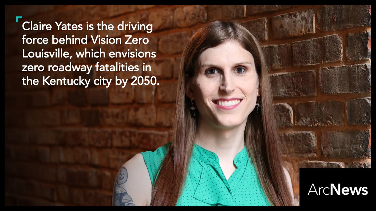
Not all heroes wear capes. Meet Claire Yates of <a href="/LouPubWorks/">Metro Public Works</a> who’s on a mission to save lives by designing safer roads for drivers and pedestrians. ow.ly/9SmG50VGp1u #GISHero #VisionZero #TrafficSafety #PedestrianSafety
Eos Positioning Systems (@eosgnss) 's Twitter Profile Photo

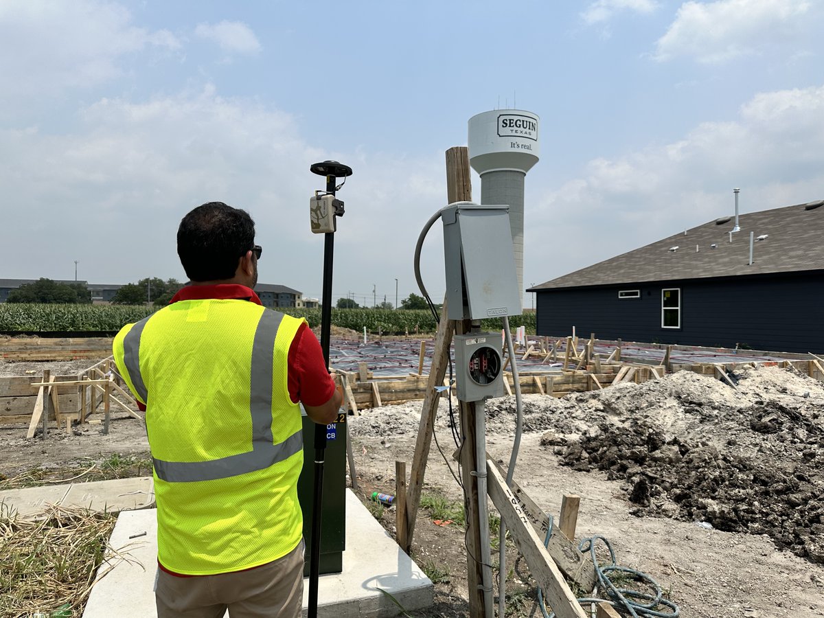
Did you see the new edition of ArcNews? Eos was excited to see the #GNSS work of the City of Seguin, Texas, featured! Learn how their team is turning high-accuracy data collection into a win for internal and external stakeholders. ow.ly/hmCX50VJMMj Seguin Texas

Did you see the new edition of <a href="/ArcNewsMagazine/">ArcNews</a>? Eos was excited to see the #GNSS work of the City of Seguin, Texas, featured! Learn how their team is turning high-accuracy data collection into a win for internal and external stakeholders.

ow.ly/hmCX50VJMMj <a href="/SeguinCityHall/">Seguin Texas</a>
ArcNews (@arcnewsmagazine) 's Twitter Profile Photo

Raise your hand if you’ve ever tripped on uneven pavement... 👀 @DeepWalk is paving the way for more accessible cities by simplifying sidewalk evaluations using iPhone lidar and GIS. ow.ly/w2fS50VGoU7 #AccessibleCities #UrbanPlanning #SmartCities #GIS #Lidar #SidewalkSafety

Raise your hand if you’ve ever tripped on uneven pavement... 👀 @DeepWalk is paving the way for more accessible cities by simplifying sidewalk evaluations using iPhone lidar and GIS. ow.ly/w2fS50VGoU7 #AccessibleCities #UrbanPlanning #SmartCities #GIS #Lidar #SidewalkSafety
Esri (@esri) 's Twitter Profile Photo

Imagine walking through a new building before it's been built. 🤯 Here's how digital twins are giving planners the edge to experiment and perfect projects before ever breaking ground. ow.ly/bV7j50VVW9T #AEC #UrbanPlanning

Imagine walking through a new building before it's been built. 🤯

Here's how digital twins are giving planners the edge to experiment and perfect projects before ever breaking ground. ow.ly/bV7j50VVW9T

#AEC  #UrbanPlanning
ArcNews (@arcnewsmagazine) 's Twitter Profile Photo

Puerto Rico was able to better track and reduce dengue cases by using products like #ArcGIS #FieldMaps to precisely georeference mosquito traps and efficiently collect data, enabling timely targeted interventions. 📱🦟 Get the full story here: ow.ly/WM1050VXnNt

Puerto Rico was able to better track and reduce dengue cases by using products like #ArcGIS #FieldMaps to precisely georeference mosquito traps and efficiently collect data, enabling timely targeted interventions. 📱🦟

Get the full story here: ow.ly/WM1050VXnNt
ArcNews (@arcnewsmagazine) 's Twitter Profile Photo

APOPO (APOPO) uses GIS to track both the health of its mine-sniffing dogs and the conditions of sites that have been cleared of explosives. Check out the article in the Spring 2025 edition of ArcUser: ow.ly/xzbP50VXnP5

APOPO (<a href="/herorats/">APOPO</a>) uses GIS to track both the health of its mine-sniffing dogs and the conditions of sites that have been cleared of explosives.

Check out the article in the Spring 2025 edition of ArcUser: ow.ly/xzbP50VXnP5
ArcNews (@arcnewsmagazine) 's Twitter Profile Photo

Introducing the Waste Collection Solver in #ArcGISNetworkAnalyst for #ArcGISPro 3.5. 🗑️ Optimize routes, cut costs, and enhance service efficiency for residents. Seamlessly share routes to crews in the field. Read the blog to learn more: ow.ly/q8Zv50VXnV0

Introducing the Waste Collection Solver in #ArcGISNetworkAnalyst for #ArcGISPro 3.5. 🗑️ Optimize routes, cut costs, and enhance service efficiency for residents. Seamlessly share routes to crews in the field. Read the blog to learn more: ow.ly/q8Zv50VXnV0
ArcNews (@arcnewsmagazine) 's Twitter Profile Photo

Hollywood stars Ryan Reynolds and Rob McElhenney’s revitalization of historic Wrexham stadium showcases innovative GIS and BIM integration, combining sustainable design with community context. ow.ly/2aWH50W3Iwf

Hollywood stars Ryan Reynolds and Rob McElhenney’s revitalization of historic Wrexham stadium showcases innovative GIS and BIM integration, combining sustainable design with community context. ow.ly/2aWH50W3Iwf