NCAR tornado risk (@tornadorisk) 's Twitter Profile
NCAR tornado risk

@tornadorisk

We'd like to understand how people receive and respond to information about tornado threats. Views are not those of NCAR, NOAA, or NSF.

ID: 882672546507829249

linkhttp://www.mmm.ucar.edu/rivett calendar_today05-07-2017 18:48:29

109 Tweet

75 Takipçi

359 Takip Edilen

Jim Cantore (@jimcantore) 's Twitter Profile Photo

The NWS is the heart and soul of the weather enterprise. They are working tirelessly to keep you safe & informed. I hate that this added stress has been placed on many of my friends. Snow and stress: Tracking the storm with no paycheck bostonglobe.com/metro/2019/01/… via The Boston Globe

Artificial Intelligence for Environmental Science (@ai2enviro) 's Twitter Profile Photo

Come with for AI2ES and help us with visualization and trustworthy AI for weather! #ArtificialIntelligence #wxtwitter #dataviz #Datavisualization

Artificial Intelligence for Environmental Science (@ai2enviro) 's Twitter Profile Photo

We are hiring an Interactive Data Visualization Research Associate II for AI and weather, climate, and coastal oceanography data through CIRA. Applications are due February 6. Please apply at cira.colostate.edu/employment/22-….

NWS Birmingham (@nwsbirmingham) 's Twitter Profile Photo

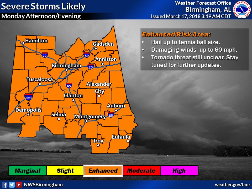
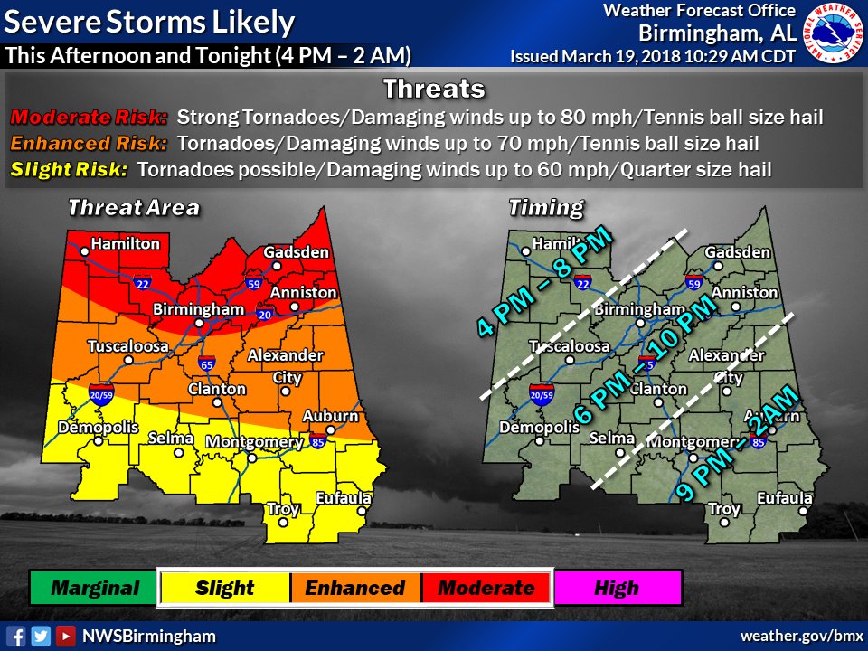
Monitoring 2 periods where severe thunderstorms will be possible. First will be tomorrow noon to 8 pm as a warm front moves north and affects the southern 1/3 of our forecast area. A potentially more widespread event could materialize Monday afternoon and Evening.

Monitoring 2 periods where severe thunderstorms will be possible. First will be tomorrow noon to 8 pm as a warm front moves north and affects the southern 1/3 of our forecast area. A potentially more widespread event could materialize Monday afternoon and Evening.
NWS Birmingham (@nwsbirmingham) 's Twitter Profile Photo

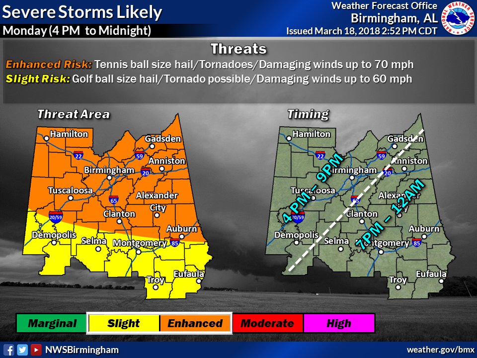
Adjusted the timing slightly for tomorrow's severe threats in Central AL. Expect a broken line of thunderstorms to move through the area in the afternoon/evening hours. Threats are large hail, tornadoes, and damaging winds. #alwx

Adjusted the timing slightly for tomorrow's severe threats in Central AL. Expect a broken line of thunderstorms to move through the area in the afternoon/evening hours. Threats are large hail, tornadoes, and damaging winds. #alwx
NWS Birmingham (@nwsbirmingham) 's Twitter Profile Photo

The primary threat for severe weather remains late this evening into the overnight hours. Here is our updated timing graphic, threats remain strong tornadoes, very large hail and damaging winds. #ALWX #BMXWX

The primary threat for severe weather remains late this evening into the overnight hours. Here is our updated timing graphic, threats remain strong tornadoes, very large hail and damaging winds. #ALWX #BMXWX
NWS Huntsville (@nwshuntsville) 's Twitter Profile Photo

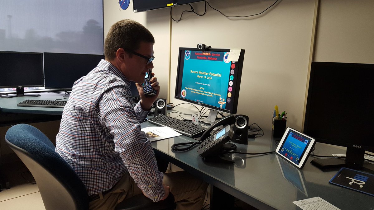
Andrew is updating our core partners for the risk of severe weather today. Be sure to stay aware of the latest forecast, have a plan, and have multiple ways to receive our warnings! #hunwx

Andrew is updating our core partners for the risk of severe weather today. Be sure to stay aware of the latest forecast, have a plan, and have multiple ways to receive our warnings! #hunwx
Alabama EMA (@alabamaema) 's Twitter Profile Photo

To effectively shelter, choose a place in your home or other building that is in a basement or an interior room on the lowest level away from corners, windows, doors and outside walls #alwx x.com/stephwvtm13/st…

National Weather Service (@nws) 's Twitter Profile Photo

An increasing threat for tornadoes this afternoon across northern AL and parts of TN, GA, and MS has lead to an upgrade to a Moderate risk from NWS Storm Prediction Center. If you live in these areas, monitor local NWS offices and media partners for updates as these storms develop this afternoon
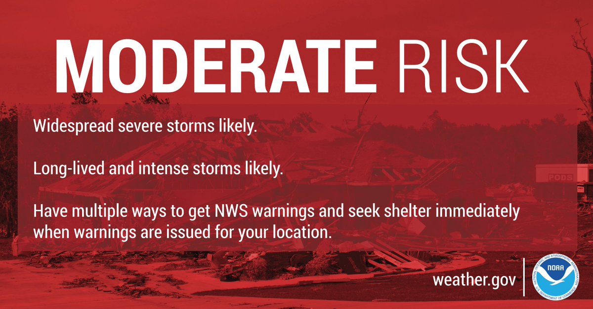
An increasing threat for tornadoes this afternoon across northern AL and parts of TN, GA, and MS has lead to an upgrade to a Moderate risk from <a href="/NWSSPC/">NWS Storm Prediction Center</a>. If you live in these areas, monitor local NWS offices and media partners for updates as these storms develop this afternoon
Local 3 Weather (@local3weather) 's Twitter Profile Photo

Here's what to do if a Tornado Warning is issued for your area, or if you see a tornado coming toward your area: Get inside as quickly as possible. Go to a basement, or to an interior room or closet which has no windows. Stay safe and weather aware.

NWS Storm Prediction Center (@nwsspc) 's Twitter Profile Photo

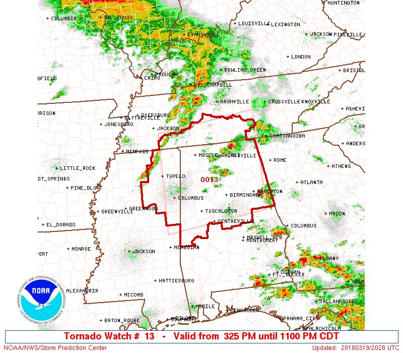
A rare "Particularly Dangerous Situation" (PDS) Tornado Watch has been issued for Northern and central Alabama, Northeast Mississippi, and Southern Tennessee. Tornadoes are expected including the possibility of a few intense/strong tornadoes. spc.noaa.gov/products/watch…

A rare "Particularly Dangerous Situation" (PDS) Tornado Watch has been issued for Northern and central Alabama, Northeast Mississippi, and Southern Tennessee. Tornadoes are expected including the possibility of a few intense/strong tornadoes. spc.noaa.gov/products/watch…
NWS Weather Prediction Center (@nwswpc) 's Twitter Profile Photo

Tomorrow marks 44 years since the Apr 3-4 1974 Super Outbreak when 148 confirmed tornadoes touched down in multiple states and Ontario. Attached are a satellite image of the storm, surface analysis from Apr 4 0000 UTC, and the original tornado outbreak track map by Ted Fujita.

Tomorrow marks 44 years since the Apr 3-4 1974 Super Outbreak when 148 confirmed tornadoes touched down in multiple states and Ontario.  Attached are a satellite image of the storm, surface analysis from Apr 4 0000 UTC, and the original tornado outbreak track map by Ted Fujita.
National Weather Service (@nws) 's Twitter Profile Photo

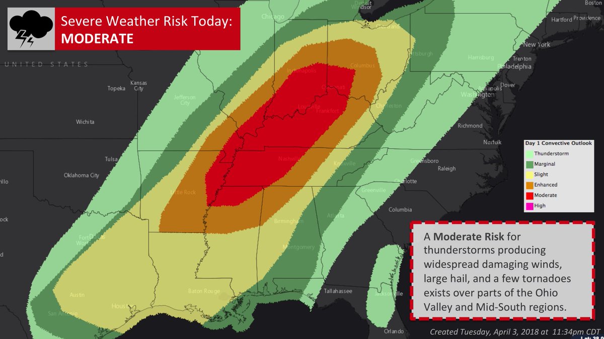
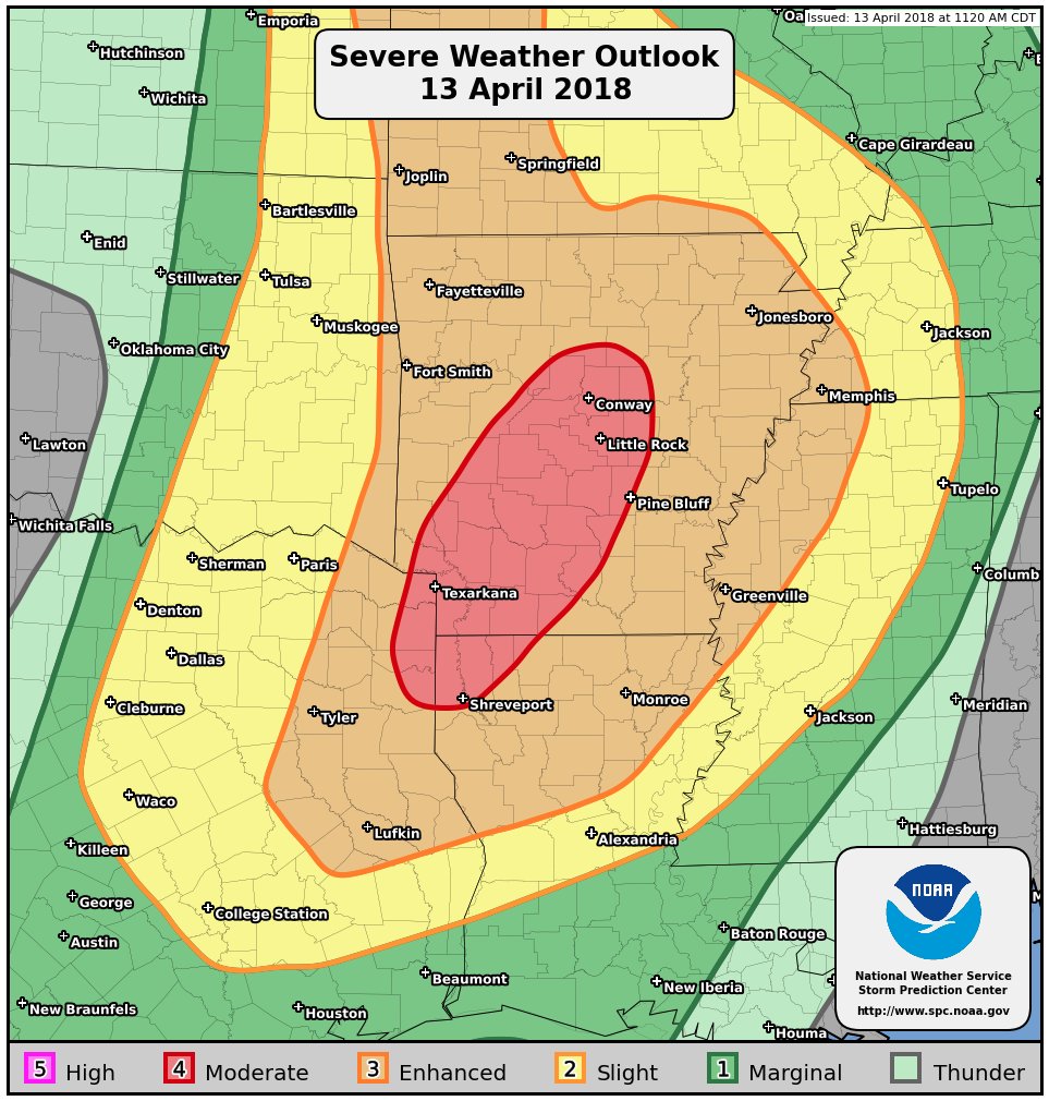
Today's severe weather outlook has been upgraded to a MODERATE RISK. If you're in the threat area highlighted, plan NOW for what you and your family will do in the event of a tornado or severe thunderstorm warning. Get the latest at weather.gov

Today's severe weather outlook has been upgraded to a MODERATE RISK. If you're in the threat area highlighted, plan NOW for what you and your family will do in the event of a tornado or severe thunderstorm warning.
Get the latest at weather.gov
Jen Henderson (@jenjhenderson) 's Twitter Profile Photo

An amazing group of early career leaders shaping the their colleagues' leadership futures. Thank you for such a wonderful workshop! CAKE! #AMSECLA18 x.com/ametsoc/status…