Source Cooperative
@source_coop
A data publishing utility that allows trusted organizations and
individuals to share using standard HTTP methods. Currently in beta.
ID: 1665772036122357760
https://source.coop 05-06-2023 17:26:20
55 Tweet
324 Takipçi
5 Takip Edilen


Thanks to Chris Holmes for creating the Overture Maps Foundation building dataset in #PMTiles format and share it on Source Cooperative beta.source.coop/cholmes/overtu…


This piece by kasey is a great explainer of emergence and why it's a good way to understand the way we do things at Radiant Earth, CNG, and Source Cooperative newsletter.rhizomerd.com/p/when-to-desi…

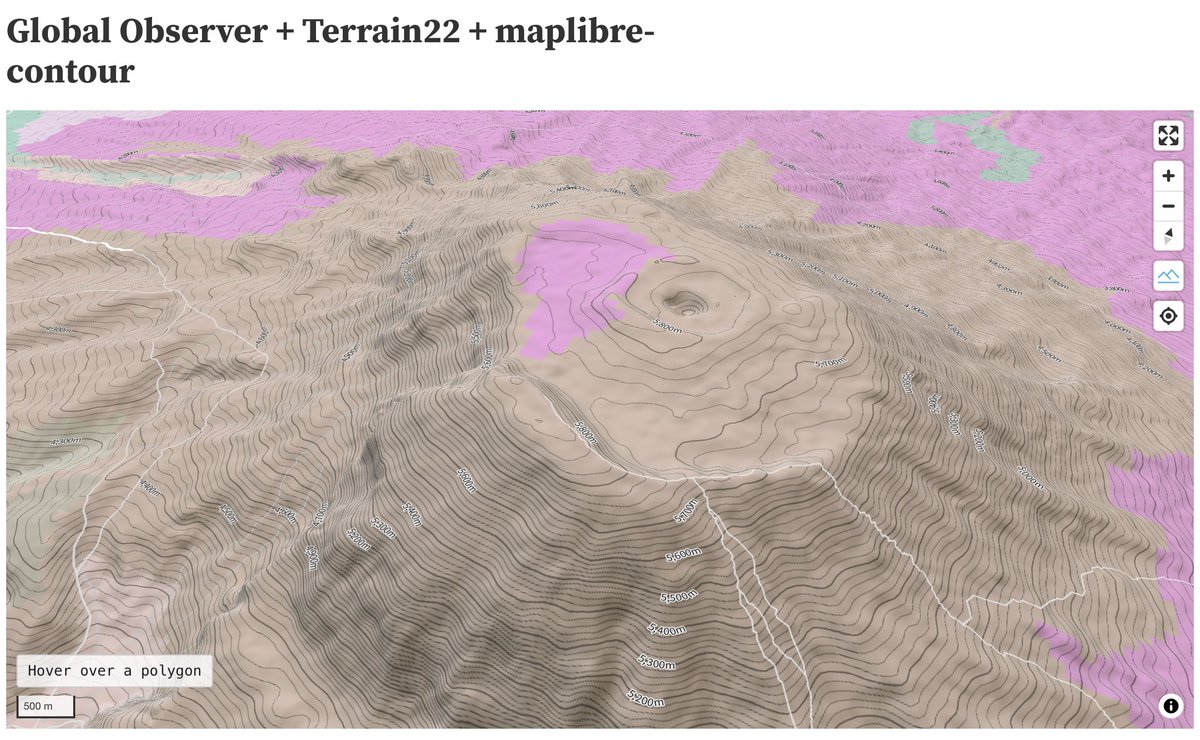
Added global contour line support to #Terrain22 using MapLibre-contour (thx to Taro Matsuzawa aka. 組長). observablehq.com/d/15509f3ef76b… DYK how to use WEBP terrain tiles in (Source Cooperative-hosted) Protomaps https://bsky.app/profile/protomaps.com #PMTiles with maplibre-contour? This version uses terrarium instead.


Jonathan Chemla Max Lenormand NextGIS Source Cooperative SpatioTemporal Asset Catalog Source has been designed to support pointing to external data sources that are openly-available on object stores. We're not quite there yet on the feature development to open that up but it's coming!

Just released the updated satellite-derived building footprints dataset (Google + Microsoft) as well as the bonus Google+Microsoft+OSM building footprints dataset on Source Cooperative! Blog Post: medium.com/vida-engineeri… GOOG+MSFT: beta.source.coop/repositories/v… +OSM: beta.source.coop/repositories/v…

Little update on Source Cooperative - Hosting over 400TB of data. - Served up 6.9TB of data last week, across 6.4 million GET requests - data.source.coop URLs show up in 152 results on GitHub search: github.com/search?q=data.… Still in beta! About to step on the gas! 🔥


This comprehensive benchmark dataset - hosted on Source Cooperative - aims to meet the growing need for accurate and scalable field boundary data for global #agricultural monitoring & assessments

🎉 Source Cooperative is now open source! The web application - github.com/source-coopera… - and the data proxy - github.com/source-coopera… - have been opened up & updated with documentation on how to get it running locally. More documentation coming soon + tasks for new developers!


New QGIS Plugin released! It enables download of any GeoParquet data, with presets for Overture Maps Foundation, Source Cooperative and even the new FSQ places data. See plugins.qgis.org/plugins/qgis_p… and install it by searching for 'GeoParquet Downloader' in the QGIS plugin manager.

✨ Big moves for Source Cooperative in 2024! ✨ Read Jed Sundwall's reflection on LinkedIn for highlights, including how Source is growing alongside CNG. Looking ahead? Don’t miss the CNG’s conference at Snowbird, UT, Apr 30–May 2, 2025 linkedin.com/posts/jedsundw…


🌏 We have shared global embeddings derived from satellite imagery on Source Cooperative. The preprocessed data allows researchers & developers to accelerate and focus on solutions that benefit Earth. 🔗medium.com/earthrisemedia…


