Linus Anari (@linusanari_) 's Twitter Profile
Linus Anari

@linusanari_

Geospatial engineering student at the University of Nairobi, passionate about leveraging spatial data for innovative solutions.

ID: 787645426967117824

calendar_today16-10-2016 13:24:38

62 Tweet

128 Takipçi

152 Takip Edilen

9News Australia (@9newsaus) 's Twitter Profile Photo

#BREAKING: The spacecraft carrying two NASA astronauts back to Earth has just detached from the International Space Station. #9News

Linus Anari (@linusanari_) 's Twitter Profile Photo

Past bloody accounts and records, the World Wars particularly, left a painful wound which I'm afraid will take aeons to heal. Innocently introduced myself today to a mate and could read the bitterness written all over his face when I mentioned that we studied German at school!

Linus Anari (@linusanari_) 's Twitter Profile Photo

What a shitty world we live in! While protestors keep carrying 'Black Lives Matter' placards, elsewhere white lives are in utter jeopardy! instagram.com/tv/CG2iT9Oj_hf… #BlackTwitter #WhiteLivesMatter #EFF #racehate #BlackLivesMatter

Digital Earth Africa (@dearthafrica) 's Twitter Profile Photo

#DEarthAfrica's ኬን ሙቤ participated at the #GISDay2022, organised by Geospatial Engineering Students Association (GESA_UoN), showcasing DEA services; #earthobservation supporting #SDGs, with examples of #DEAfrica use cases. #leavenobehind

#DEarthAfrica's <a href="/kenmubea/">ኬን ሙቤ</a> participated at the #GISDay2022, organised by Geospatial Engineering Students Association (<a href="/gesa_uon/">GESA_UoN</a>), showcasing DEA services; #earthobservation supporting #SDGs, with examples of #DEAfrica use cases. #leavenobehind
SuperMap (@supermap__gis) 's Twitter Profile Photo

Thank you GESA_UoN so much for organizing the #GISday event! It was an exciting and inspiring experience to interact with the youngsters from University of Nairobi ! Nice dance!!🥰

Thank you <a href="/gesa_uon/">GESA_UoN</a> so much for organizing the #GISday event! It was an exciting and inspiring experience to interact with the youngsters from University of Nairobi ! Nice dance!!🥰
Linus Anari (@linusanari_) 's Twitter Profile Photo

Random one; #30DayMapChallenge - 3D Population Density Map: #Kenya Gotta be honest...this was tonnes of fun! Who thought #canva could be employed in making #maps? Neither did I Data Source: WorldPop Hub Softwares used: #qgis & Aerialod Texts done on Canva #geospatial #dataviz

Random one; #30DayMapChallenge - 3D Population Density Map: #Kenya 

Gotta be honest...this was tonnes of fun! Who thought #canva could be employed in making #maps? Neither did I

Data Source: WorldPop Hub
Softwares used: #qgis &amp; Aerialod
Texts done on Canva

#geospatial #dataviz
Linus Anari (@linusanari_) 's Twitter Profile Photo

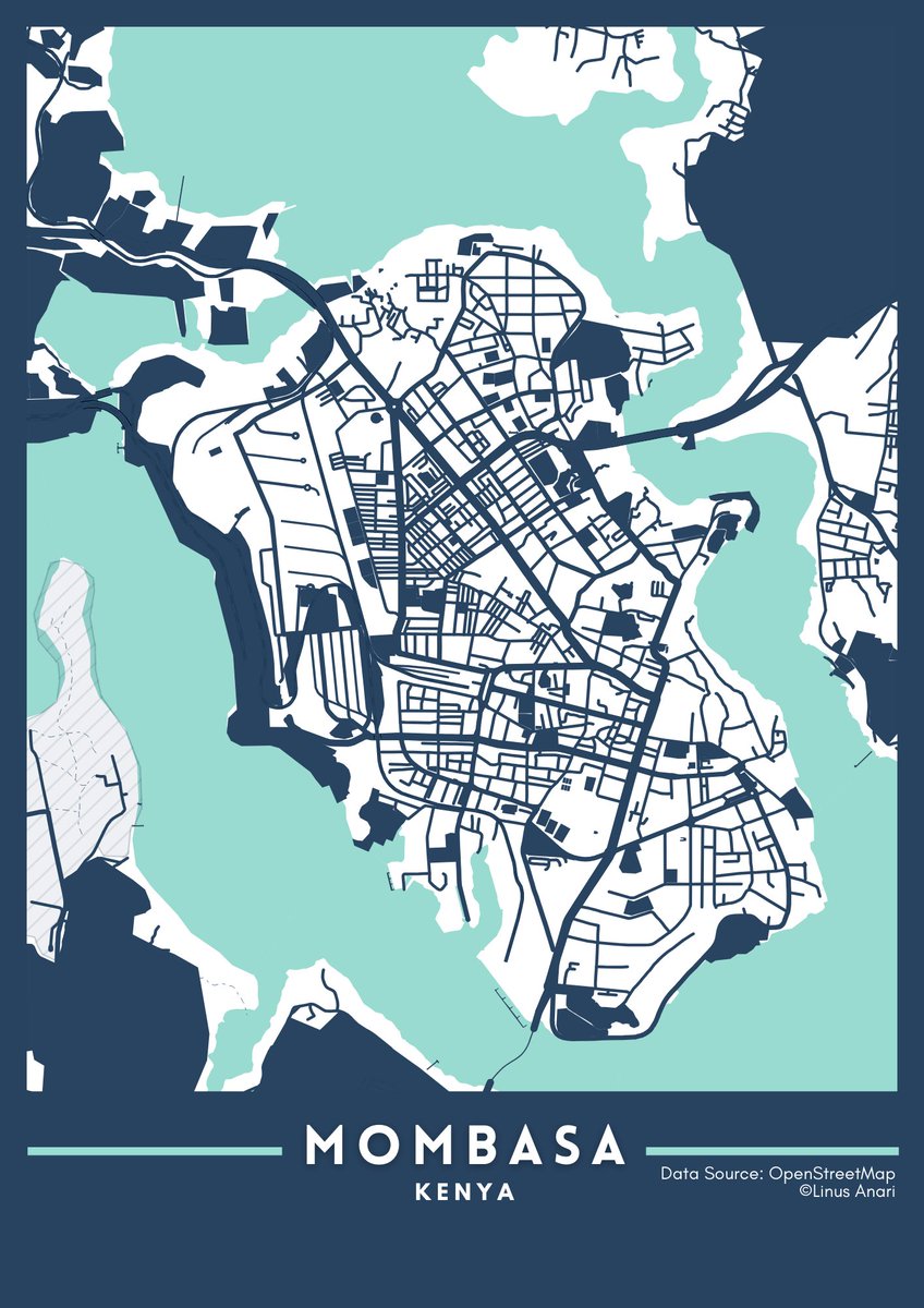
#30DayMapChallenge - DAY26: 𝐌𝐢𝐧𝐢𝐦𝐚𝐥 To the simplest of art - my first and prob all-time fav minimalistic map; Mombasa City, Kenya! 𝐃𝐚𝐭𝐚 𝐬𝐨𝐮𝐫𝐜𝐞: OpenStreetMap #gis #datascience #maps #geospatialdata #datavisualization #dataviz #spatialdata #geospatial

#30DayMapChallenge - DAY26: 𝐌𝐢𝐧𝐢𝐦𝐚𝐥

To the simplest of art - my first and prob all-time fav minimalistic map; Mombasa City, Kenya! 

𝐃𝐚𝐭𝐚 𝐬𝐨𝐮𝐫𝐜𝐞: OpenStreetMap

#gis #datascience #maps #geospatialdata #datavisualization #dataviz #spatialdata #geospatial
Linus Anari (@linusanari_) 's Twitter Profile Photo

C'mon, let's face it - cartography was but a boring chore until John Nelson happened. The Louvre Museum would envy his work! The African Savannah Elephant Migration Tutorial: youtu.be/qVGpA94Afeo Tools: #ArcGISPro Data Source: MoveBank #geospatial #elephants #gis

Linus Anari (@linusanari_) 's Twitter Profile Photo

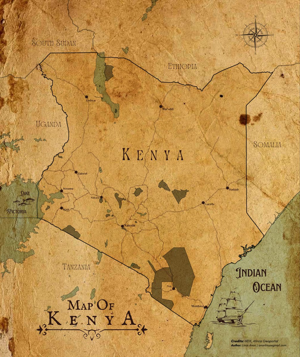
Amusing how, despite all the modern mapping techniques, some touch of retro still remains charming. Here's a nod to simpler times. #QGIS #cartography

Amusing how, despite all the modern mapping techniques, some touch of retro still remains charming. Here's a nod to simpler times.
#QGIS #cartography
UNOOSA (@unoosa) 's Twitter Profile Photo

1/ 🌍 Today at #COPUOS2024, we celebrated the incredible achievements of the Pale Blue Dot Challenge at a side event organised by the 🇺🇸 United States! 🌟 Participants showcased their innovative Earth observation visualisations to tackle global challenges.

1/ 🌍 Today at #COPUOS2024, we celebrated the incredible achievements of the Pale Blue Dot Challenge at a side event organised by the 🇺🇸 United States! 

🌟 Participants showcased their innovative Earth observation visualisations to tackle global challenges.
U.S. Embassy Nairobi (@usembassykenya) 's Twitter Profile Photo

Great to see Eileen Mburu and Linus Anari flying high at Space & Rocket Ctr & University of Alabama in Huntsville (UAH)! Their 🇰🇪 project was a winner of the #PaleBlueDotChallenge using data from space to solve real-world problems. #SpaceExchange U.S. Mission to the UN (Vienna) 🚀🛰️🔭 Read their inspiring stories⬇️
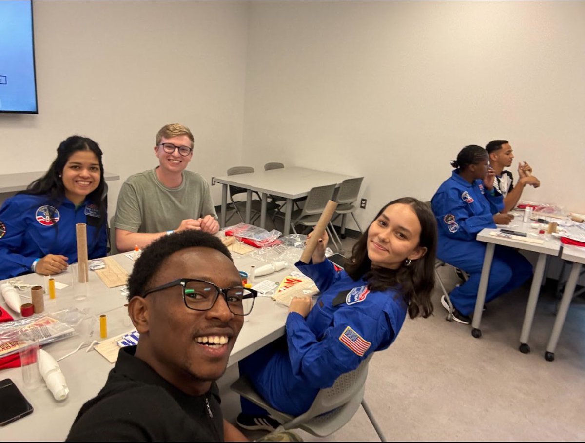
Great to see Eileen Mburu and <a href="/linusanari_/">Linus Anari</a> flying high at <a href="/RocketCenterUSA/">Space & Rocket Ctr</a> &amp; <a href="/UAHuntsville/">University of Alabama in Huntsville (UAH)</a>! Their 🇰🇪 project was a winner of the #PaleBlueDotChallenge using data from space to solve real-world problems. #SpaceExchange <a href="/usunvie/">U.S. Mission to the UN (Vienna)</a> 🚀🛰️🔭
Read their inspiring stories⬇️
Faculty of Engineering (@uon_engineering) 's Twitter Profile Photo

Congratulations to Linus Anari for winning the prestigious Pale Blue Dot Challenge! Your innovative work is truly inspiring and a proud moment for Kenya and University of Nairobi. Keep reaching for the stars! #PaleBlueDot NASA #GeospatialEngineering🇰🇪
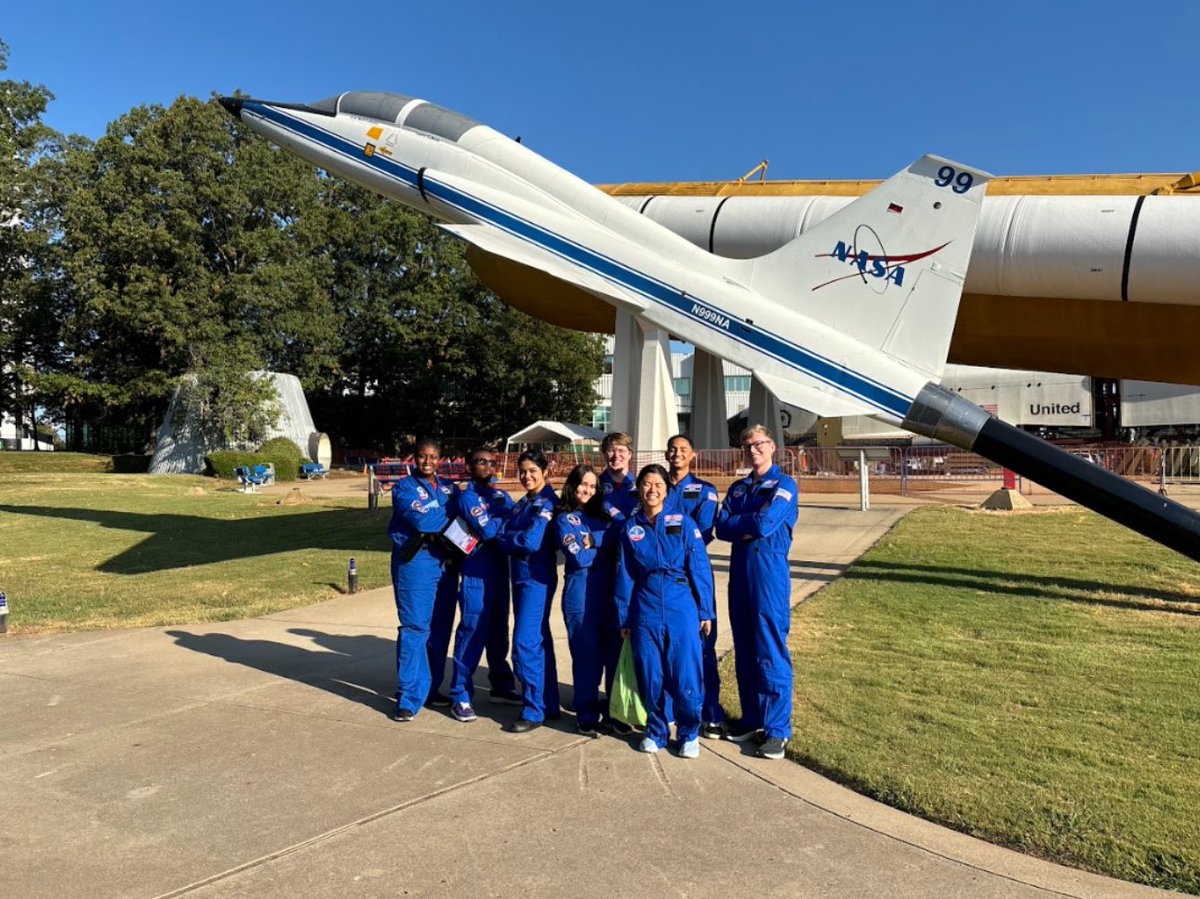
Congratulations to <a href="/linusanari_/">Linus Anari</a> for winning the prestigious Pale Blue Dot Challenge! Your innovative work is truly inspiring and a proud moment for Kenya and <a href="/uonbi/">University of Nairobi</a>. Keep reaching for the stars!  #PaleBlueDot <a href="/NASA/">NASA</a> #GeospatialEngineering🇰🇪
Linus Anari (@linusanari_) 's Twitter Profile Photo

#30DayMapChallenge - Day 2: Lines Never knew that North Eastern Kenya has got such a rich network! Data Source: ICPAC Geoportal, Esri's Living Atlas Tools: ArcGIS Pro, Canva

#30DayMapChallenge - Day 2: Lines

Never knew that North Eastern Kenya has got such a rich network!

Data Source: ICPAC Geoportal, Esri's Living Atlas
Tools: ArcGIS Pro, Canva
Linus Anari (@linusanari_) 's Twitter Profile Photo

#30DayMapChallenge - Day 3: Polygons Tools: Colab, Photoshop Data Source: OSM Inspiration: Milan Janosov #dataviz #Australian

#30DayMapChallenge - Day 3: Polygons

Tools: Colab, Photoshop
Data Source: OSM
Inspiration: Milan Janosov

#dataviz #Australian
Linus Anari (@linusanari_) 's Twitter Profile Photo

#30DaysMapChallenge Day 4: Hexagons Not gonna lie - I winged this one haha Data source: Kaggle Tools: Kepler GL, Excel, Canva #covid19 #dataviz

#30DaysMapChallenge Day 4: Hexagons

Not gonna lie - I winged this one haha

Data source: Kaggle
Tools: Kepler GL, Excel, Canva

#covid19 #dataviz
Linus Anari (@linusanari_) 's Twitter Profile Photo

#30DayMapChallenge Day 5 - Journey: Strava Reimagined What if their map could be reimagined to actually show how fast (or slow, no judgment here) I was moving through the journey? Tools: Colab, ArcGISPro, Canva Data Source: Strava's activity timeline

#30DayMapChallenge Day 5 - Journey: <a href="/Strava/">Strava</a> Reimagined
What if their map could be reimagined to actually show how fast (or slow, no judgment here) I was moving through the journey? 

Tools: Colab, ArcGISPro, Canva
Data Source: Strava's activity timeline
Linus Anari (@linusanari_) 's Twitter Profile Photo

#30DayMapChallenge: Day 7 -Vintage Style Tools: Inkscape, ArcGIS Pro, Canva Datasource: SRTM, ICPAC Geoportal, OSM #Vintage #Retro #Inkscape

#30DayMapChallenge: Day 7 -Vintage Style
Tools: Inkscape, ArcGIS Pro, Canva
Datasource: SRTM, ICPAC Geoportal, OSM
#Vintage #Retro #Inkscape
Linus Anari (@linusanari_) 's Twitter Profile Photo

#30DayMapChallenge: Day 6 - Raster And the land shall speak by the numbers(population density) Tools: Aerialod, Photoshop Data: Worldpop, Sky News #presidentialelection #gis #US

#30DayMapChallenge: Day 6 - Raster
And the land shall speak by the numbers(population density)

Tools: Aerialod, Photoshop
Data: Worldpop, Sky News

#presidentialelection #gis #US