NWS Hanford (@nwshanford) 's Twitter Profile
NWS Hanford

@nwshanford

Official X account for the National Weather Service Hanford. Details: weather.gov/twitter

ID: 595854486

linkhttp://weather.gov/hanford calendar_today31-05-2012 19:49:01

36,36K Tweet

22,22K Takipçi

393 Takip Edilen

NWS Hanford (@nwshanford) 's Twitter Profile Photo

Showers and thunderstorms are forming across Central California this afternoon. This activity is forecast to last through the evening. Be on the lookout for gusty winds, cloud to ground lightning, small hail and brief heavy rain in these thunderstorms. #cawx

NWS Hanford (@nwshanford) 's Twitter Profile Photo

Radar is continuing to show some showers and a few embedded thunderstorms in northern Kern County and southern Tulare County. These showers are producing mainly light precipitation and are moving westward at 15 to 20 mph. #cawx

NWS Hanford (@nwshanford) 's Twitter Profile Photo

Thunderstorms are possible through this afternoon across most of Kern County and the eastern portion of Tulare County. #cawx

Thunderstorms are possible through this afternoon across most of Kern County and the eastern portion of Tulare County. #cawx
NWS Hanford (@nwshanford) 's Twitter Profile Photo

A warming trend is expected to take place across our area today through Tuesday. There is a 10 to 35 percent probability of maximum temperatures exceeding 100 degrees on Tuesday before a slight cooling trend takes palace later next week. #cawx

A warming trend is expected to take place across our area today through Tuesday. There is a 10 to 35 percent probability of maximum temperatures exceeding 100 degrees on Tuesday before a slight cooling trend takes palace later next week. #cawx
NOAA Satellites (@noaasatellites) 's Twitter Profile Photo

Water vapor imagery is mesmerizing to watch, and today's view of the Pacific via NOAA's #GOESWest 🛰️ is no exception. In this visualization, deep atmospheric moisture appears green/white, while drier air is depicted as yellow/orange. #FullDiskFriday Learn more:

NWS Hanford (@nwshanford) 's Twitter Profile Photo

Tuesday looks to be the warmest day this upcoming week with a 15 to 55 percent probability of triple digits in the Valley. #CAWx #Fresno #Bakersfield

Tuesday looks to be the warmest day this upcoming week with a 15 to 55 percent probability of triple digits in the Valley. #CAWx #Fresno #Bakersfield
NWS Hanford (@nwshanford) 's Twitter Profile Photo

A warming trend is expected to continue across our area each day through Tuesday. There is a 25 to 50 percent probability of maximum temperatures exceeding 100 degrees on Tuesday before a slight cooling trend takes place later in the week. #cawx

A warming trend is expected to continue across our area each day through Tuesday. There is a 25 to 50 percent probability of maximum temperatures exceeding 100 degrees on Tuesday before a slight cooling trend takes place later in the  week. #cawx
NWS Hanford (@nwshanford) 's Twitter Profile Photo

Tuesday is expected to be the warmest day this upcoming week with a 25 to 50 percent probability of maximum temperatures of 100 degrees or higher in the San Joaquin Valley. #cawx

Tuesday is expected to be the warmest day this upcoming week with a 25 to 50 percent probability of maximum temperatures of 100 degrees or higher in the San Joaquin Valley. #cawx
National Weather Service (@nws) 's Twitter Profile Photo

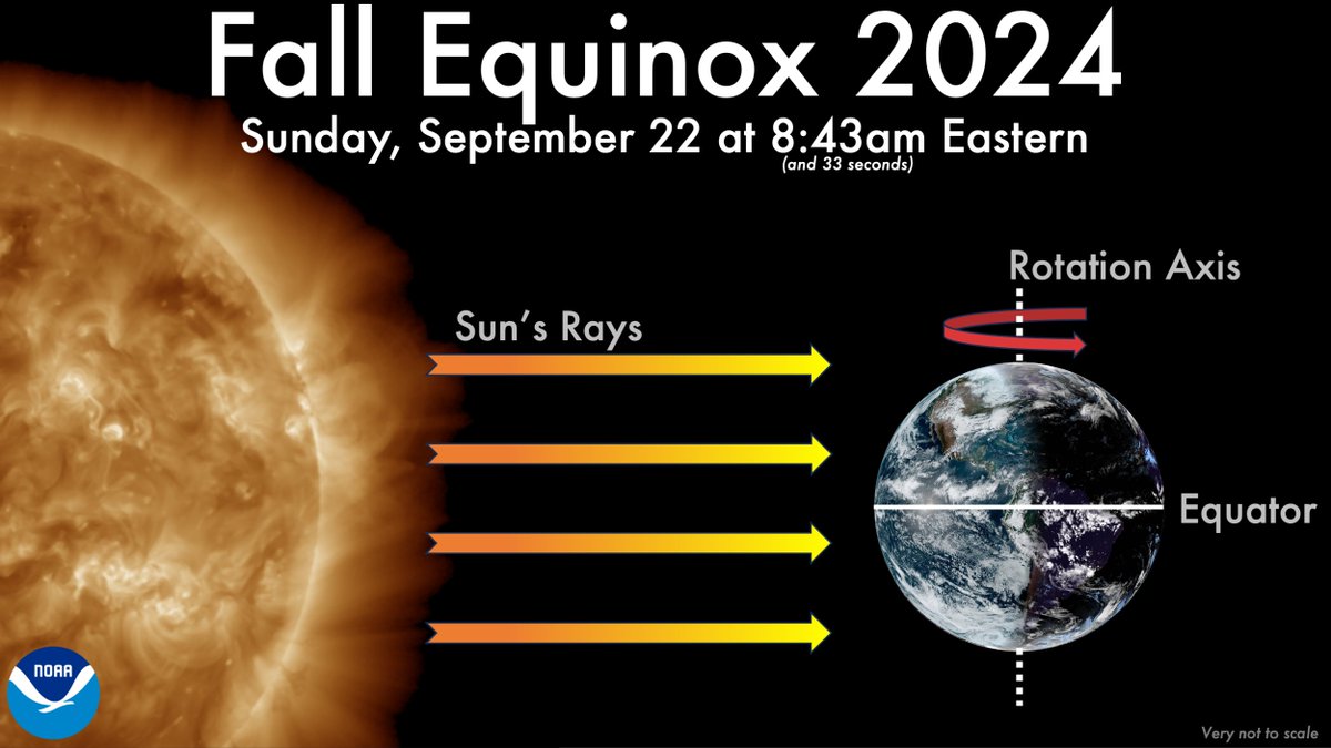
The Fall/Autumnal Equinox is TODAY at 8:43:33 AM EDT. That's the time at which our Sun is directly over the Earth's equator, signaling the start of the Northern Hemisphere's astronomical fall. The length of daylight will continue to decrease each day until the Winter Solstice.

The Fall/Autumnal Equinox is TODAY at 8:43:33 AM EDT. That's the time at which our Sun is directly over the Earth's equator, signaling the start of the Northern Hemisphere's astronomical fall. The length of daylight will continue to decrease each day until the Winter Solstice.
NWS Hanford (@nwshanford) 's Twitter Profile Photo

🍂Happy Fall central California! What are the biggest weather hazards this season? Visit our Fall Safety website to get prepared and become #WeatherReady: weather.gov/wrn/fall-safety Photo from Yosemite National Park

🍂Happy Fall central California! What are the biggest weather hazards this season? Visit our Fall Safety website to get prepared and become #WeatherReady: weather.gov/wrn/fall-safety

Photo from <a href="/YosemiteNPS/">Yosemite National Park</a>