Philip Prince (@allphilsfault) 's Twitter Profile
Philip Prince

@allphilsfault

Geology and outdoor sports lifestyle. Lidar GIFs, sandbox models, and real stuff from the field. BS Furman 2004, PhD Virginia Tech 2011.
YouTube: @TheGeoModels

ID: 1306649349800198146

linkhttps://princegeology.com/ calendar_today17-09-2020 17:41:13

538 Tweet

1,1K Followers

20 Following

Philip Prince (@allphilsfault) 's Twitter Profile Photo

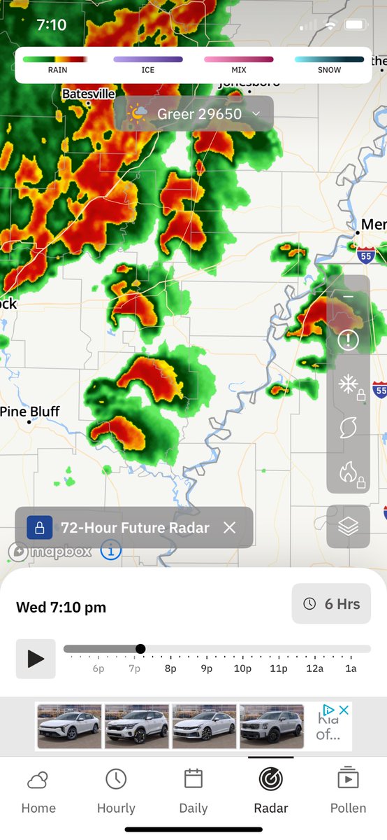
Cool storm trying to make things interesting near Greer, South Carolina on Sunday May 26. A bit late to the scenic Publix parking lot filming venue but the structure was still nice. About 9 minutes of video sped up. #SCwx

Philip Prince (@allphilsfault) 's Twitter Profile Photo

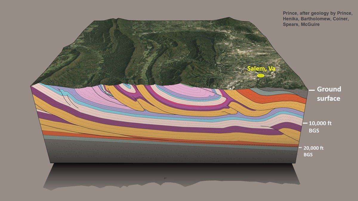
Roanoke, Virginia, area block diagram of fold-thrust Appalachia…resolution should be adequate for zooming. Definitely the land of strat changes between thrust sheets and complex footwall geometries. Gotta love all the shale. Surface relief is modest compared to structure scale!

Roanoke, Virginia, area block diagram of fold-thrust Appalachia…resolution should be adequate for zooming. Definitely the land of strat changes between thrust sheets and complex footwall geometries. Gotta love all the shale. Surface relief is modest compared to structure scale!
Philip Prince (@allphilsfault) 's Twitter Profile Photo

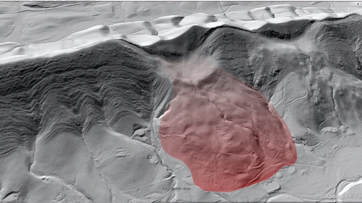
I have always liked the LiDAR look of this big slide below the Appalachian Trail on Catawba Mountain, Virginia. The slope failed in shale beneath a thick sandstone sequence. There might be enough resolution to zoom in and count the beds. Dip is 50-55 degrees towards the viewer.

I have always liked the LiDAR look of this big slide below the Appalachian Trail on Catawba Mountain, Virginia. The slope failed in shale beneath a thick sandstone sequence. There might be enough resolution to zoom in and count the beds. Dip is 50-55 degrees towards the viewer.
Philip Prince (@allphilsfault) 's Twitter Profile Photo

I harnessed the full power of Microsoft Paint to draw in “pre-failure LiDAR” for the Catawba Mountain slide. 300 ft of relief in the failed area, 850 ft relief on the ridge, and slide deposit up to 100+ ft thick, depending on details of buried slope. 55 degree dip on bedrock.

Philip Prince (@allphilsfault) 's Twitter Profile Photo

Toe removal landslide model making its way into an actual presentation…I really like the initial movement phase on this one. Reactivation with toe removal continues until the slide block breaks up due to slight changes in slide plane dip. Glass microbead sliding horizon.

Philip Prince (@allphilsfault) 's Twitter Profile Photo

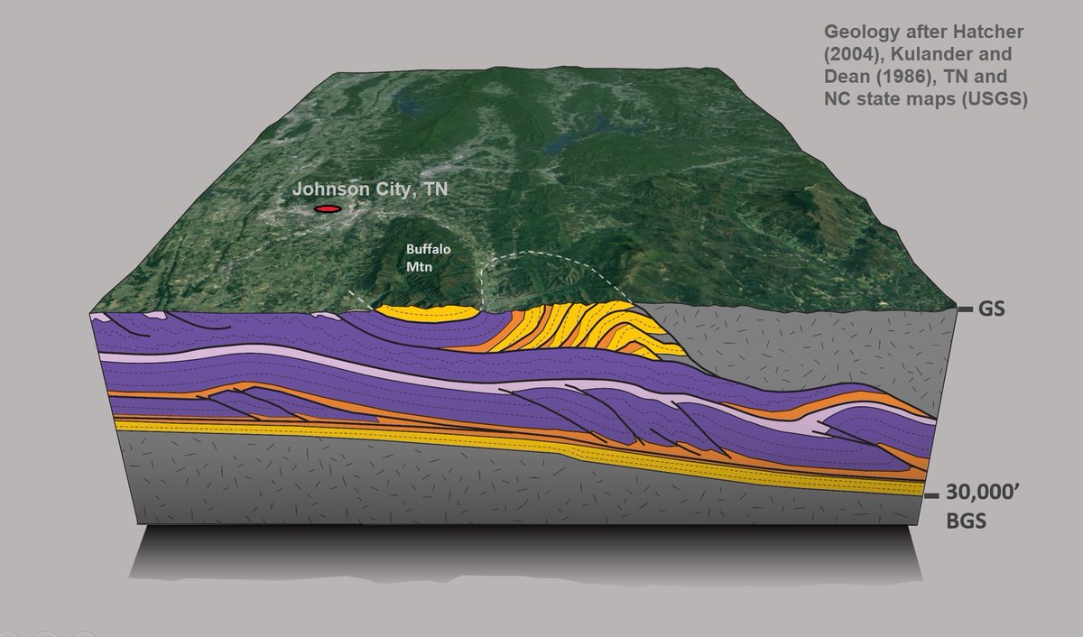
Appalachian block diagram for the Johnson City, TN, area. This is a synthesis of several published studies, fit to Google Earth. Topographic relief is scaled accurately to structural thickness. The main event is the yellow/orange antiformal stack and the Buffalo Mountain klippe.

Appalachian block diagram for the Johnson City, TN, area. This is a synthesis of several published studies, fit to Google Earth. Topographic relief is scaled accurately to structural thickness. The main event is the yellow/orange antiformal stack and the Buffalo Mountain klippe.
Philip Prince (@allphilsfault) 's Twitter Profile Photo

m.youtube.com/watch?v=oaYP0n… Been trying to put some Helene content on good old YouTube. Geology aside, I hated to see all this happen.

Philip Prince (@allphilsfault) 's Twitter Profile Photo

m.youtube.com/watch?v=oBuJxH… Field video from Helene’s biggest debris flow complex. Schistose substrate, lots of colluvium, and extreme rain made this place blow up. Superelevations and overland flow of debris above channel heads are incredible.

Philip Prince (@allphilsfault) 's Twitter Profile Photo

m.youtube.com/watch?v=zdCUYb… Helene flood impacts on a blue ridge escarpment river. Just got a new LiDAR flight thru here; curious to see what it’s going to look like

Philip Prince (@allphilsfault) 's Twitter Profile Photo

Carried away with diagrams in Paint. Trying to illustrate fluidized open slope slides as seen during Helene. Quite a legacy of them in Watauga Co NC m.youtube.com/watch?v=XWllts…

Philip Prince (@allphilsfault) 's Twitter Profile Photo

Appalachian debris flow animation from the last few weeks of post-storm work. 19 Microsoft Paint drawings as a GIF. 2 big pulses portrayed, with the second one entraining debris left by a smaller, less mobile flow.

Philip Prince (@allphilsfault) 's Twitter Profile Photo

Extensional sandbox model with some interesting normal fault-related folding. A couple of sections contain 3 anticlines due to closely spaced faults in a transfer zone. Model uses a baseplate with irregular edge to create the transfer zone.

Philip Prince (@allphilsfault) 's Twitter Profile Photo

Sandbox model of highly oblique shortening against a thick sand “backstop.” Development of the foreland fold/thrust domain is interesting to watch—individual structures expand right to left with continued movement. All sorts of complex structure in the backstop as well.

Philip Prince (@allphilsfault) 's Twitter Profile Photo

First attempts at an indentor/escape sandbox model setup. I always wondered how this might work. Coulombic aspects apply, so blocks aren’t driven outwards until enough wedge builds up, a major difference from a metal/plasticine setup. The internally undeformed blocks are cool.