NOAA WRN Ambassadors (@wrnambassadors) 's Twitter Profile
NOAA WRN Ambassadors

@wrnambassadors

Official X account for the NOAA Weather-Ready Nation Ambassador™ program. Details: weather.gov/nws_x

ID: 3331224411

linkhttps://www.weather.gov/wrn/ calendar_today17-06-2015 12:33:57

7,7K Tweet

6,6K Followers

568 Following

NOAA WRN Ambassadors (@wrnambassadors) 's Twitter Profile Photo

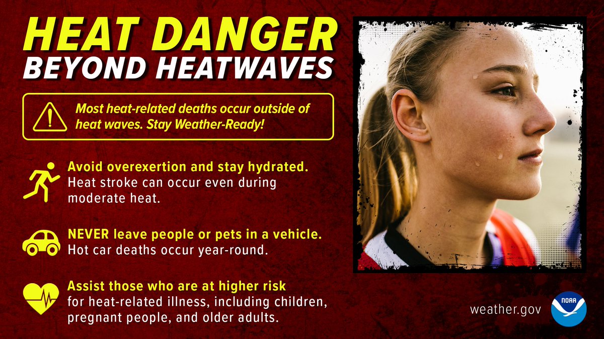
What more can we say about the dangers of extreme heat? How about this...don't only pay attention during heat waves. In fact, most heat-related deaths occur outside of heat waves. #WeatherReady

What more can we say about the dangers of extreme heat? 
How about this...don't only pay attention during heat waves. In fact, most heat-related deaths occur outside of heat waves. 
#WeatherReady
NOAA WRN Ambassadors (@wrnambassadors) 's Twitter Profile Photo

New family routines, with schools starting in many areas and a long weekend coming up, increase the chances of distractions. The "unthinkable" can happen quickly. 🌞 Set reminders 🌞Communicate w/ spouses/caregivers 🌞Never leave a child unattended in a vehicle #WeatherReady

New family routines, with schools starting in many areas and a long weekend coming up, increase the chances of distractions. The "unthinkable" can happen quickly. 

🌞 Set reminders
🌞Communicate w/ spouses/caregivers
🌞Never leave a child unattended in a vehicle
#WeatherReady
NOAA WRN Ambassadors (@wrnambassadors) 's Twitter Profile Photo

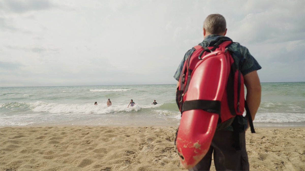
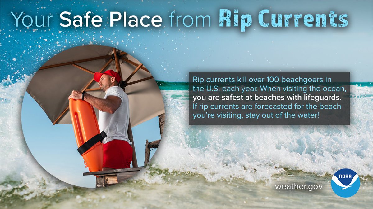
Visiting the beach this long weekend? Make an honest assessment of your swimming ability and stay aware not to put yourself in a dangerous situation. Currents, waves, and changing conditions can humble even good swimmers. And your best option is a guarded beach. #WeatherReady

Visiting the beach this long weekend? 
Make an honest assessment of your swimming ability and stay aware not to put yourself in a dangerous situation. Currents, waves, and changing conditions can humble even good swimmers. 
And your best option is a guarded beach. 
#WeatherReady
National Weather Service (@nws) 's Twitter Profile Photo

Are you #WeatherReady for the fall? The National Weather Service Fall Safety Campaign, launching today, features social media plans, infographics, and more to ensure that you and your loved ones can plan ahead and stay safe in the fall. weather.gov/wrn/fall-safety
Are you #WeatherReady for the fall? The <a href="/NWS/">National Weather Service</a> Fall Safety Campaign, launching today, features social media plans, infographics, and more to ensure that you and your loved ones can plan ahead and stay safe in the fall. weather.gov/wrn/fall-safety
National Water Center (@nwsnwc) 's Twitter Profile Photo

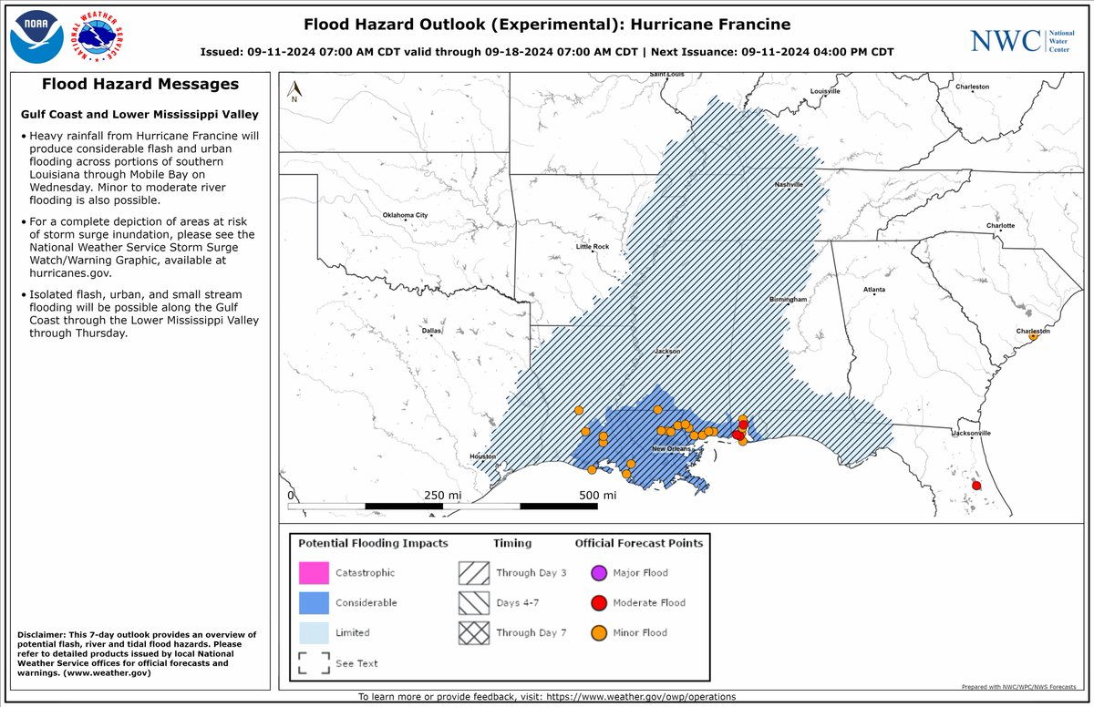
The National Water Center has issued the Tropical Flood Hazard Outlook for Hurricane Francine valid through 7:00 AM CDT on Wednesday September 18, 2024. water.noaa.gov/operations/fho #Francine #LAwx #ALwx #FLwx #TNwx

The National Water Center has issued the Tropical Flood Hazard Outlook for Hurricane Francine valid through 7:00 AM CDT on Wednesday September 18, 2024. water.noaa.gov/operations/fho #Francine #LAwx #ALwx #FLwx #TNwx
NHC Storm Surge (@nhc_surge) 's Twitter Profile Photo

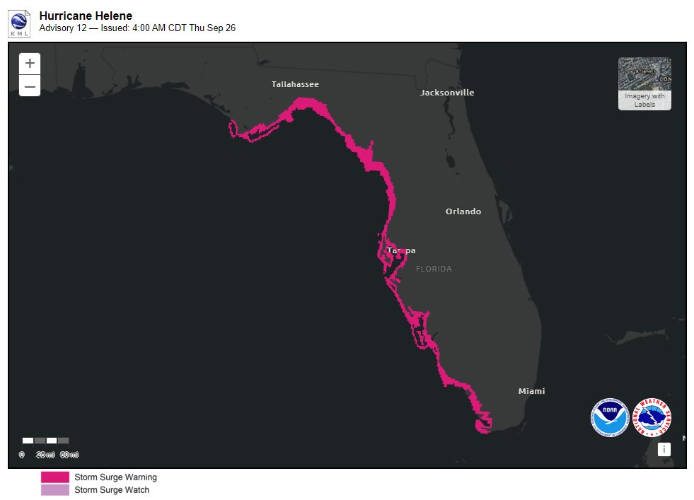
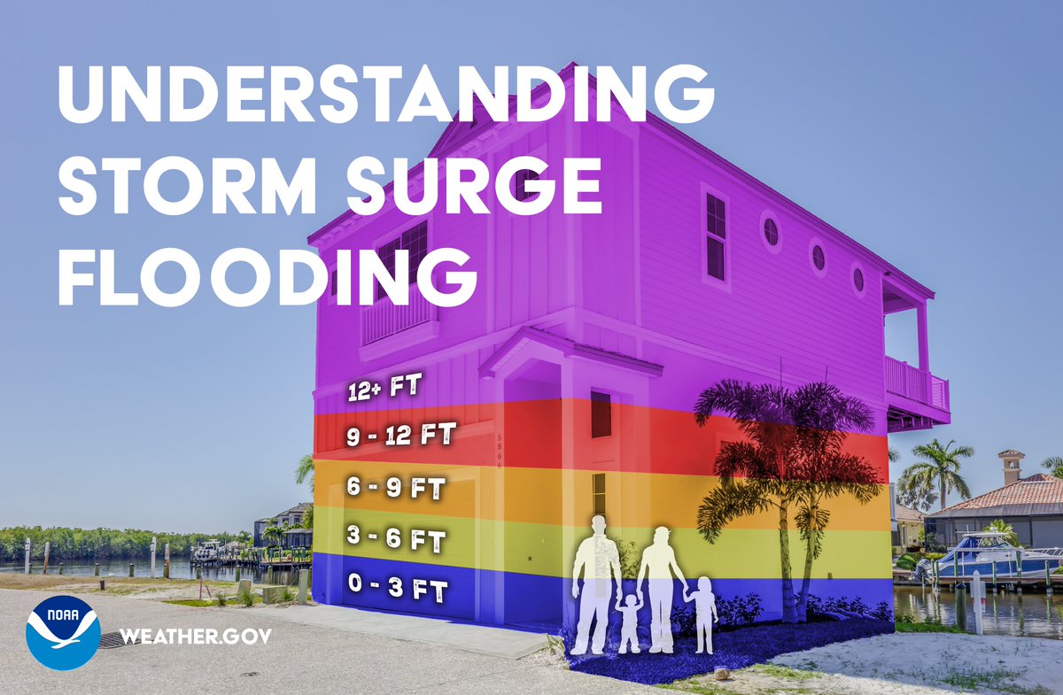
9/26 4am CDT: There is a danger of life-threatening storm surge from #Helene along the west coast of the Florida Peninsula & Florida Big Bend, where a Storm Surge Warning is in effect. Residents in the warning area should follow advice & evacuation orders from local officials.

9/26 4am CDT: There is a danger of life-threatening storm surge from #Helene along the west coast of the Florida Peninsula &amp; Florida Big Bend, where a Storm Surge Warning is in effect. Residents in the warning area should follow advice &amp; evacuation orders from local officials.
NOAA Satellites (@noaasatellites) 's Twitter Profile Photo

.NOAA's #GOESEast satellite is continuing to closely monitor #HurricaneHelene this morning as it approaches Florida. Latest updates and advisories on #Helene: noaa.gov/helene

National Hurricane Center (@nhc_atlantic) 's Twitter Profile Photo

2:25 PM Thursday Update: Air Force hurricane hunters (Hurricane Hunters) find #Helene a dangerous major hurricane. The maximum sustained winds have increased to 120 mph (195 km/h). Follow the latest at hurricanes.gov
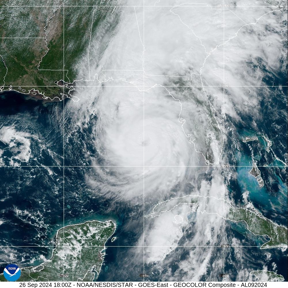
2:25 PM Thursday Update: Air Force hurricane hunters (<a href="/53rdWRS/">Hurricane Hunters</a>) find #Helene a dangerous major hurricane.   The maximum sustained winds have increased to 120 mph (195 km/h).  Follow the latest at hurricanes.gov
National Hurricane Center (@nhc_atlantic) 's Twitter Profile Photo

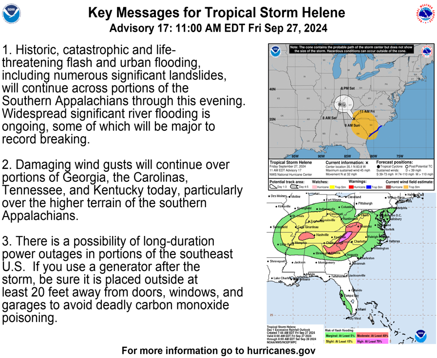
11AM EDT Sept 27: #Helene is producing historic and catastrophic flooding over portions of the southeast and southern Appalachians. For the latest visit hurricanes.gov

11AM EDT Sept 27: #Helene is producing historic and catastrophic flooding over portions of the southeast and southern Appalachians. For the latest visit hurricanes.gov
National Water Center (@nwsnwc) 's Twitter Profile Photo

Significant, life threatening, river flooding is forecast in Bakersville, NC. Prototype NWS flood inundation mapping suggests significant flooding along the Cane Creek is possible. Take action now! NWS GSP #NCwx #flooding #HELENE

Significant, life threatening, river flooding is forecast in Bakersville, NC. Prototype NWS flood inundation mapping suggests significant flooding along the Cane Creek is possible. Take action now!
<a href="/NWSGSP/">NWS GSP</a>
#NCwx #flooding #HELENE
National Water Center (@nwsnwc) 's Twitter Profile Photo

Estimated rainfall amounts from #Helene across the southern Appalachians had an Annual Recurrence Interval greater than 1000-years over a wide area; meaning there is less than a 0.1% chance (annual exceedance probability) of that happening in any given year.

Estimated rainfall amounts from #Helene across the southern Appalachians had an Annual Recurrence Interval greater than 1000-years over a wide area; meaning there is less than a 0.1% chance (annual exceedance probability) of that happening in any given year.
National Weather Service (@nws) 's Twitter Profile Photo

#MILTON is expected to grow in size and remain an extremely dangerous hurricane when it approaches the west coast of Florida on Wednesday. A large area of destructive storm surge will occur along parts of the west coast of Florida on Wednesday. This is an extremely

#MILTON  is expected to grow in size and remain an extremely dangerous hurricane when it approaches the west coast of Florida on Wednesday. A large area of destructive storm surge will occur along parts of the west coast of Florida on Wednesday.

This is an extremely
NWS Miami (@nwsmiami) 's Twitter Profile Photo

Taken by Greg Travers on SR80 a few minutes ago! **Please take the Tornado Warnings we are issuing as fast as we can seriously!** This is a very favorable environment for quick-moving and dangerous Tornadoes.

Taken by Greg Travers on SR80 a few minutes ago! 

**Please take the Tornado Warnings we are issuing as fast as we can seriously!**

This is a very favorable environment for quick-moving and dangerous Tornadoes.
National Water Center (@nwsnwc) 's Twitter Profile Photo

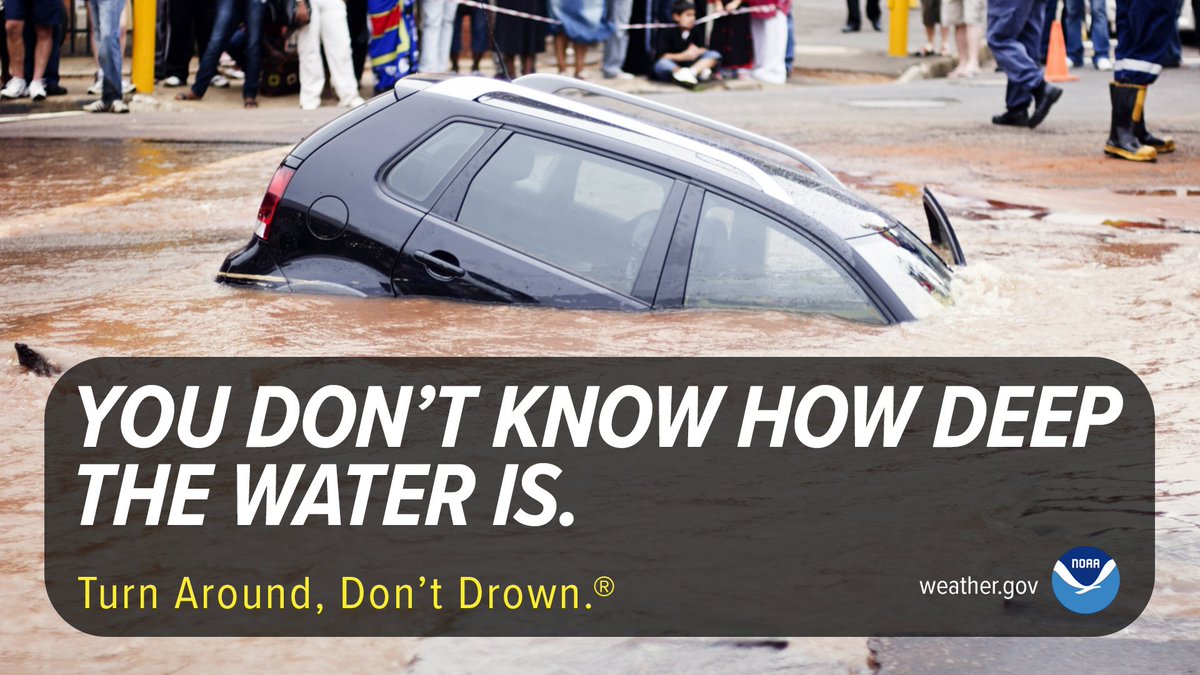
More than 50% of all flood fatalities are vehicle-related. You never know how deep the water is or if the road has been washed away or compromised beneath the water. Don’t risk driving into floodwaters. Turn Around, Don’t Drown! weather.gov/safety/flood-t… #WeatherReady

More than 50% of all flood fatalities are vehicle-related. You never know how deep the water is or if the road has been washed away or compromised beneath the water. Don’t risk driving into floodwaters. Turn Around, Don’t Drown!
weather.gov/safety/flood-t… #WeatherReady
NWS New Orleans (@nwsneworleans) 's Twitter Profile Photo

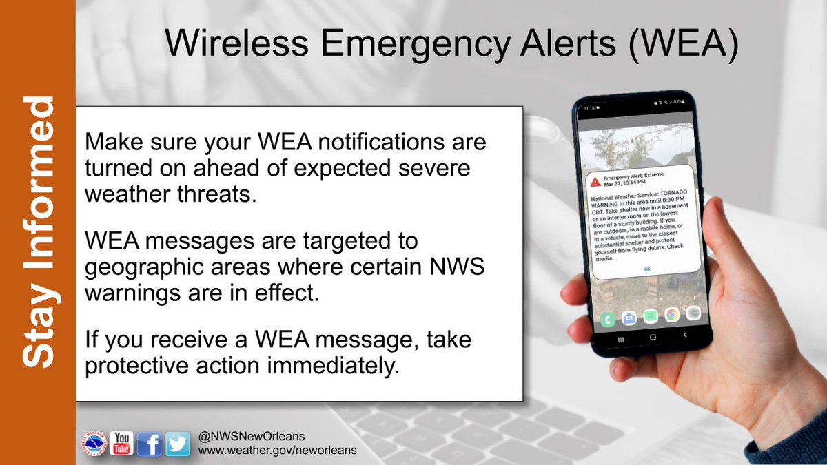
A huge part of #SeverePrep is Staying Informed! You should always have more than one way to receive warnings. One great way is the Wireless Emergency Alert System on your cell phone. If you receive a WEA message, take protective action immediately!

A huge part of #SeverePrep is Staying Informed!  You should always have more than one way to receive warnings.  

One great way is the Wireless Emergency Alert System on your cell phone. If you receive a WEA message, take protective action immediately!