T3 (@turfthreattrckr) 's Twitter Profile
T3

@turfthreattrckr

Turf Threat Tracker is your best source for site-specific weather forecasts as a Superintendent or Turfgrass manager. Sign up for a free trial today at t3.golf

ID: 1379065273681125381

linkhttp://t3.golf calendar_today05-04-2021 13:36:06

344 Tweet

369 Followers

571 Following

Garrett Bastardi (@garrettmb) 's Twitter Profile Photo

Partially rain-wrapped tornado passed just south of Taylorsville, MS. Widespread tree damage, 37N into Taylorsville impassable due to downed trees. NWS Jackson MS

T3 (@turfthreattrckr) 's Twitter Profile Photo

Real time Lightning Detection and Prediction from @FlashScientific showing we are getting very close to a suspension in play at TPC Sawgrass. THE PLAYERS

Real time Lightning Detection and Prediction from @FlashScientific showing we are getting very close to a suspension in play at TPC Sawgrass.

<a href="/THEPLAYERS/">THE PLAYERS</a>
T3 (@turfthreattrckr) 's Twitter Profile Photo

Starting to see a bit of a downtrend in the lightning coverage and chances within the hour. @FlashScientific has the threat coming down some but not fully. Will continue to monitor.

Starting to see a bit of a downtrend in the lightning coverage and chances within the hour. @FlashScientific has the threat coming down some but not fully. Will continue to monitor.
WeatherBELL (@weatherbell) 's Twitter Profile Photo

WeatherBell's Hurricane 2025 Hurricane Season Forecast "This season will be a year where in-close development is a concern, as it has been recently, due to the distortion of overall feedback patterns..." -The American Storm

WeatherBell's Hurricane 2025 Hurricane Season Forecast

"This season will be a year where in-close development is a concern, as it has been recently, due to the distortion of overall feedback patterns..."
-<a href="/BigJoeBastardi/">The American Storm</a>
FLASH Weather AI (@flashscientific) 's Twitter Profile Photo

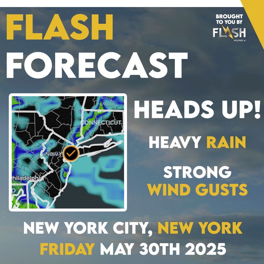
#FLASHFORECAST - FRIDAY MAY 30, 2025 Heads up! - Pittsburgh, PA: #HeavyRain and some possible localized #flooding - Washington, DC: Heavy rain and strong #thunderstorms in the area - New York City, NY: Heavy rain with Strong #windgusts See more at flashweather.ai

#FLASHFORECAST - FRIDAY MAY 30, 2025

Heads up!

- Pittsburgh, PA: #HeavyRain and some possible localized #flooding

- Washington, DC: Heavy rain and strong #thunderstorms in the area

- New York City, NY: Heavy rain with Strong #windgusts

See more at flashweather.ai
Superintendent Network (@thegcsnetwork) 's Twitter Profile Photo

Weather is a big story today at Oakmont, but it's constantly on the minds of the agronomy team. Garrett Bastardi of FLASH Weather AI has been working with the crew leading into the event and is onsite this week to provide critical info to assist in the decision making process.

FLASH Weather AI (@flashscientific) 's Twitter Profile Photo

Reliable data. Simple tools. Smarter timelines. 🔗 Learn more about how FLASH supports teams → flashweather.ai #FlashWeatherAI

Reliable data. Simple tools. Smarter timelines. 
🔗 Learn more about how FLASH supports teams → flashweather.ai
#FlashWeatherAI
FLASH Weather AI (@flashscientific) 's Twitter Profile Photo

Another round of dangerous, slow-moving thunderstorms will impact the Texas Hill Country tonight and into the day Sunday. Using the Future Radar Feature on the Flash Weather AI mobile App, users can monitor the trends of this potential significant rainfall event in real time.

FLASH Weather AI (@flashscientific) 's Twitter Profile Photo

The FlashCast Future Radar within the new version of Flash AI’s mobile app couldn’t verify much better on a strong t’storm near metro Houston. Flash’s high-res radar on the left compared with the FlashCast future radar at nearly the same time on the right are nearly identical.

The FlashCast Future Radar within the new version of Flash AI’s mobile app couldn’t verify much better on a strong t’storm near metro Houston. 

Flash’s high-res radar on the left compared with the FlashCast future radar at nearly the same time on the right are nearly identical.
Garrett Bastardi (@garrettmb) 's Twitter Profile Photo

There has been a bit of a trend on the GFS towards some low level reflection similar to the Euro AI. This has led to some signs of life on the GEFS as well. The whole set up is very marginal but its still worth monitoring to see if something gets north of the Antilles.

FLASH Weather AI (@flashscientific) 's Twitter Profile Photo

A significant risk of Flash Flooding will take shape along the I-95 corridor early this afternoon. Slow moving, heavy thunderstorms will drop 3-6"+ of rain from Washington DC to Philadelphia to New York City.

FLASH Weather AI (@flashscientific) 's Twitter Profile Photo

Mapping above is from our Weather Command Center and Mobile App. -FlashCast future radar app view. -6 hour AI Lightning Probability Forecast -Excessive Rainfall Outlook provided by NWS Weather Prediction Center Command Center: flashweather.ai Mobile App: apps.apple.com/us/app/flash-w…

FLASH Weather AI (@flashscientific) 's Twitter Profile Photo

Hurricane Erin has incredibly intensified into a strong Category 4 storm this morning, potentially even nearing Category 5 strength as it passes just north of the Leeward Islands.

FLASH Weather AI (@flashscientific) 's Twitter Profile Photo

The incredible size of Hurricane #Erin is on display on the FlashCast Future Radar today. You can use Flash’s Future Radar product and other valuable forecast products by downloading the FLASH AI app using the link below! apps.apple.com/us/app/flash-w…

FLASH Weather AI (@flashscientific) 's Twitter Profile Photo

FLASH Meteorologist Dave Downey is going live at 6 PM EST with live cameras and will be monitoring and providing updates on Hurricane Erin. Click here to join youtube.com/live/Lapu3dCkk…

FLASH Meteorologist Dave Downey is going live at 6 PM EST with live cameras and will be monitoring and providing updates on Hurricane Erin.  Click here to join youtube.com/live/Lapu3dCkk…