Rebecca(@Tonistormchaser) 's Twitter Profileg
Rebecca

@Tonistormchaser

Gaming 🎮 Photography 📷 Extreme Weather 🏳️‍🌈

ID:2578314395

calendar_today02-06-2014 19:41:01

4,0K Tweets

133 Followers

79 Following
IPS(@ips_impact) 's Twitter Profile Photo

IPS Eurotruss PR15 Roof Structure headlines Green Man Festival this weekend.
One of many sucessful builds over the last couple of frantic weeks by our super hard working team.

IPS @Eurotruss PR15 Roof Structure headlines Green Man Festival this weekend. One of many sucessful builds over the last couple of frantic weeks by our super hard working team. #stagehire #herocrew #summerstaging #outdoorevents
account_circle
SCS Software(@SCSsoftware) 's Twitter Profile Photo

It’s and today we present to you Caroline 💜 who is a great Twitch streamer and a Renault Trucks Brand Ambassador at the same time! 🚛🚛

Check out her channel at ⬇️
twitch.tv/jenko90_

It’s #SharingSaturday and today we present to you @Jenko90_ who is a great Twitch streamer and a @RenaultTrucksCo Brand Ambassador at the same time! 🚛🚛 Check out her channel at ⬇️ twitch.tv/jenko90_
account_circle
Met Office(@metoffice) 's Twitter Profile Photo

Thank you to everyone who shared their photos with us today

Whilst skies have been rather grey for many of us on , there's certainly plenty of colour in your photos

Thanks to Liam Ball, Victorthevole, Jacksweatherchannel! and Ar
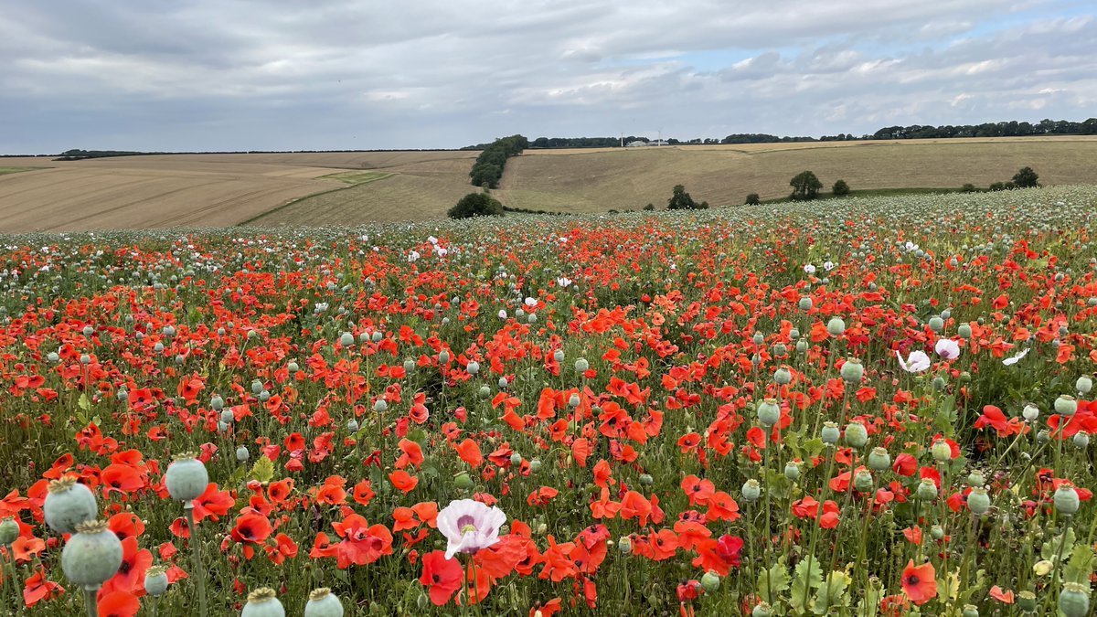
Thank you to everyone who shared their #LoveUKWeather photos with us today Whilst skies have been rather grey for many of us on #WorldPhotographyDay, there's certainly plenty of colour in your photos Thanks to @Liam_Ball92, @victorthevole, @Jacksweatherch1 and @ar_ar888
account_circle
Convective Weather(@convectivewx) 's Twitter Profile Photo

MON 09 AUG 2021:
convectiveweather.co.uk/forecast.php?d…
A large trough across Britain and Ireland and will slowly rotate eastwards. This combined with modest instability will lead to widespread showers and some thunderstorms by the afternoon. The main hazard will be localised flooding.

MON 09 AUG 2021: convectiveweather.co.uk/forecast.php?d… A large trough across Britain and Ireland and will slowly rotate eastwards. This combined with modest instability will lead to widespread showers and some thunderstorms by the afternoon. The main hazard will be localised flooding.
account_circle
Sᴏᴜᴛʜᴇʀɴ ᴇɴɢʟᴀɴᴅ ᴡᴇᴀᴛʜᴇʀ(@LondonSnowWatch) 's Twitter Profile Photo

last of these tiny thunderstorm risks

Overnight tonight some heavy showers move east, clearing the east through morning

Then some hit & miss heavy showers follow. A few of which could be thundery

As afternoon wears on, showers will become fewer and fewer

Then hello dry spell

last of these tiny thunderstorm risks Overnight tonight some heavy showers move east, clearing the east through morning Then some hit & miss heavy showers follow. A few of which could be thundery As afternoon wears on, showers will become fewer and fewer Then hello dry spell
account_circle
Convective Weather(@convectivewx) 's Twitter Profile Photo

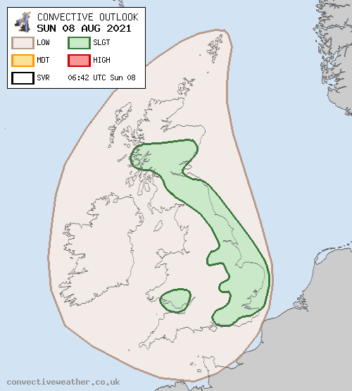
SUN 08 AUG 2021
convectiveweather.co.uk/forecast.php?d…

Main risk is localised flooding, especially across northern Britain. Small risk of some lightning close to Orkney later today, and also evening/overnight near parts of SW / Cen S England, S Wales and the English Channel

SUN 08 AUG 2021 convectiveweather.co.uk/forecast.php?d… Main risk is localised flooding, especially across northern Britain. Small risk of some lightning close to Orkney later today, and also evening/overnight near parts of SW / Cen S England, S Wales and the English Channel
account_circle
Virtual Farmer 🚜(@Virtual_Farmer) 's Twitter Profile Photo

I'm giving away a pre-order copy of on PC, Xbox or PlayStation for August's !

To enter, click the link below and:
- Retweet
- Follow twitch.tv/virtualfarmer
- Visit youtube.com/virtualfarmer

Closes 31th August 11:59pm BST

gleam.io/tPFlv/virtual-…

account_circle
Met Office(@metoffice) 's Twitter Profile Photo

Here is your latest and it is wet ☔☔☔

Heavy across Scotland this morning is slowly clearing west

Frequent showers are pilling in with some prolonged spells of rain and thunder expected this afternoon⛈️

⚠️Weather warnings in place 👉 bit.ly/WxWarning ⚠️

account_circle
Convective Weather(@convectivewx) 's Twitter Profile Photo

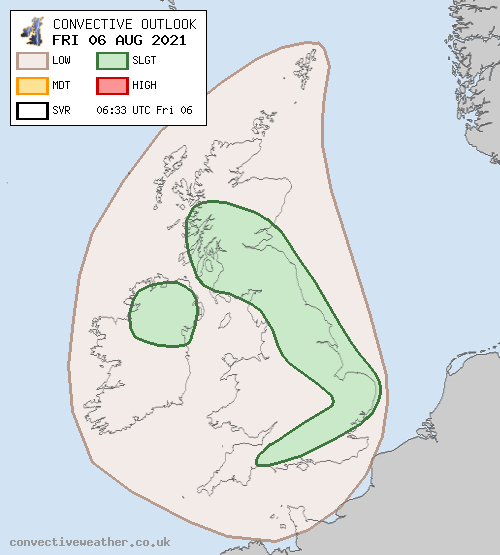
FRI 06 AUG 2021
convectiveweather.co.uk/forecast.php?d…

Main hazards will be local surface water flooding, more especially N England / C + S Scotland / Northern Ireland. Hail and gusty winds possible S England to East Anglia

FRI 06 AUG 2021 convectiveweather.co.uk/forecast.php?d… Main hazards will be local surface water flooding, more especially N England / C + S Scotland / Northern Ireland. Hail and gusty winds possible S England to East Anglia
account_circle
Sᴏᴜᴛʜᴇʀɴ ᴇɴɢʟᴀɴᴅ ᴡᴇᴀᴛʜᴇʀ(@LondonSnowWatch) 's Twitter Profile Photo

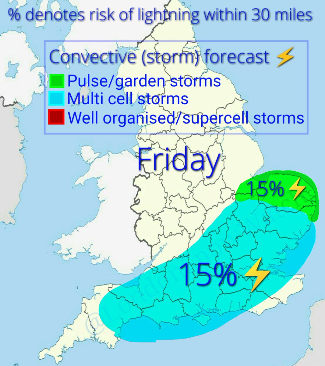
This evening instability builds and there's a very small risk that the heaviest of any showers will be thundery

Into Friday, strong wind shear but fairly weak instability brings a small risk of multi cell storms breaking out

This evening instability builds and there's a very small risk that the heaviest of any showers will be thundery Into Friday, strong wind shear but fairly weak instability brings a small risk of multi cell storms breaking out
account_circle
Convective Weather(@convectivewx) 's Twitter Profile Photo

THU 05 AUG 2021
convectiveweather.co.uk/forecast.php?d…

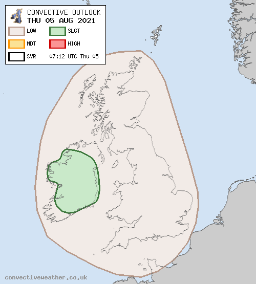
Ireland is the main focus, but also a small risk late afternoon/early evening in Wales/SW England. Other small risks evening/overnight in E Midlands/eastern England/North Sea/E Scotland, and also Irish Sea and adjacent coasts

THU 05 AUG 2021 convectiveweather.co.uk/forecast.php?d… Ireland is the main focus, but also a small risk late afternoon/early evening in Wales/SW England. Other small risks evening/overnight in E Midlands/eastern England/North Sea/E Scotland, and also Irish Sea and adjacent coasts
account_circle