RockyNPS(@RockyNPS) 's Twitter Profileg
RockyNPS

@RockyNPS

The official twitter page of Rocky Mountain National Park. Updates and important information.

ID:96783382

linkhttp://www.nps.gov/romo/index.htm calendar_today14-12-2009 15:42:21

19,7K Tweets

82,9K Followers

87 Following

RockyNPS(@RockyNPS) 's Twitter Profile Photo

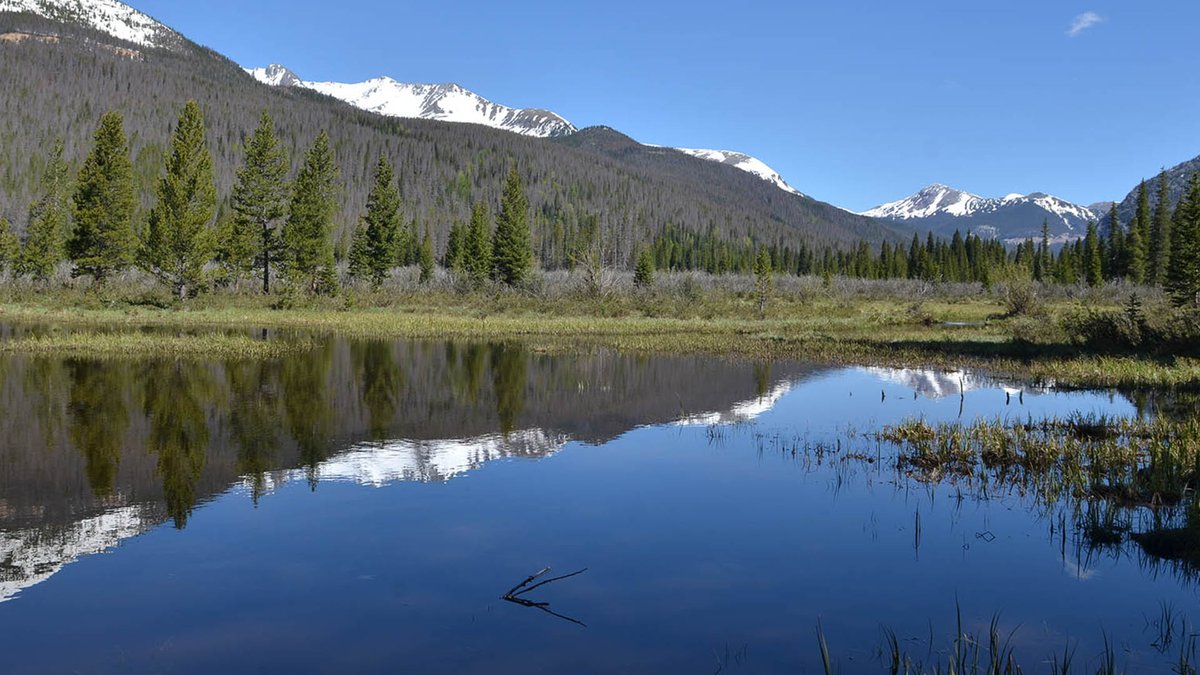
Springtime in makes snow mushy, slushy & soft. You may posthole, even in snowshoes.
Ice on lakes is melting. For your safety, it is strongly advised to avoid walking on lakes, even if they look frozen. Use extra caution near inlets, outlets & rocks, where ice can be thinner

Springtime in #RMNP makes snow mushy, slushy & soft. You may posthole, even in snowshoes. Ice on lakes is melting. For your safety, it is strongly advised to avoid walking on lakes, even if they look frozen. Use extra caution near inlets, outlets & rocks, where ice can be thinner
account_circle
CAIC:Statewide Info(@COAvalancheInfo) 's Twitter Profile Photo

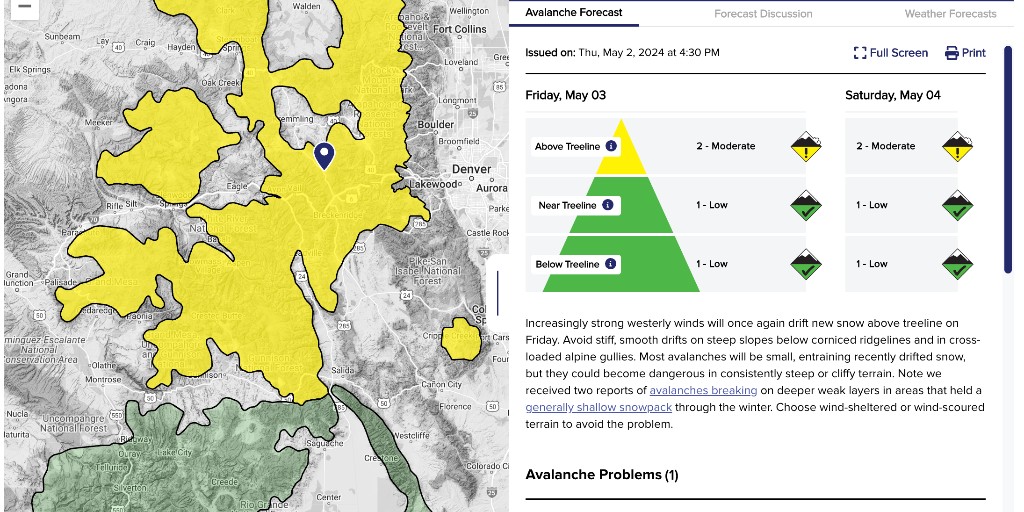
CAIC produces daily backcountry avalanche forecasts through May to help backcountry travelers stay safe. Go to Colorado.gov/avalanche to get the forecast for wherever you plan to travel. NOTE: Backcountry WEATHER Forecast discussions have ended for the 2023-24 season.

CAIC produces daily backcountry avalanche forecasts through May to help backcountry travelers stay safe. Go to Colorado.gov/avalanche to get the forecast for wherever you plan to travel. NOTE: Backcountry WEATHER Forecast discussions have ended for the 2023-24 season.
account_circle
CAIC:Statewide Info(@COAvalancheInfo) 's Twitter Profile Photo

MOD(2of5) Watch for drifted snow below cornices and in steep couloirs and gullies. Most avalanches will be small, but don't rule out a large one where you find fresh drifts deeper than a foot. You can push loose avalanches as the snow warms.colorado.gov/avalanche
account_circle
Northern Water(@northern_water) 's Twitter Profile Photo

Last weekend's precipitation boosted snowpack levels back above average. Northern Water's West Slope snowpack monitoring sites are now collectively at 107 percent of median and the East Slope stations are at 106 percent.

Last weekend's precipitation boosted snowpack levels back above average. Northern Water's West Slope snowpack monitoring sites are now collectively at 107 percent of median and the East Slope stations are at 106 percent.
account_circle
RockyNPS(@RockyNPS) 's Twitter Profile Photo

has rain and snow showers in the forecast parkwide today through Thurs night-Friday. Seriously - be prepared for snow falling on you if you come to RMNP. This is our springtime!

account_circle
FEMA Region 8(@femaregion8) 's Twitter Profile Photo

🌩️ See a FLASH, DASH inside!

Every year, lightning kills about 20 people in the United States and severely injures hundreds more.

Don't be a statistic. If you see lightning or hear thunder, head into a sturdy building.

weather.gov/safety/lightni…

account_circle
CAIC:Statewide Info(@COAvalancheInfo) 's Twitter Profile Photo

LOW(1of5) You can trigger avalanches in warming surface snow. Limit your travel on or below steep slopes where you see rollerballs, pinwheels, or wet, gloppy snow. Starting and ending your day early will limit exposure to wet snow problems. colorado.gov/avalanche
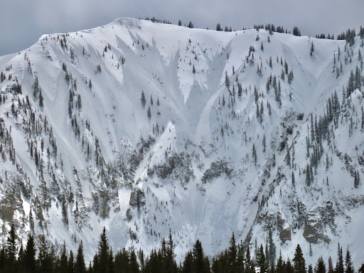
#CAICsmountains LOW(1of5) You can trigger avalanches in warming surface snow. Limit your travel on or below steep slopes where you see rollerballs, pinwheels, or wet, gloppy snow. Starting and ending your day early will limit exposure to wet snow problems. colorado.gov/avalanche
account_circle
CAIC:Statewide Info(@COAvalancheInfo) 's Twitter Profile Photo

MOD(2of5) Look for and avoid areas of wind-drifted snow. These have a rounded smooth appearance. If they crack, head to lower-angle terrain. On sunny slopes look for roller balls and sinking into wet gloppy snow past your ankles. colorado.gov/avalanche
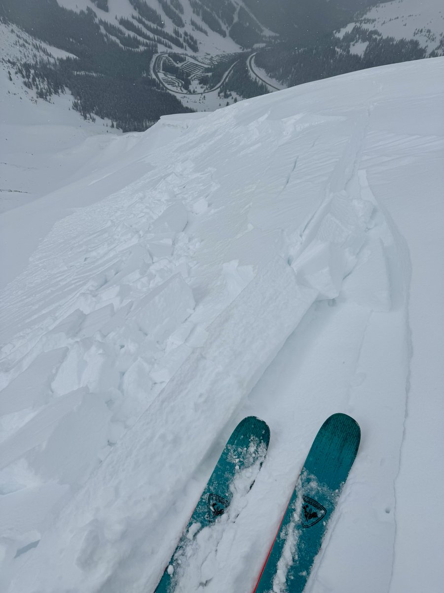
#CAICnmountains MOD(2of5) Look for and avoid areas of wind-drifted snow. These have a rounded smooth appearance. If they crack, head to lower-angle terrain. On sunny slopes look for roller balls and sinking into wet gloppy snow past your ankles. colorado.gov/avalanche
account_circle
NWS Boulder(@NWSBoulder) 's Twitter Profile Photo

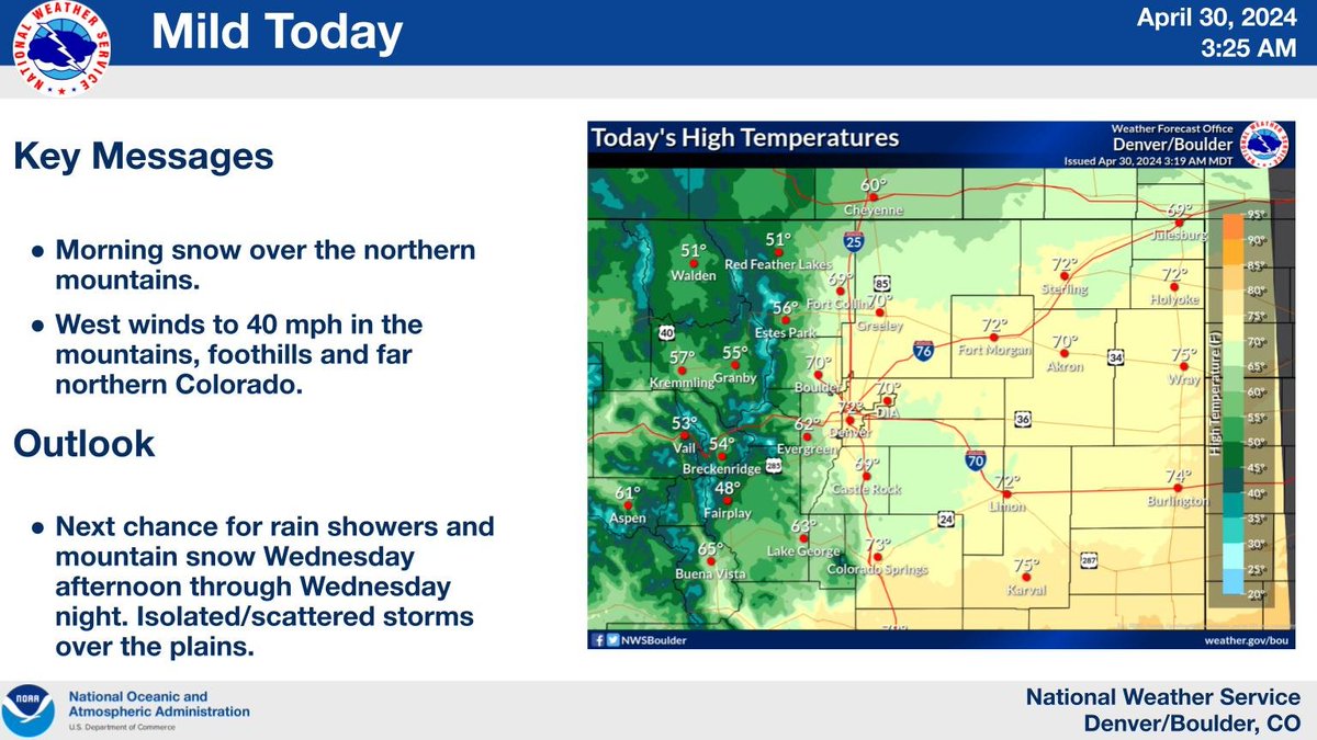
Snow showers will end mid morning over the northern mountains. Gusty west winds to 40 mph then develop by afternoon over and near the mountains, foothills, and far northern Colorado.

Snow showers will end mid morning over the northern mountains. Gusty west winds to 40 mph then develop by afternoon over and near the mountains, foothills, and far northern Colorado. #cowx
account_circle
NWS Boulder(@NWSBoulder) 's Twitter Profile Photo

It will be dry and warmer today. Breezy in the mountains, foothills and along the Cheyenne Ridge, with gusts from 25 to 35 mph. High temperatures will range from the 30s and 40s in the mountains, to around 70 across the plains.

It will be dry and warmer today. Breezy in the mountains, foothills and along the Cheyenne Ridge, with gusts from 25 to 35 mph. High temperatures will range from the 30s and 40s in the mountains, to around 70 across the plains. #COwx
account_circle
CAIC:Statewide Info(@COAvalancheInfo) 's Twitter Profile Photo

MOD(2of5) You can trigger an avalanche in the new snow. Most avalanches will be small but they could grow large on wind-drifted slopes or dangerous above terrain traps. Avoid steep slopes with over a foot of new snow. colorado.gov/avalanche

account_circle
CAIC:Statewide Info(@COAvalancheInfo) 's Twitter Profile Photo

MOD(2of5) Fresh snow, deep drifted slabs, and new snow shedding from periods of sunshine keep the avalanche danger elevated. Limit travel below slopes with wet, new snow and stick to lower angled slopes if you see cracking in drifted areas. colorado.gov/avalanche

account_circle
NWS Boulder(@NWSBoulder) 's Twitter Profile Photo

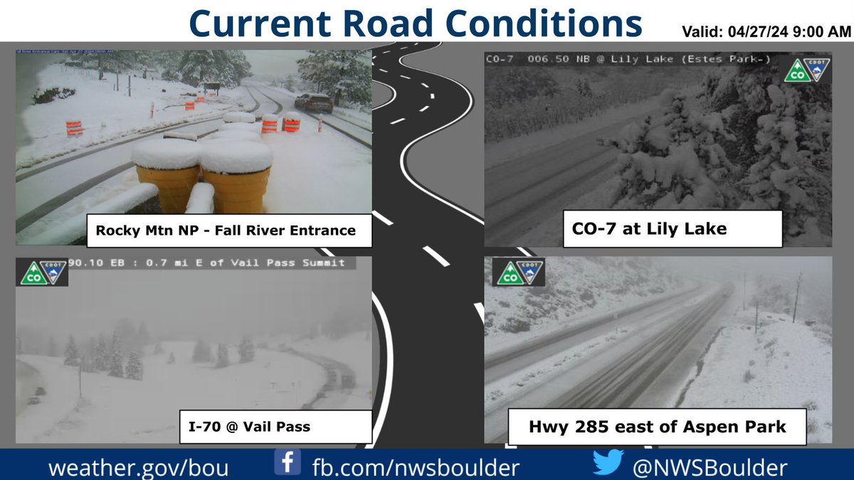
Webcam roundup from the mountains and foothills. Moderate to heavy snow will gradually become lighter this afternoon. Snow reports (ideally with picture & location) are appreciated!

Webcam roundup from the mountains and foothills. Moderate to heavy snow will gradually become lighter this afternoon. Snow reports (ideally with picture & location) are appreciated! #COwx
account_circle
RockyNPS(@RockyNPS) 's Twitter Profile Photo

NWS Forecasts for :
Bear Lake forecast.weather.gov/MapClick.php?l…
Estes Park forecast.weather.gov/MapClick.php?l…
Grand Lake forecast.weather.gov/MapClick.php?l…
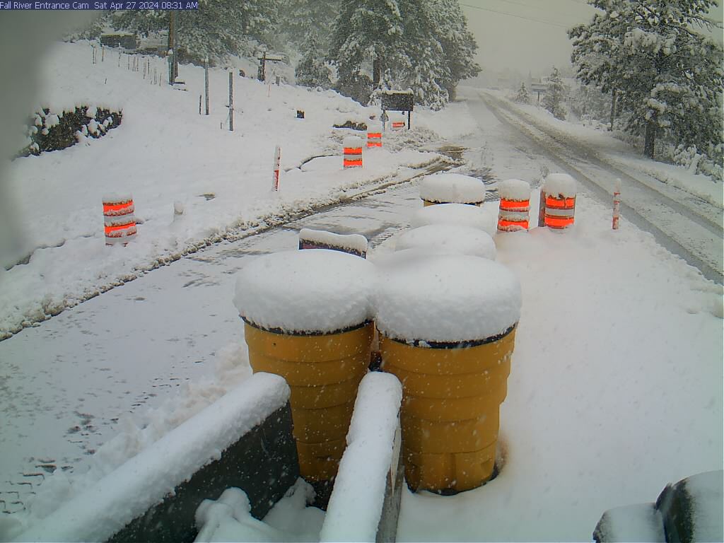
It's snowing now & supposed to continue for a while. WINTER WEATHER WARNING until tomorrow morning for east side. Traction Law in effect.

account_circle
RockyNPS(@RockyNPS) 's Twitter Profile Photo

Traction Law in RMNP means all vehicles (4WD, AWD, 2WD) must have properly rated tires (Mud+Snow, Mountain+Snow, All-Weather) with a minimum 3/16' tread. Otherwise, you must use an approved traction control device, including snow chains, cables, tire/snow socks, studded tires.

Traction Law in RMNP means all vehicles (4WD, AWD, 2WD) must have properly rated tires (Mud+Snow, Mountain+Snow, All-Weather) with a minimum 3/16' tread. Otherwise, you must use an approved traction control device, including snow chains, cables, tire/snow socks, studded tires.
account_circle
RockyNPS(@RockyNPS) 's Twitter Profile Photo

Traction Law is currently in effect in . Plows are working on clearing roads. Be aware & prepared. What do you need for Traction Law? See the section on this RMNP webpage nps.gov/romo/planyourv…

account_circle