NWS Charleston, SC(@NWSCharlestonSC) 's Twitter Profileg
NWS Charleston, SC

@NWSCharlestonSC

Official Twitter Account for National Weather Service Charleston, SC. Details: http://t.co/KKTK7cZlhK

ID:307589282

linkhttp://weather.gov/chs/ calendar_today29-05-2011 22:43:07

32,5K Tweets

52,6K Followers

198 Following

Follow People
NWS Charleston, SC(@NWSCharlestonSC) 's Twitter Profile Photo

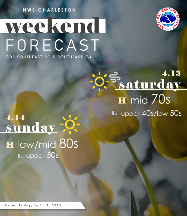
A beautiful spring weekend is ahead! 🌻🌷 We'll see temps into the mid 70s tomorrow, warming into the 80s for Sunday. Windy conditions will quiet tonight, with a nice breeze picking up tomorrow afternoon.

A beautiful spring weekend is ahead! 🌻🌷 We'll see temps into the mid 70s tomorrow, warming into the 80s for Sunday. Windy conditions will quiet tonight, with a nice breeze picking up tomorrow afternoon. #chswx #savwx #scwx #gawx
account_circle
NWS Charleston, SC(@NWSCharlestonSC) 's Twitter Profile Photo

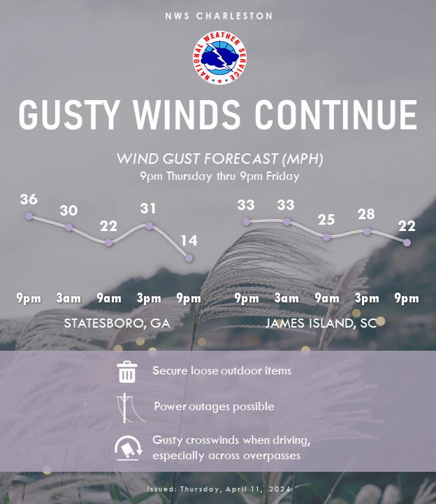
While most of the rain has cleared, winds will continue to gust 25-35 mph overnight into tmrw. Be sure to secure outdoor items through the night. Gusts could continue to bring down tree limbs, cause localized power outages & difficulty driving over bridges/overpasses.

While most of the rain has cleared, winds will continue to gust 25-35 mph overnight into tmrw. Be sure to secure outdoor items through the night. Gusts could continue to bring down tree limbs, cause localized power outages & difficulty driving over bridges/overpasses. #scwx #gawx
account_circle
NWS Charleston, SC(@NWSCharlestonSC) 's Twitter Profile Photo

Rainfall totals since midnight at our three climate sites (all three break the daily rainfall records):
*Charleston Airport: 1.90' (record was 1.59' in 1955)
*Savannah Airport: 3.42' (record was 1.75' in 1926)
*Downtown Charleston: 3.05' (record was 1.69' in 1955)

account_circle
NWS Charleston, SC(@NWSCharlestonSC) 's Twitter Profile Photo

At noon, rounds of moderate showers and thunderstorms will pass over Downtown Charleston early this afternoon. Flooding has heavily impacted Downtown Charleston today. Officials advised all residents to avoid unnecessary travel in the city. Do not drive into flooded areas.

account_circle
City of Charleston(@CityCharleston) 's Twitter Profile Photo

Flooding is heavily impacting downtown. We advise all residents to stay home and avoid unnecessary travel.

Do NOT Drive Through Flooded Streets or Around Barricades!

High tide is expected at 10:51 AM, and forecasts indicate that flooding will subside by early afternoon.

account_circle
NWS Charleston, SC(@NWSCharlestonSC) 's Twitter Profile Photo

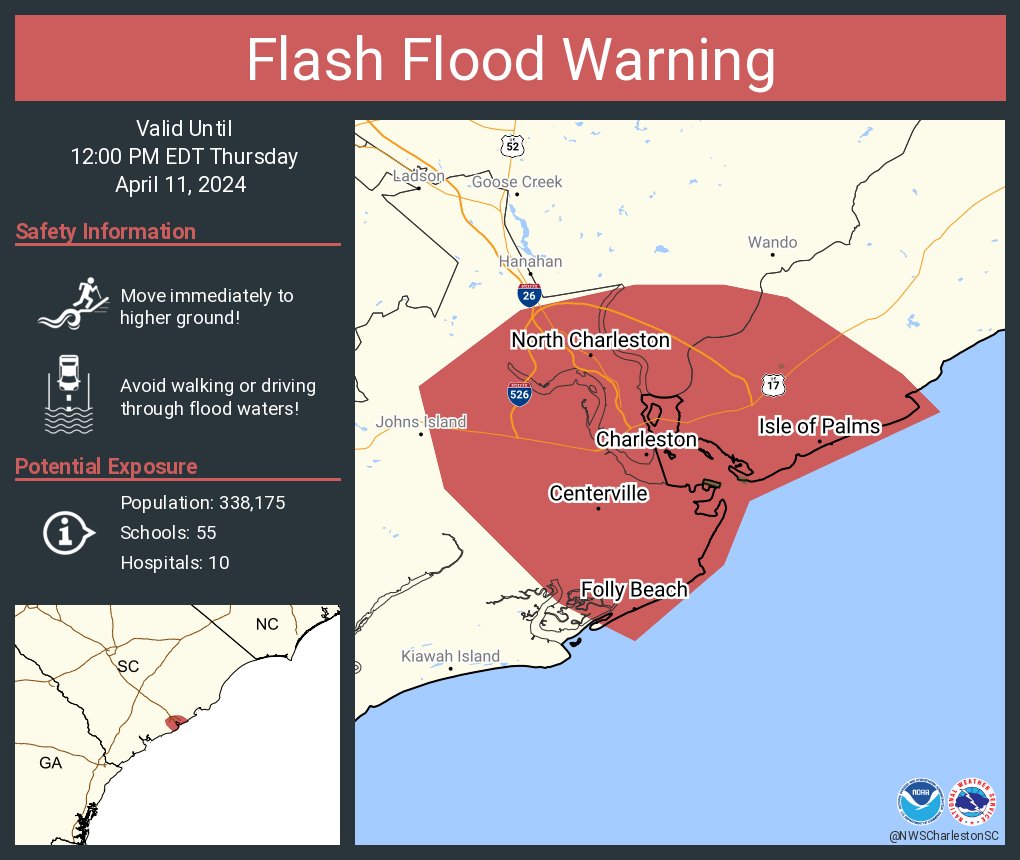
As of 930AM: Heavy downpours will track across Downtown Charleston and Mount Pleasant through 10 AM. Numerous roads have been closed across Charleston. Do not drive in flooded areas! Flash Flood Warning until noon.

account_circle
NWS Charleston, SC(@NWSCharlestonSC) 's Twitter Profile Photo

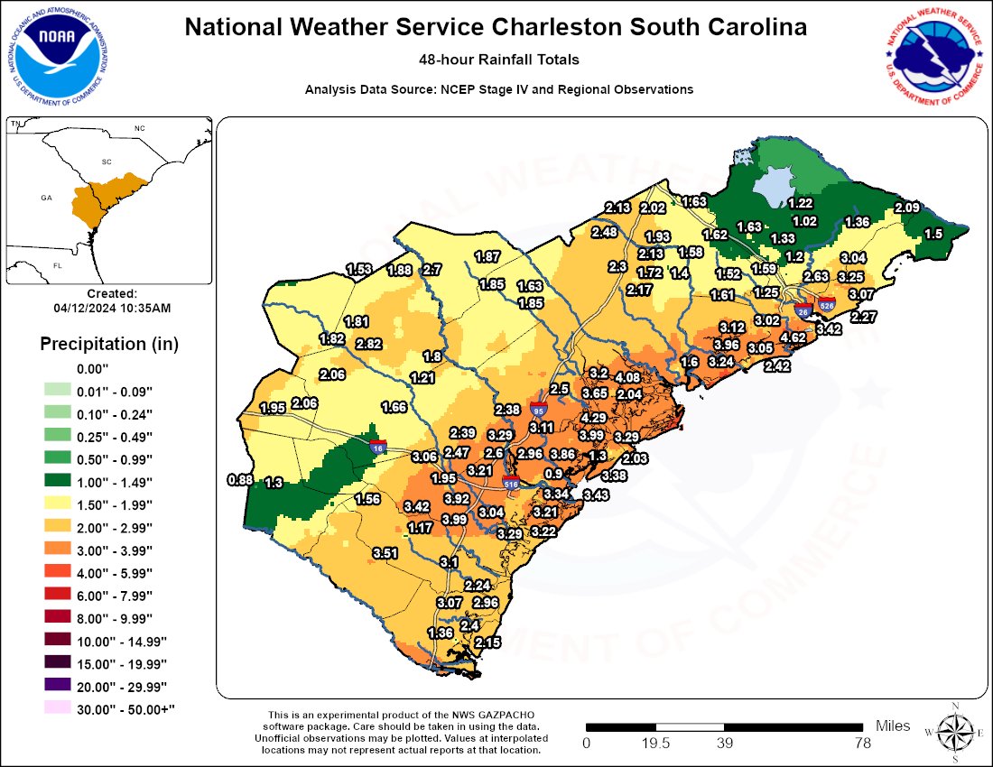
Here's the latest storm total rainfall forecast. Things have trended considerably wetter overnight. Many areas in southeast GA have already received 2-3' while southeast SC has picked up 1-2'.

Here's the latest storm total rainfall forecast. Things have trended considerably wetter overnight. Many areas in southeast GA have already received 2-3' while southeast SC has picked up 1-2'. #scwx #gawx
account_circle
NWS Charleston, SC(@NWSCharlestonSC) 's Twitter Profile Photo

πŸƒ Low pressure moving across the area is expected to bring a number of impacts, including gusty winds, high surf, and possible severe weather. Here are the latest Watches πŸ™΄ Advisories, which go into affect 8am tomorrow. For more info, go to: weather.gov/chs/briefing

πŸƒ Low pressure moving across the area is expected to bring a number of impacts, including gusty winds, high surf, and possible severe weather. Here are the latest Watches πŸ™΄ Advisories, which go into affect 8am tomorrow. For more info, go to: weather.gov/chs/briefing
account_circle
NWS Charleston, SC(@NWSCharlestonSC) 's Twitter Profile Photo

[850 PM] Multiple weather hazards will be possible on Thursday as a cold front approaches. Gusty winds will start Thursday morning and persist into the early evening hours. Max wind gusts of 30 to 40 mph will be possible. More info can be found here: weather.gov/chs/briefing

[850 PM] Multiple weather hazards will be possible on Thursday as a cold front approaches. Gusty winds will start Thursday morning and persist into the early evening hours. Max wind gusts of 30 to 40 mph will be possible. More info can be found here: weather.gov/chs/briefing
account_circle
NWS Charleston, SC(@NWSCharlestonSC) 's Twitter Profile Photo

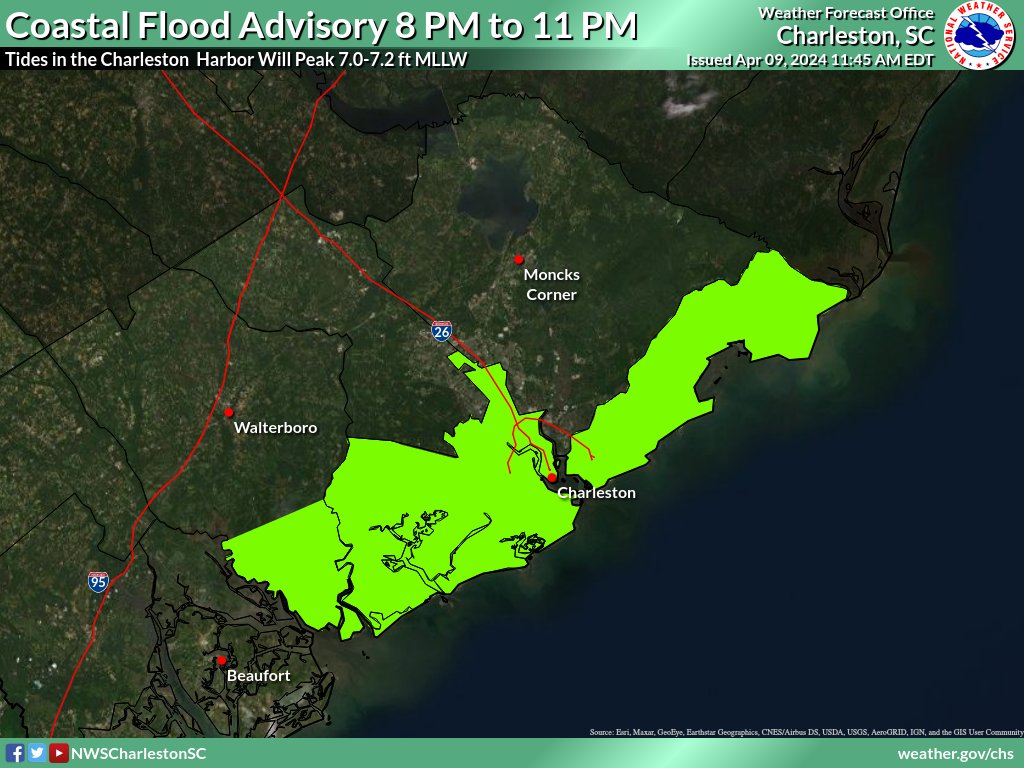
A Coastal Flood Advisory has been issued for coastal portions of Charleston and Colleton Counties from 8 PM until 11 PM. Be aware that minor saltwater flooding will be possible! Road closures in Downtown Charleston are unlikely.

A Coastal Flood Advisory has been issued for coastal portions of Charleston and Colleton Counties from 8 PM until 11 PM. Be aware that minor saltwater flooding will be possible! Road closures in Downtown Charleston are unlikely. #chswx #scwx
account_circle
NWS Charleston, SC(@NWSCharlestonSC) 's Twitter Profile Photo

Isolated severe thunderstorms are possible Thursday along with a number of other hazards. Now is the time to prepare. Remember, it's best to have multiple ways to received warnings and other urgent weather information.

Isolated severe thunderstorms are possible Thursday along with a number of other hazards. Now is the time to prepare. Remember, it's best to have multiple ways to received warnings and other urgent weather information. #chswx #savwx #scwx #gawx
account_circle
NWS Charleston, SC(@NWSCharlestonSC) 's Twitter Profile Photo

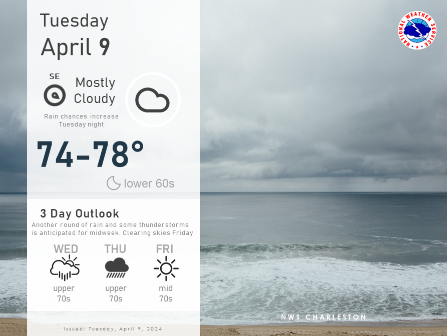
High pressure will prevail into Wednesday afternoon. A storm system will impact the region Wednesday night into Thursday, with some strong to severe storms possible. weather.gov/chs

High pressure will prevail into Wednesday afternoon. A storm system will impact the region Wednesday night into Thursday, with some strong to severe storms possible. weather.gov/chs
account_circle
NWS Charleston, SC(@NWSCharlestonSC) 's Twitter Profile Photo

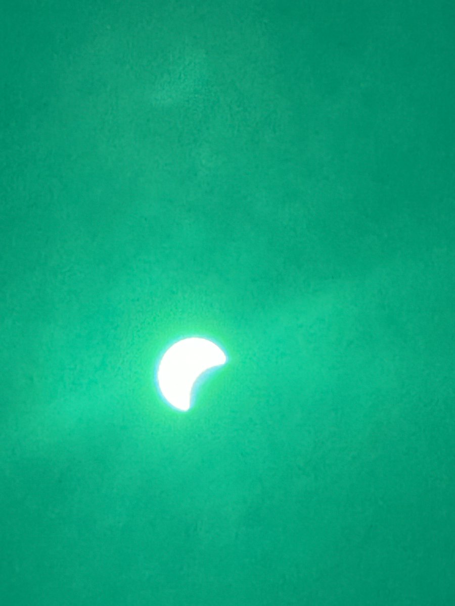
The temperature at the Charleston International Airport has dropped about 3 degrees over the past 15 min as we approach the peak of the solar eclipse.

account_circle