NICFI Satellite Data Program
@nicfisatdata
The NICFI Satellite Data Program is an initiative providing comprehensive access to high resolution satellite data across the #tropical forest regions
ID: 1564170938240966657
http://www.planet.com/nicfi 29-08-2022 08:41:06
471 Tweet
1,1K Followers
119 Following

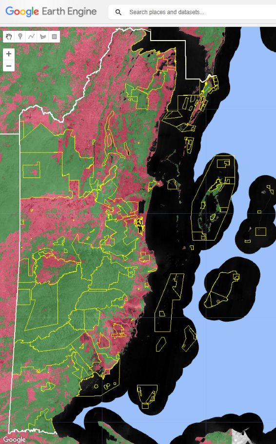
Can the NICFI Satellite Data Program be used for wall-to-wall #LandCover mapping of tropical countries? 🤔We think so.😉 Here's a preliminary #EarthEngine #ML-based map of #Belize 🇧🇿's #forest cover using the recently released April 2024 @Planet mosaic data. x.com/BzGEO/status/1…


#EOchat 📢 - Great news re: NICFI Satellite Data Program, from @ClimateForest: nicfi.no/2024/09/17/nic…


🌲The Pulitzer Center, premium user of the #NICFISatelliteDataProgram, has launched the fifth cohort of the Rainforest Investigations Network (RIN). RIN Fellows are trained to uncover root causes of deforestation & environmental destruction across tropical rainforest regions: pulitzercenter.org/journalism/ini…


🌿At #COP29, "Finding the Path Together" highlighted the importance of securing forest tenure for Indigenous Peoples & local communities, with insights from leaders like Voices from Forests & Farms and Hege Ragnhildstveit. 📽️Missed the session? Catch up at 6:30:20 here: youtube.com/live/l7ZC81L40…


