NC State Center for Geospatial Analytics (@ncsugeospatial) 's Twitter Profile
NC State Center for Geospatial Analytics

@ncsugeospatial

Everything is spatial and location matters at the Center for Geospatial Analytics, an interdisciplinary teaching and research center at NC State University.

ID: 3430786757

linkhttp://geospatial.ncsu.edu calendar_today19-08-2015 01:31:49

2,2K Tweet

1,1K Followers

337 Following

NC State Extension (@ncextension) 's Twitter Profile Photo

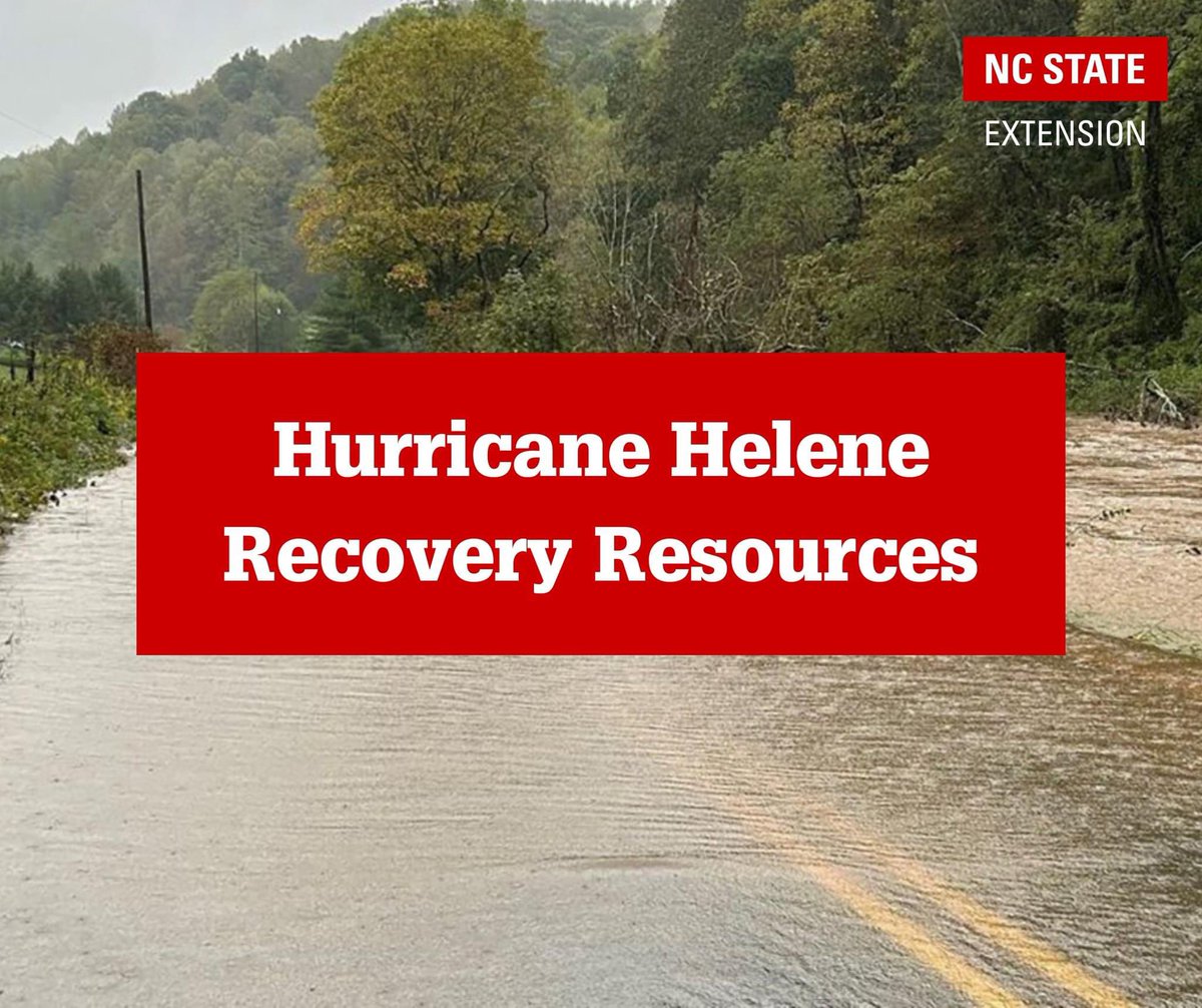
Many of our communities in WNC have been impacted by the destruction of Hurricane Helene. Our hearts are broken by this devastation, and we are here to support you in the ongoing recovery and rebuilding efforts after this disaster. Below we have listed available key resources:

Many of our communities in WNC have been impacted by the destruction of Hurricane Helene. Our hearts are broken by this devastation, and we are here to support you in the ongoing recovery and rebuilding efforts after this disaster. 

Below we have listed available key resources:
NC State Center for Geospatial Analytics (@ncsugeospatial) 's Twitter Profile Photo

On October 17, Ariel Saffer, a Geospatial Analytics doctoral student, will discuss how web news and social media can provide valuable geospatial data on spreading pests to help reduce uncertainty in global, spatiotemporal forecasts of invasive species. cnr.ncsu.edu/geospatial/eve…

On October 17, Ariel Saffer, a Geospatial Analytics doctoral student, will discuss how web news and social media can provide valuable geospatial data on spreading pests to help reduce uncertainty in global, spatiotemporal forecasts of invasive species. cnr.ncsu.edu/geospatial/eve…
NC State Center for Geospatial Analytics (@ncsugeospatial) 's Twitter Profile Photo

At the October 18 Geospatial Forum, Dr. Georgina Sanchez will discuss how geospatial modeling is used to explore alternative strategies for local and regional adaptation to the increasing threats of sea level rise and flooding. Learn more: cnr.ncsu.edu/geospatial/eve…

At the October 18 Geospatial Forum, Dr. Georgina Sanchez will discuss how geospatial modeling is used to explore alternative strategies for local and regional adaptation to the increasing threats of sea level rise and flooding.

Learn more: cnr.ncsu.edu/geospatial/eve…
NC State Center for Geospatial Analytics (@ncsugeospatial) 's Twitter Profile Photo

At our November 1 Geospatial Forum, Dr. Sparkle Malone from Yale University will discuss how the convergence of physical and analytical infrastructure can deepen our understanding of the effects of the Earth's ecosystems on greenhouse gas exchange rates. cnr.ncsu.edu/geospatial/eve…

At our November 1 Geospatial Forum, Dr. Sparkle Malone from <a href="/Yale/">Yale University</a> will discuss how the convergence of physical and analytical infrastructure can deepen our understanding of the effects of the Earth's ecosystems on greenhouse gas exchange rates. cnr.ncsu.edu/geospatial/eve…
NC State Center for Geospatial Analytics (@ncsugeospatial) 's Twitter Profile Photo

The recording of our November 1 Geospatial Forum with Dr. Sparkle Malone, assistant professor of ecosystem carbon capture at Yale University, is now available: youtu.be/VGSfRihjZ9c

NC State Center for Geospatial Analytics (@ncsugeospatial) 's Twitter Profile Photo

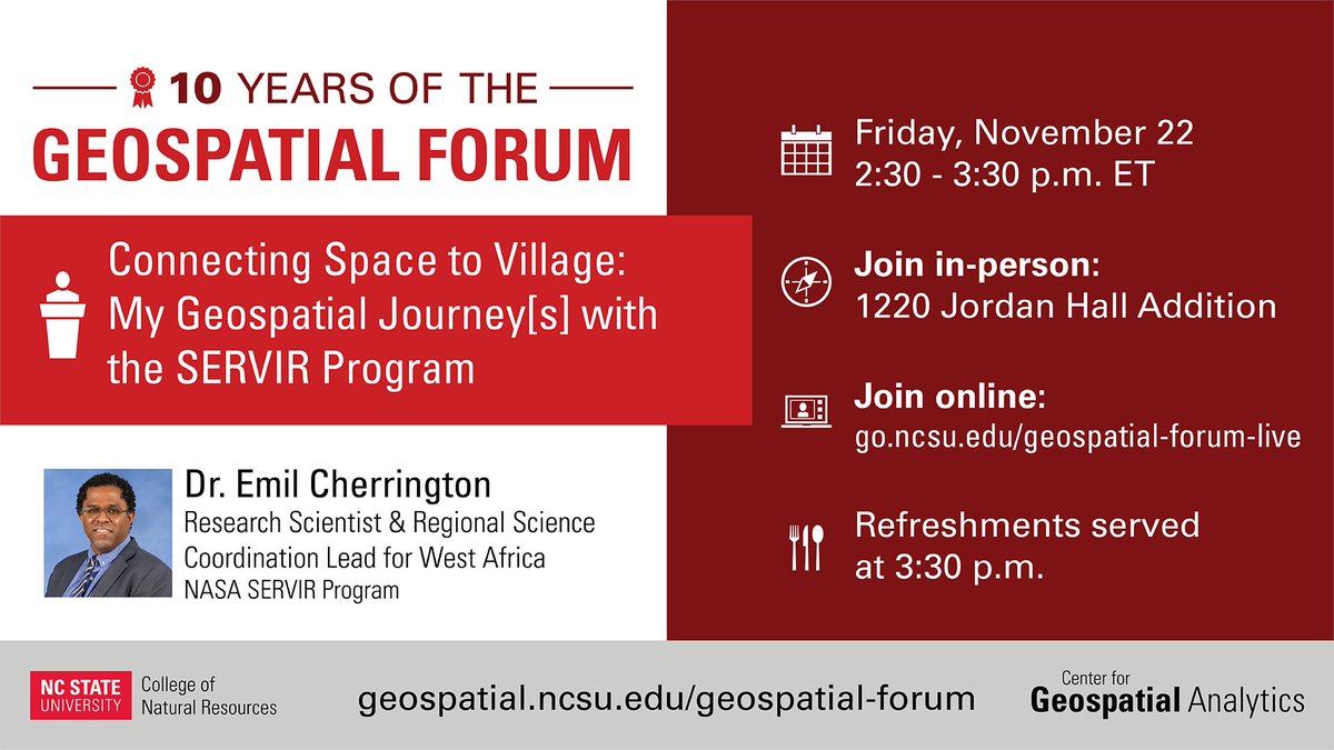
Happy GIS Week! This Friday afternoon, Dr. Emil Cherrington will discuss his nearly two decade career with NASA's SERVIR program and share his thoughts on the future of geospatial artificial intelligence. See all GIS Week events here: gisweekatncstate.org

Happy GIS Week! This Friday afternoon, Dr. Emil Cherrington will discuss his nearly two decade career with <a href="/NASA/">NASA</a>'s SERVIR program and share his thoughts on the future of geospatial artificial intelligence.

See all GIS Week events here: gisweekatncstate.org
NC State Center for Geospatial Analytics (@ncsugeospatial) 's Twitter Profile Photo

This Friday morning, Dr. Emil Cherrington from NASA's SERVIR program will lead an interactive studio that uses open satellite imagery and spaceborne LiDAR data to map land change and model vegetation height. Register here: cnr.ncsu.edu/geospatial/eve…

This Friday morning, Dr. Emil Cherrington from <a href="/NASA/">NASA</a>'s SERVIR program will lead an interactive studio that uses open satellite imagery and spaceborne LiDAR data to map land change and model vegetation height.

Register here: cnr.ncsu.edu/geospatial/eve…
NC State Center for Geospatial Analytics (@ncsugeospatial) 's Twitter Profile Photo

On December 12, Thom Worm, a Geospatial Analytics doctoral student, will discuss his novel research that integrates descriptive and modeling approaches to quantify the bridgehead effect and global invasion rates and patterns for invasive insects. cnr.ncsu.edu/geospatial/eve…

On December 12, Thom Worm, a Geospatial Analytics doctoral student, will discuss his novel research that integrates descriptive and modeling approaches to quantify the bridgehead effect and global invasion rates and patterns for invasive insects. cnr.ncsu.edu/geospatial/eve…
NC State Center for Geospatial Analytics (@ncsugeospatial) 's Twitter Profile Photo

The recording of our Nov. 22 Geospatial Forum with Dr. Emil Cherrington, West African Regional Science Coordination Lead for the NASA/USAID SERVIR program and Principal Research Scientist at the University of Alabama in Huntsville (UAH)’s Earth System Science Center, is available: youtu.be/j_C_v7gn5po

NC State Center for Geospatial Analytics (@ncsugeospatial) 's Twitter Profile Photo

Our Nov. 22 Geospatial Forum Lecture with Dr. Emil Cherrington, West African Regional Science Coordination Lead for the NASA/USAID SERVIR program and Principal Research Scientist at the University of Alabama in Huntsville (UAH)'s Earth System Science Center, is available: youtu.be/EZxK16pneoQ

NC State Center for Geospatial Analytics (@ncsugeospatial) 's Twitter Profile Photo

At this Thursday's Geospatial Forum, Dr. Eleni Bardaka will discuss the socioeconomic impacts of transit infrastructure investments through the application of advanced econometric and spatial analysis methods. More info: cnr.ncsu.edu/geospatial/eve…

At this Thursday's Geospatial Forum, Dr. Eleni Bardaka will discuss the socioeconomic impacts of transit infrastructure investments through the application of advanced econometric and spatial analysis methods.

More info: cnr.ncsu.edu/geospatial/eve…
NC State Center for Geospatial Analytics (@ncsugeospatial) 's Twitter Profile Photo

The recording of our February 6 Geospatial Forum with Dr. Eleni Bardaka, Associate Professor in NC State's Department of Civil, Construction, and Environmental Engineering (CCEE), and a CGA Faculty Fellow, is now available. Watch here: youtu.be/mPt60d_0dNw

NC State Center for Geospatial Analytics (@ncsugeospatial) 's Twitter Profile Photo

In her March 4 public presentation, Deja Perkins will discuss her analysis of socio-spatial gaps in participatory science in the U.S. and how her findings can enhance volunteer data collection, broaden environmental knowledge and democratize science.  cnr.ncsu.edu/geospatial/eve…

In her March 4 public presentation, Deja Perkins will discuss her analysis of socio-spatial gaps in participatory science in the U.S. and how her findings can enhance volunteer data collection, broaden environmental knowledge and democratize science.  cnr.ncsu.edu/geospatial/eve…
NC State Center for Geospatial Analytics (@ncsugeospatial) 's Twitter Profile Photo

In his March 7 public presentation, Varun Tiwari will discuss how Earth observation data and machine learning can be harnessed to support climate-resilient agriculture (rice production) and flood disaster management in data-scarce Bangladesh. cnr.ncsu.edu/geospatial/eve…

In his March 7 public presentation, Varun Tiwari will discuss how Earth observation data and machine learning can be harnessed to support climate-resilient agriculture (rice production) and flood disaster management in data-scarce Bangladesh. cnr.ncsu.edu/geospatial/eve…
NC State Center for Geospatial Analytics (@ncsugeospatial) 's Twitter Profile Photo

At this Thursday's Geospatial Forum, Dr. Matt Dannenberg will discuss the potential for multi-source and multi-resolution remote sensing to improve monitoring of dryland primary production and evapotranspiration: cnr.ncsu.edu/geospatial/eve…

NC State Center for Geospatial Analytics (@ncsugeospatial) 's Twitter Profile Photo

Join us this Thursday for our fifth doctoral student edition of the Geospatial Forum! Four of our Geospatial Analytics Ph.D. students will share their current research in a series of short talks. More info: cnr.ncsu.edu/geospatial/eve…

Join us this Thursday for our fifth doctoral student edition of the Geospatial Forum! Four of our Geospatial Analytics Ph.D. students will share their current research in a series of short talks.

More info: cnr.ncsu.edu/geospatial/eve…
NC State Center for Geospatial Analytics (@ncsugeospatial) 's Twitter Profile Photo

At the April 10 Geospatial Forum, Nick Okafor of trubel&co will discuss how critical GIS, guided by abolitionist strategies, can serve as a transformative tool to amplify fairness and spark civic imagination. More info at: cnr.ncsu.edu/geospatial/eve…

At the April 10 Geospatial Forum, Nick Okafor of trubel&amp;co will discuss how critical GIS, guided by abolitionist strategies, can serve as a transformative tool to amplify fairness and spark civic imagination.

More info at: cnr.ncsu.edu/geospatial/eve…
NC State Center for Geospatial Analytics (@ncsugeospatial) 's Twitter Profile Photo

Curious about CGA’s latest research & real-world impact? Join our symposia, talks, posters & workshops at @IALE_NA next week. Plenty of opportunities to engage, ask questions, and connect—hope to see you there! Learn more: drive.google.com/file/d/1FKYVXV…

Curious about CGA’s latest research &amp; real-world impact?

Join our symposia, talks, posters &amp; workshops at @IALE_NA next week. Plenty of opportunities to engage, ask questions, and connect—hope to see you there!

Learn more: drive.google.com/file/d/1FKYVXV…
NC State Center for Geospatial Analytics (@ncsugeospatial) 's Twitter Profile Photo

IALE-NA just wrapped! Our team showed up as a force of nature—leading sessions on AI in landscape ecology, climate migration, invasive species, wildfire, forest change & more. Geospatial analytics crosses disciplines to address today’s biggest environmental & social challenges.

IALE-NA just wrapped!

Our team showed up as a force of nature—leading sessions on AI in landscape ecology, climate migration, invasive species, wildfire, forest change &amp; more.

Geospatial analytics crosses disciplines to address today’s biggest environmental &amp; social challenges.