NASA Landsat (@nasa_landsat) 's Twitter Profile
NASA Landsat

@nasa_landsat

The NASA/USGS Landsat series of Earth-observing satellites has monitored our planet for over 50 years.

Verification: nasa.gov/socialmedia

ID: 219070649

linkhttp://landsat.gsfc.nasa.gov calendar_today23-11-2010 21:11:42

18,18K Tweet

78,78K Followers

457 Following

NASA Climate (@nasaclimate) 's Twitter Profile Photo

Satellites 🤝 Farmers NASA’s OpenET system turns satellite data into valuable water insights, helping farmers across the U.S. track how much water is lost to air through evapotranspiration and how to better manage their resources. More: go.nasa.gov/4j4wjt2

NASA Landsat (@nasa_landsat) 's Twitter Profile Photo

Can satellites uncover hidden history? 🛰️🤔 In Stone Town, Zanzibar, researchers are using #Landsat data to map ancient archeological sites, revealing how the city has changed from 1995 to the present. Check out the full story: go.nasa.gov/3YRo3pg

NASA Landsat (@nasa_landsat) 's Twitter Profile Photo

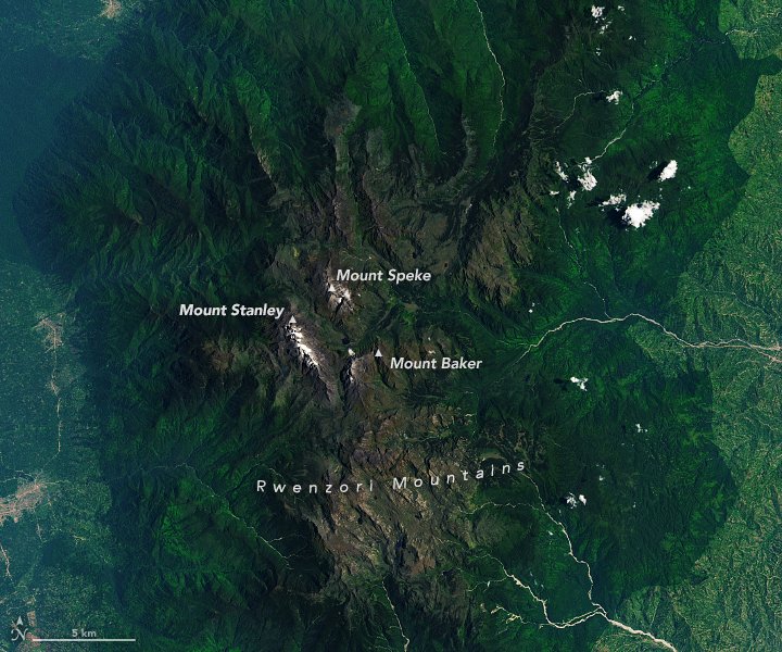
The Rwenzori Mountains in eastern Africa are renowned for their water resources and endemic biodiversity, but like elsewhere in the tropics, the glaciers are dwindling, impacting nearby communities and wildlife. Read the full story: go.nasa.gov/44LNe06

The Rwenzori Mountains in eastern Africa are renowned for their water resources and endemic biodiversity, but like elsewhere in the tropics, the glaciers are dwindling, impacting nearby communities and wildlife.

Read the full story: go.nasa.gov/44LNe06
NASA Earth (@nasaearth) 's Twitter Profile Photo

NASA has a record of Earth observation going back more than 50 years. What’s in store for the next 50? 🌎 Hear from two @nasa scientists in the final podcast episode in Curious Universe’s Earth series. Tune in: go.nasa.gov/3ZomjUy 🎧

NASA has a record of Earth observation going back more than 50 years. What’s in store for the next 50? 🌎 

Hear from two @nasa scientists in the final podcast episode in Curious Universe’s Earth series. Tune in: go.nasa.gov/3ZomjUy 🎧
NASA Earth (@nasaearth) 's Twitter Profile Photo

Severe storms unleashed hail, wind and tornadoes across the U.S. Midwest and Mid-Atlantic on May 16, 2025. Satellites revealed some of the damage in the wake of the storms, like this #Landsat view of a tornado track in southern Illinois. go.nasa.gov/4dvDmdh

Severe storms unleashed hail, wind and tornadoes across the U.S. Midwest and Mid-Atlantic on May 16, 2025. Satellites revealed some of the damage in the wake of the storms, like this #Landsat view of a tornado track in southern Illinois. go.nasa.gov/4dvDmdh
NASA Landsat (@nasa_landsat) 's Twitter Profile Photo

Did you know there are 190 confirmed impact craters on Earth? #Landsat 8 captured an image of the Goyder impact structure in Australia—discovered in the 1990s—overlaid on a digital elevation model to give a sense of the topography. 🛰️ go.nasa.gov/3H6oPbP

Did you know there are 190 confirmed impact craters on Earth? 

#Landsat 8 captured an image of the Goyder impact structure in Australia—discovered in the 1990s—overlaid on a digital elevation model to give a sense of the topography. 🛰️

go.nasa.gov/3H6oPbP
NASA Earth (@nasaearth) 's Twitter Profile Photo

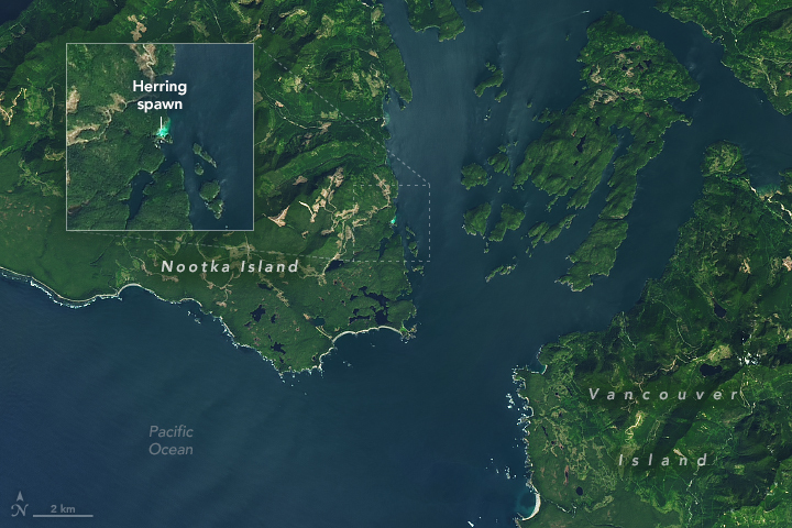
This is near Vancouver Island in British Columbia, Canada. And see that blue glow? That’s a herring spawn! Every spring, thousands of Pacific herring congregate in shallow, vegetated coastal areas around this area to spawn, like in this #Landsat 8 image from April 27.

This is near Vancouver Island in British Columbia, Canada. And see that blue glow? That’s a herring spawn!

Every spring, thousands of Pacific herring congregate in shallow, vegetated coastal areas around this area to spawn, like in this #Landsat 8 image from April 27.
NASA Earth (@nasaearth) 's Twitter Profile Photo

Monitoring Louisiana wetlands from space 🛰️ Scientists are using ARCHIVED - NASA Landsat images to detect both abrupt and gradual changes and to examine how storms, rising seas, human activities, and natural patterns have reshaped coastal ecosystems.

NASA Earth (@nasaearth) 's Twitter Profile Photo

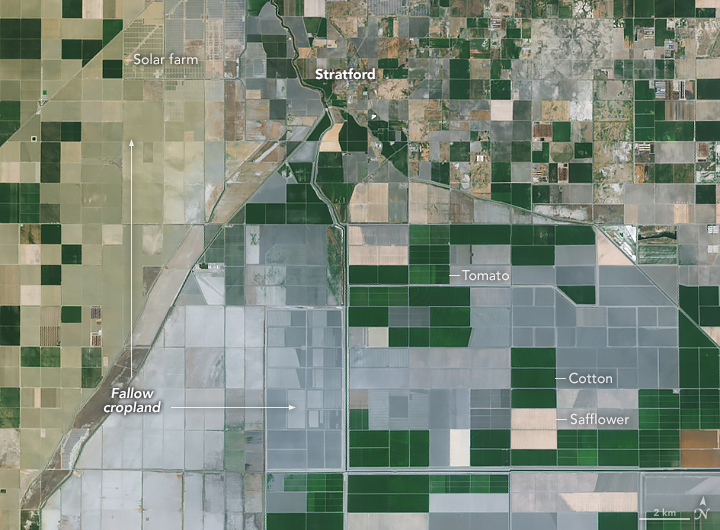
Fallow farmland is the main source of human-caused dust storms in California’s Central Valley region, according to a new study using data from NASA and others. From 2008-2022, 88% of major human-caused dust events were associated with fallow land.

Fallow farmland is the main source of human-caused dust storms in California’s Central Valley region, according to a new study using data from NASA and others.

From 2008-2022, 88% of major human-caused dust events were associated with fallow land.
USGS Landsat (@usgslandsat) 's Twitter Profile Photo

Geometric and radiometric calibration are the backbone of #Landsat's exceptional data quality. The USGS and NASA Landsat Cal/Val Team monitors the geometric and radiometric performance of the instruments to maintain the highest level. Learn more here: ow.ly/h9r250W2vTv.

Geometric and radiometric calibration are the backbone of #Landsat's exceptional data quality. The USGS and NASA Landsat  Cal/Val Team monitors the geometric and radiometric performance of the instruments to maintain the highest level. Learn more here: ow.ly/h9r250W2vTv.
USGS Landsat (@usgslandsat) 's Twitter Profile Photo

These #Landsat images show the Kati Thanda-Lake Eyre in the South Australian outback, the second largest salt lake in the world, after receiving the water from heavy rainfalls throughout the lake’s basin. The darkening blue hues show the water fill in as the month goes on.

USGS Landsat (@usgslandsat) 's Twitter Profile Photo

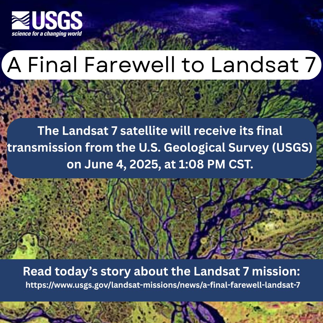
Remembering its 25 years of faithful Earth observation, the USGS and NASA announce the decommissioning of #Landsat 7 from active service June 4th. Read more here: ow.ly/WkTI50W4a0o.

Remembering its 25 years of faithful Earth observation, the USGS and NASA announce the decommissioning of #Landsat 7 from active service June 4th.

Read more here:  ow.ly/WkTI50W4a0o.
USGS (@usgs) 's Twitter Profile Photo

🌎🛰️After 25 years of Earth observation, the USGS bids farewell to #Landsat7 June 4. The legacy continues with Landsat 8 and 9, capturing planetary imagery to support farmers, city planners, and disaster recovery. 👉ow.ly/ZTf150W4mp3 #EarthObservation #NASA

🌎🛰️After 25 years of Earth observation, the USGS bids farewell to #Landsat7 June 4. The legacy continues with Landsat 8 and 9, capturing planetary imagery to support farmers, city planners, and disaster recovery. 

👉ow.ly/ZTf150W4mp3

#EarthObservation #NASA
NASA Landsat (@nasa_landsat) 's Twitter Profile Photo

Important Update: This account will be archived over the coming weeks. For continued access to the latest #Landsat news, important announcements, and resources, please follow NASA Earth and NASA Goddard or visit landsat.gsfc.nasa.gov.

NASA Earth (@nasaearth) 's Twitter Profile Photo

Although tornado damage in the U.S. has decreased slightly, damage to forests in the southeastern U.S. has been on the rise in recent decades according to a 2024 study using a data product based on NASA USGS Landsat imagery. go.nasa.gov/4kyrc5U

NASA Earth (@nasaearth) 's Twitter Profile Photo

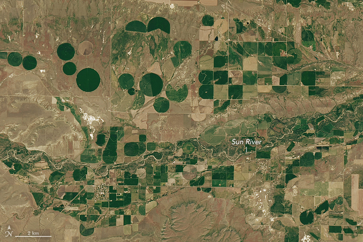
The many shapes and sizes of Montana wheat fields đźšś Landsat images like these can help farmers and resource managers analyze crop health, measure water availability and use, and monitor the impacts of drought and other hazards. go.nasa.gov/4l1NQne

The many shapes and sizes of Montana wheat fields đźšś

Landsat images like these can help farmers and resource managers analyze crop health, measure water availability and use, and monitor the impacts of drought and other hazards. go.nasa.gov/4l1NQne
NASA Landsat (@nasa_landsat) 's Twitter Profile Photo

📢 Reminder: This account will be archived soon. To stay connected to #Landsat news, stories, and resources, follow NASA Earth/NASA Goddard and subscribe to our monthly newsletter: go.nasa.gov/3UIqQ0O 🌎🛰️