Megan Healy (@meganhealytv) 's Twitter Profile
Megan Healy

@meganhealytv

Weather Anchor/Reporter @fox5sandiego | Emmy winning journalist ⚡️ 3x Golden Mike winner
Bay Area native 🌉

ID: 339426284

linkhttp://www.meganhealy.com calendar_today21-07-2011 02:46:30

3,3K Tweet

2,2K Takipçi

604 Takip Edilen

AccuWeather (@accuweather) 's Twitter Profile Photo

🦅 One of Jackie and Shadow’s baby eagles has officially left the nest, marking a historic moment for Big Bear Valley’s most famous eagle family! bit.ly/3T2Srtd

NWS San Diego (@nwssandiego) 's Twitter Profile Photo

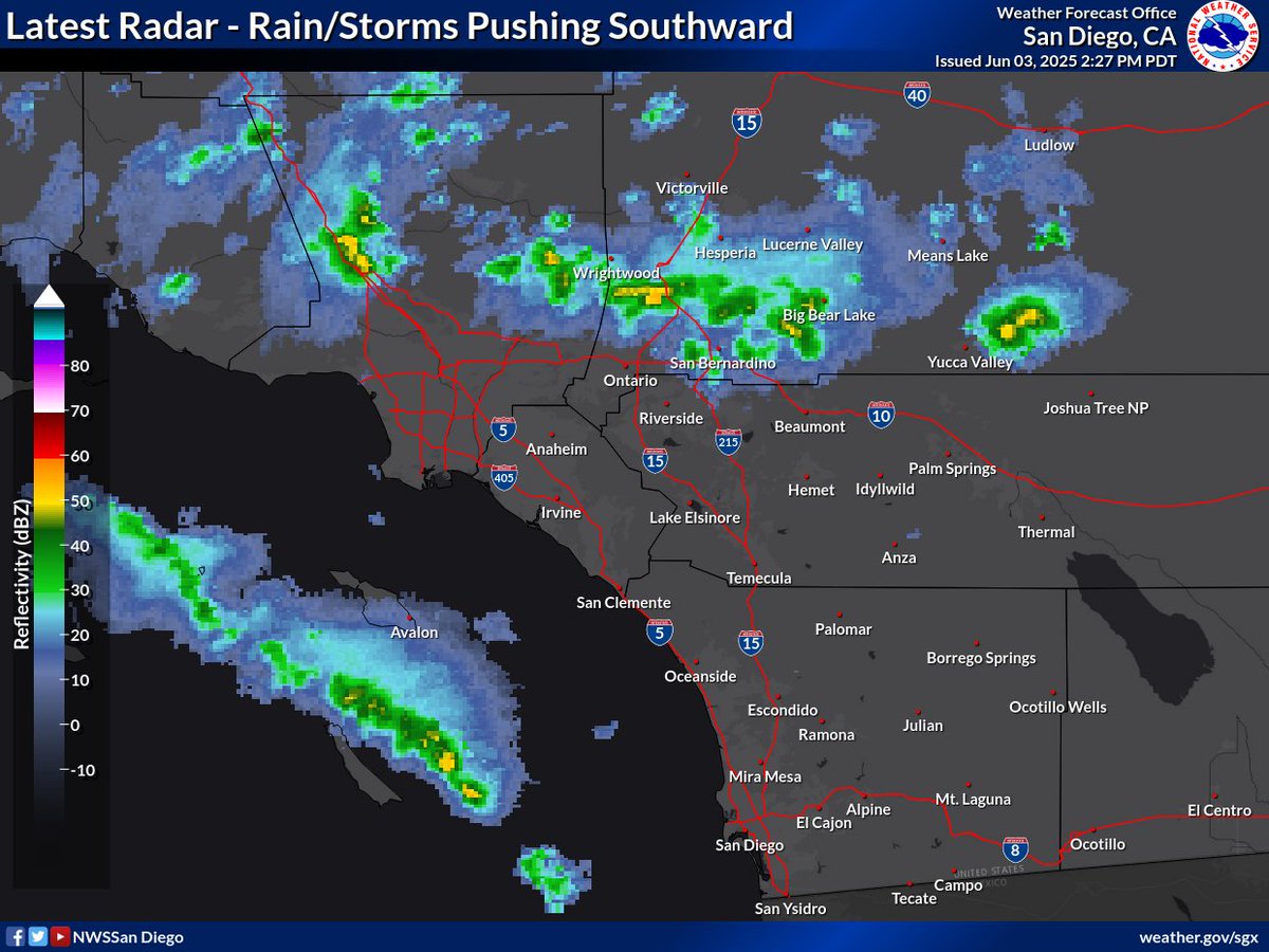
What have you been seeing out there? 🤔⛈️ Showers and storms across the San Bernardino Co mts are starting to push southward into the Inland Empire, leading to isolated activity for SoCal through tonight. #CAwx

What have you been seeing out there? 🤔⛈️

Showers and storms across the San Bernardino Co mts are starting to push southward into the Inland Empire, leading to isolated activity for SoCal through tonight. #CAwx
Dr. Daniel Swain (@weather_west) 's Twitter Profile Photo

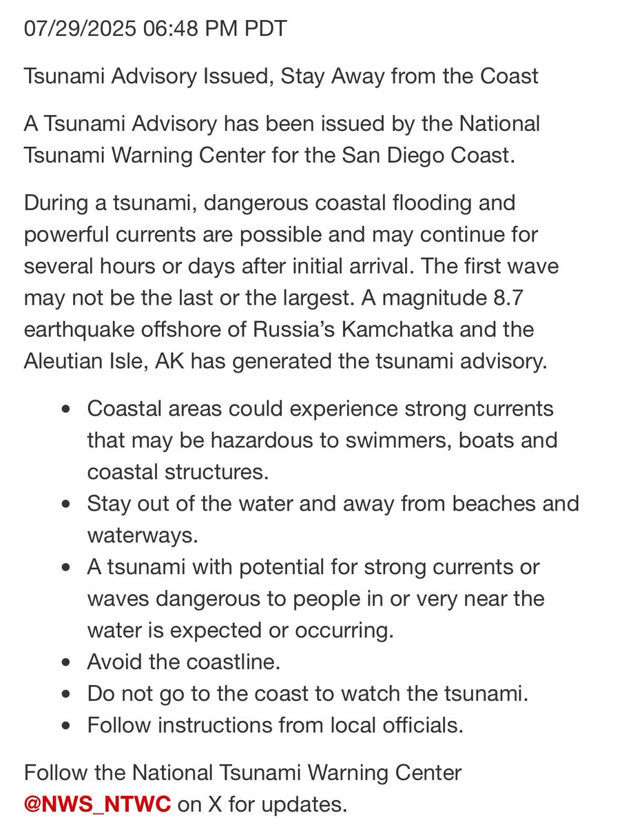
Due to mass confusion, clarifying again: Tsunami Watch: Tsunami of indeterminate magnitude is possible; stand by. Tsunami Advisory: Tsunami is likely *but will probably be small.* Evacuations unlikely. Tsunami Warning: Tsunami is likely *and may be large.* Evacuations needed.

Ryan Hall, Y’all (@ryanhallyall) 's Twitter Profile Photo

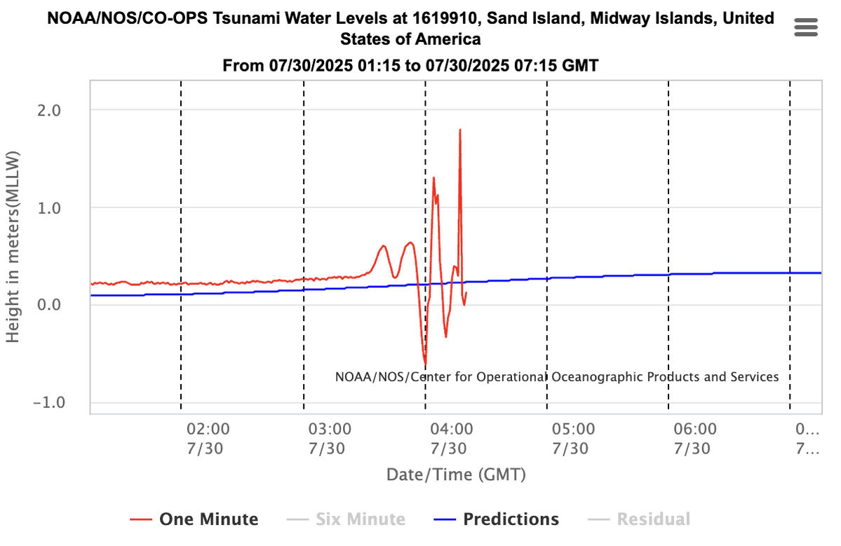
This is what a real tsunami looks like. Over 2 meters of vertical displacement measured at Midway, a huge signal for deep water. Waves like this amplify near shore. Hawaii and other Pacific coasts: this one’s not minor.

This is what a real tsunami looks like.
Over 2 meters of vertical displacement measured at Midway, a huge signal for deep water.
Waves like this amplify near shore.

Hawaii and other Pacific coasts: this one’s not minor.
NWS San Diego (@nwssandiego) 's Twitter Profile Photo

Great info by our friends at NWS Los Angeles! While we still expect lesser conditions here in SoCal, a Tsunami Advisory remains in effect. Please avoid the beaches & continue to monitor the situation on tsunami.gov. Local tide gages found here: tidesandcurrents.noaa.gov/map/index.html

KTLA (@ktla) 's Twitter Profile Photo

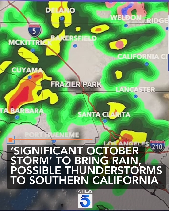
The early season storm is being called the "most significant October storm" to hit Southern California in the last 10 years. Full Story: ktla.com/news/local-new…

The early season storm is being called the "most significant October storm" to hit Southern California in the last 10 years. Full Story: ktla.com/news/local-new…
OC Scanner 🇺🇸 🇺🇸 (@oc_scanner) 's Twitter Profile Photo

BREAKING 🚨 #MorroBay / #California New video shared of the storm passing through Morro Bay this evening just as the storm went Tornado Warned. High winds and raining almost sideways. Tornado rotation could be seen on radar MorroBayOysterCo

WeatherNation (@weathernation) 's Twitter Profile Photo

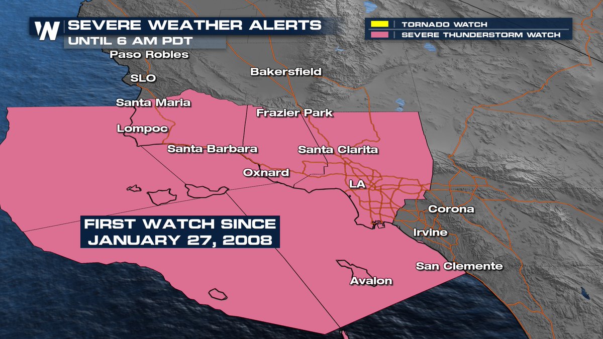
Yes you read that right. The Severe Thunderstorm Watch in place this morning was the first since 2008 for some areas of California!😲

Yes you read that right. The Severe Thunderstorm Watch in place this morning was the first since 2008 for some areas of California!😲
NWS San Diego (@nwssandiego) 's Twitter Profile Photo

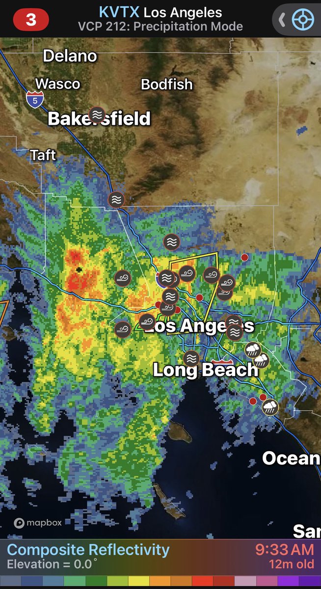
7 AM Radar Update 📡 Rain continues to move through areas east of LA County this morning. The heaviest rain, currently near Ventura, will arrive later this morning in northern areas and into the afternoon hours across southern/eastern areas. #CAwx

NWS Los Angeles (@nwslosangeles) 's Twitter Profile Photo

A narrow line of very heavy rain is just crossing into coastal Los Angeles County, moving from west to east. This line is will likely reach the Franklin and Palisades burn area by 9am. Avoid this area.

Alex Tardy Skiwxman (@sandiegowcmwx) 's Twitter Profile Photo

The core of the unusually strong October storm and precipitation continues to penetrate the LA basin while slowly moving southward, urban flooding and wind damage

The core of the unusually strong October storm and precipitation continues to penetrate the LA basin while slowly moving southward, urban flooding and wind damage
Colin McCarthy (@us_stormwatch) 's Twitter Profile Photo

Amazing satellite imagery of the incredible October storm roaring through California. Multiple Tornado Warnings on the Central Coast, flooding in the Bay Area, the first Severe Thunderstorm Watch in the Los Angeles region in 17 years, and heavy snow in the Sierra Nevada.

NWS San Diego (@nwssandiego) 's Twitter Profile Photo

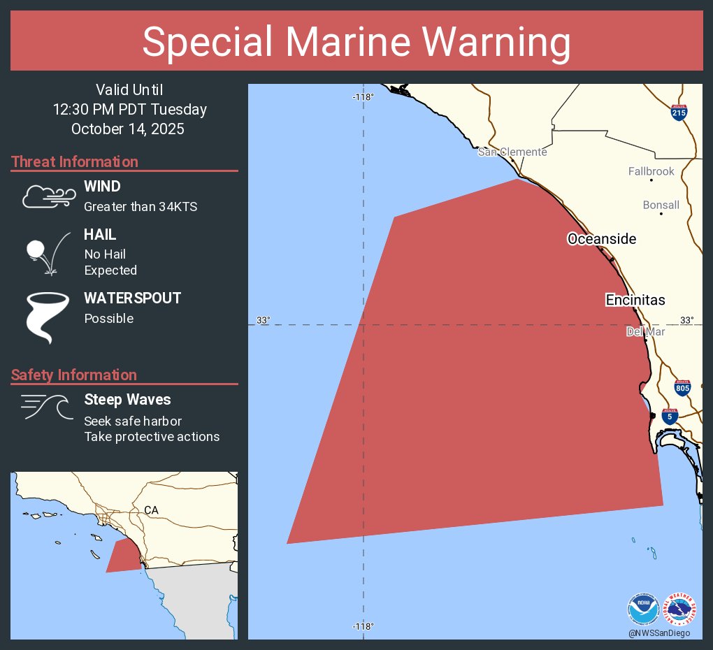
Special Marine Warning including the Waters from San Mateo point to the Mexican Border Extending 10 to 60 nm out including San Clemente Island and Coastal Waters from San Mateo Point to the Mexican Border and out to 10 nm until 12:30 PM PDT

Special Marine Warning including the Waters from San Mateo point to the Mexican Border Extending 10 to 60 nm out including San Clemente Island and Coastal Waters from San Mateo Point to the Mexican Border and out to 10 nm until 12:30 PM PDT
J. Mesh, AMS 🇺🇸 (@realwxforecast) 's Twitter Profile Photo

Followers - What a crazy night and morning in #Socal!! More showers off and on throughout #SoCal, as the storm is making it's way into the OC and SDC, communities. NWS Storm Prediction Center is really painting a good bullseye into #SoCal throughout the day. The Foothills got hit pretty hard as
Followers - What a crazy night and morning in #Socal!!  More showers off and on throughout #SoCal, as the storm is making it's way into the OC and SDC, communities. <a href="/NWSSPC/">NWS Storm Prediction Center</a> is really painting a good bullseye into #SoCal throughout the day. The Foothills got hit pretty hard as
Megan Healy (@meganhealytv) 's Twitter Profile Photo

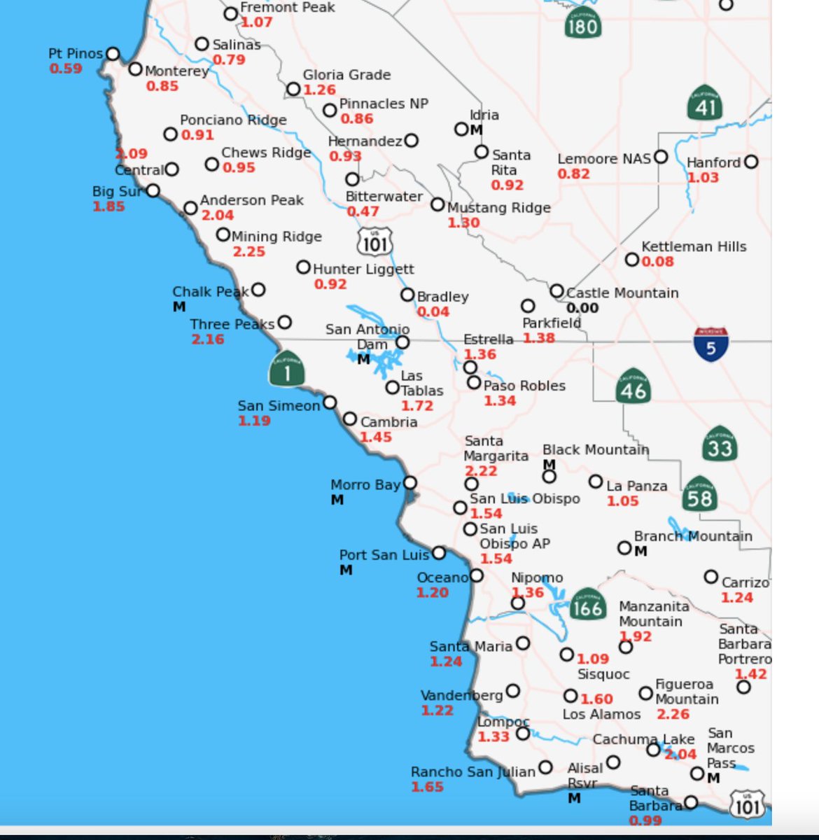
24 hour rainfall totals as of 1:30 p.m. Tuesday 10/14 from impactful Pacific Storm San Luis Obispo: 1.54" Santa Barbara 0.99" Ventura: 1.29" Ojai: 2.21" Malibu: 1.91" Burbank: 2.44" DTLA: 1.27" LAX: 0.65" San Onofre: 0.45" Encinitas: 0.10" (mainly in last 6 hours)

24 hour rainfall totals as of 1:30 p.m. Tuesday 10/14 from impactful Pacific Storm

San Luis Obispo: 1.54"
Santa Barbara 0.99"
Ventura: 1.29"
Ojai: 2.21"
Malibu: 1.91"
Burbank: 2.44"
DTLA: 1.27"
LAX: 0.65"
San Onofre: 0.45"
Encinitas: 0.10" (mainly in last 6 hours)
NWS San Diego (@nwssandiego) 's Twitter Profile Photo

1:30 PM - A line of heavier showers has made it southward to San Diego County. Bouts of heavy downpours are expected. Winds will begin to ease as this line passes as well. #CAwx