Mahdi Motagh
@mahdimotagh
Prof. in Radar Remote Sensing @GFZ_potsdam @UniHannover, interested in remote sensing for earth system science and engineering. Tweets my own
ID: 2726234572
https://www.gfz-potsdam.de/en/staff/mahdi-motagh/ 27-07-2014 11:06:17
1,1K Tweet
1,1K Takipçi
537 Takip Edilen

The IEEE GRSS Turkey Chapter Summer School, UYGU 2024, with the theme of "Remote Sensing for Disaster Management" will be held in Istanbul Technical University, Turkey, between the dates of June 10 - 12, 2024. IEEE Geoscience and Remote Sensing Society IEEE GRSS Türkiye İTÜ - İstanbul Teknik Üniversitesi grssturkey.org/en/uygu2024
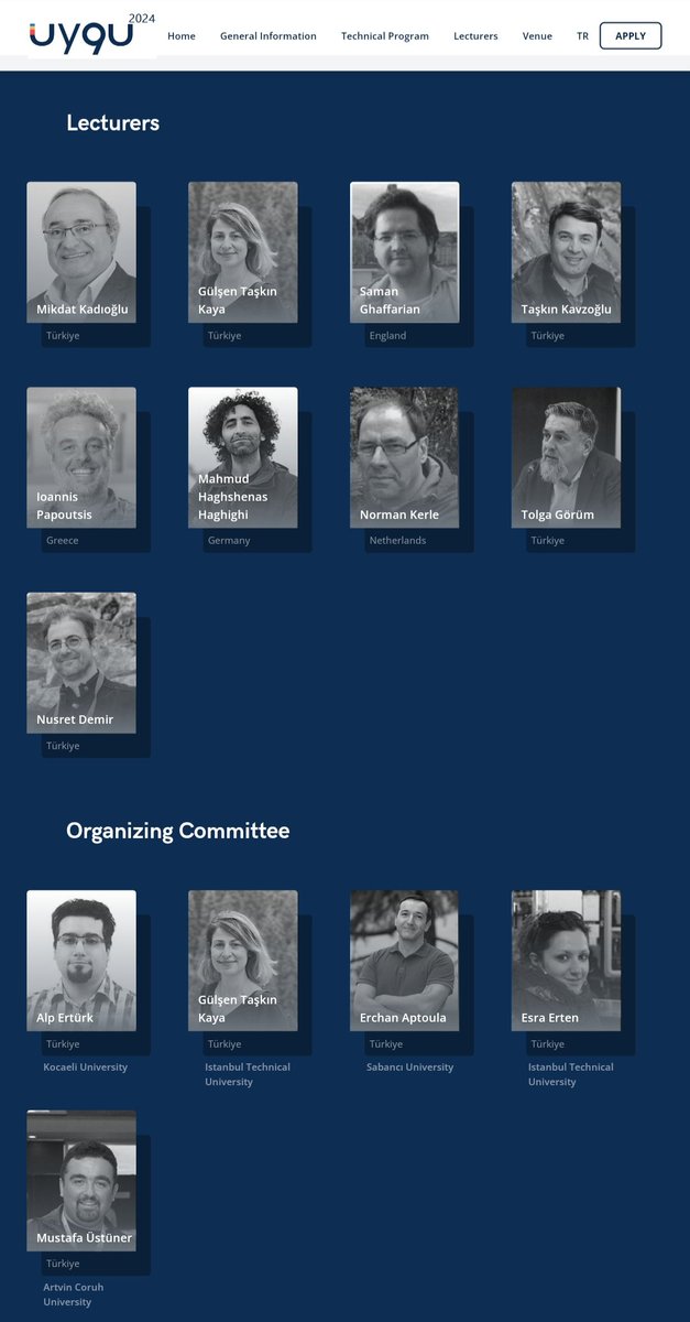

Dr. Mahmud Haghshenas Haghighi, Leibniz Universität Hannover, presents his lecture titled "SAR / InSAR for Geohazards" in UYGU Summer School 2024 in Istanbul Technical University. Mahmud Haghshenas RS4GeoHZ Mahdi Motagh Leibniz Uni Hannover IEEE GRSS Türkiye IEEE Geoscience and Remote Sensing Society



Mahmud Haghshenas, ER, Mahdi Motagh and Sigrid from our group in a visit to 🇹🇼 for scientific cooperation with National Taiwan Normal University to investigate hazards related to #subsidence and #landslide in 🇹🇼 UNESCO Land Subsidence International Initiative


2nd day of expedition in 🇹🇼 . Mahmud Haghshenas, ER & Mahdi Motagh visiting a susidence area in 🇹🇼 . Mahmud Haghshenas makes an experiment for creating a hole on a soil fully saturated with water.

New Paper Alert! In this publication at the #Journal of #Hydrology, led by TangWei, we have shown how decades of effective #water management stategies in northern #China led to reversal of land #subsidence UNESCO Land Subsidence International Initiative Mahdi Motagh Link--> authors.elsevier.com/c/1jZqg52cufA80


Our recent work for #land #subsidence in #Iran that was published earlier this year by Mahmud Haghshenas & Mahdi Motagh in Science Advances was featured in The Guardian UNESCO Land Subsidence International Initiative GFZ Link to Guardian--> theguardian.com/science/2024/s…

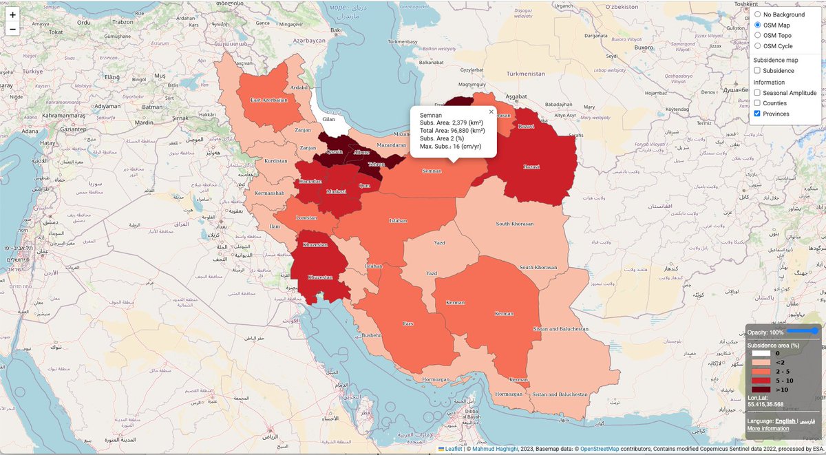
An Interactive map of #land #subsidence in #Iran, developed in a collaboration between Leibniz Uni Hannover & GFZ subsmap.github.io/iran/ Link to paper-> science.org/doi/10.1126/sc… link to Zenodo -> zenodo.org/records/108155… UNESCO Land Subsidence International Initiative United Nations University-FLORES Mahdi Motagh Mahmud Haghshenas


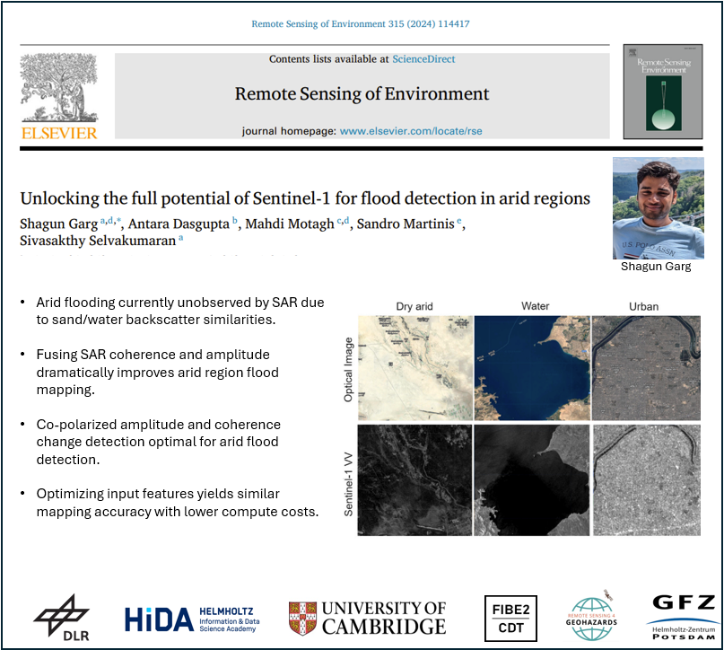
New paper alert! In this new study, led by Shagun Garg-PhD student from Cambridge University & #HIDA scholar at GFZ, we have shown how potentials of #SAR data can be exploited for accurate flood mapping in arid regions link--> sciencedirect.com/science/articl…

In this forum article led by Mahdi Motagh, a team of scientists discusses the critical role of a data-driven #nexus approach in understanding hazards related to #landslides & #land_subsidence Link to paper-> link.springer.com/article/10.100… UNESCO Land Subsidence International Initiative Shagun Garg Francesca Cigna


Analysing complex #SAR #echoes associated with #powerlines is important for inspection management applications. In this paper, we proposed a novel tracing method to analyze #multireflection effects of such objects in #TSX data. Wuhan University link to paper -> ieeexplore.ieee.org/document/10662…


