Chief Meteorologist Lisa Teachman (@lisateachman) 's Twitter Profile
Chief Meteorologist Lisa Teachman

@lisateachman

Chief Meteorologist KSNW-Wichita / Proud Kansan / BS Geosciences, Mississippi State / BA Communication, Wichita State / Emmy Award Winner / AMS Seal of Approval

ID: 1375977096

linkhttp://KSN.com/weather calendar_today24-04-2013 02:40:52

35,35K Tweet

10,10K Followers

2,2K Following

KSN News Wichita (@ksnnews) 's Twitter Profile Photo

The EF-3 tornado that tore through the town of Plevna storm left a path of destruction, but the damage does not meet the threshold required for state or federal disaster aid. ksn.com/weather/weathe…

Chief Meteorologist Lisa Teachman (@lisateachman) 's Twitter Profile Photo

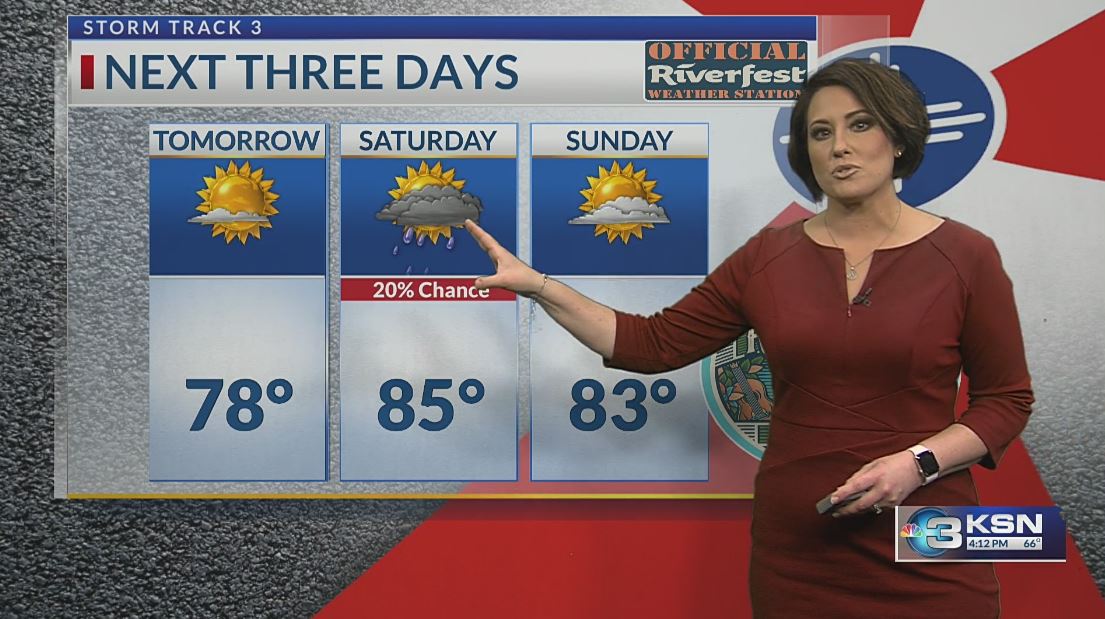
#kswx #okwx #newx STORM TRACK 3 FORECAST 5-29-25: Just about time for Wichita's biggest party of the year -- Wichita Wichita Riverfest ! The KSN News Wichita KSN Storm Track 3 weather team is the official weather sponsor this year. We could not ask for better weather for the Sundown Parade!
#kswx
#okwx
#newx
STORM TRACK 3 FORECAST 5-29-25:  Just about time for Wichita's biggest party of the year -- Wichita <a href="/Riverfest/">Wichita Riverfest</a>  !  The <a href="/KSNNews/">KSN News Wichita</a> <a href="/KSNStormTrack3/">KSN Storm Track 3</a>  weather team is the official weather sponsor this year.  We could not ask for better weather for the Sundown Parade!
Chief Meteorologist Lisa Teachman (@lisateachman) 's Twitter Profile Photo

We may be competitors on TV, but friends behind the scenes with the same goals in mind. Protecting you and your family. Good to see you Jay Prater, CBM KAKE at Wichita Riverfest today. KSN News Wichita KSN Storm Track 3 #kswx Ksn.com/weather

We may be competitors on TV, but friends behind the scenes with the same goals in mind.  Protecting you and your family.  Good to see you <a href="/JayPraterKAKE/">Jay Prater, CBM KAKE</a> at Wichita Riverfest today.

<a href="/KSNNews/">KSN News Wichita</a> <a href="/KSNStormTrack3/">KSN Storm Track 3</a> #kswx 
Ksn.com/weather
Chief Meteorologist Lisa Teachman (@lisateachman) 's Twitter Profile Photo

Three storm trackers walk into a wedding in Hesston… The weather united the 3 of us years ago. It was an honor to attend Storm Tracker Lisa Dimmitt’s daughter’s wedding (and an honor to be asked to do Lisa’ makeup for the event) while being entertained by Storm Tracker Jacob

Three storm trackers walk into a wedding in Hesston…

The weather united the 3 of us years ago.  It was an honor to attend Storm Tracker Lisa Dimmitt’s daughter’s wedding (and an honor to be asked to do Lisa’ makeup for the event) while being entertained by Storm Tracker Jacob
Chief Meteorologist Lisa Teachman (@lisateachman) 's Twitter Profile Photo

SEVERE UPDATE 2:19 PM (6-2-25): The first Severe Thunderstorm Watch of the day is in effect until 9 PM Monday for the Oklahoma Panhandle. Another watch will fill in across Western Kansas later this evening for damaging winds, large hail and a tornado or two. A Flood Watch is

SEVERE UPDATE 2:19 PM (6-2-25):  The first Severe Thunderstorm Watch of the day is in effect until 9 PM Monday for the Oklahoma Panhandle.  Another watch will fill in across Western Kansas later this evening for damaging winds, large hail and a tornado or two.  A Flood Watch is
Chief Meteorologist Lisa Teachman (@lisateachman) 's Twitter Profile Photo

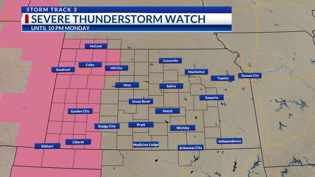
NEW - SEVERE THUNDERSTORM WATCH 3:47 PM (6-2-25): Western Kansas and most of our Southwest Nebraska counties are under a new SEVERE THUNDERSTORM WATCH until 10 PM. Please be weather aware for damaging winds, large hail and a tornado or two. Stay connected with KSN News Wichita

NEW - SEVERE THUNDERSTORM WATCH 3:47 PM (6-2-25):  Western Kansas and most of our Southwest Nebraska counties are under a new SEVERE THUNDERSTORM WATCH until 10 PM.  Please be weather aware for damaging winds, large hail and a tornado or two.  

Stay connected with <a href="/KSNNews/">KSN News Wichita</a>
Chief Meteorologist Lisa Teachman (@lisateachman) 's Twitter Profile Photo

#kswx #okwx #newx STORM TRACK 3 FORECAST (6-2-25): Severe storms track from Western Kansas to the east overnight, capable of 60-80 MPH winds. A slow-moving cold front will produce another round of rowdy weather on Tuesday with an increasing flooding threat. Here is what you

#kswx
#okwx
#newx
STORM TRACK 3 FORECAST (6-2-25):  Severe storms track from Western Kansas to the east overnight, capable of 60-80 MPH winds.  A slow-moving cold front will produce another round of rowdy weather on Tuesday with an increasing flooding threat.  Here is what you
Chief Meteorologist Lisa Teachman (@lisateachman) 's Twitter Profile Photo

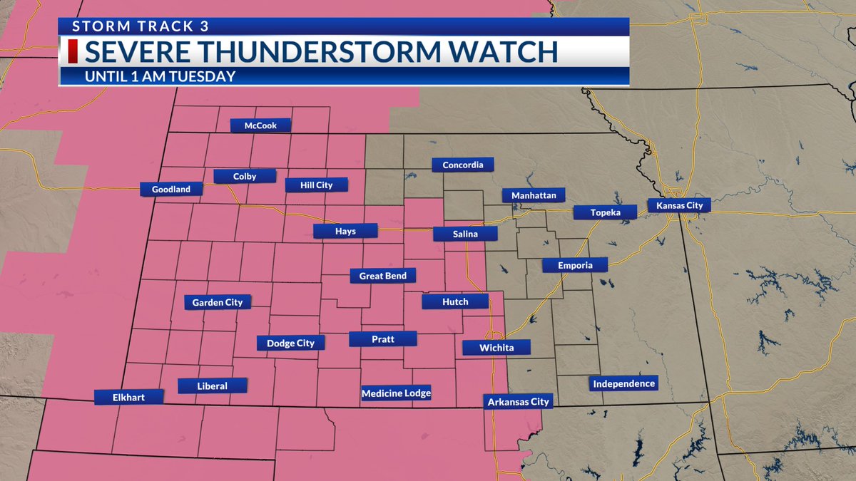
#kswx #okwx #newx SEVERE UPDATE 5:53 PM (6-2-25): A SEVERE THUNDERSTORM WATCH has been expanded farther east. This includes Wichita and Sedgwick County until 1 AM Tuesday. Damaging 60-80 MPH winds are taking center stage. Large hail and a tornado cannot be ruled out. Stay

#kswx
#okwx
#newx
SEVERE UPDATE 5:53 PM (6-2-25):  A SEVERE THUNDERSTORM WATCH has been expanded farther east.  This includes Wichita and Sedgwick County until 1 AM Tuesday.  Damaging 60-80 MPH winds are taking center stage.  Large hail and a tornado cannot be ruled out.
Stay
IEMBot GLD (@iembot_gld) 's Twitter Profile Photo

At 5:54 PM MDT, Sharon Springs [Wallace Co, KS] Law Enforcement reports Tstm Wnd Gst of E80 MPH #kswx mesonet.agron.iastate.edu/lsr/?by=wfo&wf…

Meteorologist Lucy Doll (@lucydollwx) 's Twitter Profile Photo

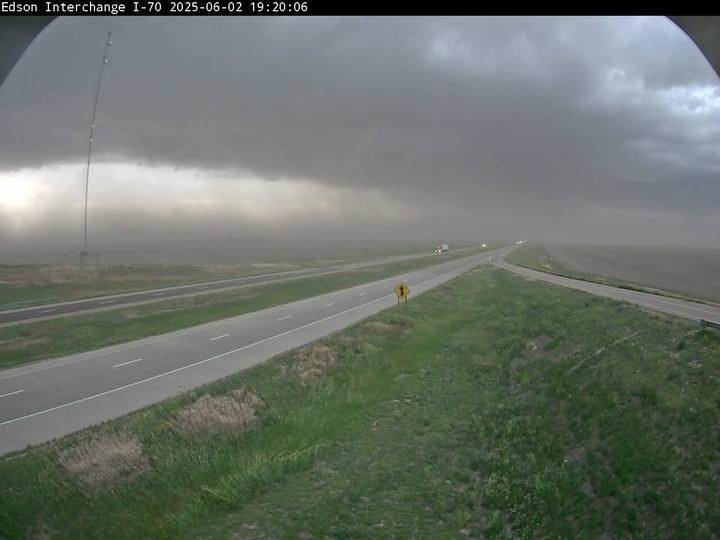
WOW! Check out the dust storm rolling into Edson as strong winds up to 80 MPH are kicking up dirt. This is a DESTRUCTIVE thunderstorm please take shelter if you are in Sherman County. ksn.com/weather Kansas Department of Transportation KSN News Wichita #KSNStormTrack3 #kswx

WOW! Check out the dust storm rolling into Edson as strong winds up to 80 MPH are kicking up dirt. This is a DESTRUCTIVE thunderstorm please take shelter if you are in Sherman County.
ksn.com/weather
<a href="/KDOTHQ/">Kansas Department of Transportation</a> <a href="/KSNNews/">KSN News Wichita</a> #KSNStormTrack3 #kswx
Chief Meteorologist Lisa Teachman (@lisateachman) 's Twitter Profile Photo

Heads up for a line of storms approaching Riverfest by 10:30 PM Monday. Gusty winds (50-60 MPH), heavy rainfall and lightning are all concerns for the downtown area within the hour. KSN News Wichita KSN Storm Track 3 #kswx ksn.com/weather

Chief Meteorologist Lisa Teachman (@lisateachman) 's Twitter Profile Photo

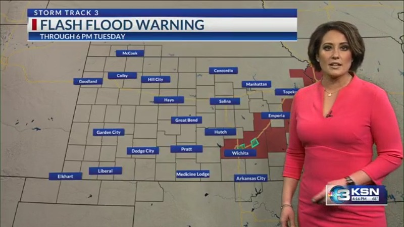
#kswx SEVERE UPDATE - 3 PM (6-3-25): Flash Flood Emergencies and Flash Flood Warnings are in effect right now, including Wichita and El Dorado! Evacuations are happening in El Dorado and multiple roads are in flood. Please, if you come up to an area that is flooded, find

Chief Meteorologist Lisa Teachman (@lisateachman) 's Twitter Profile Photo

#kswx #okwx #newx STORM TRACK 3 FORECAST 6-3-25: Flash Flood Warnings and a Severe Thunderstorm Watch remain in effect through early Tuesday evening. Storms are lining up and tracking east with an approaching cold front. When we briefly dry out ahead of more unsettled weather

#kswx
#okwx
#newx
STORM TRACK 3 FORECAST 6-3-25:  Flash Flood Warnings and a Severe Thunderstorm Watch remain in effect through early Tuesday evening.  Storms are lining up and tracking east with an approaching cold front.  When we briefly dry out ahead of more unsettled weather
Chief Meteorologist Lisa Teachman (@lisateachman) 's Twitter Profile Photo

41 YEARS at KSN News Wichita ! Please join us in congratulating Laura McMillan on her retirement today. I have watched her go from producing our 5 PM newscast to being a rockstar on the web. She is a strong journalist who has meant so much to our team. We are going to miss her

41 YEARS at <a href="/KSNNews/">KSN News Wichita</a> ! 

Please join us in congratulating Laura McMillan on her retirement today.  I have watched her go from producing our 5 PM newscast to being a rockstar on the web.  She is a strong journalist who has meant so much to our team.  We are going to miss her