Jay Yang (@jiueanyang) 's Twitter Profile
Jay Yang

@jiueanyang

Geospatial Data Scientist @ City of Hope | EnvironmentalExposure | Mobility | GeoAI | Health

ID: 49293661

calendar_today21-06-2009 11:20:37

119 Tweet

177 Followers

222 Following

Jay Yang (@jiueanyang) 's Twitter Profile Photo

Thank you AAG Health Geography, we are honored. With the mindset of making scientific efforts more accessible to a broader audience, it's truly encouraging to be acknowledged by our academic community.

Jay Yang (@jiueanyang) 's Twitter Profile Photo

Representing our collab (HDScaleCollab@COH) at AWS Summit Anaheim today. Exploring possibilities and ideas to integrate more cloud-based technologies in our research approach. Let’s meet up and chat about cool thoughts on geospatial and health #AWS #AWSSummitANA2019

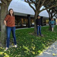
Representing our collab (<a href="/hdscalecollab/">HDScaleCollab@COH</a>) at AWS Summit Anaheim today.   Exploring possibilities and ideas to integrate more cloud-based technologies in our research approach.    Let’s meet up and chat about cool thoughts on geospatial and health #AWS #AWSSummitANA2019
HDScaleCollab@COH (@hdscalecollab) 's Twitter Profile Photo

Join us Thursday or Friday in Fresno for these #FREE workshops on utilizing our online data visualization platform for understanding preterm birth and other health metrics in Fresno County! #pretermbirth #analytics #visualization PTBi Fresno County California Preterm Birth Initiative fresnodata.eventbrite.com

California Preterm Birth Initiative (@ucsfptbi) 's Twitter Profile Photo

We’re exploring why it is so important to use visual data to tell the story of a community's health and we'll teach you how to do it. Join us on 10/21 for a hands-on workshop using a new online mapping tool. #Collaboratory RSVP: bit.ly/StoryMapforCha…

We’re exploring why it is so important to use visual data to tell the story of a community's health and we'll teach you how to do it. Join us on 10/21 for a hands-on workshop using a new online mapping tool. #Collaboratory RSVP: bit.ly/StoryMapforCha…
UC San Diego News (@ucsdnews) 's Twitter Profile Photo

.UC San Diego researchers develop interactive map to help identify possible causes of premature births in central California. #ucsd Qualcomm Institute ucsdnews.ucsd.edu/pressrelease/P…

.<a href="/UCSanDiego/">UC San Diego</a> researchers develop interactive map to help identify possible causes of premature births in central California. #ucsd  <a href="/QI_UCSD/">Qualcomm Institute</a>
ucsdnews.ucsd.edu/pressrelease/P…
Song Gao (@gissong) 's Twitter Profile Photo

#COVID19 Did people in each county react to #SocialDistancing by reducing daily mobility? Yes, but spatial heterogeneity in each state still exists. American Association of Geographers The GeoDS Lab at UW-Madison Geography launches a Web portal for mapping mobility temporal changes geods.geography.wisc.edu/covid19/physic…


#COVID19 Did people in each county react to #SocialDistancing by reducing daily mobility? Yes, but spatial heterogeneity in each state still exists.  <a href="/theAAG/">American Association of Geographers</a>  The GeoDS Lab at <a href="/UWMadisonGeog/">UW-Madison Geography</a>  launches a Web portal for mapping mobility temporal changes
  geods.geography.wisc.edu/covid19/physic…
Grant McKenzie (@grantdmckenzie) 's Twitter Profile Photo

I parsed Google's COVID-19 Community Mobility PDF for #Canada in order to better visualize the data. Someone else might find it useful. #COVID19 #covid19Canada #COVID19data platial.science/covid19/

Jay Yang (@jiueanyang) 's Twitter Profile Photo

Mobility reports by Google is one of the proxies to understand stay-at-home orders, regional lockdowns, and social distancing. Just keep in mind that the data is based on oogle service users. google.com/covid19/mobili…

Jay Yang (@jiueanyang) 's Twitter Profile Photo

COVID-19 resources from Esri includes list of existing data dashboards, can be found at: …virus-disasterresponse.hub.arcgis.com U Penn's COVID-19 Hospital Impact Model for Epidemics (CHIME) model is added to ArcGIS Pro as a toolbox: …virus-disasterresponse.hub.arcgis.com/datasets/chime…

Song Gao (@gissong) 's Twitter Profile Photo

Our lab group feels honored to be featured by UW–Madison News: researchers tracking travel, social media to help contain virus. On, Wisconsin! #StayHomeSaveLives #COVID19 UW-Madison Geography news.wisc.edu/uw-madison-res…
Trisalyn Nelson (@trisalynnelson) 's Twitter Profile Photo

GIScience ALL STARS discuss digital contract tracing technology and privacy issues. The goal is to draft a white paper on the GIScience research agenda. Come join us and bring your questions!

Grant McKenzie (@grantdmckenzie) 's Twitter Profile Photo

CfP: Special issue in the Journal of Location Based Services on "Contact-Tracing, Apps and location-based data for the COVID-19 Pandemic" theinternetofthings.eu/special-issue-…

Jay Yang (@jiueanyang) 's Twitter Profile Photo

For those working on COVID-19 projects, here's a great collection of COVID-19 related APIs provided by Postman. covid-19-apis.postman.com #COVID19 #WebDev

GC@UZH (@gcuzh) 's Twitter Profile Photo

We're looking for a new team member. Got a PhD? Interested in contributing to GIScience research on text and novel data sources to understand the environment? Excited about teaching? Come and join us UZH Geography Apply apply.mnf.uzh.ch/positiondetail…: Views like this in walking distance..

We're looking for a new team member. Got a PhD? Interested in contributing to GIScience research on text and novel data sources to understand the environment? Excited about teaching? Come and join us <a href="/uzh_geo/">UZH Geography</a> 

Apply  apply.mnf.uzh.ch/positiondetail…: Views like this in walking distance..
Yanjia Cao (@geoyanjia) 's Twitter Profile Photo

Had a great time at #GeoMED2022 ! My first in-person academic conference in three years. Presented my work with HDScaleCollab@COH and Jay Yang on food environment comparing. Well, plus a poster on MUAP COVID-19. And a nice tour on campus with Yingjie Hu guided by Avipsa Roy

Had a great time at #GeoMED2022 ! My first in-person academic conference in three years. Presented my work with <a href="/hdscalecollab/">HDScaleCollab@COH</a> and <a href="/JiueanYang/">Jay Yang</a> on food environment comparing. Well, plus a poster on MUAP COVID-19. And a nice tour on campus with <a href="/Yingjie_Hu/">Yingjie Hu</a> guided by <a href="/AvipsaRoy/">Avipsa Roy</a>
HDScaleCollab@COH (@hdscalecollab) 's Twitter Profile Photo

While there are many perks of being a virtual lab, meeting in person is just so wonderful. First time we are all in one spot at #GeoMed2022! With Yanjia Cao Jay Yang

While there are many perks of being a virtual lab, meeting in person is just so wonderful. First time we are all in one spot at #GeoMed2022! With <a href="/geoyanjia/">Yanjia Cao</a> <a href="/JiueanYang/">Jay Yang</a>
Senator Jon Tester (@senatortester) 's Twitter Profile Photo

I was just handed a 479-page tax bill a few hours before the vote. One page literally has hand scribbled policy changes on it that can’t be read. This is Washington, D.C. at its worst. Montanans deserve so much better.

STKO (@stko_ucsb) 's Twitter Profile Photo

THIS IS NOT NORMAL! How can people even tolerate this? The moment small kids need to practice not getting killed in school is the moment a society fails. 'This is America: 9 out of 10 public schools now hold mass shooting drills for students' vox.com/policy-and-pol…