Hannah Attard (@hannahattard) 's Twitter Profile
Hannah Attard

@hannahattard

3x alum of @UAlbanyDAES (PhD, MS, BS). Tweets mostly about the stratosphere.

ID: 151874424

linkhttp://www.atmos.albany.edu/student/hattard calendar_today04-06-2010 13:29:58

553 Tweet

1,1K Takipçi

91 Takip Edilen

Hannah Attard (@hannahattard) 's Twitter Profile Photo

4-year old walks into my office and asks: "Mom, why are you pumping while working?" Me: "Because that's what moms do." "this 'mom penalty' is even higher for women who are better educated... this step back comes with a 'dad premium.'" source: NPR cutt.ly/SgUlcIC

Capital Weather Gang (@capitalweather) 's Twitter Profile Photo

The polar vortex is predicted to be strong, stable and well-behaved to start winter. That means big Arctic outbreaks are less likely and mild conditions are more likely over much of the Lower 48: wapo.st/2IHtDGX w/ Judah Cohen @DrAHButler & Hannah Attard

Hannah Attard (@hannahattard) 's Twitter Profile Photo

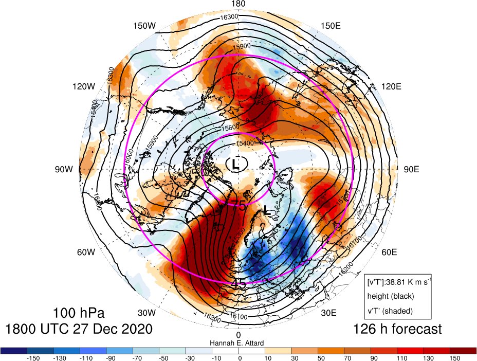
Will it or won't it? GEFS ensemble mean fcsts an SSW ~7 Jan Why? Lower stratospheric (re: 100 hPa) ridge over Greenland and trough over the Russian Far East --> pos. heat flux in east Atlantic & pos heat flux from 150E to 180 --> anomalously positive zonal mean heat flux

Will it or won't it? 

GEFS ensemble mean fcsts an SSW ~7 Jan

Why? Lower stratospheric (re: 100 hPa) ridge over Greenland and trough over the Russian Far East --> pos. heat flux in east Atlantic & pos heat flux from 150E to 180 
--> anomalously positive zonal mean heat flux
Hannah Attard (@hannahattard) 's Twitter Profile Photo

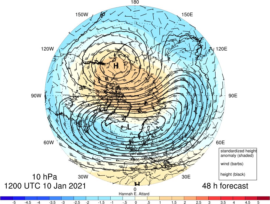
Compare the 10 hPa zonal-mean u forecast at 60N and 65N: At 60N: u is forecast to return to westerly and then back to easterly. (@SimonLeeWx) At 65N: u is forecast to stay easterly. Either way: vortex is elongated and displaced.

Compare the 10 hPa zonal-mean u forecast at 60N and 65N:

At 60N: u is forecast to return to westerly and then back to easterly. (@SimonLeeWx)

At 65N: u is forecast to stay easterly. 

Either way: vortex is elongated and displaced.
Hannah Attard (@hannahattard) 's Twitter Profile Photo

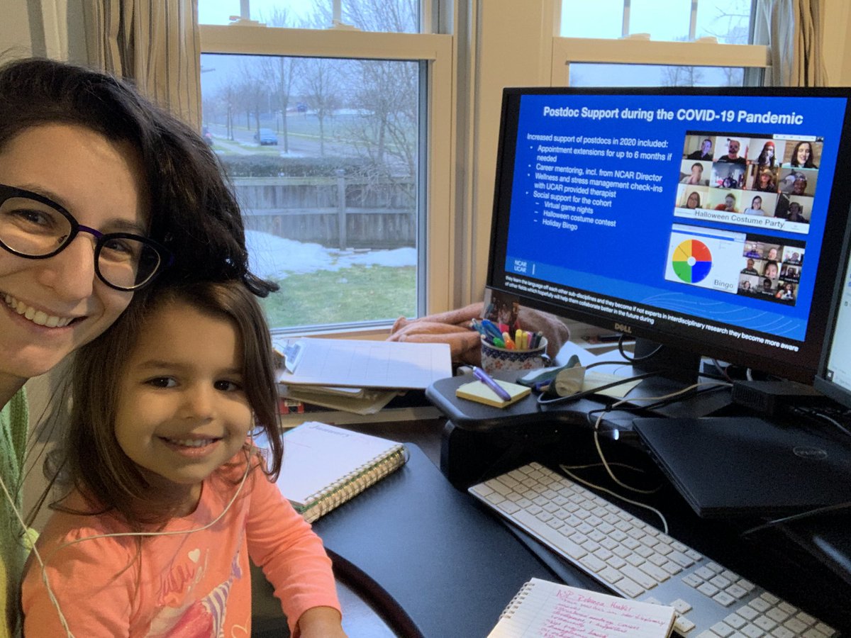
#AMS2021 looks a little different this year but we are still learning a lot! Looking forward to attending the live sessions this week!

#AMS2021 looks a little different this year but we are still learning a lot! Looking forward to attending the live sessions this week!
Hannah Attard (@hannahattard) 's Twitter Profile Photo

A couple observations and learnings from day 1 of #AMS2021 1. Have short video meetings with colleagues/friends -- small groups are best! 2. For the poster session: put your own zoom room in the chat (credit: Andrew Winters ) 3. The science is top notch as always

Hannah Attard (@hannahattard) 's Twitter Profile Photo

Just learned about a Student opportunity for a 3-day workshop this August you're interested in Planetary Boundary Layer: dnwsite.weebly.com/pbl-workshop-2… #AMS2021

AMS BRAID (@amsbraid) 's Twitter Profile Photo

For their tireless effort to build and grow a career in our field, shoutout to all our early career women! Meet Dr. Dr. Rosimar Rios-Berrios who advised "we must be allies to each other", read more about her! #AMSWomen #ChooseToChallenge #WomensHistoryMonth
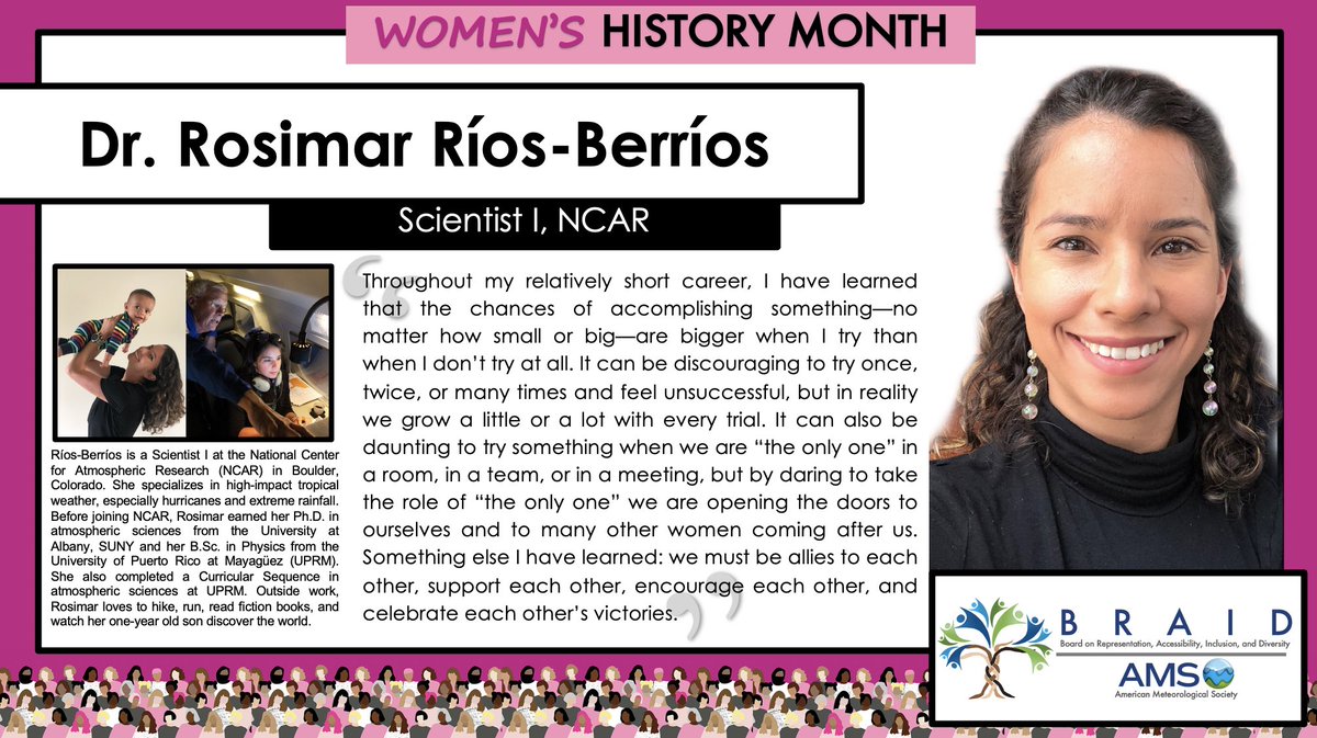
For their tireless effort to build and grow a career in our field, shoutout to all our early career women! Meet Dr. <a href="/RosimarWx/">Dr. Rosimar Rios-Berrios</a> who advised "we must be allies to each other", read more about her!

#AMSWomen #ChooseToChallenge #WomensHistoryMonth
Nick P Bassill (@nickpbassill) 's Twitter Profile Photo

An intense lake effect band is pounding downtown Buffalo right now. The pink dots here are NYS Mesonet at UAlbany-operated New York State Thruway Authority sites, and their camera snapshots give a sense of the conditions. The mesonet's NYSDOT Western NY site at the Skyway (purple) has gusted as high as 59 mph.
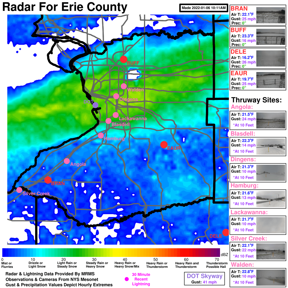
An intense lake effect band is pounding downtown Buffalo right now. The pink dots here are <a href="/nysmesonet/">NYS Mesonet at UAlbany</a>-operated <a href="/NYSThruway/">New York State Thruway Authority</a> sites, and their camera snapshots give a sense of the conditions. The mesonet's <a href="/NYSDOTBuffalo/">NYSDOT Western NY</a> site at the Skyway (purple) has gusted as high as 59 mph.
Naoko Sakaeda (@nsakaeda) 's Twitter Profile Photo

Dr. James Ruppert and I are looking for a Master or PhD-level graduate research assistant to study the S2S prediction skills of the diurnal cycle and MJO over the Maritime Continent. Please see this website (nsakaeda.oucreate.com/open-gra-posit…) or contact me if you have any questions!

NWS Buffalo (@nwsbuffalo) 's Twitter Profile Photo

Let's talk timeline. This will be a long event, with heavy lake effect snow developing tonight and lasting all the way through the weekend. With the lake effect bands slowly changing orientations, no one location will see the heavy snow for the entire duration of the event.🧵

National Weather Service (@nws) 's Twitter Profile Photo

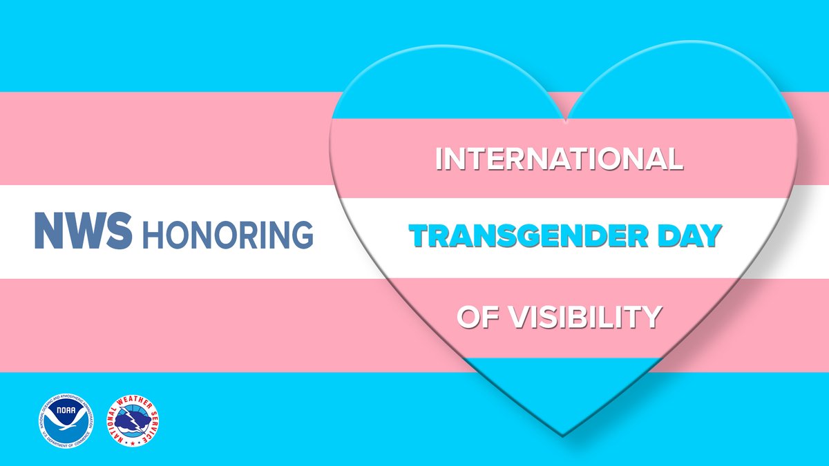
To promote justice, equality, and equity for the transgender community, the National Weather Service family champions and stands alongside our transgender employees on this day and every day! #TransDayOfVisibility

To promote justice, equality, and equity for the transgender community, the National Weather Service family champions and stands alongside our transgender employees on this day and every day! #TransDayOfVisibility
NWS Buffalo (@nwsbuffalo) 's Twitter Profile Photo

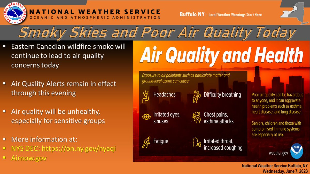
A thick plume of smoke from the eastern Canadian wildfires will continue over the region today, resulting in a noticeable smell of smoke and lower visibility. Air quality will be unhealthy, especially for sensitive groups. Air Quality Alerts remain through this evening. #nywx

A thick plume of smoke from the eastern Canadian wildfires will continue over the region today, resulting in a noticeable smell of smoke and lower visibility. Air quality will be unhealthy, especially for sensitive groups. Air Quality Alerts remain through this evening.  #nywx