GEDI (@gedi_knights) 's Twitter Profile
GEDI

@gedi_knights

NASA/UMD's Global Ecosystem Dynamics Investigation is a lidar mission on the ISS mapping forest structure. Account managed by UMD. Tweet/retweet ≠ endorsement

ID: 2886077429

linkhttp://gedi.umd.edu calendar_today20-11-2014 20:31:06

611 Tweet

6,6K Followers

47 Following

GEDI (@gedi_knights) 's Twitter Profile Photo

Latest press release! 📢 U.S. Senators Chris Van Hollen and Ben Cardin and Congressman Steny Hoyer announce NASA's reinstallation of the #GEDI instrument to its original location on the ISS vanhollen.senate.gov/news/press-rel… Department of Geographical Sciences BSOS @ UMD NASA Goddard

BSOS @ UMD (@bsosumd) 's Twitter Profile Photo

#ICYMI faculty from Department of Geographical Sciences are part of a team that was recently awarded $5M to to explore the potential of a new satellite mission set to launch in 2030 or 2032! Learn more about the Earth Dynamics Geodetic Explorer (EDGE) mission at go.umd.edu/geogEDGE

#ICYMI faculty from <a href="/umdgeography/">Department of Geographical Sciences</a> are part of a team that was recently awarded $5M to to explore the potential of a new satellite mission set to launch in 2030 or 2032!

Learn more about the Earth Dynamics Geodetic Explorer (EDGE) mission at go.umd.edu/geogEDGE
GEDI (@gedi_knights) 's Twitter Profile Photo

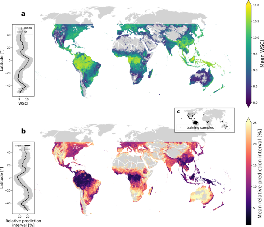
GEDI L4C Footprint Level Waveform Structural Complexity Index, Version 2 has been released! This dataset estimates of prediction intervals for each footprint estimate at 95% confidence. daac.ornl.gov/GEDI/guides/GE…

GEDI L4C Footprint Level Waveform Structural Complexity Index, Version 2 has been released! This dataset estimates of prediction intervals for each footprint estimate at 95% confidence. 

daac.ornl.gov/GEDI/guides/GE…
GEDI (@gedi_knights) 's Twitter Profile Photo

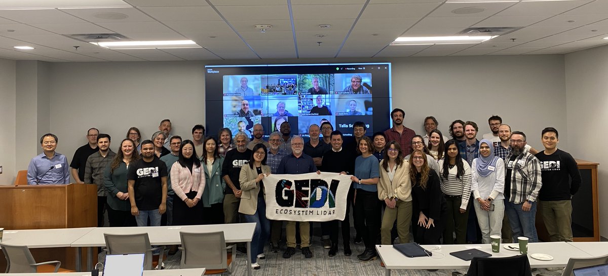
Summary of the 2023 #GEDI Science Team Meeting published in NASA newsletter, The Earth Observer! Check it out to learn more about mission status, data products, and the first competed science team cohorts' research using GEDI! science.nasa.gov/uncategorized/…

Laura Duncanson (@lauraduncanson) 's Twitter Profile Photo

Census + TLS + UAV lidar + airborne lidar in Australia! Led by PI John Armston’s NASA CMS project with huge support from CSIRO, Queensland DESI and UQ we measured a range of vegetation biomass for calval of satellite products GEDI NASA CMS Queensland Science UQ News

Census + TLS + UAV lidar + airborne lidar in Australia! Led by PI <a href="/ArmstonJohn/">John Armston</a>’s <a href="/NASA/">NASA</a> CMS project with huge support from <a href="/CSIRO/">CSIRO</a>, Queensland DESI and UQ we measured a range of vegetation biomass for calval of satellite products <a href="/GEDI_Knights/">GEDI</a> <a href="/NASA_Carbon/">NASA CMS</a> <a href="/qldscience/">Queensland Science</a> <a href="/UQ_News/">UQ News</a>
GEDI (@gedi_knights) 's Twitter Profile Photo

🌳What are old forest ecosystems? 🌲Why are they important? 🛰️How does #GEDI help identify and map old and mature forests throughout the United States? Learn more at our website: gedi.umd.edu/applications/o…

🌳What are old forest ecosystems? 
🌲Why are they important? 
🛰️How does #GEDI help identify and map old and mature forests throughout the United States?  

Learn more at our website: gedi.umd.edu/applications/o…
Amazon Conservation (@aca_dc) 's Twitter Profile Photo

New update from MAAP! 🛰️❗ Thanks to the help of two new tools, MAAP #213 gives us a more detailed look at above-ground carbon estimates within protected areas and Indigenous territories in the Amazon. 🌳 amazonconservation.org/how-maap-is-us…

Dr. Susan Rivera 🇵🇷 (@srivera_tw) 's Twitter Profile Photo

I am so pleased to share the GREAT news that the Department of Geographical Sciences-led Global Ecosystems Dynamics Investigation (GEDI) is once again collecting data that will help researchers address the grand challenge that is climate change. Well done, GEDI! x.com/bsosumd/status…

Lin Xiong (@lin_umd) 's Twitter Profile Photo

new 12m resultion of global mangrove canopy height map is online! Using TanDEM-X data, calibrated by GEDI GEDI . Very important datasets for coastal forest structure and blue carbon dynamics! daac.ornl.gov/CMS/guides/CMS…

new 12m resultion of global mangrove canopy height map is online! Using TanDEM-X data, calibrated by GEDI
<a href="/GEDI_Knights/">GEDI</a>
. Very important datasets for coastal forest structure and blue carbon dynamics!
daac.ornl.gov/CMS/guides/CMS…
Department of Geographical Sciences (@umdgeography) 's Twitter Profile Photo

🛰️ At the ASEAN Carbon Trading Workshop in Indonesia, researcher Adrian Pascual Arranz showcased GEDI and TanDEM-X's potential in advancing forest carbon mapping in Southeast Asia. Learn more: go.umd.edu/carbon-mapping #remotesensing #lidar

🛰️ At the ASEAN Carbon Trading Workshop in Indonesia, researcher Adrian Pascual Arranz showcased <a href="/GEDI_Knights/">GEDI</a> and TanDEM-X's potential in advancing forest carbon mapping in Southeast Asia.

Learn more: go.umd.edu/carbon-mapping #remotesensing #lidar