MetCast(@EssexWeather) 's Twitter Profileg
MetCast

@EssexWeather

AI-Enhanced Hyperlocal Weather Forecasts For Essex, England. Stay #WeatherAware. Latest news and updates. Monitored 24 hours a day.

ID:173644912

linkhttps://www.metcast.co.uk calendar_today02-08-2010 00:41:41

152 Tweets

30,9K Followers

105 Following

Follow People
MetCast(@EssexWeather) 's Twitter Profile Photo

Becoming much colder next week with temperatures well below average both during the day and at night. A quick return to milder conditions appears likely by next weekend.

No snow is expected across our area next week, with mostly dry conditions throughout.

Becoming much colder next week with temperatures well below average both during the day and at night. A quick return to milder conditions appears likely by next weekend. No snow is expected across our area next week, with mostly dry conditions throughout.
account_circle
MetCast(@EssexWeather) 's Twitter Profile Photo

Snow showers becoming more widespread for a time this afternoon, risk of ice in places. Met Office warning in force until 03:00 Tuesday:

metoffice.gov.uk/weather/warnin…

account_circle
MetCast(@EssexWeather) 's Twitter Profile Photo

The exact track is uncertain, but another area of heavy rainfall will likely affect Essex tomorrow evening and overnight into Friday. Localised totals of 25-40mm are possible.

The exact track is uncertain, but another area of heavy rainfall will likely affect Essex tomorrow evening and overnight into Friday. Localised totals of 25-40mm are possible.
account_circle
MetCast(@EssexWeather) 's Twitter Profile Photo

will bring very strong winds to much of Essex this afternoon and into the early evening. Wind gusts of 55-60mph are likely inland, perhaps 70mph along the coast.

Amber warning issued by the @MetOffice

#StormHenk will bring very strong winds to much of Essex this afternoon and into the early evening. Wind gusts of 55-60mph are likely inland, perhaps 70mph along the coast. Amber warning issued by the @MetOffice
account_circle
MetCast(@EssexWeather) 's Twitter Profile Photo

Showers developing just off the Essex coast moving further inland over the next few hours, falling as snow in places.

Most inland areas have a dry and cold Friday with spells of sunshine. Highs of 3C.

account_circle
MetCast(@EssexWeather) 's Twitter Profile Photo

Temperatures falling well below average next week with widespread overnight frosts and daytime highs only a few degrees above freezing.

Temperatures falling well below average next week with widespread overnight frosts and daytime highs only a few degrees above freezing.
account_circle
MetCast(@EssexWeather) 's Twitter Profile Photo

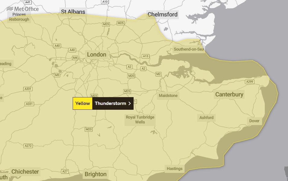
A yellow warning has been issued for parts of Essex tomorrow morning.

Sudden, torrential downpours will bring 15-20 mm of rain in a short period of time. Showers will likely be accompanied by thunder and lightning. Gusts of winds to 40-50 mph are also likely, as is hail.

A yellow warning has been issued for parts of Essex tomorrow morning. Sudden, torrential downpours will bring 15-20 mm of rain in a short period of time. Showers will likely be accompanied by thunder and lightning. Gusts of winds to 40-50 mph are also likely, as is hail.
account_circle
MetCast(@EssexWeather) 's Twitter Profile Photo

Good morning. A wet start to Monday, but the rain soon clearing into the North Sea. Becoming windy for a time as passes well to our north, with gusts to 45mph locally. Highs of 15C.

account_circle
MetCast(@EssexWeather) 's Twitter Profile Photo

Centre of passing over Essex shortly, pressure circa 955mb which is a record low reading for the month of November.

Local media reporting that Essex will be 'battered by winds' soon... not the case. Rain the biggest concern for the rest of the day.

account_circle
MetCast(@EssexWeather) 's Twitter Profile Photo

Amber weather warning cancelled by @MetOffice for Essex coast.

Yellow warning for wind remains in effect for central and eastern districts until 23:59 today.

account_circle
MetCast(@EssexWeather) 's Twitter Profile Photo

Another band of rain pushing northwards through the area currently. Embedded thunderstorms are likely with squally conditions in places.

account_circle
MetCast(@EssexWeather) 's Twitter Profile Photo

Still a lot of uncertainty with the track of tomorrow. For Essex, heavy rain for much of the day (15-20mm) and wind gusts of 50-55mph inland, higher along the coast up to 65mph.

account_circle
MetCast(@EssexWeather) 's Twitter Profile Photo

Heavy, squally rain arriving across Essex this morning. Brighter conditions follow behind before arrives overnight.

account_circle
MetCast(@EssexWeather) 's Twitter Profile Photo

Good morning. A very disturbed week of weather is on the way with two potential storms bringing wet and windy conditions to Essex.

Storm Ciarán expected on Thursday (Met Office warning issued) and another storm is being watched closely for the weekend.

Good morning. A very disturbed week of weather is on the way with two potential storms bringing wet and windy conditions to Essex. Storm Ciarán expected on Thursday (Met Office warning issued) and another storm is being watched closely for the weekend.
account_circle
MetCast(@EssexWeather) 's Twitter Profile Photo

Tonight's rain further west than modelled, therefore nothing significant in terms of rainfall for our area. Met Office warning also cancelled.

account_circle
MetCast(@EssexWeather) 's Twitter Profile Photo

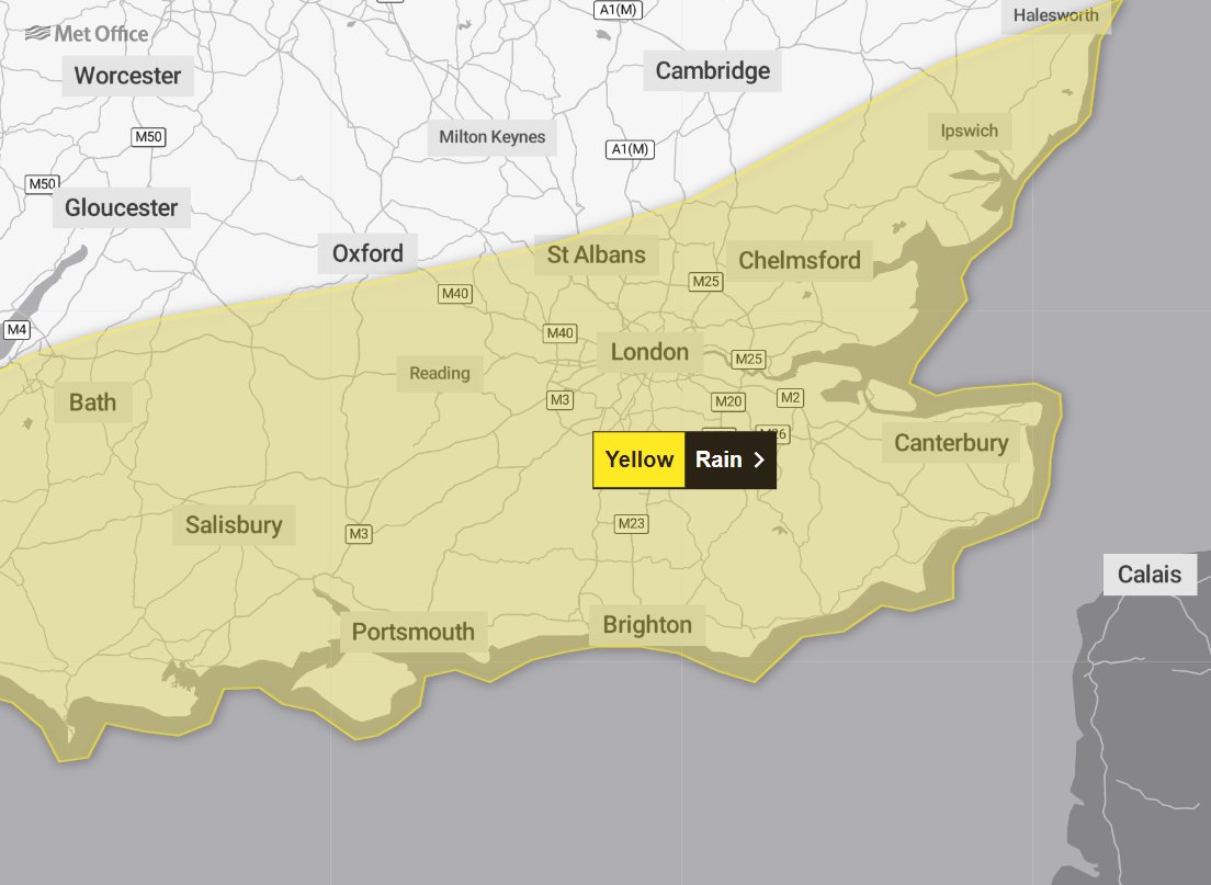
A weather warning has been issued for tonight's heavy rain.

15-25mm of rain is expected widely and is likely to cause some flooding and disruption on Wednesday morning.

A weather warning has been issued for tonight's heavy rain. 15-25mm of rain is expected widely and is likely to cause some flooding and disruption on Wednesday morning.
account_circle
MetCast(@EssexWeather) 's Twitter Profile Photo

Good morning. Overnight rain clearing to allow brighter conditions to develop. A few showers this afternoon, though most areas stay dry. Highs of 15C.

Further rain arriving overnight into Wednesday, some heavy and perhaps thundery.

account_circle
MetCast(@EssexWeather) 's Twitter Profile Photo

Potential for severe weather tomorrow (Friday) morning with widespread rainfall totals of 15-20mm, perhaps over 30mm in places.

There should be an update, perhaps new weather warnings from the Met Office in a few hours.

account_circle
MetCast(@EssexWeather) 's Twitter Profile Photo

Good morning. A cloudy start with showery rain in places, before dry and bright conditions develop.

A scattering of showers and thunderstorms this afternoon, but feeling warmer than in recent days. Highs of 19C.

account_circle
MetCast(@EssexWeather) 's Twitter Profile Photo

Good morning. Dry and bright this morning with early sunshine, before increasingly cloudy conditions arrive this afternoon.

Rain, heavy and persistent affecting all areas this evening accompanied by coastal gales.

account_circle