Ethan Williams (@ewilliams_cbc) 's Twitter Profile
Ethan Williams

@ewilliams_cbc

Reporting and presenting on weather and climate for @CBCSask and @CBCSaskatoon. Story idea? [email protected]. He/him

ID: 1125524239400960000

calendar_today06-05-2019 22:14:24

1,1K Tweet

880 Takipçi

872 Takip Edilen

Jenny Hagan LostInSk (@lostinsk) 's Twitter Profile Photo

Some damage in Gravelbourg #skstorm after the tornado warning. Northern Tornadoes Project 🇨🇦 very isolated. Debris is backwards from wind direction of cell. May be downburst. Rest of town showing some hail damage. Will send the video tomorrow showing the storm
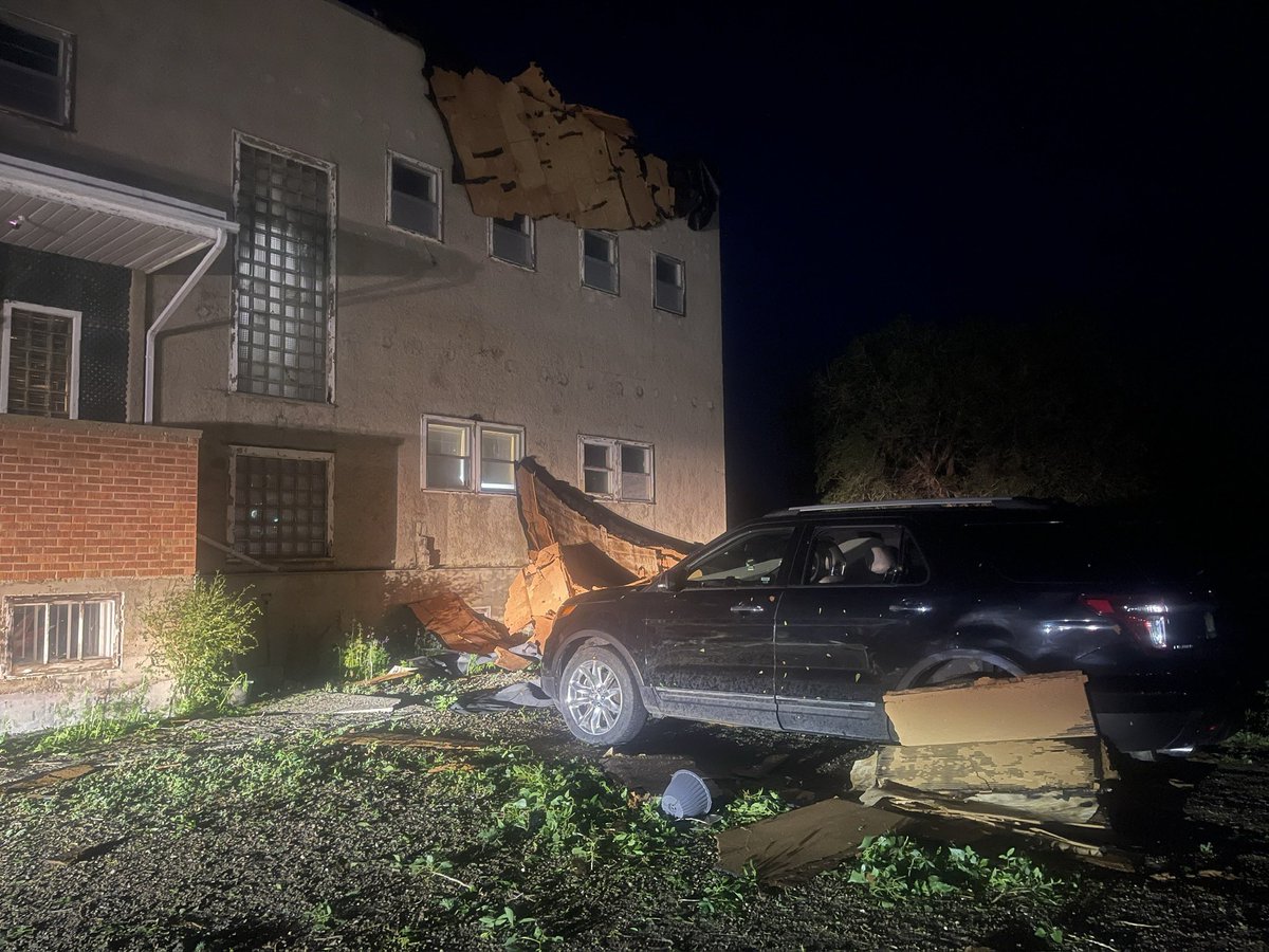
Some damage in Gravelbourg #skstorm after the tornado warning. <a href="/westernuNTP/">Northern Tornadoes Project 🇨🇦</a>  very isolated. Debris is backwards from wind direction of cell. May be downburst. Rest of town showing some hail damage. Will send the video tomorrow showing the storm
Ethan Williams (@ewilliams_cbc) 's Twitter Profile Photo

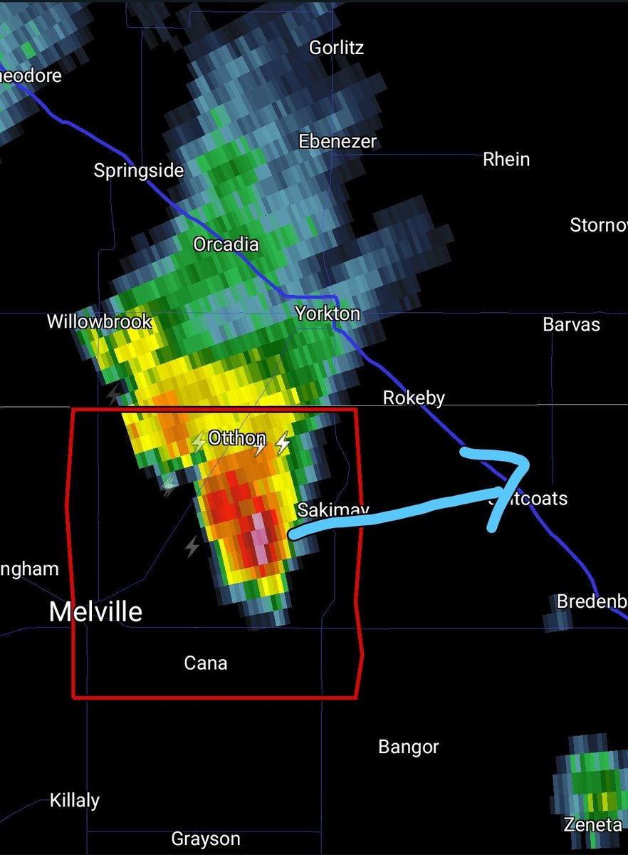
435 PM CST: TORNADO WARNING on this cell in the RM of Cana, headed east toward Sakimay and Saltocats. A member of the public has reported a tornado. Seek shelter now. Melville will NOT be impacted by this storm #skstorm

435 PM CST: TORNADO WARNING on this cell in the RM of Cana, headed east toward Sakimay and Saltocats.

A member of the public has reported a tornado. Seek shelter now.

Melville will NOT be impacted by this storm #skstorm
Ethan Williams (@ewilliams_cbc) 's Twitter Profile Photo

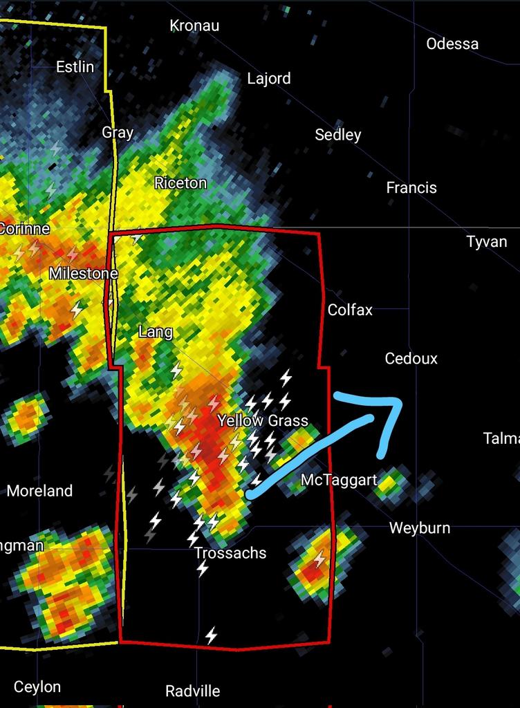
555 PM CST: TORNADO WARNING for RMs of Scott and Brokenshell. Storm is moving NE toward Yellow Grass and could also impact McTaggart. Folks in Weyburn should also be on alert, as it likely will pass just to your NW Seek shelter now #skstorm

555 PM CST: TORNADO WARNING for RMs of Scott and Brokenshell.

Storm is moving NE toward Yellow Grass and could also impact McTaggart. 

Folks in Weyburn should also be on alert, as it likely will pass just to your NW

Seek shelter now #skstorm
Ethan Williams (@ewilliams_cbc) 's Twitter Profile Photo

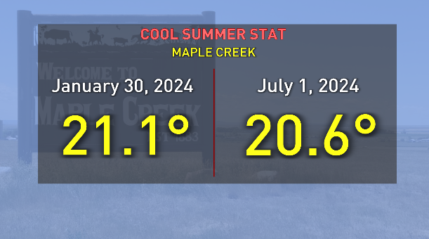
Happy weekend! This one will be much warmer in Sask. compared to last. You're not just imagining it was cooler than normal. In Maple Creek, it was actually warmer on Jan 30 than it was on Canada Day (and 12 days in June) this year #skwx

Happy weekend! This one will be much warmer in Sask. compared to last.

You're not just imagining it was cooler than normal.

In Maple Creek, it was actually warmer on Jan 30 than it was on Canada Day (and 12 days in June) this year #skwx
Ethan Williams (@ewilliams_cbc) 's Twitter Profile Photo

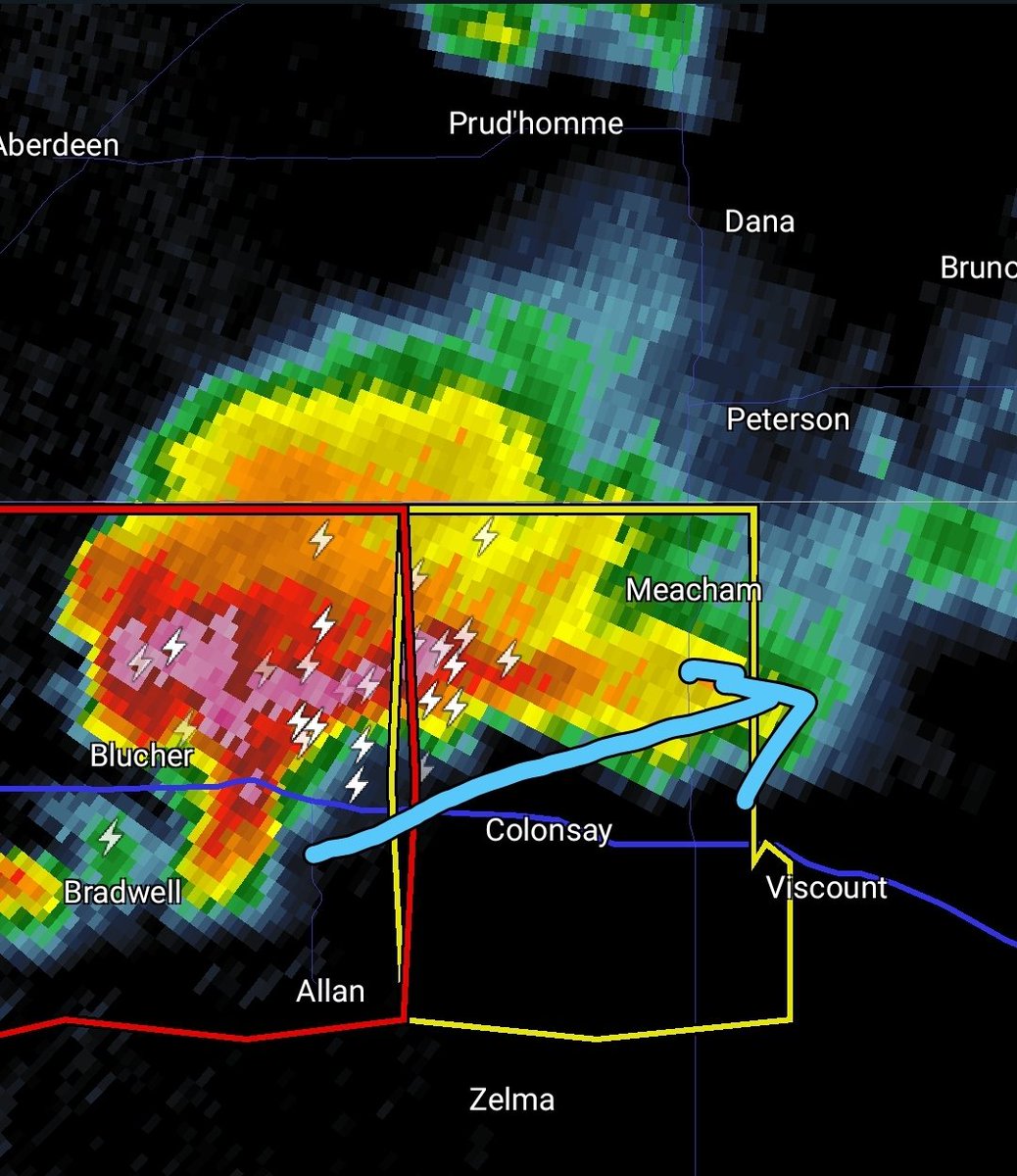
TORNADO WARNING on this cell for RM of Blucher, about to cross into RM of Colonsay. Storm is moving slowly ENE toward Colonsay, Elstow, Meacham and Viscount. This includes HWY 16 between Elstow and Viscount #skstorm

TORNADO WARNING on this cell for RM of Blucher, about to cross into RM of Colonsay.

Storm is moving slowly ENE toward  Colonsay, Elstow, Meacham and Viscount.

This includes HWY 16 between  Elstow and Viscount #skstorm
Ethan Williams (@ewilliams_cbc) 's Twitter Profile Photo

The tornado warning for this storm has ended, but the potential for another touchdown exists. Folks in Whitewood/Grenfell/Broadview should be advised as this cell is headed your way #skstorm

Ryan Crouse (@ryancrouse1) 's Twitter Profile Photo

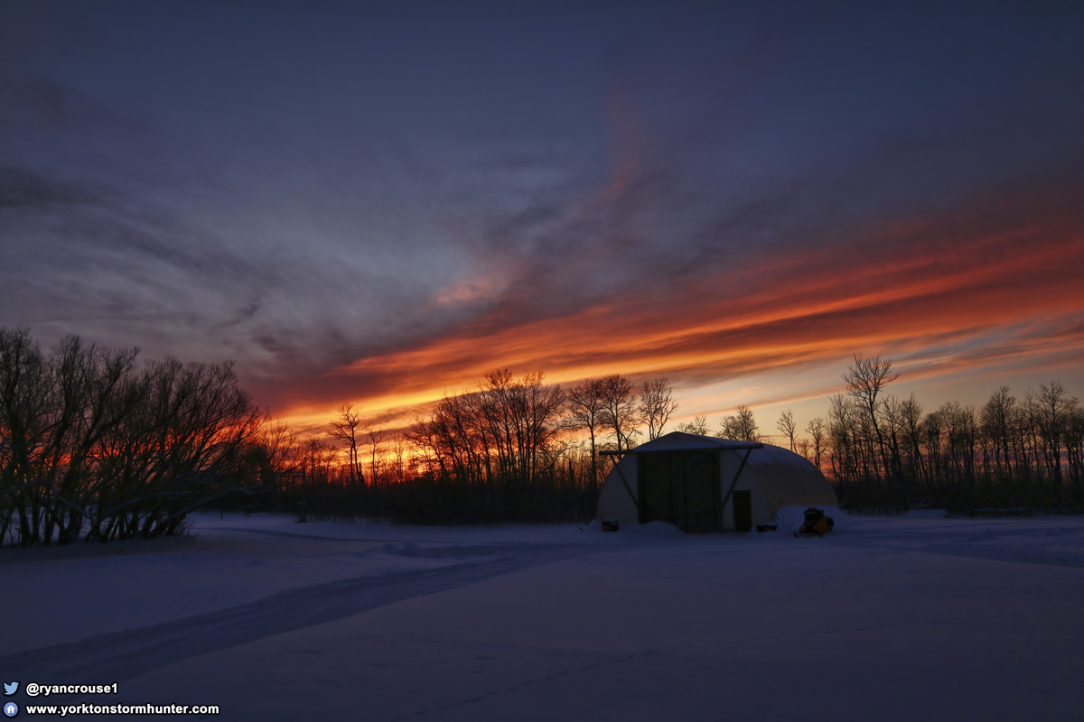
Beautiful #Sunset on #Christmas evening, East of #Yorkton ! #stormhour #storm #thunderstorm #NaturePhotography #ThePhotoHour #natgeoyourshot #photooftheday #BeautifulWorld #exploresask #wxtwitter #stormchasing #weather #skstorm

Beautiful #Sunset on #Christmas evening, East of #Yorkton !
#stormhour #storm #thunderstorm #NaturePhotography #ThePhotoHour #natgeoyourshot #photooftheday #BeautifulWorld #exploresask #wxtwitter #stormchasing #weather #skstorm
World Meteorological Organization (@wmo) 's Twitter Profile Photo

🌍 The WMO confirms 2024 as the warmest year on record, at about 1.55°C above pre-industrial levels. 🔗More in the press release: wmo.int/news/media-cen…