
David Karnes
@davidkarnes3
Chief Meteorologist at Local3News
ID: 912290696
https://www.local3news.com/weather 29-10-2012 12:01:40
14,14K Tweet
5,5K Takipçi
646 Takip Edilen

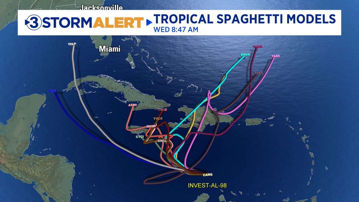
11AM Thursday Tropical Storm Melissa update. The official track has the storm coming MUCH closer to Jamaica, even strafing the south coast with category 4 winds up to 130 mph. Notice the margin of error is still huge, encompassing all of the central Caribbean. David Karnes

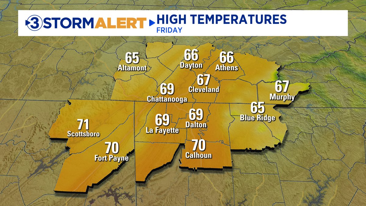
Cool, crisp fall weather through Saturday. Clouds Sunday. Rain Sunday night through Monday. Spotty showers Tuesday. Rain Wednesday afternoon. Clearing Thursday, though a light wintry mix is possible above 2000' in the NC mountains. David Karnes

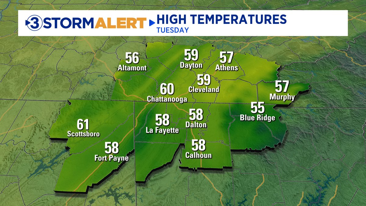
Showers ending tonight. Cloudy, cool Tuesday. Rainy Wednesday. Cool, dry Thursday through the weekend. David Karnes

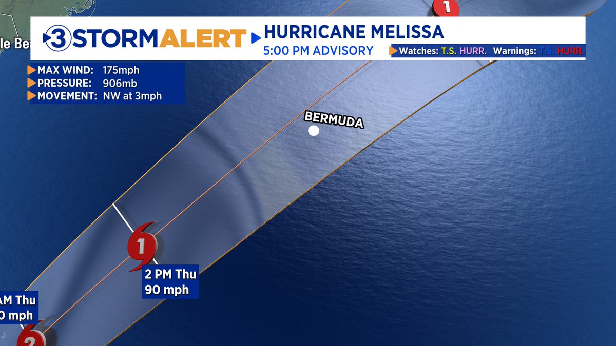
5pm Monday update on Hurricane Melissa. Impacts on Jamaica expected to be flooding rains up to 30", mudslides, 15'-25' wave heights, winds over 100 mph. David Karnes

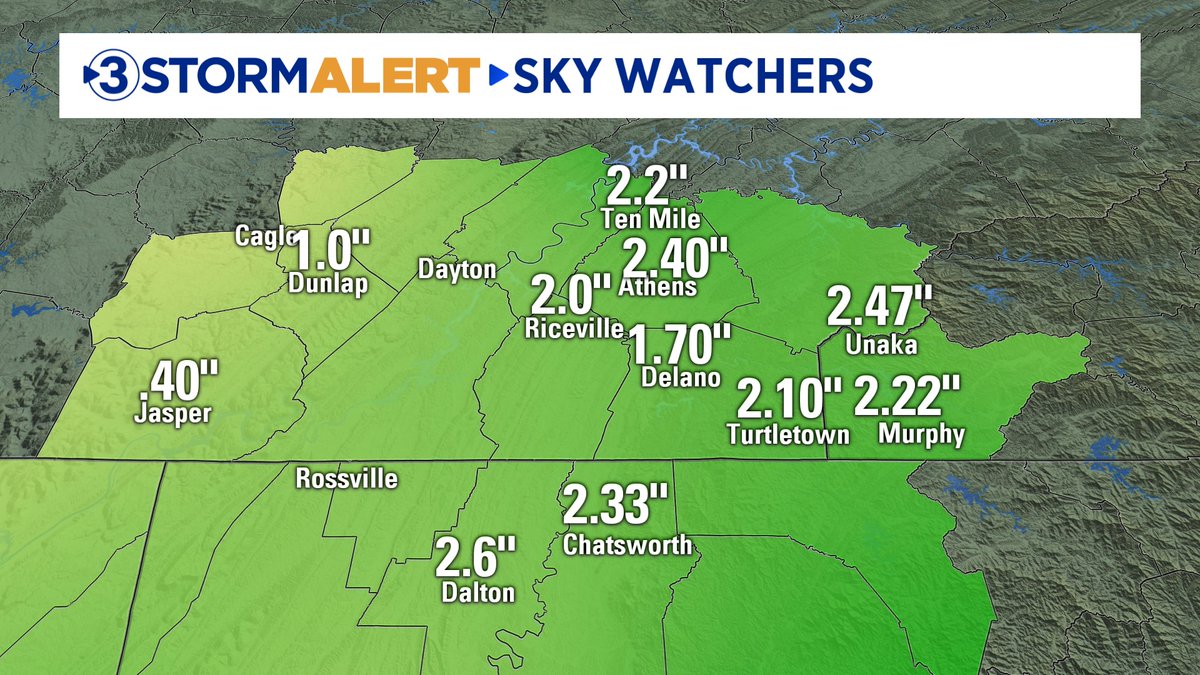
Not much of a warm-up today with the high only hitting 56. Check out some of the rainfall amounts turned in by our awesome Local 3 Weather Sky Watchers! Not a bad drink of water. David Karnes

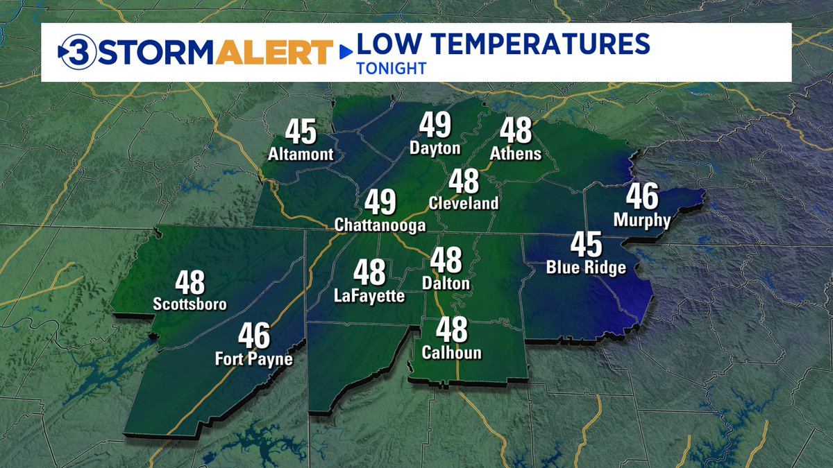
Rainy Wednesday. Clearing, chilly Thursday through the weekend. No weather problems for Halloween. David Karnes

11:33pm Eastern - Hurricane Melissa update heading into the overnight. David Karnes


Where were you during the great "leaf eddy of 2025?". Excellent video of the fall leaves swirling around from Shawn Miller. David Karnes

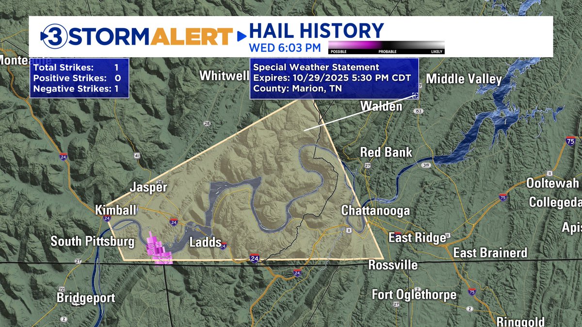
6:03pm Eastern. SPECIAL WEATHER STATEMENT until 5:30 central for parts of Marion and Hamilton Counties. Storm producing small hail and gusts to 30 mph is moving east at 25 mph. David Karnes

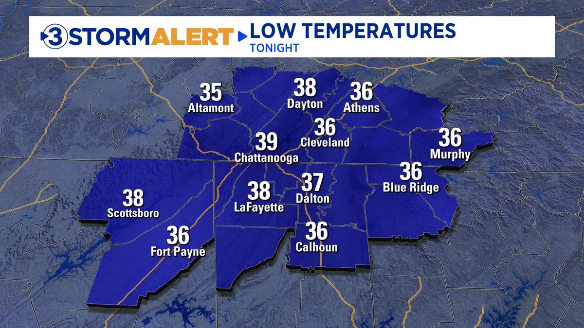
Evening sprinkles. Clearing overnight. Sunny, nice Halloween. Showers Saturday night into Sunday. Clearing, warming next week. David Karnes


WEATHER IN A MINUTE. Short sleeves or sweaters and scarves for Halloween? Here is the quick 1 minute answer. Follow me at David Karnes

We wrap up Daylight Saving Time this weekend. It's also a reminder to check on a few things. With the ceiling fan, when you run it clockwise, it draws cool air up and circulate warm air down keeping you warmer (and saving $$). Share with a friend! Follow me at David Karnes

7:45am Sunday. We will stay pretty rainy through the early afternoon at least. Showers will taper off late afternoon into this evening. Temps likely won’t get out of the low 50s. David Karnes


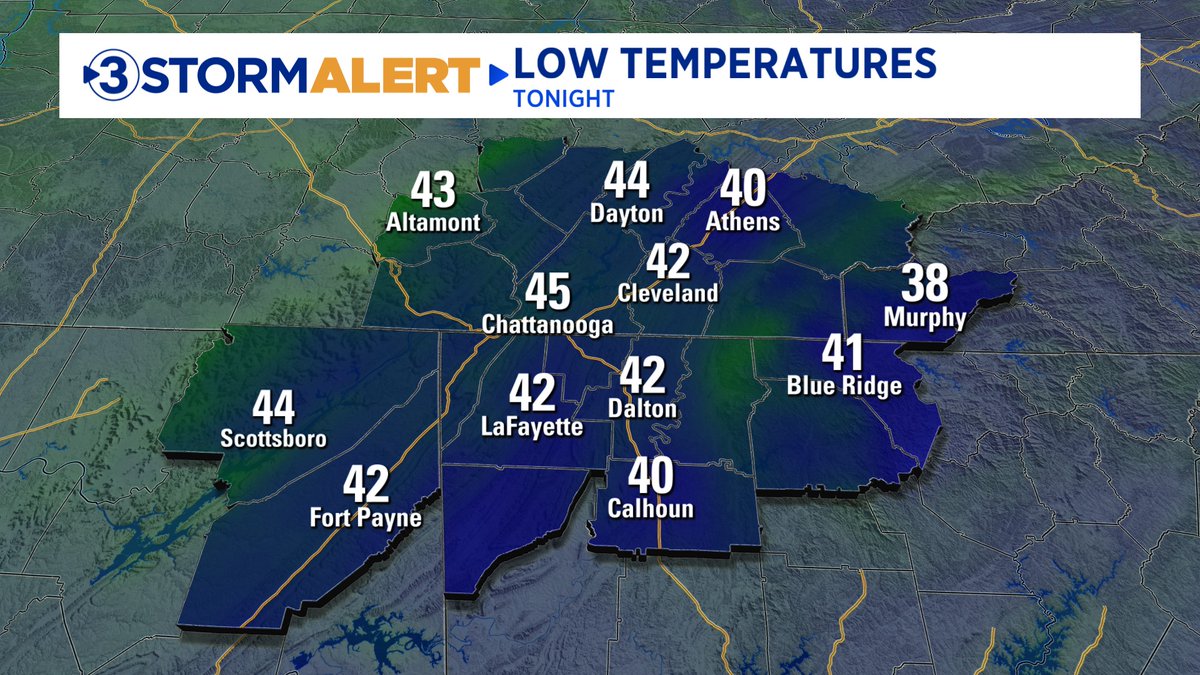
Cool mornings and warm afternoons through Friday. Showers overnight Friday into Saturday. Clearing Sunday with MUCH colder air moving in to start next week. David Karnes

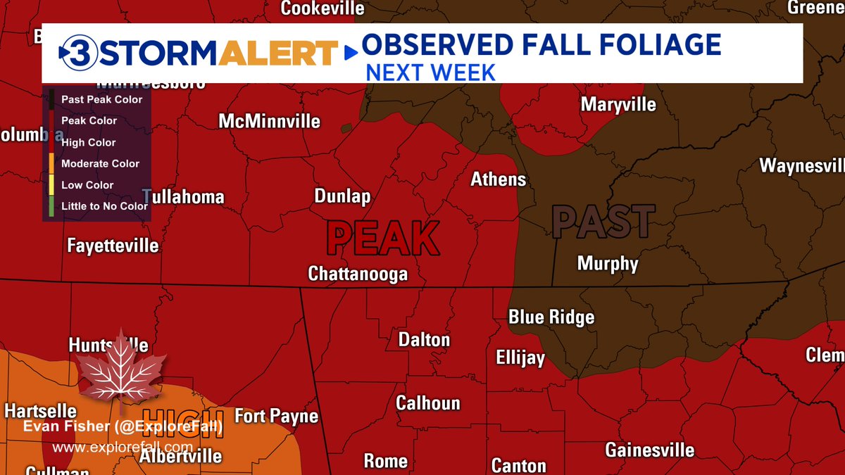
The next two weeks will be THE TIME to see the fall colors (which are pretty amazing this year) in the Tennessee Valley. We will be peaking through next week and then the leaves will start to fall in preparation for winter. Get some great shots while you can! David Karnes

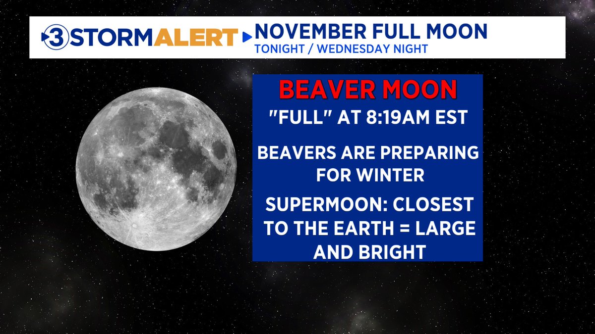
The November "supermoon" will officially be full at 8:19am Wednesday, but it will appear full both tonight and Wednesday night. Skies will be clear so get out there and snap some great pictures! It is super close so it will be a big, bright moon. David Karnes

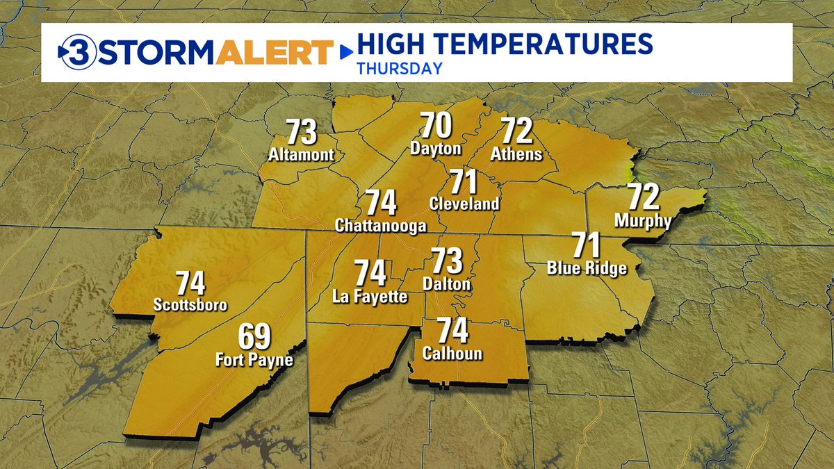
Warm, sunny Thursday. Increasing clouds, showers Friday through Sunday with falling temps Sunday into next week. David Karnes
![David Karnes (@davidkarnes3) on Twitter photo 3:12pm Sunday. Latest radar and FutureCast. Showers / storms moving east of Chattanooga within a couple of hours but showers remain in the Blue Ridge Mtns until about 8 or 9pm. @[19114480] 3:12pm Sunday. Latest radar and FutureCast. Showers / storms moving east of Chattanooga within a couple of hours but showers remain in the Blue Ridge Mtns until about 8 or 9pm. @[19114480]](https://pbs.twimg.com/media/G4xqmeGWQAAl-Vg.jpg)