Denton Police Department
@DENTONPD
Proudly serving the City of Denton, Texas. This account is not monitored 24/7. RTs ≠ endorsements.
Call 911 for emergencies. Non-emergency line: 940-349-8181
ID:41371217
http://www.dentonpolice.com 20-05-2009 14:42:25
14,3K Tweets
53,8K Followers
2,1K Following

EXPECT DELAY on SB I35 at Rector Road between Denton and Sanger. Thankfully no injuries. One lane getting through.
City of Denton, TX Denton Police Department Denton County Scanner DFW Scanner


TRAFFIC UPDATE ON LOCUST/LOOP 288 CLOSURE: WB exit to Locust and Locust northbound access is closed. SB Locust must take Milam as alternate. Expect closure for several hours on this serious crash.
City of Denton, TX Denton Police Department Denton County Scanner DFW Scanner


TRAFFIC ALERT for serious crash involving 2 vehicles. Locust St closed at Loop 288. Expect lengthy closure.
City of Denton, TX Denton Police Department Denton County Scanner


WORKING STRUCTURE FIRE in 500 block of S-I35E producing a lot of smoke. Service road being shut down between Ft. Worth Drive and Teasley.
City of Denton, TX Denton Police Department Denton County Scanner


SEVERE THUNDERSTORM WARNING issued for Denton and should arrive very soon from the south.
City of Denton, TX Denton Police Department Denton Parks & Rec Denton County Scanner


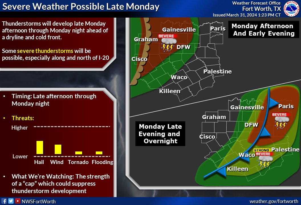
HEADS UP- SEVERE WEATHER AFTER THE ECLIPSE: 48-hours of severe weather potential, with multiple rounds starting this afternoon after 4. 2-3 inches of rain, large hail and tornado potential. Follow us on Facebook for latest. City of Denton, TX Denton Police Department Denton Parks & Rec




SIRENS ACTIVATED for 1.5” and larger hail on the south side of Denton in Crawford/35W area.
City of Denton, TX Denton Police Department Denton Parks & Rec Denton County Scanner

SEVERE THUNDERSTORM WARNING FOR DENTON just issued. Please take shelter now.
City of Denton, TX Denton Police Department Denton Parks & Rec Denton County Scanner
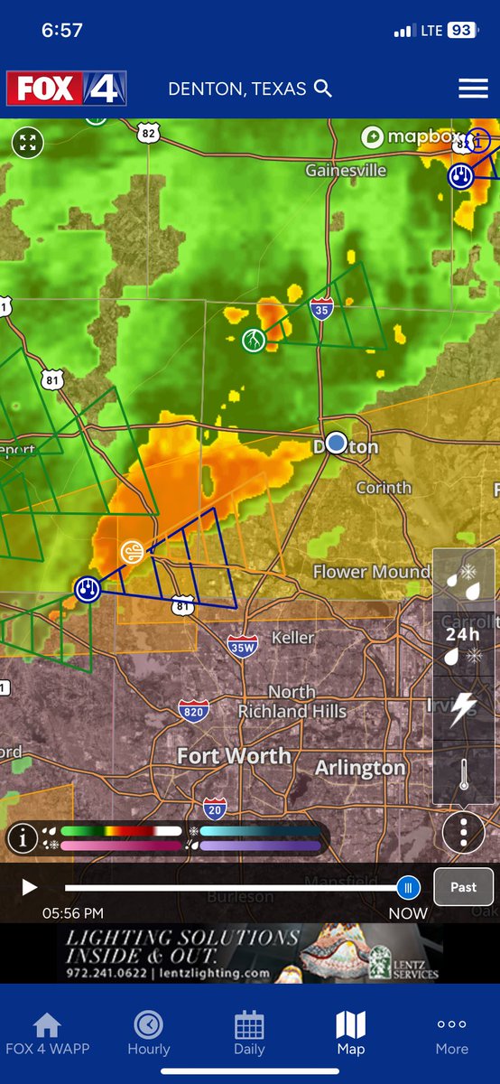





![NWS Fort Worth (@NWSFortWorth) on Twitter photo 2024-04-01 19:57:36 [2:55pm April 1] Severe storms will move in from the west later this afternoon. Threats will include very large hail, damaging wind gusts and a tornado or two. The main tornado threat will be north of the I-20 corridor. Remember to have multiple ways of receiving weather alerts! [2:55pm April 1] Severe storms will move in from the west later this afternoon. Threats will include very large hail, damaging wind gusts and a tornado or two. The main tornado threat will be north of the I-20 corridor. Remember to have multiple ways of receiving weather alerts!](https://pbs.twimg.com/media/GKGpfs9a4AEQ6PH.jpg)
