Cool Kid(@CoolKid3441) 's Twitter Profileg
Cool Kid

@CoolKid3441

ID:1740914088853585920

calendar_today30-12-2023 01:54:02

1,1K Tweets

108 Followers

493 Following

Doppler on Wheels (DOW)(@DOWFacility) 's Twitter Profile Photo

Preliminary Wind Summary Measurements and Analysis from Harlan, IA tornado on Friday (26 April 2024).
Winds of ~224 mph and diameter of max winds of ~2966 ft.
Observations were taken as part of the U.S. National Science Foundation -sponsored project led by karen kosiba and Joshua Wurman
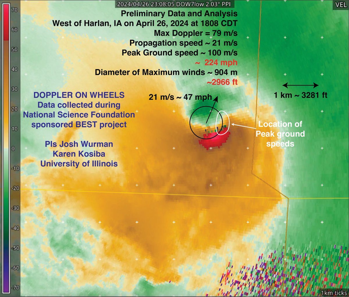
Preliminary Wind Summary Measurements and Analysis from Harlan, IA tornado on Friday (26 April 2024). Winds of ~224 mph and diameter of max winds of ~2966 ft. Observations were taken as part of the @NSF -sponsored #BEST project led by @karen_kosiba and @JoshuaWurman
account_circle
NWS Storm Prediction Center(@NWSSPC) 's Twitter Profile Photo

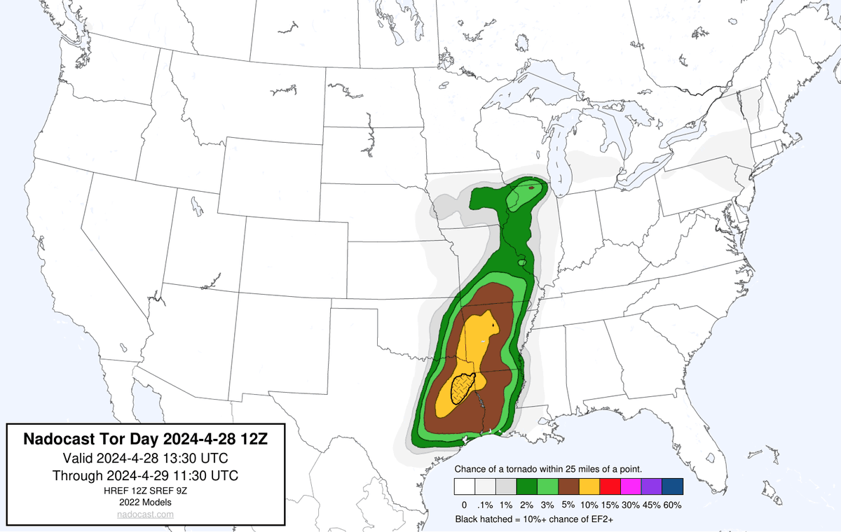
7:42am CDT Day1 Outlook Enhanced Risk: through early tonight from the ArkLaTex southward into east TX spc.noaa.gov/products/outlo…

7:42am CDT #SPC Day1 Outlook Enhanced Risk: through early tonight from the ArkLaTex southward into east TX spc.noaa.gov/products/outlo…
account_circle
NWS Storm Prediction Center(@NWSSPC) 's Twitter Profile Photo

11:27am CDT Day1 Outlook Enhanced Risk: this afternoon and evening across parts of east Texas, northwest Louisiana, and southwest Arkansas. spc.noaa.gov/products/outlo…

11:27am CDT #SPC Day1 Outlook Enhanced Risk: this afternoon and evening across parts of east Texas, northwest Louisiana, and southwest Arkansas. spc.noaa.gov/products/outlo…
account_circle
NWS Storm Prediction Center(@NWSSPC) 's Twitter Profile Photo

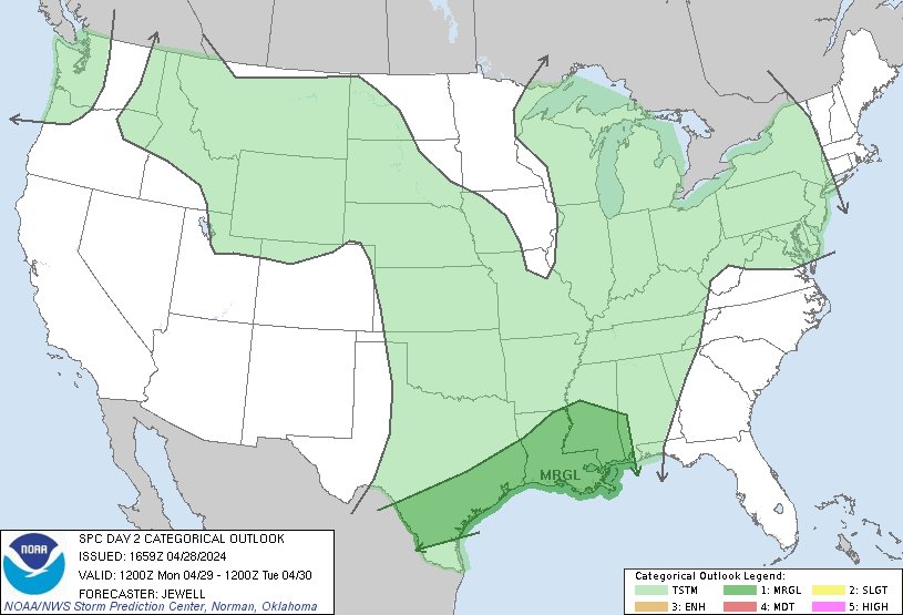
12:01pm CDT Day2 Outlook Marginal Risk: lower Mississippi Valley into parts of southeastern Texas spc.noaa.gov/products/outlo…

12:01pm CDT #SPC Day2 Outlook Marginal Risk: lower Mississippi Valley into parts of southeastern Texas spc.noaa.gov/products/outlo…
account_circle