Changhyun Choi(@ChanghyunChoi13) 's Twitter Profileg
Changhyun Choi

@ChanghyunChoi13

Postdoc researcher in Seoul National University (SNU) with @ryuyr77
Global Biomass / Vegetation monitoring using InSAR and Lidar measurements

ID:1620598456405590016

linkhttps://scholar.google.co.kr/citations?user=NUQMFWEAAAAJ&hl=en calendar_today01-02-2023 01:42:45

67 Tweets

57 Followers

110 Following

Philippe.ciais(@ciais_philippe) 's Twitter Profile Photo

W’re looking for a motivated candidate for a research software engineer position to help our team LSCE IPSL IPSL 🌍 to produce forest maps at scale using satellite imagery, LiDAR, ground data & models

bit.ly/3T1iMaW

🙏for distributing !

W’re looking for a motivated candidate for a research software engineer position to help our team @LSCE_IPSL @IPSL_outreach to produce forest maps at scale using satellite imagery, LiDAR, ground data & #ArtificialIntelligence models bit.ly/3T1iMaW 🙏for distributing !
account_circle
GEDI(@GEDI_Knights) 's Twitter Profile Photo

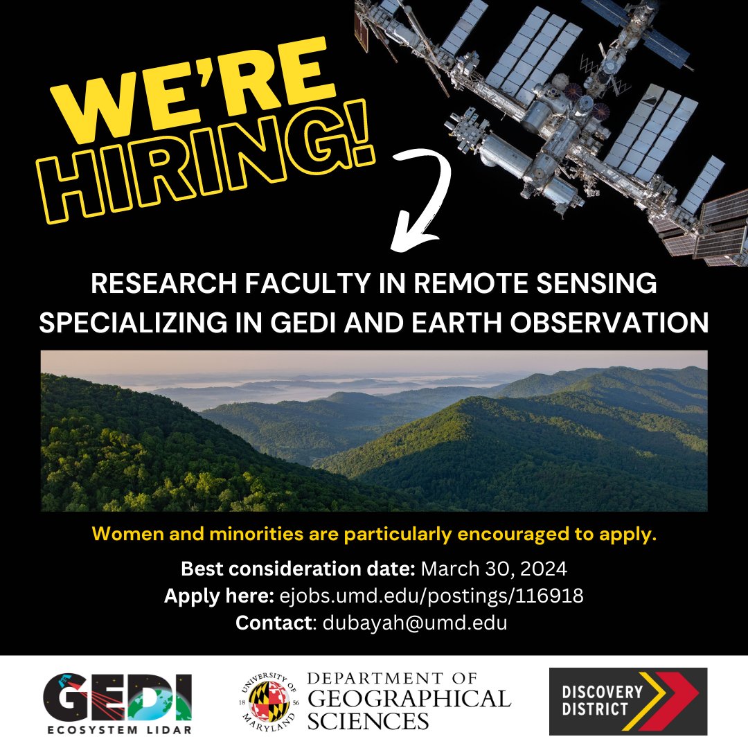
📢 Come work with us! Support projects related to , NASA CMS, mature and old-growth forest monitoring, and more 🌳

🔗ejobs.umd.edu/postings/116918

Please share widely! 🤩

📢 Come work with us! Support projects related to #GEDI, @NASA_Carbon, mature and old-growth forest monitoring, and more 🌳 🔗ejobs.umd.edu/postings/116918 Please share widely! 🤩
account_circle
Xing Li(@XingLi_rs) 's Twitter Profile Photo

Deeply honored to have worked with you and our lovely, amazing team over these past three years. Thank you for all the support and guidance from every team member and from you throughout this journey. I look forward to continuing our collaboration. RyuLab@SNU

account_circle
Patrick Greenfield(@pgreenfielduk) 's Twitter Profile Photo

“The biggest uncertainty we have in terms of atmospheric CO2 driving climate change is the balance between deforestation and subsequent regrowth. GEDI is helping us address that.”

Scientists battle to save 'key' Nasa forest sensor.
👇🌳🌿🌳🛰️
theguardian.com/environment/20…

account_circle
GEDI(@GEDI_Knights) 's Twitter Profile Photo

🚨 Updated L4B country-level summaries of aboveground were published this month!

🌳 gridded 1km x 1km estimates of aboveground biomass density
🌱 data from April 2019 to March 2023
🔍 doi.org/10.3334/ORNLDA…

account_circle
Zhe Zhu 🌎🛰️(@GERSLab) 's Twitter Profile Photo

The GERS Laboratory is hiring a Postdoctoral Researcher to develop new methods for mapping global construction changes based on multi-sensor time series observations and artificial intelligence. Please send your CV to [email protected] if you are interested ASAP.

Please RT!

The GERS Laboratory is hiring a Postdoctoral Researcher to develop new methods for mapping global construction changes based on multi-sensor time series observations and artificial intelligence. Please send your CV to zhe@uconn.edu if you are interested ASAP. Please RT!
account_circle
Martin Brandt(@matin_brandt) 's Twitter Profile Photo

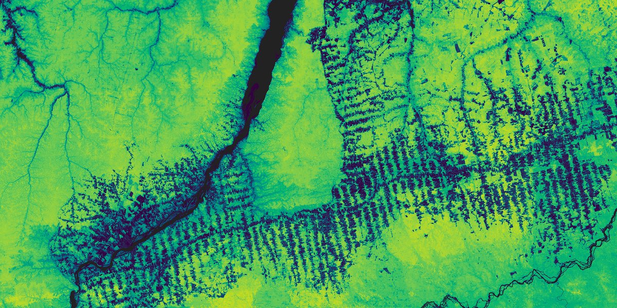
Check our viewer to have a look at our 3-m canopy height map for entire Europe, including both forest and non-forest trees: …-chm-eu-2019.projects.earthengine.app/view/euchm
European Research Council (ERC) Planet Philippe.ciais CTrees
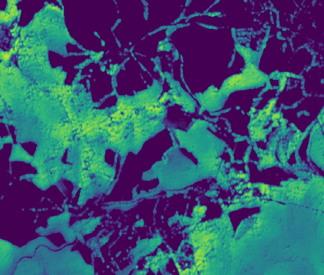
Check our viewer to have a look at our 3-m canopy height map for entire Europe, including both forest and non-forest trees: …-chm-eu-2019.projects.earthengine.app/view/euchm @ERC_Research @planet @ciais_philippe @CTrees_org
account_circle
Sung Ching (Nick) Lee(@sclee_micromet) 's Twitter Profile Photo

Great honour to give a keynote talk at . Thanks a lot for the invitation (met lots of great people!), also thanks my group members, collaborators, and especially my mentors (Andreas Christen, Markus Reichstein, Sara, Andy).
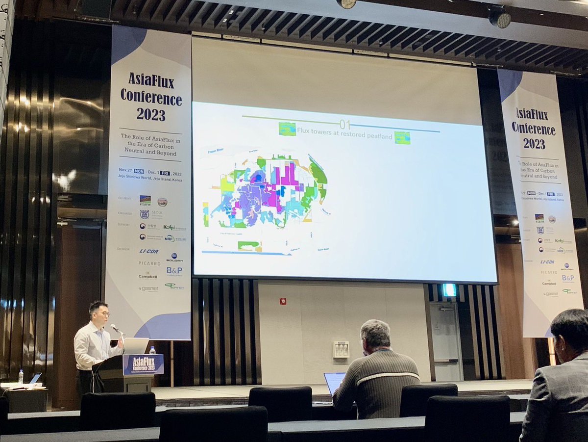
Great honour to give a keynote talk at #Asiaflux2023. Thanks a lot for the invitation (met lots of great people!), also thanks my group members, collaborators, and especially my mentors (@envmet, @Reichstein_BGC, Sara, Andy).
account_circle
RyuLab@SNU(@ryuyr77) 's Twitter Profile Photo

Hot off the press! New lab paper by Sheir Afgen in IEEE-GRSS 🎉🥳

Made in-season prediction of crop type mapping in the whole Cornbelt of US at 30 m resolution 🛰️🧠🌽

Overall accuracy increased from 0.8 (June), 0.84 (July) and 0.93 (August)

Seoul National University CALS Seoul National University CALS Press

account_circle
RyuLab@SNU(@ryuyr77) 's Twitter Profile Photo

Hot off the press! New lab paper by Ryoungseob Kwon 🎉
Counted 1.2 M trees in a city with multimodal data & deep learning. Species detection done from vehicle and

Seoul National University CALS IRIS@UNIST CitizenScience.Gov EcoVision Jan Dirk Wegner Martin Brandt

sciencedirect.com/science/articl…

account_circle
Philippe.ciais(@ciais_philippe) 's Twitter Profile Photo

🖼️ A new ground breaking method gives high accuracy estimates of forest biomass based on very high resolution aerial photos

By Sizhuo Li, Martin Brandt and colleagues

CEA IPSL 🌍 CTrees

researchgate.net/publication/37…
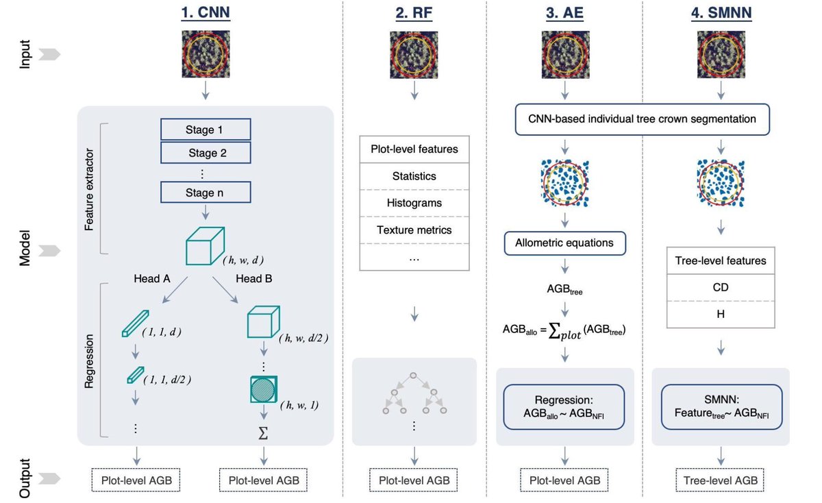
🖼️ A new ground breaking #ArtificialInteligence method gives high accuracy estimates of forest biomass based on very high resolution aerial photos By Sizhuo Li, @matin_brandt and colleagues @CEA_Officiel @IPSL_outreach @CTrees_org researchgate.net/publication/37…
account_circle
Will Marshall(@Will4Planet) 's Twitter Profile Photo

Proud to launch our Forest Carbon data! Accurate, timely maps of aboveground forest carbon, structure & height, *globally*. 🌳🌲🌍

The goal? Help underpin global carbon markets to accelerate our transition to a sustainable economy.

Really beautiful data, too :)
1/2

Proud to launch our Forest Carbon data! Accurate, timely maps of aboveground forest carbon, structure & height, *globally*. 🌳🌲🌍 The goal? Help underpin global carbon markets to accelerate our transition to a sustainable economy. Really beautiful data, too :) 1/2
account_circle
Mike Wulder(@mikewulder) 's Twitter Profile Photo

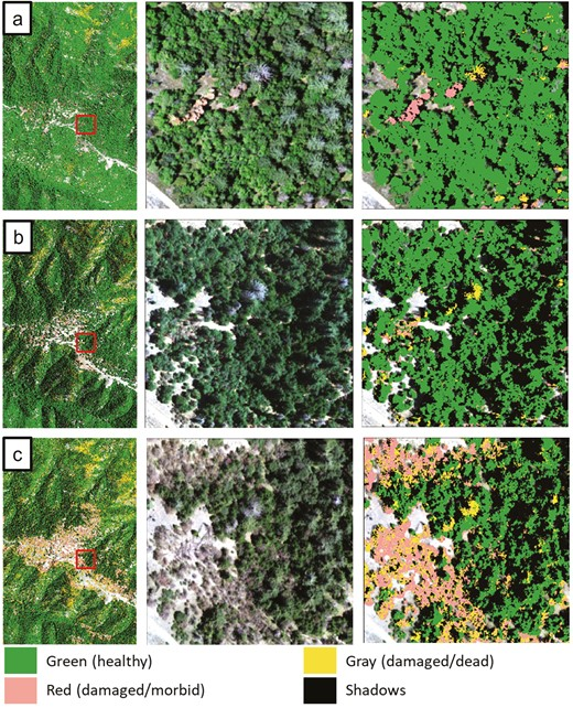
Wegmueller et al. Tree Condition and Analysis Program – Detecting Forest Disturbance at the Tree Level across the Contiguous United States with High Resolution Imagery.
TreeCAP is operational ready software program. Uses NAIP airborne imagery & LiDAR data.
academic.oup.com/jof/advance-ar…

Wegmueller et al. Tree Condition and Analysis Program – Detecting Forest Disturbance at the Tree Level across the Contiguous United States with High Resolution Imagery. TreeCAP is operational ready software program. Uses NAIP airborne imagery & LiDAR data. academic.oup.com/jof/advance-ar…
account_circle
Zilong Zhong(@zilong_zhong) 's Twitter Profile Photo

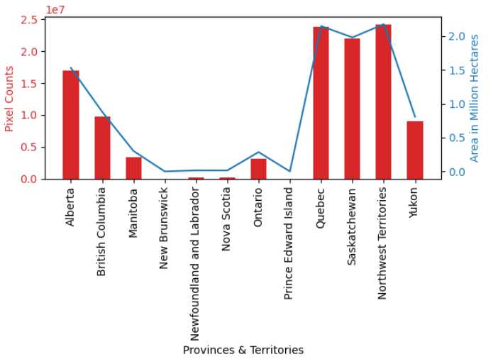
🌲🔥Exciting Update! We've overlaid our preliminary 30-m res burned area detection results on the Above Ground Biomass (ABG) image for Canada, revealing insights into areas affected by wildfires. It's estimated that 17.7 million hectares of forest have been burned this year!

🌲🔥Exciting Update! We've overlaid our preliminary 30-m res burned area detection results on the Above Ground Biomass (ABG) image for Canada, revealing insights into areas affected by wildfires. It's estimated that 17.7 million hectares of forest have been burned this year!
account_circle
Martin Brandt(@matin_brandt) 's Twitter Profile Photo

The biomass of every tree in Europe was mapped. That allows us to quantify the overlooked contribution of trees outside forests, such as in urban areas, to national carbon stocks. Maps and codes for download via the paper in Science Advances science.org/doi/10.1126/sc…

account_circle